
A prolonged stretch of dangerous heat appears increasingly likely across the Mid-Atlantic beginning this weekend and continuing into the first week of July as a strong upper-level ridge builds over the eastern United States.
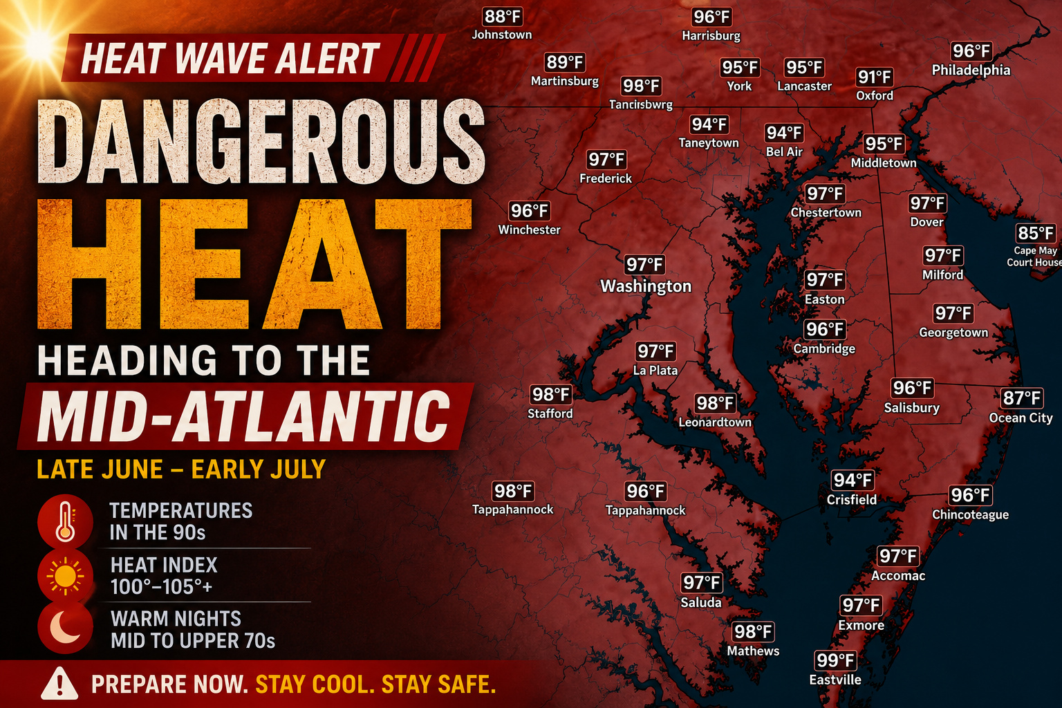
Forecast guidance indicates temperatures will climb well into the 90s across much of the region, while high humidity levels push heat index values above 100 degrees. Some locations could experience heat indices between 100 and 105 degrees, with isolated areas approaching 110 degrees during the hottest afternoons.
The greatest concern may be the lack of overnight relief. Overnight lows are expected to remain in the mid to upper 70s, allowing heat stress to accumulate over several consecutive days.


Long-range outlooks from the Climate Prediction Center continue to show a strong signal for above-normal temperatures across the Mid-Atlantic through at least July 7. Meanwhile, the Weather Prediction Center’s Extreme Heat Outlook highlights much of the region for a moderate to high risk of dangerous heat during the July 1-7 period.
Major cities such as Washington, Baltimore, Philadelphia, and surrounding communities could see multiple days of oppressive heat and humidity. Delmarva is also expected to be impacted, with temperatures likely running well above seasonal averages heading into the Independence Day holiday.

With confidence growing in a prolonged heat event, residents are encouraged to begin preparing now by staying hydrated, limiting outdoor activities during peak heating hours, and ensuring access to air conditioning or other cooling options.
While specific temperature forecasts will continue to be refined over the coming days, all signs point toward one of the hottest stretches of weather so far this summer across the Mid-Atlantic.