Good morning, Delmarva! Start your Sunday with caution if you’re heading out early — patchy fog will be lingering through about 8 a.m., so give yourself extra time and keep those headlights on. Once that fog lifts, we’re in for a beautiful summer day with mostly sunny skies and a high near 86°F. A northwest wind around 15 mph will keep things feeling fresh, though gusts up to 30 mph are possible, so secure any lightweight patio furniture or umbrellas.
Tonight looks lovely — mostly clear skies with a comfortable low of 66°F. Perfect sleeping weather with the windows open!
Heading into Monday, sunshine continues with a high near 84°F — another great beach or bay day. However, Monday night brings a change: clouds will be increasing, and we’re tracking a chance of showers and thunderstorms overnight, with lows around 70°F. Keep an eye on the forecast as we get closer.
Enjoy your Sunday, Delmarva — it’s a gorgeous one! I’ll see you back here for updates. Stay weather aware!
China’s national weather authority issued a heavy rain alert Sunday for portions of southern China, coming just one day after officials warned of mountain flood dangers in areas including Chongqing and Yunnan, with potential emergency evacuations ordered in the most at-risk locations.
The massive rain belt cuts diagonally across southern China, extending from the southwestern province of Yunnan all the way to the Yangtze River Delta along the country’s eastern coastline.
Train travel has also been affected — rail officials suspended certain passenger trains operating on the Shanghai–Kunming railway Sunday because of the heavy rainfall, according to state broadcaster CCTV.
In Yunnan, a number of popular tourist destinations, including the Tiger Leaping Gorge, were shut down temporarily after heavy rain pounded the area over the weekend.
The southwestern Guangxi region, which is still dealing with the aftermath of Typhoon Maysak earlier this month, is now facing another round of heavy rain expected to last through Tuesday.
Water levels in some rivers in Guangxi’s Baise area climbed between one and three metres — roughly three to nine feet — over the course of just 24 hours, CCTV reported Sunday.
Meanwhile, rescue crews are working urgently in Chongqing, where a rain-induced landslide struck a county in the southwest on Friday. Eight people have been confirmed dead, and searchers are still trying to locate 34 individuals who remain missing.
A crash on Interstate 95 southbound has resulted in a left lane closure near the Claymont crosswalk, according to Delaware transportation officials.
Motorists traveling through the area are advised to use caution and allow for extra travel time as crews work in the affected zone. The closure may cause slowdowns along that stretch of the highway.
Drivers are encouraged to stay alert and watch for emergency personnel and equipment near the scene.
Northbound lanes on Delaware Route 7 are currently closed between Stanton Christiana Road and Delaware Park Road following a crash, according to state transportation officials.
Motorists traveling through that stretch of roadway should anticipate significant delays and are encouraged to seek alternate routes until the lanes are reopened.
No additional details about the crash, including the number of vehicles involved or any injuries, have been released at this time. Drivers are urged to use caution in the area.
Lawson Road is closed between Hollyville Road and Zoar Road following a report of downed wires in the area.
Motorists traveling through that stretch of road are advised to find an alternate route until crews can address the situation and the roadway is cleared for travel.
No further details regarding the cause of the downed wires or an estimated time for the road to reopen have been made available at this time. Drivers should use caution in the surrounding area.
Motorists should avoid the intersection of Mount Zion Road and Seaford Road, which is currently closed due to downed wires in the area.
The closure is in effect while crews work to address the hazardous conditions caused by the fallen wires. Drivers are urged to plan ahead and use alternate routes to avoid delays.
No information regarding the cause of the downed wires or an estimated time for the road to reopen has been released at this time. TV Delmarva will provide updates as more information becomes available.
A portion of Careys Road is closed between Delaware Route 24 and Atkins Court following a downed wire incident, according to transportation officials.
Motorists traveling in the area are advised to plan for alternate routes until the roadway is cleared and deemed safe for travel. Downed wires can pose serious safety risks, and drivers should avoid the affected stretch of road.
No timeline for reopening has been announced at this time. Updates are expected as crews work to resolve the situation.
Tobacco Road is closed at Fox Hole Road following a downed wire incident, according to transportation officials.
Motorists traveling in the affected area are advised to find alternate routes and avoid the intersection until crews are able to clear the hazard and reopen the road.
No information regarding the cause of the downed wires or an estimated time for the road to reopen has been released at this time. Drivers should use caution in the surrounding area and watch for traffic control personnel or detour signage.
Salem Church Road is closed between Elm Drive and Route DE-4, according to a traffic incident report from DelDOT.
Motorists traveling in the affected area are advised to seek alternate routes and allow extra travel time until the roadway reopens.
No further details regarding the cause or expected duration of the closure have been released at this time. Drivers should check for updates as conditions change.
Salem Church Road is closed between Elm Drive and DE 4 following a downed wire incident, according to Delaware Department of Transportation officials.
Motorists traveling in the area are advised to use alternate routes and avoid the affected stretch of roadway until crews can address the situation and reopen the road.
No additional information regarding the cause of the downed wires or an estimated time for the road to reopen was immediately provided. Drivers should use caution in the surrounding area and plan for delays.
The National Weather Service out of Mount Holly, New Jersey issued a Severe Thunderstorm Warning on July 18, beginning at 7:11PM EDT and set to remain in effect until 7:45PM EDT.
Residents in areas covered by the warning are urged to seek shelter immediately, stay away from windows, and avoid any unnecessary travel until the warning has expired.
No additional details regarding storm location, movement, or specific hazards were included in the alert text. Check back for updates as more information becomes available.
The National Weather Service office in Mount Holly, New Jersey issued a Severe Thunderstorm Warning on the evening of July 18, effective from 7:09 PM EDT through 7:30 PM EDT.
Residents in the warned area were advised to seek shelter immediately, move away from windows, and remain indoors until the warning expired. Severe thunderstorms can bring dangerous lightning, damaging winds, and large hail.
If you are under a severe thunderstorm warning, officials recommend staying off roads, unplugging electronics, and avoiding contact with water during the storm. Monitor your local weather for updates as conditions can change rapidly.
The National Weather Service out of Mount Holly, New Jersey issued a Severe Thunderstorm Warning on the evening of July 18, beginning at 6:55 PM EDT and set to remain in effect until 7:30 PM EDT.
Residents under the warning are urged to seek shelter immediately, stay away from windows, and avoid outdoor activities until the warning has been lifted. Severe thunderstorms can bring dangerous lightning, strong winds, and heavy rainfall in a short period of time.
Check the National Weather Service website or your local weather alerts for the most up-to-date information on which areas are included in this warning and any changes to the forecast.
The National Weather Service office in Mount Holly, New Jersey has issued a Severe Thunderstorm Warning that went into effect at 6:54 PM EDT on July 18 and is set to expire at 7:45 PM EDT the same evening.
Residents in the areas covered by this warning are urged to take shelter immediately and remain indoors until the warning has been lifted. Severe thunderstorms can bring dangerous conditions including damaging winds, large hail, and heavy rainfall.
Stay tuned to TV Delmarva for the latest updates as this storm system moves through the area.
The National Weather Service office located in Mount Holly, New Jersey issued a Severe Thunderstorm Warning on July 18, taking effect at 6:42 PM EDT and set to expire at 7:00 PM EDT.
Residents in the areas covered by the warning were advised to seek shelter immediately and remain indoors until the warning expired. Severe thunderstorms can bring dangerous lightning, damaging winds, and heavy rainfall.
The alert was issued through official NWS channels. Anyone in the warned area was encouraged to monitor local weather updates and avoid unnecessary travel until conditions improved.
The National Weather Service out of Mount Holly, New Jersey issued a Severe Thunderstorm Warning on July 18, beginning at 6:40 PM EDT and running through 7:30 PM EDT.
Anyone in the affected area is urged to seek shelter indoors immediately, stay away from windows, and avoid any unnecessary travel until the warning has expired.
Severe thunderstorms can bring dangerous lightning, large hail, and strong damaging winds. Residents should stay tuned to local forecasts for updates as conditions develop.
The National Weather Service out of Mount Holly, New Jersey issued a Tornado Warning on the evening of July 18, effective beginning at 6:38 PM Eastern Time.
The warning was scheduled to expire at 7:00 PM Eastern Time, giving residents a narrow window to seek safe shelter immediately.
When a Tornado Warning is issued, it means a tornado has been detected on radar or spotted by a trained weather observer. Residents in the warned area should move to the lowest level of a sturdy building, away from windows, and protect their heads and necks until the warning has passed.
The National Weather Service out of Mount Holly, New Jersey issued a Tornado Warning on the evening of July 18, effective from 6:27 PM Eastern Time until 7:00 PM Eastern Time.
Residents in the warned area were advised to take shelter immediately and stay away from windows. A Tornado Warning means that a tornado has either been spotted or indicated by weather radar, making it a serious and immediate threat to life and property.
Authorities encouraged anyone in the path of the storm to move to the lowest level of a sturdy building, away from exterior walls, and to avoid seeking shelter under highway overpasses or in vehicles.
Stay with TV Delmarva for any additional updates as this weather situation develops.
The National Weather Service office in Mount Holly, New Jersey has issued a Severe Thunderstorm Warning that went into effect at 6:16 PM EDT on July 18 and is set to expire at 7:00 PM EDT the same evening.
Residents in the warned area are urged to take immediate precautions. Severe thunderstorms can bring dangerous lightning, damaging winds, and heavy rain in a very short period of time.
Stay away from windows, avoid using electrical appliances, and do not venture outside until the warning has been lifted. If you are driving, pull over to a safe location away from trees and power lines.
TV Delmarva will continue to monitor this storm and bring you the latest information as it becomes available.
The National Weather Service office in Mount Holly, New Jersey issued a Severe Thunderstorm Warning on the evening of July 18, effective from 5:59 PM EDT through 6:15 PM EDT.
Residents in the areas covered by the warning were advised to seek shelter immediately and stay away from windows. Severe thunderstorms can bring dangerous lightning, damaging winds, and heavy rainfall in a short period of time.
The warning was issued as part of the NWS’s ongoing effort to alert the public to rapidly developing dangerous weather conditions. Residents are encouraged to monitor local forecasts and heed all warnings issued by the National Weather Service.
The National Weather Service out of Mount Holly, New Jersey issued a Severe Thunderstorm Warning on the evening of July 18, beginning at 5:58 PM EDT and set to expire at 6:15 PM EDT.
Residents in the areas covered by the warning were advised to seek shelter immediately and remain indoors until the warning expired. Severe thunderstorms can bring dangerous lightning, damaging winds, and heavy rainfall in a short period of time.
As always, officials recommend that people stay away from windows, avoid using electrical appliances, and refrain from going outdoors during an active severe thunderstorm warning. If you are driving, pull over safely and wait for conditions to improve.
Stay with TV Delmarva for the latest weather updates as conditions develop in your area.
The National Weather Service office located in Mount Holly, New Jersey issued a Severe Thunderstorm Warning on July 18, beginning at 5:43 PM EDT and remaining in effect until 6:15 PM EDT.
Those in the warned area are urged to seek shelter immediately and remain indoors away from windows until the warning has expired. Severe thunderstorms can bring dangerous lightning, damaging winds, and heavy rainfall in a short period of time.
No additional specifics regarding storm location or expected impacts were included in the alert. Residents should monitor local forecasts and official weather channels for any updates or extensions to this warning.
The National Weather Service out of Mount Holly, New Jersey issued a Severe Thunderstorm Warning on July 18, taking effect at 5:39 PM EDT and remaining in place until 6:15 PM EDT.
Residents in the warned area should seek shelter indoors, stay away from windows, and avoid travel until the warning has expired. Severe thunderstorms can bring dangerous lightning, strong winds, and heavy rainfall in a short period of time.
No additional details about storm location or specific impacts were included in the official alert. Viewers are encouraged to monitor local forecasts and follow guidance from the National Weather Service as conditions develop.
The National Weather Service office located in Mount Holly, New Jersey issued a Severe Thunderstorm Warning on July 18, taking effect at 5:26 PM EDT and remaining in place until 6:15 PM EDT.
Residents in the areas covered by this warning are urged to seek shelter indoors immediately, stay away from windows, and avoid any unnecessary travel until the warning has expired.
Severe thunderstorms can bring dangerous lightning, damaging winds, and large hail. Authorities recommend staying informed through local weather alerts and waiting for an official all-clear before resuming outdoor activities.
The National Weather Service office in Mount Holly, New Jersey issued a Severe Thunderstorm Warning on July 18, effective from 5:14 PM EDT through 6:15 PM EDT.
Residents in the warned area are urged to take cover immediately. Severe thunderstorms can bring dangerous lightning, damaging winds, and large hail that pose serious risks to people caught outdoors.
Authorities recommend moving indoors, staying away from windows, and avoiding travel until the warning has expired. Do not wait until conditions worsen before taking action.
Check the National Weather Service for the latest updates and watch for any additional warnings or advisories that may be issued as storms develop.
The National Weather Service office in Mount Holly, New Jersey has issued a Tornado Watch for the region, beginning at 1:55 PM EDT and running through 9:00 PM EDT this evening, July 18.
A Tornado Watch means that weather conditions are favorable for the development of tornadoes. Residents are urged to stay weather-aware and keep a close eye on updated forecasts throughout the remainder of the afternoon and evening.
If a Tornado Warning is issued for your area, you should immediately move to the lowest floor of a sturdy building, away from windows, and take cover. Do not wait to see or hear a tornado before taking action.
TV Delmarva will continue to monitor this weather situation and provide updates as conditions develop. Stay tuned for the latest information from your local forecast team.
Southbound travelers on Coastal Highway, also known as Delaware Route 1, should expect slow going between Dartmouth Drive and Rehoboth Avenue Extension.
According to Delaware Department of Transportation, heavy congestion in that stretch is adding 15 to 20 minutes to travel times for drivers heading in that direction.
Motorists are encouraged to allow extra time or consider alternate routes to avoid the backup.
A Heat Advisory is in effect for Inland Sussex County through 8 o’clock tonight, as dangerously hot and humid conditions push heat index values as high as 106 degrees.
The National Weather Service out of Mount Holly issued the advisory this afternoon, warning residents that the combination of soaring temperatures and oppressive humidity could quickly lead to heat-related illness if proper precautions aren’t taken.
Health officials urge everyone in the affected areas to take the heat seriously. Residents should drink plenty of fluids — even before feeling thirsty — and stay inside an air-conditioned space as much as possible. Avoid prolonged time in direct sunlight, and if you must be outdoors, take frequent breaks in the shade or indoors.
Authorities are also asking neighbors to look out for one another. Check in on elderly relatives, young children, and anyone who may not have access to air conditioning — they face the greatest risk in these extreme conditions.
The advisory remains in effect until 8 p.m. this evening. Conditions are expected to become more comfortable after sunset. TV Delmarva will continue to monitor the forecast and bring you any updates as conditions change.
The National Weather Service office in Mount Holly, New Jersey has issued a Heat Advisory that took effect at 12:43 PM EDT on Friday, July 18, and is set to expire at 8:00 PM EDT that same evening.
Residents are encouraged to take steps to stay safe during the advisory period. Health officials generally recommend staying hydrated, limiting time outdoors during peak heat hours, and checking on elderly neighbors and young children during periods of elevated heat.
The advisory was issued to alert the public to potentially dangerous heat conditions expected through the early evening hours.
Delaware State Police are looking into a shooting that took place in the early morning hours of Saturday, July 18, 2026, outside a Waffle House restaurant in Newark, leaving four people with gunshot wounds.
Troopers were called to the Waffle House at 1450 Pulaski Highway at around 12:10 a.m. after reports of a shooting. Upon arrival, officers discovered three victims in the parking lot who had been struck by gunfire. A 20-year-old man from New Castle, a 19-year-old man from Bear, and an 18-year-old woman from Wilmington were all transported to a nearby hospital with serious but non-life-threatening injuries. A fourth victim, a 17-year-old girl from New Castle, later drove herself to the hospital and was also treated for injuries that were not life-threatening.
Early findings in the investigation indicate that one or more unidentified suspects opened fire on the victims from within a large crowd that had assembled in the parking lot before fleeing the area.
The Criminal Investigations Unit out of Delaware State Police Troop 2 is continuing to work the case. Detective H. Carroll is leading the investigation and can be reached at (302) 365-8467. Tips can also be submitted through a private Facebook message to the Delaware State Police or by contacting Delaware Crime Stoppers at (800) 847-3333.
Anyone who has been affected by this incident or has lost a loved one to a sudden death can reach the Delaware State Police Victim Services Unit and the Delaware Victim Center around the clock by calling the toll-free hotline at 1-800-VICTIM-1 (1-800-842-8461), or by emailing [email protected].
Canadian military forces were gearing up Saturday to airlift residents out of a remote northwestern Ontario community as massive forest fires continued to push dangerous smoke across a wide stretch of the United States — including right here in Delaware.
Federal Emergencies Minister Eleanor Olszewski announced late Friday that armed forces aircraft would be used to evacuate the roughly 600 people living in Fort Hope, located in a sparsely populated region of northwestern Ontario where some of the most severe fires are raging. The area has limited road access and depends largely on air transportation. Thousands of others from fire-affected zones have already been moved to communities farther south in Ontario.
Canada’s federal natural resources ministry reported Saturday that 69 new fires broke out overnight, pushing the total number of active fires to 955 across the country. The total land burned so far has reached nearly 11,000 square miles — or about 28,500 square kilometers — which remains well below the five-year average. However, wind patterns have driven the smoke across the U.S. border, leading officials to issue air quality alerts and health advisories across multiple states.
As of 8 a.m. Eastern Time Saturday, the U.S. Environmental Protection Agency’s AirNow monitoring site listed air quality as “unhealthy” across a broad region that included southern Ontario, eastern Ohio and West Virginia, most of Pennsylvania and New Jersey, much of Virginia, and all of Maryland, Delaware, and Washington, D.C.
Conditions were even worse in parts of western Pennsylvania, including the Pittsburgh area, where air quality was rated “very unhealthy.” AirNow projected that those areas would see gradual improvement as the day went on.
The smoke is also expected to have minimal effect on Sunday’s soccer World Cup final at New York New Jersey Stadium, according to forecaster AccuWeather, which made that assessment on Friday.
President Donald Trump weighed in on Friday, blaming what he described as poor Canadian forest management practices for the smoke situation. He stated he would factor in the “incalculable cost” of addressing the pollution when determining tariffs on Canadian goods.
Following the president’s remarks, Minister Olszewski pushed back, noting that Canada has put C$12 billion — roughly $8.56 billion U.S. — into forest sustainability and fire prevention efforts since 2020 as the nation faces increasingly dry and warm weather conditions.
Climate experts have long pointed to rising temperatures as a driver of drier forest conditions and greater wildfire risk. Large-scale forest fires have now become a near-annual event across Canada, which is home to some of the largest forested landscapes on the planet.
Levels Road southbound is closed at Middletown Warwick Road, also known as Delaware Route 299, following a vehicle fire in the area.
Motorists traveling southbound on Levels Road should plan for delays and consider using an alternate route until the road reopens. No further details regarding the incident have been made available at this time.
Drivers are urged to stay alert and follow any instructions from emergency personnel on scene.
A right lane closure is currently affecting westbound Maryland Avenue at Boxwood Road, according to traffic officials.
The lane restriction is expected to remain in place until 2 p.m. Drivers traveling through the area should anticipate potential slowdowns and consider using alternate routes to avoid delays.
Westbound Foulk Road is closed at the intersection of Silverside Road following a crash, according to traffic officials.
Motorists traveling in the area are advised to seek alternate routes and allow extra travel time until the roadway is reopened. The closure is currently in effect, and drivers should use caution near the scene.
No additional details regarding the crash have been made available at this time. Updates are expected as conditions change.
Drivers traveling along Paper Mill Road (Route 72) should be aware of a traffic adjustment currently in place in both directions.
A lane shift affecting eastbound and westbound travel is active between Willow Creek Lane and Limestone Road (Route 7). The shift is expected to remain in place until 9PM.
Motorists are encouraged to slow down and proceed with caution through the affected stretch of roadway.
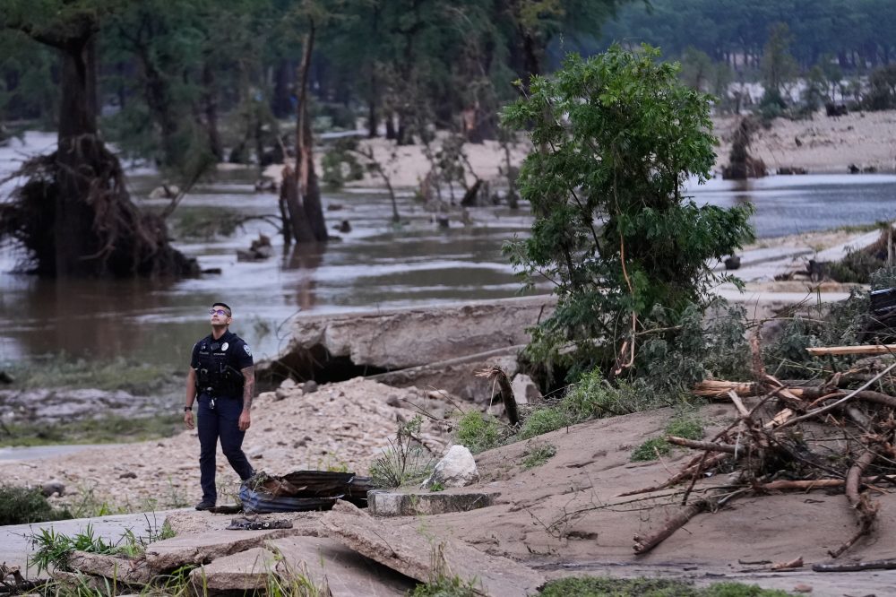
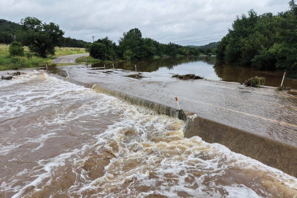
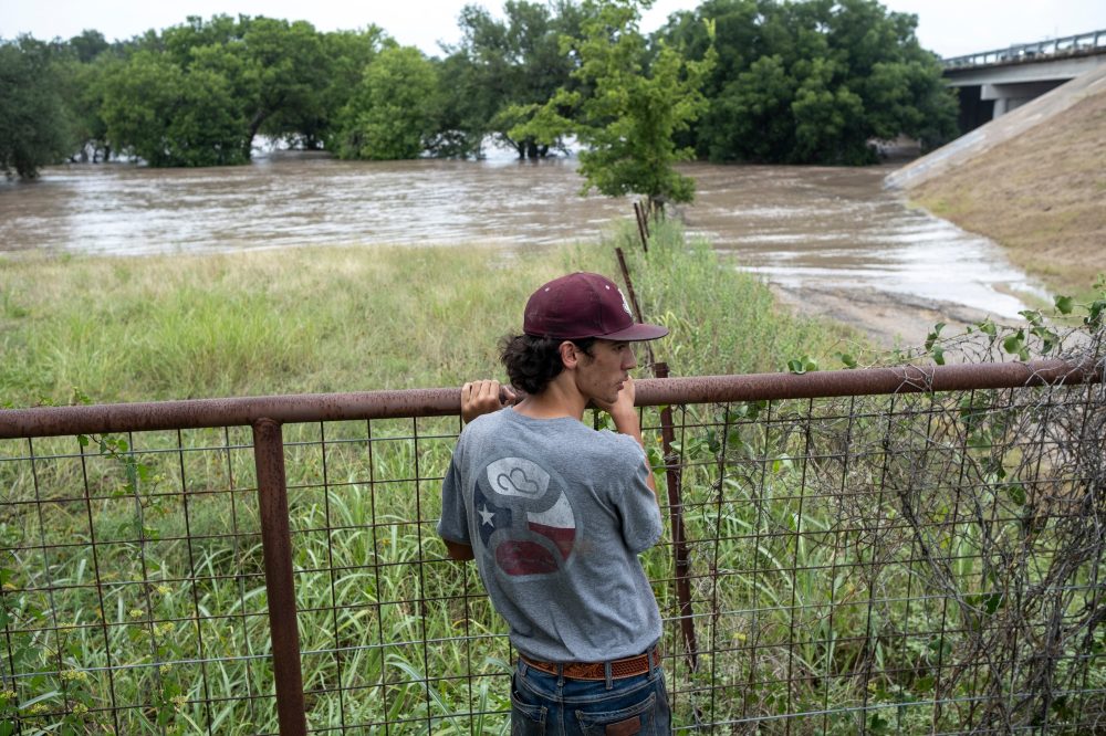
Fresh rainfall soaking Texas this week is bringing back heartbreaking memories for those who survived the catastrophic Hill Country floods that struck one year ago.
Lorena Guillen finds herself reflecting on that harrowing experience as the rain returns. She and her husband risked their lives attempting to rescue a family who had been caught in the floodwaters near their RV park during last year’s massive flooding event in the Hill Country region.
For survivors like Guillen, the sound and sight of heavy rain is a painful reminder of the destruction and loss that unfolded during the deadly 2025 floods — a disaster that left deep emotional scars that have yet to fully heal.
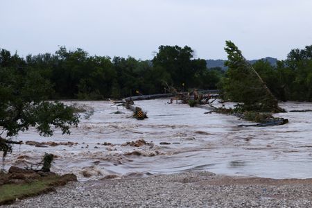
Less than a year after catastrophic flooding claimed more than 100 lives across Texas’ Hill Country, a fresh round of powerful storms unleashed devastating flash floods this week in many of the same communities — putting newly installed warning systems to the test for the first time.
At least two people lost their lives in the latest disaster, and hundreds of others had to be rescued from rising waters. But unlike the deadly floods of July 2025, many residents said they received timely warnings that gave them a chance to reach safety.
New flood sirens wailed in the middle of the night. Cell phones buzzed with emergency alerts that never came during last year’s disaster. For some, that made all the difference.
Still, the flooding exposed ongoing challenges. Some residents were caught completely off guard, underscoring how difficult it remains to build a reliable early warning network across a vast, rural stretch of Texas long known as Flash Flood Alley.
An Associated Press investigation following last summer’s floods — which killed 136 people, including 28 children at a sleepaway camp for girls — found that state and local agencies had missed multiple opportunities over the past decade to put flood warning systems in place along the Guadalupe River.
That reporting helped spark action. In Kerr County, local officials had acknowledged being hesitant to “cry wolf” during last year’s disaster and failed to send wireless emergency alerts. This time around, Kerr County issued four alerts and the city of Kerrville issued one early Thursday as flood conditions developed, according to an AP review of available data. Residents near Quinlan Creek were told to evacuate to higher ground and warned of “extremely dangerous” flash flooding. The National Weather Service also pushed out flood watches, warnings, and emergency messages through broadcast stations, weather radios, and mobile phones. Those who had signed up for Kerr County’s CodeRED notification system received text message warnings as well.
Kerrville resident Suzanne Sutphin Gschwind said the contrast with last year was striking. “Last year, we got no alarms. We had no idea what was going on,” she said. “This year, very different” — with texts and calls arriving from local authorities, a weather channel, and even her doorbell camera. On one night, alerts came in “about every two hours.” She added, “I think we would all like to err on the side of too much.”
Between early Tuesday morning and approximately 9 a.m. Thursday, the National Weather Service sent 38 alerts to residents in certain southwest Texas communities, including 14 tornado warnings and 24 flood warnings describing conditions as occurring or imminent and potentially “life threatening.”
However, those National Weather Service alerts often lack the highly specific local information that county and city emergency agencies can provide — and those local alerts can be more critical for people deciding whether to evacuate.
An AP review of wireless emergency alert data found no alerts listed as sent by agencies in Uvalde County, which was heavily impacted by flooding, though local agencies there may have used other methods to notify residents.
Jaclyn Gonzales was jolted awake at 2 a.m. Wednesday by a friend calling to warn about a possible tornado near her Uvalde-area home. When she got out of bed, the floor was already wet. “It was the shock of the water to my feet that made me really wake up,” she said.
Kat Sprawls, who lives in Batesville, only found out floodwaters were approaching after a friend called her at 3:30 a.m. Friday. It took five or six calls before she woke up — her phone had been set to do-not-disturb mode. “There’s no warning system at all. It’s just like the flood in Kerrville last year — we had no warnings,” Sprawls said. “Over half of Batesville is under water now.”
Jessica Belmarez, secretary of the Zavala County Sheriff’s Department, said the department was posting evacuation information on Facebook and that officers were going door-to-door in flooded areas, including Batesville.
State Sen. Paul Bettencourt, who authored legislation in 2025 to help fund flood sirens, said newly installed sirens in Ingram and in Kerr and Kendall counties were activated this week. He noted that 28 additional counties are eligible for flood warning funding and that most are working on implementation plans for review by the Texas Water Development Board. “Between the outdoor sirens, and the cellphone alerts, the response was very positive in getting people out of the way and to higher ground,” Bettencourt said. “It’s an enormous improvement over a year ago.”
Tara Bushnoe, manager of the Upper Guadalupe River Authority, said three of the six newly installed sirens in Kerr County were activated to alert people to seek higher ground. The remaining three were located in areas that experienced only minor flooding.
In the small town of Comfort, the volunteer fire department recently added two more sirens to the single one that had been in place for years. Assistant Fire Chief Danny Morales said some residents were reluctant to leave even after the sirens sounded. “Some people just don’t want to leave — that’s our problem here,” he said. “But we did set them off twice, probably an hour from one to another, just because we had people just lingering, and not wanting to move.”
Ian Cunningham launched a company called River Sentry following the 2025 floods, building siren towers for privately owned locations such as RV parks, camps, and hotels. The sirens are triggered automatically by rising water levels. The company has now installed 104 sirens along the Guadalupe River, Cunningham said, including several near the site of an RV park where more than three dozen people perished in 2025. “We installed them about three months ago and did not expect them to be used so soon,” he said.
A company called Hononu, which developed water-level sensor technology and a real-time data network, was awarded a state contract making it easier for agencies to purchase its flood warning technology. The fire-tracking app Watch Duty, used by millions of people, also expanded earlier this year to help monitor flood conditions.
Texas Gov. Greg Abbott credited the lessons learned from 2025 with improving this year’s emergency response. “Everybody in Texas has been far more prepared to deal with what has happened this year,” Abbott said at a news conference in Uvalde. “Lives have been saved.”
Good morning, Delmarva! It’s going to be a rough one out there today, so pay close attention to this forecast. We’re dealing with smoky skies to start the day, and that hazy air combined with the heat will push our heat index as high as 101°F — even though our actual high will reach near 93°F. Make sure you’re staying hydrated and limiting time outdoors if you can.
Storms will be developing through the afternoon, and some of those storms could turn severe. We’re looking at an 80% chance of showers and thunderstorms, with rainfall totals between a quarter and half an inch possible. If you hear thunder, get inside immediately.
Tonight, storm chances linger into the evening before gradually tapering off, with a mild low around 74°F.
The good news? Sunday looks beautiful! Mostly sunny skies and a comfortable high of 86°F with a clear night dropping to 69°F — a perfect summer weekend rebound.
Stay weather-aware today, Delmarva. I’ll see you on TV Delmarva with updates throughout the day!
The National Weather Service office in Mount Holly, New Jersey has put a Flood Watch into effect starting early Friday morning, July 18, and lasting through 2:00 AM EDT on Saturday, July 19.
The watch was issued at 2:13 AM EDT on July 18, signaling that conditions are favorable for flooding to develop across the affected area during that timeframe.
A Flood Watch means that flooding is possible. Residents are encouraged to monitor local forecasts closely, avoid low-lying areas prone to water accumulation, and be ready to act quickly if a Flood Warning is issued. Do not attempt to drive through flooded roadways.
TV Delmarva will continue to monitor this weather alert and provide updates as conditions develop. For the latest information, stay tuned to your local forecast.
At least four people lost their lives and four more remain missing after a fast-moving flash flood devastated a mountain village in Vietnam’s northern Lai Chau province, according to state media reports released Saturday.
The flood struck Muong Than village in the early morning hours of Friday, following several days of relentless heavy rain across multiple areas of northern Vietnam. Seven people were also reported injured in the disaster, according to the Vietnam News Agency.
Images published by the Vietnam News Agency showed thick red mud and floodwaters covering the village, with boulders and wooden logs heaped along a heavily damaged roadway.
Vietnam regularly faces deadly storms and flooding during its rainy season, which is most intense between July and September. Government figures show that natural disasters — the majority of them floods — claimed 489 lives across the country last year.
Since Wednesday, a combination of landslides and flash floods triggered by the ongoing heavy rainfall has caused widespread damage throughout the region. Roads, power infrastructure, and hundreds of homes have been affected, and approximately 238 hectares of crops have been submerged, according to the country’s disaster management agency.
Forecasters are warning that parts of northern Vietnam could receive rainfall totals reaching up to 250 millimeters on Saturday alone, raising the threat of additional flash floods and landslides in the coming hours.
A crash on the flyover ramp connecting Interstate 95 southbound to Delaware Route 1 southbound has led to the closure of two lanes, according to traffic officials.
Motorists traveling in that corridor should be prepared for significant slowdowns and are encouraged to seek alternate routes until the situation is cleared.
No additional information regarding the cause of the crash or any injuries was immediately available. Drivers are urged to use caution in the area and allow extra travel time.
The National Weather Service office in Mount Holly, New Jersey has issued a Flood Watch for the region, effective from the evening of Thursday, July 17 through 2:00 AM EDT on Saturday, July 19.
A Flood Watch means that conditions are favorable for flooding to develop in the watch area. Residents are urged to stay informed and be ready to take action if flooding begins or a Flood Warning is issued.
Authorities recommend that people avoid low-lying areas and be cautious near streams, drainage ditches, and other bodies of water that could rise quickly during heavy rainfall. Do not attempt to drive through flooded roadways.
TV Delmarva will continue to monitor this weather situation and provide updates as conditions develop. For the latest information, keep an eye on official National Weather Service alerts and your local forecast.
The National Weather Service office in Mount Holly, New Jersey has issued a Flood Watch for the area, effective from the evening of Thursday, July 17 at 9:25 PM Eastern Time through the early morning hours of Saturday, July 19 at 2:00 AM Eastern Time.
A Flood Watch means that conditions are favorable for flooding to develop in the warned area. Residents should remain alert, especially in low-lying areas or near bodies of water, and be prepared to take action if flooding begins or a warning is issued.
Authorities encourage people to avoid driving through flooded roadways and to monitor local weather updates closely as conditions evolve over the coming days.
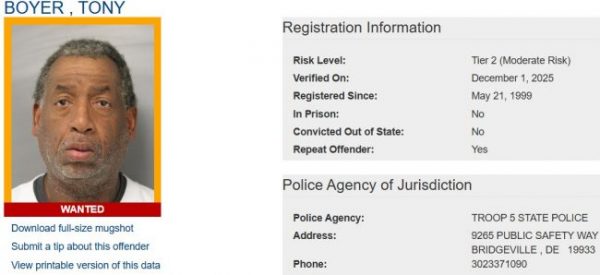
The Delaware State Police Sex Offender Apprehension and Registration Unit, known as SOAR, has released public notifications regarding both wanted and homeless registered sex offenders in the state.
Wanted Sex Offenders
SOAR is actively searching for the following sex offenders who have failed to register or update their address as required by law: Tony Boyer, Gene Dukes, Charles Fulton, Christopher Gartner-Hunter, Daniel Kirlin, Michael Viscount, Spencer Wright, and Randy Crum.
Anyone with information about the whereabouts of these individuals is urged to call SOAR at (302) 739-5882. Tips can also be submitted anonymously through Delaware Crime Stoppers at (800) 847-3333. Please note that these individuals represent only a portion of the total wanted sex offenders in Delaware. A complete list is available on the Delaware Sex Offender Registry website.
Homeless Sex Offenders
SOAR has also issued notifications for the following sex offenders who have recently been reported as having no fixed address: James Barrineau, Lawrence Blain, Julius Brown, Willis Grayson, Shemar McAllister, and Jordan Taylor.
These individuals are not currently wanted for failing to register, but state police want the public to be aware of their homeless status. If anyone has information suggesting that any of these individuals are living at a residence, please contact SOAR at (302) 739-5882 or reach out to Delaware Crime Stoppers at (800) 847-3333. A full list of homeless sex offenders can be found on the Delaware Sex Offender Registry website.
Motorists traveling along Kirkwood Highway should plan for delays as lane closures are currently in effect in both directions.
The eastbound and westbound left lanes are shut down between Meadowood Drive and East Green Valley Circle. Drivers are advised to use caution and allow for extra travel time in the area.
The lane restrictions are expected to be lifted by 6 a.m. Travelers may want to consider alternate routes until the closure is cleared.
Northbound travelers on Red Lion Road (DE-71) are encountering a lane shift between Jester Street and Wrangle Hill Road (DE-72) as crews conduct road work in the area.
DelDOT has reported the lane configuration change, which requires drivers to adjust their path through the work zone. The shift is in place to accommodate construction activity along that stretch of roadway.
Drivers are advised to slow down, stay alert for workers and equipment, and follow all posted signage through the affected area.
Millions of Americans across the Great Lakes, Northeast, and Mid-Atlantic regions endured another difficult day of hazardous air Friday, as out-of-control wildfires sent a thick, eerie haze drifting over Washington, D.C. and surrounding areas.
Air quality alerts were set to remain in place through Saturday across a large portion of the country, though forecasters say weekend rainfall and thunderstorms could provide some temporary relief to affected communities.
Don’t expect the smoky skies to disappear quickly, however. Bob Oravec, a lead forecaster with the National Weather Service based in Maryland, warned that fires continue to burn unchecked across remote areas of Canada, with additional blazes in a Minnesota wilderness area adding to the problem.
“The source of the smoke is going to continue on for certainly a week, probably,” Oravec said. “So in some form, there’s going to be smoke that gets transported from the fires downstream, and it’s just going to depend upon which way the wind’s blowing as to where the smoke is going to affect the most.”
On Friday, communities in Minnesota, Michigan, and Illinois near the Canadian border and the Boundary Waters Canoe Area Wilderness in Minnesota recorded some of the worst air quality readings on the planet, according to IQAir, an air quality monitoring website.
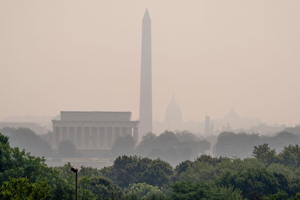
Washington, D.C. was not far behind. The Washington Monument, Lincoln Memorial, and other iconic national landmarks were swallowed up in a dense, orange-tinted haze early Friday morning.
Stewart Verdery, a former assistant secretary at the U.S. Department of Homeland Security, captured the scene in a sunrise panorama he posted on X. “Wow that Canadian smoke haze is no joke,” he wrote. “Almost nothing visible — no sun, no monuments, no Reagan Airport.”
Air quality in and around the nation’s capital was expected to deteriorate further throughout the day, potentially reaching “very unhealthy” and even “hazardous” levels on the air quality index, according to regional officials.
Health authorities urged residents — especially those with heart or lung conditions, older adults, and children — to stay indoors as much as possible until conditions improve.
There is also growing concern about how the poor air quality could affect the World Cup final match between Spain and Argentina at MetLife Stadium in New Jersey on Sunday. Oravec noted that while Saturday is expected to be rough, conditions should improve somewhat by game day.
Just one day earlier, skies over several states turned dark with an orange and yellow tinge, partially obscuring Manhattan’s skyline in a now-familiar haze.
Officials in New York, New Jersey, Pennsylvania, and other Northeastern states handed out free KN95 face masks, scrapped outdoor events, and opened libraries and public buildings as indoor refuges from the polluted air.
By Friday afternoon, air quality readings had improved from “unhealthy” to “moderate” in parts of the New York City area. Bright sunshine broke through a thin layer of smoke, and stretches of clear blue sky returned to much of the region.
Saturday is forecast to bring a strong chance of thunderstorms across the Northeast and Mid-Atlantic, which should help clear the air temporarily. How long that improvement lasts depends largely on what happens far to the north, where roughly 100 wildfires continue to burn with no end in sight, primarily in Ontario, Canada. In the U.S., authorities have closed the Boundary Waters area while battling several fires there.
Health experts warn that prolonged exposure to smoky air can worsen existing medical conditions and lead to serious long-term health issues, including respiratory illness, cardiovascular and neurological disease, and even premature death.
Drivers traveling on Paper Mill Road should be aware of lane shifts currently in place between Willow Creek Lane and Limestone Road.
The lane shifts are the result of construction activity in the area and are expected to remain in effect until 5:00 PM.
Motorists are encouraged to use caution when passing through the construction zone and to allow for additional travel time if their route takes them through that stretch of road.
The National Weather Service office located in Mount Holly, New Jersey has issued an Air Quality Alert, according to an official notice released at 3:45 PM Eastern Time on July 17.
Residents in the affected areas should be aware that air quality conditions may pose health concerns, particularly for sensitive groups such as the elderly, children, and those with respiratory conditions like asthma.
During periods of reduced air quality, health officials generally recommend limiting prolonged outdoor activity, especially strenuous exercise. Those who are sensitive to air pollution are advised to remain indoors when possible and keep windows closed.
TV Delmarva will continue to monitor this alert and provide updates as more information becomes available from the National Weather Service.
The National Weather Service office in Mount Holly, New Jersey has issued an Air Quality Alert, effective as of 3:45 PM Eastern Time on July 17.
During periods of poor air quality, health officials generally advise that sensitive groups — including children, the elderly, and individuals with respiratory or heart conditions — limit their time outdoors and reduce strenuous physical activity.
Residents are encouraged to monitor local forecasts and heed any guidance provided by health and environmental authorities until the alert has expired.
The National Weather Service office in Mount Holly, New Jersey has issued an Air Quality Alert for the region.
Details regarding the specific timing, affected areas, and pollutant levels were included in the official alert notice. Residents — especially those with respiratory conditions, the elderly, and young children — are encouraged to take precautions and limit time spent outdoors while the alert remains in effect.
For the most current information on air quality conditions and any updates to this alert, residents can visit the National Weather Service website or check with local air quality authorities.
The United States is grappling with three major weather emergencies at once — choking wildfire smoke blanketing the East Coast, devastating floodwaters surging through Texas for a third straight day, and new fires erupting overnight across the Pacific Northwest.
As of Friday, July 17, firefighters were battling 68 large wildfires burning across 15 states — a jump of nearly two dozen from the previous day. Seventeen new blazes ignited in the Pacific Northwest after a series of lightning strikes, making it the most active fire region in the nation, according to the National Interagency Fire Center.
The scale of the response is enormous: more than 17,400 personnel, 140 helicopters, and four military C-130 air tanker crews have been deployed across the country. The NIFC reports that record-low snowpack in the Mountain West and widespread drought have pushed fire conditions to levels typically not seen until mid-August.
So far this year, nearly 3.72 million acres — approximately 1.51 million hectares — have burned nationwide, surpassing last year’s mid-July total by more than one million acres.
Jesse Berman, a professor at the University of Minnesota School of Public Health who studies how extreme weather impacts human health, said disasters happening at the same time amplify the danger. “These are compound events, and that can sometimes make the impacts of them far worse than what we would experience with any one of these events individually,” Berman said.
University of Pennsylvania climatologist Michael Mann linked the simultaneous crises to a wave pattern in the jet stream called “resonance” — a phenomenon where large jet stream waves become amplified and locked in place, causing extreme weather to linger over a region for extended periods. Mann said his research shows that human-driven climate change has caused these stalled jet stream events to triple in frequency since the 1950s.
Hazy Skies Across the East
Smoke drifting south from Canadian wildfires has turned skies from Minneapolis to Washington, D.C. an orange-brown haze, pushing dangerous air quality conditions onto tens of millions of people across the Midwest, Northeast, and Mid-Atlantic regions.
On Friday, Chicago ranked as having the second-worst air quality of any city in the world, according to Swiss air quality technology company IQAir. Local officials responded by closing parks and beaches along Lake Michigan indefinitely and moving parks department activities indoors.
Those closures left few options for residents without air conditioning — about 4% of city households, according to the Civic Data Atlas. Temperatures in Chicago were expected to climb above 90 degrees Fahrenheit (32 degrees Celsius), with heat index values reaching up to 97 degrees, the National Weather Service said, prompting the city to activate its community cooling centers.
Earlier in the week, Detroit, Minneapolis, and Toronto were among the most polluted cities on the planet. A heat dome sitting over the Carolinas has been pushing northwesterly winds that funnel smoke from Minnesota and Canada into the nation’s most densely populated corridor. Rain expected over the weekend may offer some relief.
Texas Flooding Continues
In Texas, there was no relief in sight as the Hill Country suffered through a third consecutive day of severe flash flooding. More than 27 inches of rain have fallen in some parts of the region since Tuesday, according to the National Weather Service.
Governor Greg Abbott confirmed two deaths tied to this week’s flooding: a 65-year-old man who was swept away in his RV near the town of Comfort, and a 74-year-old man who drove into floodwaters in Uvalde County. Rescue crews have pulled hundreds of people from rising waters throughout the week.
The National Weather Service forecast that rainfall in Texas would begin tapering off Friday, with hot and dry conditions expected in the days ahead.
This week’s flooding comes just two weeks after the one-year anniversary of last July’s deadly Guadalupe River flood, which killed at least 135 people in many of the same communities now experiencing flooding again.
The Delaware Farm Bureau (DEFB) has announced the addition of Ashley Holmes to its team, naming her as the organization’s new Digital Media Assistant. In her new capacity, Holmes will work to spotlight the organization’s programs, upcoming events, and the broader world of Delaware agriculture through digital content and outreach.
Holmes comes to the position with a strong foundation in both agriculture and marketing, along with a genuine enthusiasm for telling the stories of Delaware’s farming families. She earned a bachelor’s degree in agricultural communications from Oklahoma State University and went on to gain experience in agricultural education and communications work with the Delaware Department of Agriculture. Today, Holmes also runs her family’s operation, Alley Mill Farm, located in Clayton, Delaware.
In her new role, Holmes will support DEFB’s core mission of promoting and protecting Delaware agriculture through education and advocacy — with the ultimate goal of securing a strong quality of life for farmers, their families, and the consumers they serve. Her work will include developing social media content, maintaining the organization’s website, and building digital campaigns designed to raise DEFB’s profile online.
“I am excited to work for the Delaware Farm Bureau because it provides me the opportunity to support our farmers and agricultural community,” Holmes said. “I look forward to helping advocate for agriculture, building strong relationships with producers, and contributing to an organization that works hard to ensure a successful future for Delaware’s farming families.”
For more information about the Delaware Farm Bureau, visit defb.org or follow the organization on social media.
SALISBURY, Maryland — The City of Salisbury has called off its upcoming 3rd Friday event, originally planned for July 17, 2026, after officials reviewed ongoing air quality conditions and determined that cancellation was the safest course of action.
City leaders say the decision was made out of concern for the health and well-being of everyone who would have taken part in the outdoor event, including city employees, vendors, performers, and members of the public.
The city expressed gratitude for the community’s patience and understanding as officials continue keeping a close eye on changing conditions.
Salisbury residents won’t have to wait too long for the next 3rd Friday celebration. The city says it looks forward to hosting a Back-to-School-themed 3rd Friday event on August 21, 2026.
For the latest updates on upcoming city events, residents are encouraged to check the City of Salisbury’s official communication channels.
Five student-athletes from the Delaware State University men’s basketball team have been recognized for their hard work in the classroom, earning prestigious honors from the National Association of Basketball Coaches (NABC).
The NABC announced the recipients of its 2025-26 NABC Team Academic Excellence Awards and NABC Honors Court, which highlight academic achievement among men’s college basketball programs and individual players across the country.
The Hornets’ five honorees represent the program’s commitment to excellence both on the court and in their studies, earning recognition alongside players from programs nationwide.
A Flood Watch has been issued by the National Weather Service office in Mount Holly, New Jersey, effective starting July 17 at 1:40 PM Eastern Daylight Time and running through the early morning hours of July 19 at 2:00 AM Eastern Daylight Time.
Residents in the areas covered by this watch should remain on alert for the possibility of flooding during this period. A Flood Watch means that conditions are favorable for flooding to develop, and people in the affected zones should take precautions and be ready to act quickly if flooding begins.
Officials urge the public to avoid low-lying areas, never attempt to drive through flooded roadways, and stay informed by monitoring the latest updates from the National Weather Service and local emergency management authorities.
A moving operation is currently underway along Little Creek Road in both the eastbound and westbound directions between US-13 and DE-1, according to Delaware Department of Transportation officials.
Motorists traveling through that stretch of roadway should be aware that the operation may affect normal traffic flow. Drivers are encouraged to allow extra time or consider alternate routes if possible.
No additional details about the nature or duration of the moving operation were provided at this time. DelDOT continues to monitor the situation, and updates may be issued as conditions change.
A University of Delaware quarterback is heading into the 2026 season with some serious recognition behind him.
The Conference USA announced Friday that Nick Minicucci has been named the league’s 2026 Preseason Offensive Player of the Year. The honor highlights Minicucci as one of the top offensive players in the conference heading into the upcoming season.
The announcement was made from Dallas, where the conference is based.
The City of Rehoboth Beach has shared an early look at what residents and planners had to say during the recent Charrette Week community planning event. A full report from Joe Kohl is set to be delivered at the Mayor and Commissioners Meeting on July 17 at 2:00 p.m., and the complete presentation will be posted once it becomes available.
Here is a rundown of the nine key themes that emerged from the sessions:
Revitalizing Downtown Rehoboth Beach topped the list of priorities, with participants calling for greater focus and investment in the city center. Closely tied to that goal was a push to make mixed-use development easier to achieve, with the aim of bringing more life and activity to downtown.
Future development, participants said, should be designed with pedestrians in mind — helping to cut down on parking demand and vehicle traffic. Along those lines, there was support for reducing parking requirements in certain areas and taking a fresh look at alternative transportation strategies, including transit, bicycle access, and multimodal options.
Attendees also called for a clear plan to address vacant commercial properties, as well as incentives to encourage the creation of workforce housing.
Other priorities included expanding outdoor dining and public gathering spaces, and strengthening cultural, arts, and community-serving uses throughout the city.
Finally, participants emphasized that both Wilmington Avenue and Baltimore Avenue are in urgent need of attention and improvement.
The Delaware Department of Transportation (DelDOT) is warning drivers in New Castle County about a series of upcoming overnight closures at the I-95 and SR 896 interchange.
On Monday night, crews will close lanes on southbound I-95 as well as the southbound I-95 off-ramp leading to SR 896. Both closures are related to traffic activities in the area.
Also on Monday, a lane and shoulder closure will be in effect on southbound SR 896 overnight, again due to traffic activities.
Drivers on northbound I-95 should expect more significant disruptions. Multi-lane closures are planned for paving work running from Monday through Thursday overnight.
Motorists traveling through the area during those nights should plan for delays and consider alternate routes where possible.
Parts of Texas remained in the crosshairs of dangerous flash flooding Friday, even as some of the hardest-hit communities began cleaning up after days of relentless rainfall that has been blamed for two deaths.
In the early morning hours, the National Weather Service declared a flash flood emergency for Sonora, a city in Sutton County located roughly 170 miles northwest of San Antonio. Local authorities used a boat to pull one person to safety, and officials were urging — though not requiring — residents in low-lying areas near the Dry Devils River to leave their homes as heavy rain continued to fall.
Chief Deputy Jon Gann described the dire situation along the riverbanks. “The water’s up to the top of the banks,” he said. “If we get any more, we’re going to be into homes.”
Flash flood warnings were also issued for multiple counties across the Texas Hill Country — a region still recovering from devastating floods just one year ago. Flood warnings were expected to remain in effect through the weekend in many downstream areas, and some rivers were forecast to hit historic levels, even as rainfall began to ease in some spots Friday.
Since the storms kicked off Tuesday, some areas west of San Antonio have received two feet of rain or more. Gov. Gregg Abbott said rescuers using boats and helicopters have saved more than 200 people, including drivers stranded on flooded roads and families trapped inside their homes. At the peak of concern, approximately 6 million Texas residents were under a flood watch.
The storms claimed two lives. One victim was driving on a flooded road near Uvalde when the vehicle was swept away. The second fatality was 65-year-old John Mark Steward of Kerrville, whose mobile home was carried into Goat Creek on the Guadalupe River, according to his wife. The Guadalupe River gained tragic notoriety last year when flash flooding killed more than two dozen children and counselors at Camp Mystic.
Meteorologists said the slow-moving storm system was expected to drift in a northwesterly direction Friday, eventually heading toward the Big Bend region in far west Texas.
In Uvalde, one of the cities most severely impacted by the flooding, water levels were dropping and officials announced that Route 90, a major highway, had reopened after floodwaters had cut off most routes in and out of the city overnight Wednesday into Thursday.
For many residents, the crisis stirred painful memories of last summer’s catastrophic Hill Country floods, which killed more than 100 people over the July Fourth holiday weekend.
“It’s crazy happening two times in one year,” said Josiah Rodriguez, a Kerrville resident who woke up around 2 a.m. Thursday to the sound of heavy rain and drove through flooded streets to help evacuate family members.
Rodriguez noted a significant difference between this year’s flooding and last year’s disaster. “Last year there was no warning of it,” he said. “It just kind of happened overnight and it took everyone by surprise. This year, a lot more alerts have gone into place, a lot more safety measures.”
Many residents said they were blindsided in 2024 when the Guadalupe River surged without adequate warning, and some local officials faced criticism for their slow response.
So far this year, the Guadalupe has stayed below the record-breaking levels seen in 2025. Near Camp Mystic — which has not reopened since last year’s tragedy — the river near Hunt reached approximately 20.5 feet, a level high enough to cause flooding, according to data from the U.S. Geological Survey and the National Water Prediction Service.
It’s a question that keeps coming up around Sussex County: why does Rehoboth Beach operate with a significantly larger budget than the City of Lewes? Officials have put together a detailed comparison to help answer that question.
One of the biggest factors is how each city handles utility services. Rehoboth Beach includes both Water and Wastewater operations as part of its budget — bringing in $8.2 million and $12 million respectively. Those two enterprise funds alone make up roughly 40.3% of the city’s total budget. Lewes, on the other hand, handles utility operations through a separate Board of Public Works, meaning those figures don’t appear in the city’s main budget at all.
When looking at General Fund revenues — the core operating budgets for each city — the gap is still substantial. Rehoboth Beach takes in $29.9 million in General Fund revenue, while Lewes brings in $13.8 million, making Lewes’s General Fund about 46.1% the size of Rehoboth Beach’s.
Interestingly, property taxes play a bigger role in Lewes than in Rehoboth Beach. Lewes collects $3.1 million in property tax revenue, which represents about 22.8% of its total revenues. Rehoboth Beach collects slightly less in property taxes — $2.7 million — but that figure only accounts for about 10.3% of its total revenues. The difference reflects how heavily Rehoboth Beach leans on tourism-driven income to fund city operations.
Parking revenue is one of the clearest illustrations of that tourism impact. Rehoboth Beach budgets $10.6 million from parking, compared to just $1.5 million for Lewes. A similar gap exists with lodging and accommodation taxes — Rehoboth Beach projects $4.9 million from that source, while Lewes budgets $1.2 million, or about 23.9% of what Rehoboth Beach expects to collect.
Capital spending also sets the two cities apart. Rehoboth Beach directs roughly 27.2% of its total budget toward capital improvements and infrastructure, compared to just 9.9% for Lewes. City officials say that higher figure is driven in part by the demands of maintaining utility systems and a broader range of municipal services.
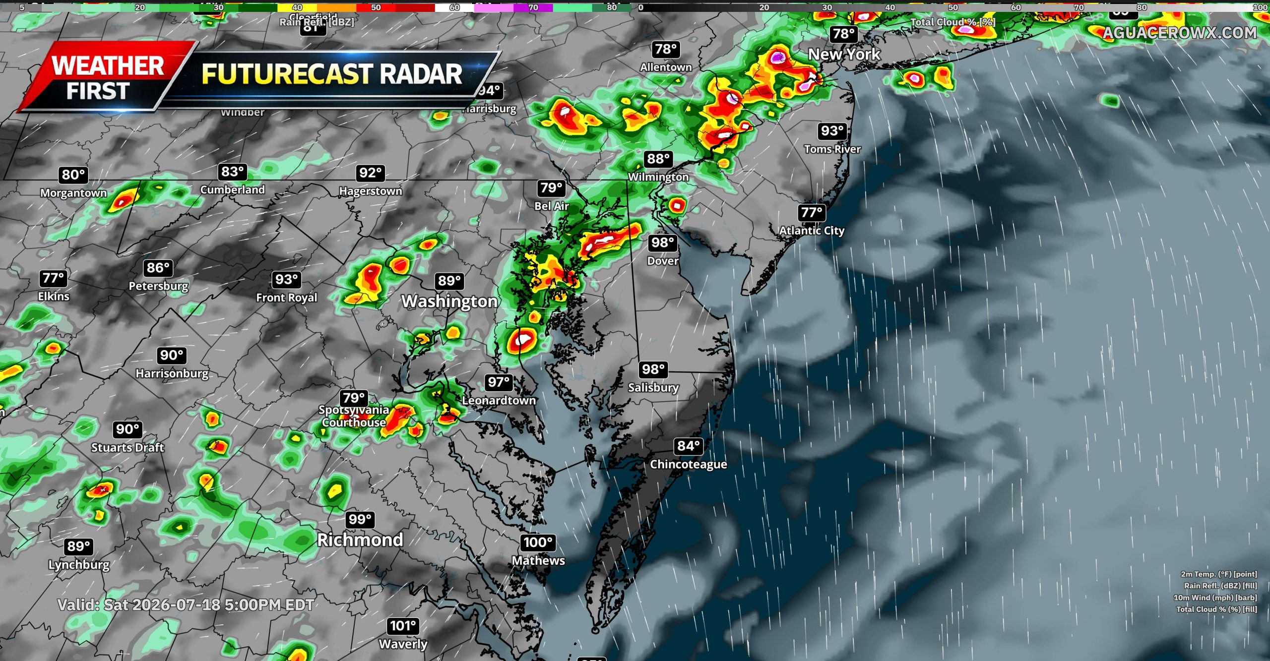
A potentially active round of severe thunderstorms is expected across the Mid-Atlantic on Saturday as a strong upper-level disturbance and an approaching cold front move into the region.
Showers and thunderstorms may already be ongoing during the morning as a warm front lifts northward through the area. Some of this early activity could become locally strong, especially near the warm front, but the greatest concern is expected to develop from the mid to late afternoon into the evening.
During that time, another round of thunderstorms is forecast to form ahead of the approaching cold front and move east across Pennsylvania, Maryland, Delaware, New Jersey, Virginia, and the surrounding region.
Damaging Winds Will Be the Primary Threat
The atmosphere is expected to become increasingly unstable Saturday afternoon, with 1,000 to more than 2,000 J/kg of instability possible. At the same time, wind shear through the atmosphere may increase to around 35 to 50 knots.
This combination could support organized thunderstorms, including clusters, line segments, and a few supercells. Damaging wind gusts will be the primary severe weather threat, with the possibility of swaths of wind damage where storms organize into stronger lines.
Some supercells could also produce large hail. A few tornadoes cannot be ruled out, particularly near the lifting warm front or along a prefrontal trough where low-level wind shear may be locally enhanced.
Very Heavy Rain and Flash Flooding Also Possible
In addition to the severe weather threat, the atmosphere will contain an unusually high amount of moisture. Precipitable water values are forecast to climb above 2 inches, which is well above normal for this time of year.
Thunderstorms will be capable of producing intense rainfall rates of more than 2 inches per hour. Flash flooding could quickly develop in urban areas, low-lying locations, poor-drainage areas, and near creeks and streams.
Locations affected by multiple rounds of thunderstorms will face the greatest flooding risk, especially where the ground becomes saturated from earlier rainfall.
Morning Storms and Wildfire Smoke Add Uncertainty
There is still some uncertainty regarding how Saturday’s severe weather threat evolves. Morning thunderstorms and cloud cover could limit how much instability develops later in the day.
Persistent wildfire smoke across portions of the Mid-Atlantic may also reduce incoming sunlight and slow daytime heating. However, if enough clearing occurs and the atmosphere recovers during the afternoon, conditions could become favorable for a more widespread severe weather event.
Even with these uncertainties, the overall weather pattern supports the potential for several areas of damaging winds, localized flash flooding, large hail, and a few tornadoes across the broader region.
A moving operation is taking place in the vicinity of the Bunker Hill Bridge on US-301, according to Delaware Department of Transportation officials.
Travelers using this stretch of roadway should be prepared for potential slowdowns or traffic disruptions in the area while the operation is in progress.
Drivers are encouraged to allow extra travel time or consider using an alternate route until the situation is resolved. No additional details regarding the duration of the operation were immediately available.
A disabled vehicle is causing a left lane closure on Delaware Route 1 southbound at the overpass of DuPont Parkway, also known as US Route 13, near Eagles Nest Landing Road.
Drivers traveling in that area should be prepared for potential slowdowns and are encouraged to use caution as crews work to address the situation.
No additional details about the duration of the closure have been released at this time. Motorists are urged to allow extra travel time or consider alternate routes if possible.
Motorists traveling along Meadowbrook Avenue should plan for intermittent lane closures as construction crews work in the area.
The lane restrictions are in effect along the stretch of Meadowbrook Avenue between Newport Gap Pike and Kiamensi Road. Closures are expected to remain in place until 6 p.m.
Drivers are encouraged to allow extra travel time or consider alternate routes to avoid potential delays in the area.
Motorists traveling northbound on Old Orchard Road are facing a lane restriction due to ongoing construction work in the area.
The closure affects the stretch of road running from Edgemoor Street to the Lewes-Georgetown Trail. Drivers are encouraged to plan ahead and allow extra travel time or consider an alternate route if possible.
The lane is expected to reopen by 5 p.m. Travelers should remain alert for construction crews and equipment in the area and follow all posted traffic control signs.
Authorities in Claymont are reaching out to the public for assistance in identifying a suspect believed to be behind a series of attempted break-ins that took place Thursday morning in the Darley Green neighborhood.
According to police, officers were dispatched around 10:05 a.m. on July 16, 2026, after receiving reports of attempted burglaries at several homes along the 3500 block of Naamans Drive, as well as a residence in the 1400 block of Historical Way.
Upon arriving at the scene, officers determined that an unknown individual had attempted to burglarize the properties. The suspect’s identity remains unknown at this time.
Anyone who may recognize the suspect or has information related to these incidents is urged to contact local law enforcement.
A northbound lane on Old Mill Bridge Road is currently closed to traffic between Millers Neck Road and Ellsworth Lane as construction crews work in the area.
The lane restriction is expected to remain in place until 5 PM. Drivers traveling through that stretch should allow extra time or consider an alternate route to avoid delays.
Motorists traveling in the area should be aware of an extended road closure affecting Gravel Hill Road in Sussex County.
According to transportation officials, Gravel Hill Road will be closed to through traffic between Lewes Georgetown Highway and Bennum Switch Road. The closure is the result of ongoing construction work in the area.
The road is expected to remain closed until 10 p.m. on July 24, 2026. Drivers are encouraged to allow extra time and seek alternate routes during the construction period.
Drivers traveling along Carsdale Court near Arundel Drive should be prepared for intermittent lane closures as construction work continues in the area.
The lane restrictions are expected to remain in place until 6 p.m. Motorists are encouraged to use caution when passing through the construction zone and to allow for additional travel time if their route takes them through the affected area.
No further details about the nature of the construction were provided. Updates on traffic conditions can be found through local traffic resources.
A mobile trash removal crew is currently active along northbound Interstate 95 in the stretch between Newark and Wilmington, according to traffic officials.
The crew is expected to remain on the highway until 3 p.m. Drivers traveling through that corridor should remain alert and use caution as workers may be present along the roadway.
Motorists are encouraged to slow down and stay aware of any personnel or equipment near the travel lanes while the cleanup operation is underway.
Construction activity is causing intermittent lane closures on Quail Hollow Drive at Village Drive, according to traffic officials.
The lane restrictions are expected to remain in place until 6 p.m. Drivers traveling through the area should anticipate possible delays and consider alternate routes if available.
No additional details about the nature of the construction work were provided. Motorists are urged to slow down and use caution when passing through the work zone.
Residents across dozens of American cities are waking up to hazy, orange-tinted skies as wildfire smoke continues to drift across wide stretches of the United States.
The smoky conditions have triggered poor air quality alerts in multiple cities, raising health concerns for people who spend time outdoors. Officials are urging the public to stay inside as much as possible until conditions improve.
Relief may not come quickly — forecasters say the air quality situation is unlikely to get better until the weekend arrives.
Good morning, Delmarva! It’s going to be a hazy, smoky Friday across the peninsula, so keep that in mind if you’re planning any outdoor activities today. Temperatures will climb to a warm high near 90°F under partly sunny skies, with light and variable north winds staying between 0 and 5 mph. The smoke may irritate those with respiratory sensitivities, so folks with asthma or breathing conditions may want to limit time outdoors.
Tonight stays warm and muggy with that smoky haze lingering and overnight lows settling around 71°F.
Looking ahead to Saturday, more of the same smoke-filled skies are expected through the day, with highs again reaching 90°F. However, Saturday night brings a significant change — showers and thunderstorms are on the way, with lows around 75°F. Make sure you have your umbrella handy if you have Saturday evening plans!
Stay safe out there, Delmarva, and we’ll keep a close eye on those weekend storms for you. Have a great Friday!
PARIS — Two people have lost their lives after powerful thunderstorms tore through France overnight, bringing a deadly end to a prolonged period of extreme heat. By Friday, roughly 53,000 households were left without electricity, according to French media reports and grid operator Enedis.
In the central Haute-Vienne department, a woman died Thursday evening when a falling tree struck her in the town of Saint-Victurnien. Separately, in the eastern town of Dolomieu, a man was discovered burned to death late Thursday night inside a workshop that had caught fire after being struck by lightning, according to AFP.
Grid operator Enedis reported Friday that the power outages were concentrated primarily in two regions — the Auvergne Rhone-Alpes area in the southeast and Nouvelle Aquitaine in the southwest.
France’s national weather service, Météo-France, lifted an orange-level thunderstorm alert Friday for all southeastern departments that had previously been under the warning. Earlier, forecasters had cautioned residents about the threat of large hailstones and powerful wind gusts stretching from the Massif Central mountain range to the Alps.
An NPR reporter recently got a hands-on introduction to one of the Chesapeake Bay’s most cherished traditions — catching crabs.
Frank Langfitt of NPR took a turn at crabbing on the Bay, experiencing firsthand what draws so many people to the water each season. While Maryland alone issues more than 5,000 commercial crabbing licenses, the number of people who crab purely for enjoyment is far greater — reaching into the tens of thousands.
The experience shines a light on a pastime that has long been woven into the culture and way of life along the Chesapeake Bay region.
A devastating flood emergency is unfolding across parts of Texas, where relentless rainfall has left at least two people dead and hundreds of others in need of rescue.
Several Texas communities have been overwhelmed by more than 20 inches of rain that has fallen since the start of the week, sending floodwaters surging through neighborhoods and trapping residents in their homes and vehicles.
Emergency responders have conducted hundreds of rescues as the floodwaters continue to pose serious dangers to those caught in the affected areas.
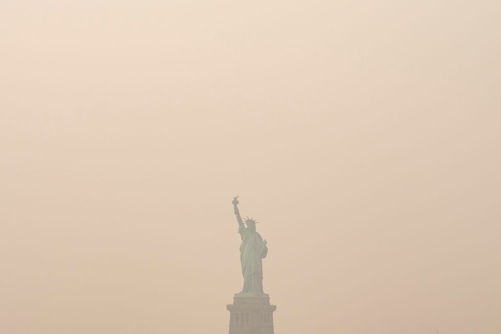
A thick, acrid haze from wildfires spread across a wide stretch of the United States on Thursday, dimming skies from the Great Lakes region eastward to parts of the East Coast.
The heavy smoke significantly reduced visibility in affected areas, and officials cautioned that outdoor air quality had reached levels that could be harmful to breathe.
The Associated Press compiled a photo gallery documenting the dramatic scenes as the smoky skies settled over the region.
The National Weather Service office located in Mount Holly, New Jersey has issued an Air Quality Alert, effective as of 3:45 PM Eastern Time on July 16.
During periods of poor air quality, health officials generally recommend that sensitive groups — including the elderly, children, and those with respiratory or heart conditions — limit their time outdoors and reduce strenuous physical activity.
Residents are encouraged to monitor local forecasts and updates from the National Weather Service for any changes to this alert or additional advisories as conditions develop.
The National Weather Service office in Mount Holly, New Jersey has issued an Air Quality Alert, according to an official notice released on July 16 at 3:45 PM Eastern Daylight Time.
Residents in the affected area are advised to be aware of current air quality conditions, which may present health risks for certain individuals. Those who are sensitive to air pollution — including the elderly, young children, and people with respiratory or heart conditions — are urged to limit their time outdoors and reduce physical activity outside.
Authorities recommend that everyone monitor local air quality updates and follow any guidance provided by health officials. Keeping windows closed and staying in air-conditioned spaces may help reduce exposure to poor air quality conditions.
Additional details, including the specific geographic area covered by this alert and the expected duration, were included in the official notice from the National Weather Service. Residents should check the latest updates from local authorities and weather services for the most current information.
The National Weather Service office located in Mount Holly, New Jersey has issued an Air Quality Alert, effective as of 3:45 PM Eastern Daylight Time on July 16.
Authorities are urging residents to be mindful of air quality conditions during the alert period. People who are sensitive to air pollution — including those with asthma, heart conditions, or other respiratory issues — are encouraged to limit their time outdoors and reduce physical activity outside when possible.
Children, the elderly, and anyone with pre-existing lung or heart conditions are considered most at risk during periods of poor air quality. Residents should monitor local forecasts and updates from the National Weather Service for any changes to the alert status.
Thick, foul-smelling wildfire smoke rolled across a broad stretch of the country on Thursday, stretching from the Great Lakes all the way to portions of the East Coast. The haze reduced visibility and triggered urgent warnings from officials telling people to avoid breathing outdoor air.
Across many cities, residents were told to remain indoors or wear protective masks if going outside was unavoidable. Air quality climbed to unhealthy and hazardous levels — conditions considered dangerous for everyone, not just those with pre-existing health concerns. The smoke originates primarily from wildfires burning in Canada, with additional fires in northern Minnesota also contributing. A stalled high pressure system has been pushing the smoke down toward ground level, according to Steven Freitag, a meteorologist with the National Weather Service in Detroit, where air quality ranked among the worst of any major city in the world.
“Sure enough, it arrived in force here and it’s really pretty extreme levels,” Freitag said, adding that visibility in certain spots had dropped to just half a mile.
Detroit resident Omar Mitchell, 50, had a mask on as he made his way to his restaurant, glancing up at the sky with concern. “It’s scary,” he said. “You don’t know necessarily what the side effects may be. That’s days or months later.”
Health experts warn that the tiny particles in wildfire smoke can penetrate deep into the lungs and enter the bloodstream, potentially causing heart and lung complications along with other serious long-term health consequences.
Sky turns yellow, air reeks across the region
The entire state of Michigan and large portions of Minnesota were placed under hazardous air quality alerts. In the Chicago metropolitan area, air quality fluctuated between very unhealthy and hazardous readings.
National Weather Service meteorologist Jake Petr cautioned that even if northwest winds help clear the air later in the week as forecast, smoky conditions could keep returning until the fires are fully extinguished — a process that could stretch on for months, possibly until snowfall arrives in Canada and northern Minnesota.
In downtown Chicago, 76-year-old Bill Ostrowski walked through streets shrouded in smoke, a mask covering his face. “It stinks. It’s not a good sign when you wake up in the morning and you can smell the air,” he said.
In St. Paul, Minnesota, Brent Williams, who heads the soil, water and climate department at the University of Minnesota, described the sky as “glowing yellow.” He said the region “could be looking at weeks to months of continued smoke and flare-ups off and on as the winds blow in different directions.”
A study released this year determined that prolonged exposure to fine particles from wildfire smoke was linked to an average of 24,100 deaths annually across the lower 48 states. Extended exposure can worsen existing medical conditions and lead to serious chronic illnesses, including respiratory disease, cardiovascular and neurological problems, and early death.
New York City hands out masks, cancels outdoor plans
Over the New York City area, a dense haze cast an orange and yellow tint across the morning sky, partially hiding Manhattan’s skyline from view.
City officials opened cooling centers, and health authorities asked New Yorkers to cut back on vigorous or lengthy outdoor activities. Schools, parks, and other city agencies moved programming indoors, postponed events, and adjusted how they operated. State officials handed out tens of thousands of face masks at transit hubs and other high-traffic locations.
Gwen Moseley, 65, was among the first to pick up a free mask at Rosedale Library in Queens. She spends much of her workday traveling as a therapist for children with autism. “Who wants to be breathing this? It’s not healthy,” she said while waiting for a young client. “When I’m out walking, I can feel the scratchiness in my throat.”
Weather service meteorologist Maureen Hastings said the smoke had eased somewhat but was expected to thicken again by late afternoon or evening, potentially lingering through the night. She indicated it might shift southward briefly on Friday before returning after dark.
The state Department of Environmental Conservation flagged the potential for temporary spikes of “very unhealthy” air quality stretching from Buffalo in the western part of the state to Rochester near Lake Ontario, then to Syracuse in the central region and down into the greater New York City area.
In Philadelphia, officials encouraged residents to avoid strenuous outdoor activity and to stay inside when possible, or wear N95 or KN95 masks if heading out. “Today is not the day to start your marathon training plan,” said Dr. Palak Raval-Nelson, the city’s public health commissioner.
Minnesota wildfires continue to spread
In Minnesota, forest rangers spent Thursday searching a remote wilderness area to locate anyone who might still be present, days after wildfires forced officials to close the region.
The Boundary Waters area along the U.S.-Canada border was shut down on Tuesday. Between 6,000 and 10,000 people were believed to be inside at the time of the closure, though Superior National Forest staff estimated by Wednesday that they had made contact with approximately 90 percent of them, according to Karen Harrison, a spokesperson for the state and federal agencies coordinating the response.
Harrison said Thursday that heavy smoke has grounded helicopters and that the fires are continuing to spread despite active firefighting efforts. “There will be fire on the landscape until fall, and some fire will be burning until snow cover,” she said.
In a separate development, the Royal Canadian Air Force successfully evacuated 11 Minnesota teenagers and four staff members on Wednesday from wildfires burning in an Ontario provincial park located roughly 175 miles north of the Minnesota border.
Motorists traveling along Delaware Route 1 through the Dover Toll Plaza should plan for brief delays as rolling lane closures are currently in effect in both directions.
According to DelDOT, the temporary closures are the result of an ongoing spraying operation at the toll plaza. Both northbound and southbound lanes are affected on a rolling basis, meaning lanes will be closed and reopened periodically as crews move through the area.
The operation is expected to wrap up by 6:00 AM. Drivers are encouraged to use caution when passing through the area and to follow the direction of any posted signs or traffic control personnel on site.
Northbound travelers on US Route 13 are facing restricted lanes overnight due to ongoing construction activity.
Three left lanes on US 13 northbound are currently closed in the stretch between 2nd Avenue and 3rd Avenue. Drivers in the area should plan for potential slowdowns and allow extra travel time.
The lane closures are expected to remain in effect until 5:00 AM, at which point the roadway is anticipated to return to normal traffic flow. Motorists are advised to use caution when passing through the construction zone.
UVALDE, Texas — Days of heavy rainfall have triggered catastrophic flooding across parts of Texas, overwhelming communities and forcing emergency teams into round-the-clock rescue operations.
Homes and roads have been swallowed by rising floodwaters, with hundreds of people requiring rescue as conditions continue to deteriorate. Emergency responders have been stretched to their limits as they work to reach those trapped or endangered by the ongoing disaster.
The flooding remains an active threat, with communities across the affected region bracing for further danger as floodwaters persist.
A right lane on US-13 southbound has been closed in the stretch between Llangollen Boulevard and Schaffer Boulevard, according to traffic incident information.
Motorists traveling through that corridor should be aware of the lane restriction and allow extra time for their commute. No information regarding the cause of the closure or an estimated reopening time was immediately available.
Drivers are encouraged to use caution in the area and watch for workers or equipment that may be present near the roadway.
A right lane closure is currently in effect on US-13 southbound between Llangollen Boulevard and Schaffer Boulevard, according to traffic officials.
Drivers traveling in that direction should be prepared for potential slowdowns in the area and are encouraged to use caution while passing through the closure zone.
No information was released regarding the cause of the lane restriction or when the affected lane is expected to reopen. Motorists should check for updated traffic conditions before heading out.
Travelers using DE-24 eastbound near Daniels Way should be prepared for intermittent lane closures as road work crews are active in the area.
The lane restrictions are expected to remain in place until 12:00 AM. Drivers are encouraged to use caution when passing through the work zone and to expect possible delays.
No additional detour information was provided. Motorists should stay alert for work zone signage and flaggers that may be directing traffic in the area.
Old Furnace Road is currently closed between Waller Road and Asbury Road as a result of a crash, according to transportation officials.
Motorists traveling through the area are advised to avoid the stretch of roadway and plan alternate routes until further notice. The closure remains in effect as crews address the situation on the ground.
No additional details regarding the crash, including the number of vehicles involved or any injuries, have been made available at this time. TV Delmarva will continue to monitor this developing situation and provide updates as more information becomes available.
Before the sun came up Thursday morning in Texas, the Guadalupe River surged to heights matching a two-story building — and it did so in just five hours — sending a wall of water crashing through a region that is still recovering from last summer’s deadly flash floods.
For the second year in a row, severe flooding has triggered dozens of high-water rescues, washed out roads, and claimed at least one life, according to authorities. Days of nonstop heavy rain have served as yet another terrifying reminder of just how dangerous the flood-prone Texas Hill Country can be. Experts say this latest event was fueled by a combination of atmospheric conditions and an abundance of available moisture in the air.
“Last year, it was one big wave that came through. And it wiped everything out, and then it receded, and then we could deal with the damage. This time, we’re on day three of heavy rain and everything keeps continuing to rise, and it’s expected to rain today and tonight,” said Suzanne Sutphin Gschwind of Kerrville, one of the communities hit hardest by the flooding.
A mass of hot air sitting over the center of the continental United States caused storm systems to stall and move very slowly, allowing round after round of rain to fall — sometimes at a rate of several inches per hour over roughly the past three days. Bob Oravec, a meteorologist with the National Weather Service, described the flooding as being “about as bad as it gets,” calling these kinds of conditions typically rare.
“Obviously, something like this doesn’t occur every year, but it has occurred over two years in a row and it has occurred over a region that is prone to flash flooding by its topography,” Oravec said.
Over those three days, nearly 1 trillion gallons of rain fell across the three counties hit hardest in Texas. According to Ryan Maue, former chief scientist at the National Oceanic and Atmospheric Association, Uvalde County alone received more rainfall during that stretch than the entire state of California has seen over the past month.
The flooding that struck over the Fourth of July weekend last year killed more than 100 people, including approximately two dozen children and camp counselors at Camp Mystic, a now-closed Christian summer camp for girls. This week’s storms dropped rain across an even broader area, overlapping with many of the same locations where floodwaters overturned vehicles, tore down trees, and forced rescuers into emergency action last July.
A local official in Travis County, which encompasses Austin, reported that residents were stranded on barn rooftops and in trees. Texas Gov. Greg Abbott confirmed that drones and helicopters had been deployed to carry out rescues.
“We are looking at every square inch of the entire area for anybody who may be stranded anywhere. And there will be help coming very rapidly to whoever may be displaced, wherever they are,” Abbott said.
The storms hit the Texas Hill Country, a region of central and south Texas defined by steep, rugged terrain. Thin layers of soil sit on top of limestone hills that have been saturated for days. Rather than soaking into the ground, rainwater rushes directly into rivers with steep banks, causing water levels to spike dangerously fast — a scenario that can catch people completely off guard.
Tyler Roys, a senior meteorologist with the forecasting company AccuWeather, said that when rivers rise that quickly, “it’s almost like a river tsunami.” He noted that these situations are so deadly because water is both extremely heavy and fast-moving. A single cubic foot of water — roughly the size of a box slightly larger than a basketball — weighs about 62 pounds, or 28 kilograms.
Texas State Climatologist John Nielsen-Gammon noted that while this week’s flooding is serious, the rain has fallen somewhat less intensely than last year’s event in many locations, and rivers have generally not risen quite as rapidly.
“This one is producing greater overall precipitation totals, but it is mostly doing it with lower rain rates. They are still fairly high, but they aren’t as high as they were last year,” he said.
Although the Guadalupe River is running very high, its levels have mostly stayed below the record marks set during last year’s deadly floods — with one notable exception. At the small community of Comfort, the river climbed to 37 feet, or 11.3 meters, early Thursday morning. That is 1.5 feet, or about half a meter, higher than it reached at the same location last year. At its peak last year, water equivalent in weight to the Empire State Building was flowing downstream roughly every minute. The all-time record at that location stands at 42.3 feet, or 12.9 meters, set back in 1869.
Scientists say it is difficult to directly link any single storm to climate change, especially while events are still unfolding. Oravec noted that the atmospheric conditions responsible for this storm — hot air that slows and steers storm systems — have existed for a long time, but that climate change could make those conditions more frequent. A warmer atmosphere is also capable of holding more moisture, which can lead to heavier rainfall.
Last year’s deadly floods did increase public awareness of the dangers that flash floods pose, particularly when they strike at night, Oravec said.
“I think overall it has been a good forecast. The effects are catastrophic, but the signal was there for potential heavy rainfall,” he said.
Travelers using US-40 eastbound near Glendale Boulevard should be aware of intermittent lane closures that are expected to remain in effect until midnight.
The lane restrictions may cause delays in the area, and drivers are encouraged to use caution when passing through the affected stretch of roadway.
No additional details regarding the cause of the closures were provided. Motorists are advised to consider alternate routes if possible and to stay alert for traffic control personnel or signage in the area.
Two people are dead in Texas after being swept away in their vehicles by floodwaters, and state officials are warning that the worst may still be ahead. Texas Governor Greg Abbott announced Thursday afternoon that the state is preparing for what he called “record-shattering” rainfall expected over the following 24 hours.
Emergency crews have already carried out 230 rescues across the affected areas, including a dramatic operation in which a man and his dog were lifted from a submerged truck using a helicopter and a rescue swimmer, according to Abbott.
The state has mobilized 2,350 emergency responders along with 1,400 pieces of equipment — among them Black Hawk helicopters and swiftwater rescue boats. Officials are determined to avoid a repeat of last year’s tragedy, when flooding in the same Texas Hill Country region killed at least 135 people, including 27 campers and counselors — most of them children — at a summer camp.
“We’re facing record-shattering rainfall that leads to very dangerous flooding. We want to do everything we possibly can to protect our lives,” Abbott told reporters following a briefing, standing alongside emergency response officials.
The National Weather Service reported that 10 to 20 inches of rain — roughly 25 to 50 centimeters — had already fallen across parts of the Hill Country over the previous two days. That region includes Camp Mystic, a Christian summer camp for girls located along the Guadalupe River, which was the site of last year’s deadly disaster.
Abbott identified the two victims as a man who was swept away while in his recreational vehicle and a woman whose vehicle was overtaken by rising floodwaters.
The governor urged residents to stay off the roads until the storms pass, which is expected sometime late Friday. Across the state, 125 roadway sections have been impacted, with 87 of them closed — including a bridge that was struck by a barge.
Uvalde and Johnson City were highlighted as areas of particular concern. The Nueces River near Uvalde was forecast to surpass its record crest set in 1996, while the Frio and Pedernales rivers were expected to reach some of their highest levels ever recorded.
Good news for residents across the Delmarva Peninsula and neighboring communities — the Heat Advisory that was in effect has now ended, according to the National Weather Service office in Mount Holly, New Jersey.
The advisory, which covered a wide swath of the region including New Castle, Kent, Queen Anne’s, Talbot, Caroline, and surrounding counties in Delaware, Maryland, Pennsylvania, and New Jersey, was officially canceled at 7:51 PM Wednesday evening.
While the immediate threat has passed, meteorologists remind residents that summer heat can remain dangerous even after an advisory expires. Health officials recommend continuing to drink plenty of water, avoid prolonged time outdoors during peak afternoon hours, and check on elderly neighbors, young children, and pets who may be especially vulnerable to heat-related illness.
Residents should also remain aware that heat conditions can change quickly during the summer months. TV Delmarva will continue monitoring any developing weather threats across the peninsula and bring you the latest updates as conditions evolve.
For the most current weather information, stay tuned to TV Delmarva and visit our website.