
The National Weather Service Storm Prediction Center (SPC) is preparing to roll out an important update to how severe weather threats are communicated, with changes expected to take effect in March. The update centers on a concept known as Conditional Intensity, which aims to provide clearer insight into how intense severe weather could become if it occurs.
Currently, SPC outlooks focus on the probability that severe weather will occur within a given area. These probabilities describe the likelihood of hazards such as tornadoes, large hail, or damaging winds occurring within 25 miles of a location during the forecast period. While this approach has been effective for identifying areas at risk, it does not explicitly communicate how strong those hazards may be.
The upcoming changes seek to address that gap.
What Is Conditional Intensity?
Conditional intensity describes the expected severity of a weather hazard, assuming that hazard actually occurs. In other words, it answers the question not just of whether severe weather is possible, but how strong it could be if storms develop.
For example, instead of only indicating that tornadoes are possible in an area, conditional intensity information can highlight whether the most likely tornado intensity would be weak or potentially strong. The same applies to hail size and wind speed, offering more detail on the potential impacts of severe storms.
This information has been tested for several years through experimental forecasting programs and research efforts within NOAA. Based on those results, SPC is now moving toward limited operational use.
What Will Change in March?

Beginning in March, SPC plans to add Most Probable Peak Intensity information to certain forecast products, starting with Mesoscale Discussions. These discussions are issued when conditions are becoming favorable for severe weather and often precede watches and warnings.
The new intensity information will provide estimates of the most likely maximum hail size, wind gusts, or tornado strength associated with developing storms. This will give emergency managers, broadcasters, and the public a clearer picture of potential impacts during rapidly evolving severe weather situations.
At this stage, the update will not replace existing outlook categories or probabilities. Instead, it will complement them by adding another layer of context to help users better understand risk.
Why This Matters
Severe weather risk is often misunderstood when forecasts focus solely on probabilities. A lower probability event can still produce significant impacts if the storms that form are intense. Conditional intensity information helps bridge that gap by highlighting potential worst-case outcomes when storms do occur.
This added detail is expected to improve decision making for emergency response, school and business planning, and public preparedness. It also aligns with broader efforts across meteorology to better communicate risk and uncertainty, especially during high-impact weather events.
Looking Ahead
The March rollout marks the first step toward integrating conditional intensity information into operational severe weather forecasting. SPC and its research partners will continue evaluating how this information is used and how it may expand into additional forecast products in the future.
As severe weather season approaches, forecasters emphasize that the public should continue to rely on official watches, warnings, and outlooks, while becoming familiar with this new information as it becomes available.


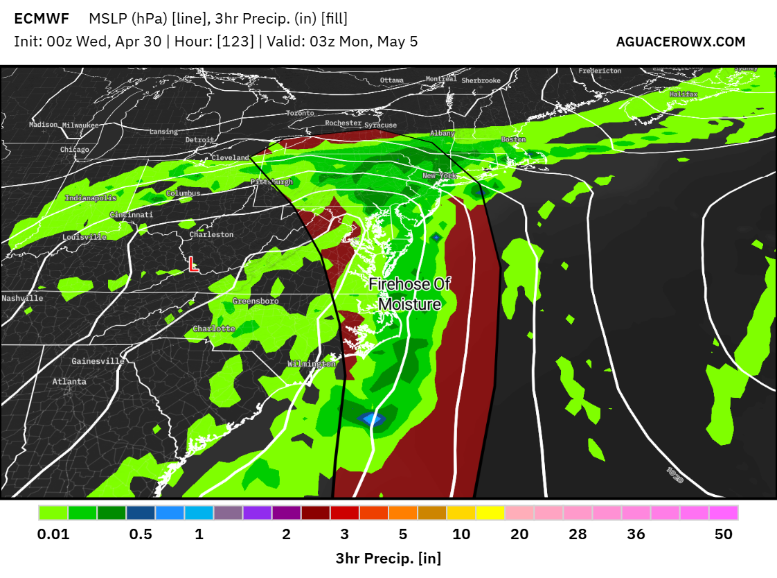


 ICON Model Output