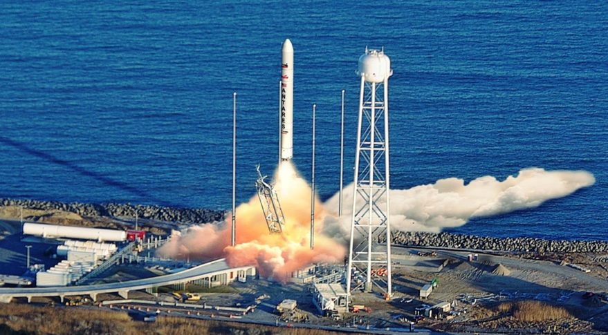

NASA and commercial cargo provider Northrop Grumman are targeting 12:40 p.m. EST Saturday, Feb. 19, for the launch of the company’s 17th resupply mission to the International Space Station from NASA’s Wallops Flight Facility on Wallops Island, Virginia.
Live launch coverage will air on NASA Television and the agency’s website, as well as YouTube, Twitter, Facebook, and NASA’s App, beginning at 12:15 p.m.
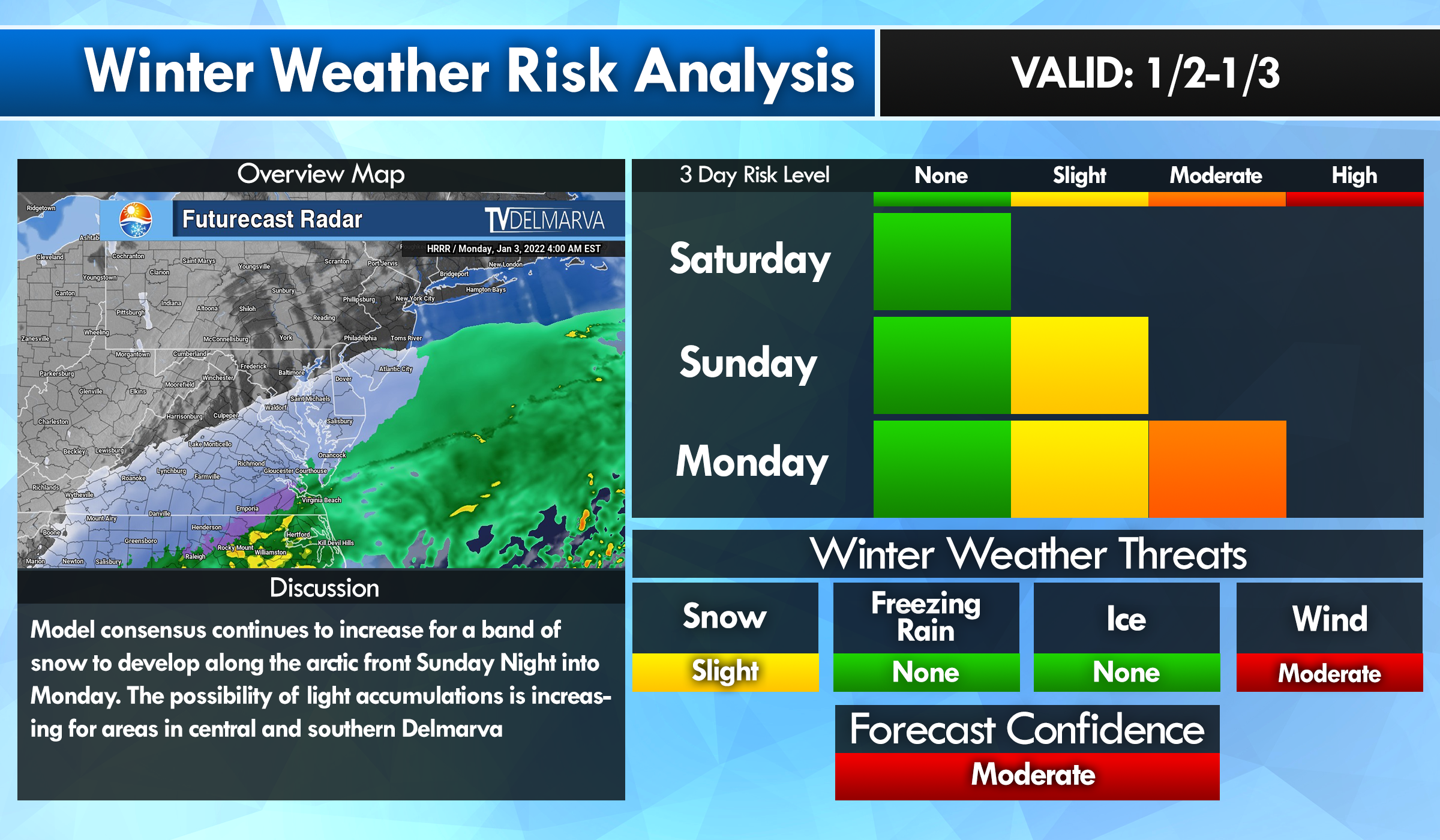
TV Delmarva will be in Wallops Island to bring you live coverage from ground level with this mission
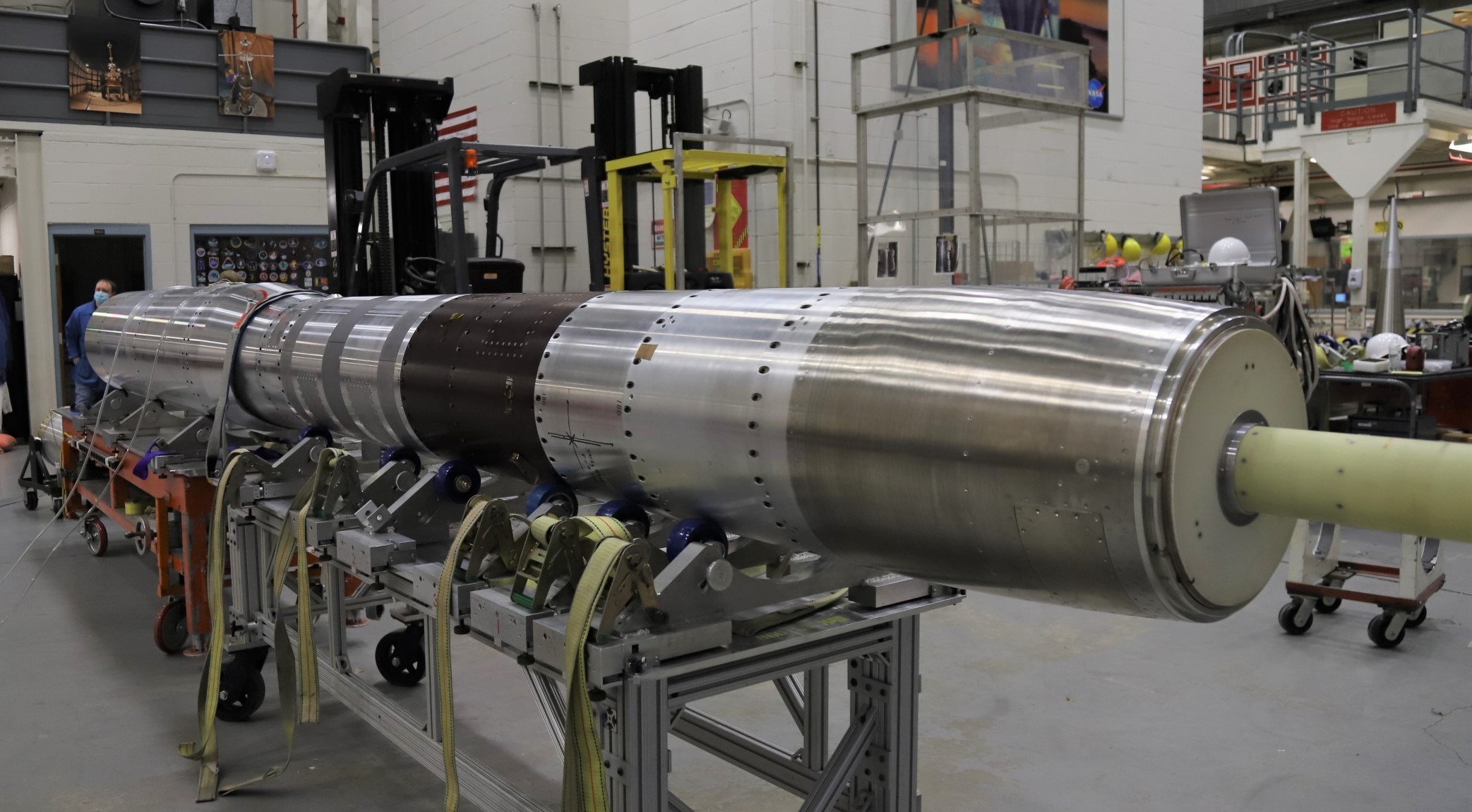
Loaded with more than 8,200 pounds of research, crew supplies, and hardware, Northrop Grumman’s Cygnus cargo spacecraft will launch on the company’s Antares rocket from Virginia Space’s Mid-Atlantic Regional Spaceport.
The Cygnus spacecraft, named the S.S. Piers Sellers in honor of the late NASA astronaut who spent nearly 35 days across three missions helping to construct the space station, will arrive at the orbiting outpost Monday, Feb. 21. At about 4:35 a.m., NASA astronaut Raja Chari will capture Cygnus, with NASA astronaut Kayla Barron acting as backup. After Cygnus capture, mission control in Houston will send ground commands for the station’s arm to rotate and install it on the station’s Unity module Earth-facing port.
Highlights of space station research facilitated by this mission include:
- a study that examines the effects of a drug on breast and prostate cancer cells;
- a new combustion facility
- an investigation from Colgate-Palmolive that will leverage the acceleration of skin aging in microgravity to help create and validate an engineered tissue model to serve as a platform for testing potential products to protect aging skin
- a demonstration of a lithium-ion secondary battery capable of safe, stable operation under extreme temperatures and in a vacuum environment
- new hydrogen sensors that will be tested for the space station’s oxygen generation system
- a system that will test hydroponic and aeroponic techniques for plant growth and will allow scientists to observe root growth through video and still images
The Cygnus spacecraft is scheduled to remain at the space station until May, when it will depart the station, disposing of several tons of trash during a fiery reentry into Earth’s atmosphere.