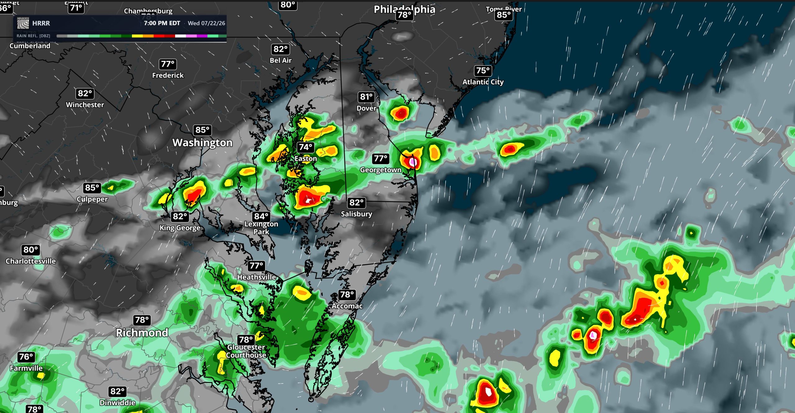

Another round of thunderstorms may develop across portions of the Mid-Atlantic this afternoon as a cold front approaches the region. The greatest potential for stronger storms will be south and east of the Interstate 95 corridor, including much of Delmarva.

Storm coverage is expected to be more limited than during the previous round of severe weather, but any thunderstorm that becomes well organized could produce locally damaging wind gusts. The combination of instability and wind shear will be greatest near Delmarva and areas farther south, supporting an isolated severe thunderstorm threat through the afternoon.

The primary concern will be strong, outflow-driven winds capable of bringing down tree limbs and causing isolated power outages. Frequent lightning and brief torrential rainfall will also accompany the stronger storms.

A localized flash flood threat remains across portions of Delmarva. Atmospheric moisture will gradually decrease as drier air moves into the region, but enough moisture will remain available for thunderstorms to produce heavy rainfall over a short period. Areas that received several inches of rain during the past 24 hours will be particularly vulnerable to renewed flooding.
Even a brief downpour could quickly cause water to collect on roads, in poor drainage areas, and near creeks or streams. Motorists should avoid flooded roadways and never attempt to drive through high water.
There remains uncertainty regarding how many storms will redevelop ahead of the front. Most forecast guidance suggests coverage may remain scattered or isolated, which would reduce the overall severe weather and flooding threat. However, conditions will still need to be monitored closely through the afternoon, especially across southern New Jersey, Delaware, and Maryland’s Eastern Shore.
The cold front will move through the region later today and tonight. Behind it, much drier and more comfortable air will arrive from the northwest. Pleasant conditions are expected to continue through the end of the week and into the weekend.