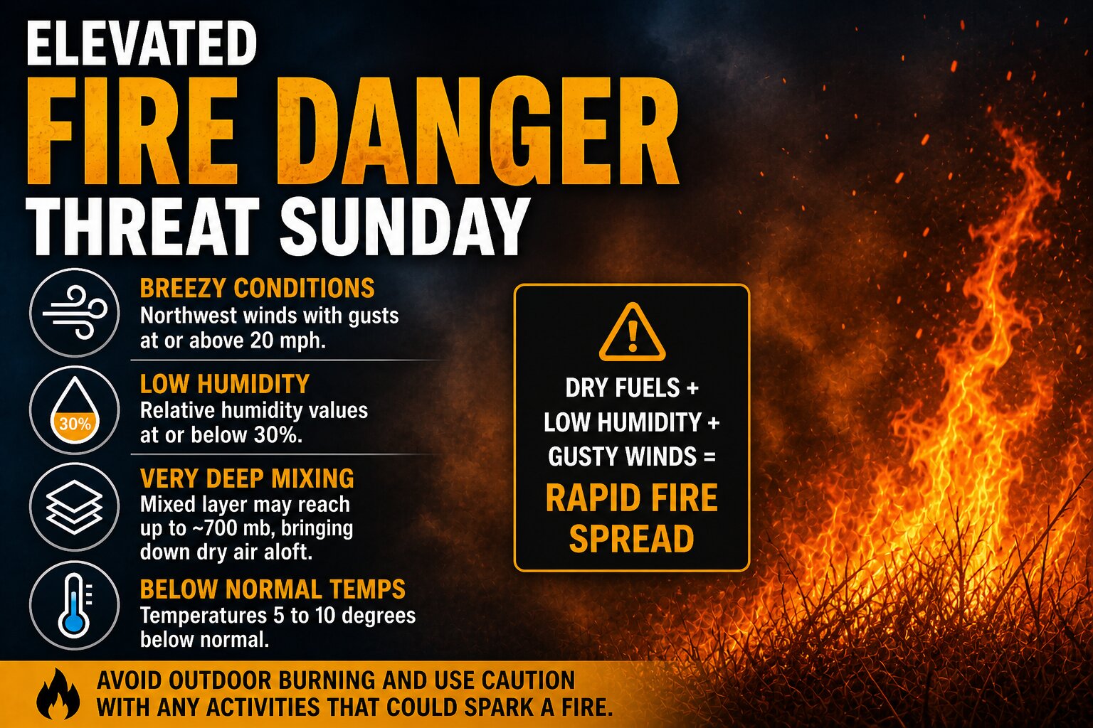

An increased risk for fire spread is expected to develop across the Delmarva region on Sunday as a dry and breezy weather pattern takes hold behind a departing offshore storm system.
As the coastal low pulls farther out to sea, high pressure will begin building in from the southeastern United States. This setup will tighten the pressure gradient locally, leading to a strengthening northwest wind across the region. At the same time, the atmosphere is expected to mix deeply during the day, allowing very dry air from aloft to be transported down to the surface.

Forecast soundings indicate an unusually deep mixed layer for this time of year, potentially extending up to around 700 mb. This efficient vertical mixing will help drive down dew points more than typical model guidance suggests, especially given the tendency for models to overestimate moisture in springtime patterns like this. As a result, relative humidity values are expected to fall to around or below 30 percent during the afternoon hours.

Even though temperatures will run slightly below average, generally about 5 to 10 degrees cooler than normal, the combination of dry air and increasing winds will create an environment supportive of fire growth. Wind gusts are expected to reach 20 mph or higher at times, which, when combined with low humidity, can allow any fires that ignite to spread quickly.
The overall fire risk will ultimately depend on the condition of local fuels, but given the recent dry stretch across parts of the region, the potential for rapid fire spread cannot be ruled out. Residents are urged to avoid outdoor burning and to exercise caution with any activities that could produce sparks.
Conditions are expected to improve later Sunday evening as winds begin to diminish and humidity levels recover.