The University of Maryland Eastern Shore women’s basketball team made Senior Night a memorable celebration as their veteran players delivered a commanding performance against South Carolina State.
The Hawks’ senior class put on a scoring clinic, combining to rack up 51 points in the victory that sent the home crowd into celebration mode. The experienced players stepped up when it mattered most, leading their team to a decisive win on a night dedicated to honoring their contributions to the program.
The emotional Senior Night ceremony recognized the departing players who have been instrumental in building the Hawks’ basketball program. Their final home game performance served as a fitting tribute to their years of dedication and hard work in a UMES uniform.
The victory against South Carolina State showcased the leadership and skill that these senior athletes have brought to the court throughout their collegiate careers, giving fans and teammates a performance to remember as the regular season winds down.
The Blue Hens men’s tennis team claimed a convincing 5-2 victory against Georgetown University this past Saturday in Newark, marking a successful Alumni Day celebration at the university.
The Delaware squad showcased strong performance on their home courts, outmatching the visiting Georgetown team in the majority of their contests during the weekend matchup.
Two University of Delaware track and field athletes brought home podium finishes from the Conference USA Indoor Championships held in Lynchburg, Virginia this past weekend.
Olamide Ayeni, who competes in throwing events, and distance runner Marie-Theres Gruber both secured top-three placements as the Blue Hens track and field squad participated in the conference meet on February 27-28.
The strong performances by both Delaware athletes highlight the competitive level of the university’s track and field program in Conference USA competition.
KENNESAW, Ga. – The University of Delaware men’s basketball squad mounted a spirited late rally Saturday afternoon, but their efforts fell short as they dropped a 90-82 decision to Kennesaw State on the road.
The defeat leaves the Blue Hens with a 9-20 record for the season and a 5-13 mark in Conference USA competition. Meanwhile, Kennesaw State improved to 18-11 overall and 10-8 in league play with the victory.
Despite the final score indicating a close contest, Delaware’s comeback attempt came too late to overcome the deficit they faced against the Owls in Saturday’s matchup.
The Goldey-Beacom Lightning opened their three-game series against Millersville University on a winning note, defeating their opponents 6-4 in the first matchup.
The Lightning managed to secure the victory in what appears to be the start of an important series for the Delaware-based baseball program.
This opening game sets the stage for the remainder of the series as both teams look to gain momentum moving forward in their respective seasons.
SALISBURY, Md. – A historic winning streak came to a dramatic end Saturday afternoon as Salisbury University’s men’s lacrosse program suffered a stunning setback on home ground.
The Sea Gulls, who entered the contest ranked second nationally, watched their incredible 45-game home winning streak evaporate in a 15-12 defeat to the University of Lynchburg Hornets, ranked tenth in the nation.
The loss marks the first time Salisbury has fallen at home since their streak began, representing a major milestone for the visiting Hornets who managed to overcome the ranking differential and hostile home environment to secure the upset victory.
NEWARK, Del. – The University of Delaware women’s basketball squad dropped a 67-53 decision to Middle Tennessee during Saturday’s contest at the Bob Carpenter Center. The defeat occurred on Senior Day, when the program celebrated four graduating players.
With the loss, the Fightin’ Blue Hens’ record moves to 12-16 overall and 6-11 in Conference USA play. Meanwhile, Middle Tennessee improved their standing to 15-13 overall with a 10-6 conference record.
The game marked an emotional day for Delaware as the team honored seniors Sarah Jenkins, Amiya Carroll, Jiya Perry, and Ella Wanzer before tipoff. Despite the special recognition ceremony, the Blue Hens were unable to secure a victory in front of their home crowd.
The 14-point margin of defeat represents another setback for Delaware’s women’s basketball program as they continue their Conference USA campaign. The Blue Raiders capitalized on the opportunity to strengthen their conference tournament positioning with the road victory in Newark.
University of Delaware softball player Sydney Shaffer etched her name in the record books during opening day action at the Blue Hen Invitational, launching her 30th career home run in a doubleheader that saw the Blue Hens go 1-1 against visiting teams.
Delaware defeated Le Moyne 9-3 before falling to Bryant 6-3 in an eight-inning contest during the tournament’s first day of competition.
Shaffer’s milestone blast places her among elite company in Blue Hens history, joining Anna Steinmetz (44 home runs) and Mariah Kondravy (34 home runs) as the only three players in the program’s history to reach the 30-homer plateau.
The historic achievement came as Delaware hosted multiple teams for their invitational tournament, showcasing the Blue Hens’ talent on their home field.
The University of Maryland Eastern Shore Hawks marked a milestone Friday as they took the field at their newly renovated Hawk Stadium for the first time this season, though the historic moment was dampened by a loss to the Manhattan Jaspers in their home opener.
The upgraded facility provided a fresh backdrop for Hawks baseball, but the team couldn’t capitalize on the excitement of playing in their improved home venue. Manhattan managed to spoil the stadium’s debut game with a victory over the Eastern Shore squad.
While the Hawks fell short in the team effort, individual performances provided bright spots for the home crowd. Gonzalez Perez stood out offensively, collecting three hits in four at-bats while driving in a team-leading three runs during the contest.
The renovated Hawk Stadium represents a significant investment in the university’s athletic facilities, giving the baseball program an enhanced home field advantage for future contests. Despite the opening loss, the Hawks will look to bounce back in upcoming games as they adjust to playing in their upgraded surroundings.
The team will continue their season with hopes that Perez’s strong offensive showing signals positive momentum ahead, even as they work to turn their early-season performance around at their newly improved home venue.
The Goldey-Beacom Lightning basketball team secured their position as second-place finishers in the Central Atlantic Collegiate Conference following an intense 106-101 overtime triumph against Bridgeport on Friday evening.
The Lightning weathered a dramatic back-and-forth contest at Wilmington’s Jones Center, ultimately prevailing in the extra period to lock up their conference standing. The high-scoring affair showcased both teams’ offensive capabilities in what proved to be a thrilling conclusion to the regular season.
With the victory, Goldey-Beacom solidifies their positioning heading into postseason play, having navigated through what can only be described as an emotional marathon against a determined Bridgeport squad.
NEWARK, Del. – The University of Delaware baseball team extended their hot streak to three consecutive victories Saturday afternoon, thanks to a dramatic seventh-inning rally that secured a 5-4 triumph over Rider University at Bob Hannah Stadium.
The hero of the afternoon was Evan Bouldin, whose clutch two-run homer in the bottom of the seventh frame provided the winning margin for the Fightin’ Blue Hens. The timely blast capped off a thrilling comeback that lifted Delaware’s record to 4-7 on the season.
With the loss, Rider’s record dropped to 3-2 as they fell victim to Delaware’s late-game heroics. The Blue Hens’ recent surge has provided a bright spot in what started as a challenging campaign, as the team continues to find its rhythm in the early portion of the season.
The victory at Bob Hannah Stadium showcased the team’s resilience and ability to deliver in pressure situations, qualities that will serve them well as they progress through their schedule.
The Goldey-Beacom Lightning women’s basketball squad wrapped up their campaign with a heartbreaking 69-65 defeat to the Bridgeport Purple Knights in their season finale at home.
The contest proved to be a nail-biter, with both teams battling until the closing moments before Bridgeport managed to secure the four-point victory over the Lightning.
Prior to tipoff, Goldey-Beacom took time to celebrate four graduating players in a senior night ceremony, recognizing Rory Ciszkowski, Gaia Zimbardo, Karlee Lemon, and Azra Ozgul for their contributions to the program.
Despite the disappointing result in their final home game, the Lightning showed fight against the Purple Knights in what proved to be an exciting finish to their season.
CHESTERTOWN, Md. – Salisbury University’s nationally-ranked women’s lacrosse squad delivered a dominant performance Saturday afternoon, defeating Washington College 16-10 in Maryland.
The Sea Gulls, currently sitting at No. 3 in national rankings, controlled the game’s final quarter by outscoring the Shorewomen 5-2 during the closing period at Roy Kirby Jr. Stadium.
The victory showcased the team’s ability to finish strong, as they pulled away from Washington College with their impressive fourth-quarter surge to secure the decisive six-goal margin of victory.
SALISBURY, Md. – Salisbury University’s baseball squad, currently holding the fourth position in national rankings, dominated on the mound while generating crucial runs during key moments to defeat the TCNJ Lions 5-2 on Saturday at Donnie Williams Sea Gull Baseball Stadium.
The Sea Gulls’ pitching staff delivered an impressive performance, recording 11 strikeouts throughout the contest while limiting the Lions’ offensive opportunities.
Salisbury’s offense came alive during the middle frames of the game, producing the necessary runs to secure the victory on their home field.
The win continues the Sea Gulls’ strong season as they maintain their top-five national ranking in collegiate baseball.
Maryland State Police crash investigators are working to determine what caused a deadly collision in Caroline County that took the life of a Ridgely resident yesterday afternoon.
Joseph Dsouza, 30, of Ridgely, died at the scene of the crash. Emergency medical personnel declared him deceased after his 2017 Kia Sorento collided with an Isuzu box truck on Maryland Route 480.
A 50-year-old passenger from Kuwait, Hillary Coelho, was riding in Dsouza’s vehicle at the time of impact. State police aviation transported Coelho to a trauma center where he remains hospitalized.
The box truck operator, James Sherry, 50, of Greensboro, was also taken to a hospital for treatment following the crash.
Emergency responders were called to Route 480 north of Eveland Road just before 2:00 p.m. yesterday, where they discovered both vehicles had left the roadway after the collision.
According to initial findings from crash investigators, the box truck was heading north when it veered across the centerline into the southbound lanes. Police believe Dsouza tried to prevent a direct head-on collision by steering his Kia onto the shoulder of the southbound side, but the vehicles still collided there.
Easton Barrack troopers and Caroline County emergency medical teams responded to the scene. Maryland Department of Transportation personnel helped manage road closures and traffic diversions while the highway remained shut down. Caroline County’s State’s Attorney’s Office has been informed of the incident.
Investigators have not yet established the definitive cause of the crash, though they suspect impairment may have contributed to the collision. Criminal charges could be filed depending on what the investigation reveals.
Commercial Vehicle Enforcement Division officers also examined the truck following the crash. The Maryland State Police Crash Team is leading the ongoing investigation.
Maryland’s Department of Natural Resources now oversees a sacred burial ground where enslaved ironworkers from the 1700s are interred, following a land donation that adds the historic cemetery to Cunningham Falls State Park.
The two-acre African American cemetery in Frederick County serves as the final resting place for skilled workers who labored at the Catoctin Furnace, which operated during America’s founding era.
State officials held a ceremony on February 28 at the historic Harriet Chapel, a church that never practiced segregation, to mark the land transfer from the Catoctin Furnace Historical Society. Family members descended from those buried at the site attended the solemn gathering during Black History Month.
Maryland DNR Secretary Josh Kurtz emphasized the significance of the transfer during the ceremony. “The transfer of this land to the Maryland Park Service is more than a procedural step; it is a declaration,” Kurtz stated. “It is a promise that the State of Maryland will protect this ground with dignity and ensure that these stories are celebrated and shared with honesty. As we finish celebrating Black History Month and turn toward celebrations of America’s 250th Anniversary, this important place will serve forever as a reminder that African American heritage is foundational to Maryland and American history.”
The iron-making operation began in 1776 under Thomas Johnson, who signed the Declaration of Independence and became Maryland’s first elected governor, along with his three brothers. Workers at the facility created iron products for George Washington’s Continental Army, including ammunition used in the decisive Revolutionary War battle at Yorktown, Virginia. The furnace also manufactured everyday items like dishes and heating stoves for colonial households. The original furnace ruins already sit within the state park boundaries.
Maryland Park Service Director Angela Crenshaw spoke about honoring the workers’ memory and contributions. “We gather to honor the individuals whose lives shaped Catoctin Furnace – skilled ironworkers, laborers, mothers, fathers, and children; people whose contributions to Maryland were immense, even when history failed to record their names,” Crenshaw said. “Their lives mattered. Their dignity endures. And their story deserves to be told honestly, fully, and permanently.”
Crenshaw praised the Catoctin Furnace Historical Society for their efforts to research, document, and maintain the cemetery throughout their ownership. Elizabeth Comer, who serves as both historian and archaeologist as well as president of the historical society, referenced a 1979 archaeological dig that uncovered 35 burial sites, representing roughly one-third of the total graves believed to exist in the cemetery.
The historical society also runs the Museum of the Ironworker, located close to the cemetery grounds.
Beginning in 2014, the Catoctin Furnace Historical Society initiated an extensive campaign to educate the public about African Americans’ crucial role in iron production at Catoctin Furnace and similar operations, while showcasing their broader influence on America’s industrial development.
After seven years of fundraising efforts, the historical society successfully purchased the privately-owned cemetery within a 1.921-acre plot in May 2025, which they have now transferred to the Park Service.
Comer reflected on the timing of the land transfer during America’s 250th birthday celebration. “How fitting is it that on this, the 250th anniversary of the founding of the United States, we can fully commemorate the lives of these founders of Maryland who lived, worked, and died at Catoctin,” Comer said.
The historical society plans to maintain their involvement and support of the site going forward. The related nonprofit Catoctin Furnace Friends Group Inc. is currently raising money to help DNR and the historical society create a conservation and preservation management plan and perform ground-penetrating radar surveys for a proposed trail extension to reach the cemetery.
A University of Delaware men’s lacrosse player reached a significant career milestone during the team’s recent loss to Villanova University.
Powers accomplished the feat of scoring his 100th career point during the matchup against the Wildcats. The individual achievement provided a bright spot for the Blue Hens despite the team’s defeat.
The milestone represents years of dedication and skill development for Powers, marking him as one of the program’s standout performers. Reaching triple digits in career points is a notable accomplishment in collegiate lacrosse.
While the Blue Hens were unable to secure a victory against Villanova, Powers’ achievement highlights the individual talent within the Delaware program. The team continues its season as they work to build on both individual successes and team performance.
Motorists traveling on southbound Route 7 are experiencing delays this morning due to a broken down vehicle blocking part of the roadway.
According to DelDOT traffic officials, the disabled vehicle is positioned before Exit 164, causing a partial obstruction in one of the travel lanes.
Drivers heading south on Route 7 should expect slower traffic conditions and consider alternate routes if possible while crews work to clear the roadway.
DelDOT has not provided an estimated time for when the lane blockage will be resolved.
Delaware State Police are looking into a deadly motorcycle accident that happened Friday afternoon on DuPont Highway in Wilmington.
The crash took place around 3:30 p.m. on February 27, 2026, when a motorcyclist riding a Harley-Davidson northbound on US Route 13 struck a Lexus UX that was waiting in the left turn lane at Millside Drive. The Lexus had been stopped behind a Mitsubishi Mirage when the collision occurred. Police have not yet determined what caused the motorcycle to hit the vehicle.
The impact threw the rider from his bike and caused the Lexus to slam into the Mitsubishi ahead of it.
Emergency crews rushed the motorcyclist, a 29-year-old New Castle resident, to a local hospital where he later died from his injuries. Authorities are holding his identity until relatives can be contacted.
Traffic was shut down on that stretch of highway for about three hours while investigators examined the scene.
The Delaware State Police Collision Reconstruction Unit continues to piece together what happened. Master Corporal R. Kunicki is asking anyone who saw the crash or has relevant information to call (302) 365-8417. Tips can also be shared through a private message to the Delaware State Police Facebook page or by calling Delaware Crime Stoppers at 1-800-847-3333.
Families affected by crimes or sudden deaths can get help around the clock from the Delaware State Police Victim Services Unit and Delaware Victim Center by calling 1-800-VICTIM-1 (1-800-842-8461) or emailing [email protected].
NEWARK, Del. – A late-night traffic stop on Route 40 resulted in serious charges for a motorist who was clocked driving recklessly at excessive speeds Thursday evening.
Members of the Active Crime Trends Team were patrolling the Pulaski Highway area around 10:45 p.m. on February 26th when they witnessed a green Dodge Challenger speeding dramatically while burning rubber and committing numerous traffic infractions. Officers reported the vehicle was clocked traveling more than 100 miles per hour.
The high-speed chase and subsequent arrest led to charges including driving under the influence and illegal firearm possession. The incident occurred in the heavily traveled Route 40 corridor, where police have increased patrols as part of ongoing crime prevention efforts.
Authorities have not released the identity of the suspect pending formal charges. The arrest highlights ongoing concerns about dangerous driving behaviors on major roadways in New Castle County.
Delaware State Police continue their investigation into a deadly crash that claimed the life of a Laurel man during the early morning hours on Saturday.
According to authorities, the fatal accident happened around 2:25 a.m. on February 28, 2026, when a Chevrolet S10 pickup truck was heading west on Laurel Road near Curley Road in Laurel. Police say the vehicle was unable to navigate a gentle bend in the road and veered off the southern side of the roadway. The truck then plunged into a deep drainage ditch, collided with a tree, and flipped over completely.
The 26-year-old driver from Laurel was not buckled in at the time of the crash and died at the scene, police reported. Authorities are withholding the victim’s identity pending notification of his relatives.
The crash forced officials to shut down the roadway for about three hours while investigators conducted their preliminary examination of the scene.
Delaware State Police Collision Reconstruction Unit continues to examine the circumstances surrounding the crash. Investigators are seeking help from the public and ask anyone who saw the accident or has relevant information to reach out to Master Corporal K. Argo at (302) 703-3264. Tips can also be submitted through private message to the Delaware State Police Facebook page or by calling Delaware Crime Stoppers at 1-800-847-3333.
Those affected by crime or sudden loss can access support through the Delaware State Police Victim Services Unit and Delaware Victim Center, which provides round-the-clock assistance via their hotline at 1-800-VICTIM-1 (1-800-842-8461). The unit can also be reached by email at [email protected].
Motorists traveling eastbound on Park Avenue will need to find alternate routes today as construction crews have blocked traffic between Woodbranch Road and Nanticoke Avenue.
According to the Delaware Department of Transportation, the eastbound lane closure is scheduled to continue until 5 p.m. this afternoon while work is being completed in the area.
Drivers are advised to plan extra time for their commute and consider using alternate routes to avoid delays in the construction zone.
Drivers traveling eastbound on Park Avenue will encounter a lane closure that’s expected to last through Monday evening, according to DelDOT officials.
The eastbound lane remains blocked between Woodbranch Road and Nanticoke Avenue as construction crews continue their work in the area. Traffic restrictions are set to remain in place until 5 p.m. today.
Motorists are advised to seek alternative routes or allow extra travel time when navigating through the affected area during the closure period.
Delaware Department of Transportation officials have implemented a temporary road closure on eastbound College Road today due to ongoing construction work.
The affected stretch runs from Kenton Road to Oakmount Drive, with the shutdown scheduled to last until 3 p.m. this afternoon.
Motorists traveling in the area should plan alternate routes and expect potential delays during the closure period. DelDOT has not provided additional details about the specific nature of the construction work being performed.
Good morning, Delmarva! We’re starting this Saturday with some patchy fog across the peninsula, but don’t let that fool you – it’s going to be a beautiful day once that fog clears out around 8 AM.
Expect mostly sunny skies with a high near 56 degrees this morning, though temperatures will actually drop to around 49 this afternoon as a cold front approaches. Winds will stay light from the south at 0 to 5 mph, making it a pleasant day to get outside and enjoy the sunshine.
Tonight, that patchy fog returns with lows dipping to 36 degrees – perfect sweater weather! Looking ahead to Sunday, we’re tracking a chance of light rain with cooler temperatures only reaching 47 degrees. Bundle up Sunday night as we’ll see a significant temperature drop to just 22 degrees under partly cloudy skies.
It’s a great day to enjoy the outdoors before Sunday’s rain moves in. Have a wonderful Saturday, Delmarva, and stay weather-aware!
Weather officials from the National Weather Service’s Mount Holly, New Jersey office have issued a special weather statement for the Delaware region early Thursday morning.
The weather advisory was released at 4:17 AM Eastern Standard Time on February 28th, according to official records.
Residents across the First State should stay alert for potential weather developments and monitor local forecasts for any updates or changes to conditions.
The National Weather Service continues to track weather patterns affecting the mid-Atlantic region and will provide additional information as conditions warrant.
Delaware Department of Transportation officials have implemented a temporary speed reduction on Interstate 495, dropping the limit to 55 miles per hour due to current weather conditions affecting the area.
The speed restriction has been put in place as a precautionary safety measure to help protect motorists navigating the highway during adverse weather. DelDOT regularly adjusts speed limits on major roadways when weather conditions pose potential hazards to drivers.
Motorists traveling on I-495 are advised to observe the reduced speed limit and exercise additional caution while driving. The temporary speed reduction will remain in effect until weather conditions improve and normal highway speeds can be safely restored.
A motor vehicle collision has prompted officials to shut down Laurel Road at the Curley Road intersection, according to Delaware Department of Transportation reports.
The roadway closure remains in effect as emergency responders and cleanup crews work at the crash site. Drivers are advised to find alternative routes to avoid delays.
DelDOT has not yet provided details about the severity of the accident or an estimated timeline for reopening the intersection.
Dense fog is creating dangerous driving conditions across Delaware today, prompting state transportation officials to issue a safety warning for all motorists.
The thick fog has been spotted at different levels of density throughout the First State, significantly reducing visibility on roadways and making travel more hazardous than normal.
Delaware Department of Transportation officials are urging drivers to take extra precautions while behind the wheel during these challenging weather conditions. Reduced visibility can make it difficult to see other vehicles, road signs, and potential hazards ahead.
Motorists should consider slowing down, increasing following distance, and using low-beam headlights when driving through foggy areas. Drivers may also want to delay non-essential travel until conditions improve.
Three public restroom facilities in Lewes are once again available to residents and visitors after being temporarily closed due to winter weather conditions.
City officials announced that facilities at Mary Vessels Park, the Trail Head located at the Lewes Public Library, and Zwaanendael Park have resumed normal operations as of February 27, 2026.
According to the city, municipal staff will conduct daily evaluations to determine when additional public restroom facilities can safely reopen. The decision to reopen more locations will depend on how quickly ice and snow conditions continue to improve throughout the area.
The closures were implemented as a precautionary measure during the recent winter weather event that affected the coastal Delaware region.
Motorists traveling along Lesley Lane are encountering periodic lane restrictions today as construction work continues in the area.
The lane closures are affecting the stretch of Lesley Lane that runs between East Roosevelt Avenue and Morrison Road. DelDOT officials indicate these construction-related restrictions will remain in place until 5 p.m. today.
Drivers are advised to expect delays and consider alternate routes when possible during the affected hours.
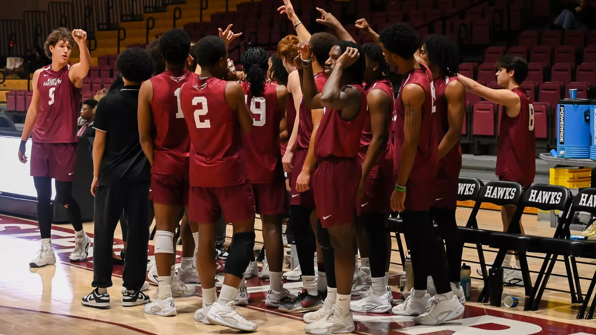
The University of Maryland Eastern Shore men’s volleyball squad continued their flawless start to Northeast Conference competition, defeating D’Youville in straight sets to preserve their unbeaten record.
The Hawks dominated throughout the match, with three offensive players achieving double-digit kill totals in the victory over the Saints. This balanced attacking approach proved too much for D’Youville to handle as UMES controlled the tempo from start to finish.
The comprehensive victory keeps the Hawks’ perfect conference slate intact as they build momentum in Northeast Conference play. The team’s offensive depth was on full display, showcasing the multiple weapons at their disposal.
UMES will look to extend their undefeated conference run as they continue their Northeast Conference schedule in the coming weeks.
A traffic accident has forced authorities to completely shut down westbound Delaware Route 300 where it meets Route 6, according to the Delaware Department of Transportation.
DelDOT’s traffic incident reporting system shows the roadway closure is currently in effect, though officials have not released information about the circumstances surrounding the crash or potential injuries.
Motorists traveling in the area should seek alternate routes while crews work to clear the scene. No timeline has been provided for when the intersection might reopen to traffic.
COLUMBIA, S.C. — Former President Joe Biden emerged from relative seclusion Friday evening to attend a special appreciation event in South Carolina, where Democratic supporters honored him as the candidate they helped propel to the presidency six years ago. Despite facing criticism elsewhere for his unsuccessful reelection bid that led to Donald Trump’s White House return, the Columbia audience greeted the Delaware native as a champion.
“Thank you,” Biden responded to enthusiastic applause as longtime ally Rep. Jim Clyburn introduced him on a stage inside a downtown Columbia art museum. “It’s good to be back home.”
During his speech, Biden took aim at Trump, warning that the current president might interfere with upcoming midterm elections. He claimed Trump is “trying to steal the election, because he knows he can’t win your vote.”
“Mark my words,” Biden continued. “I hope I’m wrong.”
The rainy evening event, organized by South Carolina’s Democratic Party, marked six years since Biden’s crucial primary triumph in the state. His presidential campaign had been struggling until that South Carolina win launched him to the nomination’s forefront.
Biden has maintained a low profile since departing the presidency. This South Carolina visit provided some comfort following a challenging period for the 83-year-old former leader. Trump has reversed numerous Biden administration policies, and Biden revealed in May that he’s battling prostate cancer that has metastasized to his bones. His spokesperson confirmed in October that he’s undergoing radiation and hormone treatments.
The former president has often called South Carolina his adopted home state beyond his Delaware roots. His family regularly vacations on Kiawah Island near Charleston, and he sought solace there following his son Beau’s cancer death.
“Folks, when it mattered, you were there for me,” Biden told the crowd Friday. “You believed in me … and I believed in you, too.”
During his Senate years, Biden forged strong bonds with the state’s veteran senators from both parties — Republican Strom Thurmond and Democrat Fritz Hollings — even delivering funeral speeches for both at South Carolina ceremonies.
Biden concluded his presidency in Charleston this past January, encouraging Americans to “keep the faith in a better day to come” as Trump prepared for his return to office.
However, Biden’s strongest South Carolina connection remains his friendship with Clyburn, whose pre-primary endorsement in 2020 seemingly energized Black voters who form the backbone of the state’s Democratic base.
“My buddy Jim Clyburn, you brought me back!” he declared.
Clyburn, who presented Biden on Friday, expressed no regrets about his endorsement decision.
“There is no American ever who has demonstrated through his service more substance and, I might add, sustenance, than Joe Robinette Biden Jr.,” he stated.
Biden elevated South Carolina’s prominence during his administration. He successfully pushed for the state to lead the Democratic primary schedule, reshaping the party’s nomination process, and appointed Orangeburg native Jaime Harrison as Democratic National Committee chairman.
South Carolina Democrats now face uncertainty as the national party reviews its primary timeline, potentially diminishing the state’s political significance.
State Democratic Party Chair Christale Spain defended South Carolina’s importance, arguing that the state’s 2020 support for Biden ultimately led to Trump’s defeat.
“South Carolina did what South Carolina does best,” Spain explained. “We made the difference.”
Biden entertained the Democratic audience with jokes targeting Trump.
“Did you see Trump give the State of the Union the other night?” he asked, referencing Tuesday’s record-length address. “He still talking?”
Delaware State University is paying tribute to Captain Larry Potts during Black History Month, honoring a distinguished alumnus who made the ultimate sacrifice for his country.
Captain Potts holds a somber place in Delaware State University history as the sole graduate from the institution to die while serving in the Vietnam War. His story represents both the contributions of African American servicemen during the conflict and the personal cost paid by the DSU community.
The university’s recognition of Captain Potts comes as part of their ongoing Black History Month programming, which highlights the achievements and sacrifices of African American individuals connected to the Dover-based institution.
Delaware State University continues to honor the memory of alumni who served their nation, with Captain Potts’ legacy serving as a reminder of the price of freedom and the courage displayed by those who answered their country’s call to duty.
SALISBURY, Md. – Salisbury University’s women’s basketball squad punched their ticket to the Coast-to-Coast Conference Tournament Championship game following a commanding 78-57 victory over Johnson & Wales – Charlotte during semifinal action Friday evening.
The Sea Gulls dominated their opponents at Maggs Gymnasium, marking their first appearance in the conference title game since 2015. The decisive 21-point margin of victory showcased the team’s strength as they prepare for the championship round.
This semifinal triumph represents a significant milestone for the program, ending a nine-year drought from championship game competition. The Sea Gulls will now have the opportunity to compete for the Coast-to-Coast Conference Tournament title.
As commodity prices continue to struggle, agricultural producers across Delmarva are exploring new ways to maintain profitability on their operations.
Grain sorghum has captured increased interest among local farmers in recent years, with many choosing to plant it on fields where traditional crops fail to generate adequate returns.
Although the majority of sorghum production occurs in the Great Plains states, this crop – sometimes referred to as milo – has historical roots in the Mid-Atlantic area.
Historical USDA records indicate that approximately one million acres of sorghum were cultivated along the eastern seaboard before genetically modified corn and soybeans became the dominant crops. While Delmarva states currently grow only a small portion of that historical amount, USDA data shows each state expanded sorghum acreage beyond their three-year averages last year.
Wicomico County producer Mike Harcum remembers university extension agents promoting sorghum during the late 1980s.
“They were pushing it as an alternative to corn then,” he said. “Everybody tried it.”
However, many farmers abandoned the crop due to various problems including weed management difficulties, disappointing yields, and harvesting complications. Harcum admits he typically plants sorghum reluctantly, mainly attempting to recover some value from fields destroyed by deer.
“We don’t put it on our best ground,” he said. “For me it’s a rotation thing. A lot of it’s got to do with the farm. Weather will dictate some of it.”
Industry experts report that prolonged low corn prices combined with escalating deer damage has driven farmers back to sorghum recently. Modern genetics have significantly improved compared to previous decades, enhancing both yields and crop management practices.
Tyler Franklin, who owns Elevated Ag Systems in Eastern Virginia, discusses sorghum with nearly every seed customer he visits. Franklin notes that current and projected commodity market conditions have producers considering every available option.
“If corn was $6, we wouldn’t be talking about it,” he said. “The demand is there, but that’s not the driver. The economics is pushing them along.”
Sorghum offers several advantages, including superior heat and drought resistance compared to corn, development of more extensive root systems, and the ability to reduce nematode populations that damage soybean crops. Farmers report it shows promise in double-cropping situations and typically generates substantial biomass that enhances soil organic matter. Despite improvements in genetics and management practices, its primary appeal remains its unpalatable nature to deer.
“In the last 10 years, deer have become such a problem on some places, you either plant milo or give up farming it,” Harcum said.
Steve Hurley, Harcum’s neighbor and experienced sorghum producer, cultivates between 300 and 400 acres annually. While initially adopting the crop to address deer damage, he has since invested in on-farm storage facilities and established contracts with birdseed manufacturing companies.
Hurley explains that they have conducted extensive experimentation with planting dates, seeding rates, and other management factors, as the crop’s limited regional acreage generates minimal local research compared to more common row crops.
“Every year you learn a little more,” Hurley said. “We’ve had to teach ourselves a lot over the last few years.”
Although sorghum requires less labor than corn production, Hurley emphasizes that planting it on marginal land doesn’t justify marginal management practices.
“There’s some potential,” Hurley said. “But if you treat it like a stepchild, it’ll pay you like a stepchild.”
Seed technology improvements have enhanced the situation through herbicide tolerance and hybrids specifically developed for Mid-Atlantic growing conditions.
Following a seven-year development process, Carolina Seed Systems introduced its Launch sorghum hybrid in 2019, featuring anthracnose resistance and high aphid tolerance, later releasing Launch 2.0 with genetic aphid resistance.
Company Founder and Chief Technology Officer Zach Brenton announced plans to release three additional hybrids next year with enhanced yield potential, while also developing herbicide tolerance traits.
Since 2021, Corteva, Advanta, and S&W Seed Company have introduced proprietary systems featuring herbicide-tolerant hybrids and specialized herbicide formulations enabling post-emergence grass control options.
Brenton reports that Carolina Seed System’s varieties are planted from Pennsylvania to Louisiana, with Maryland showing the fastest acreage growth. He advises farmers that sorghum deserves serious consideration in areas where corn consistently yields below 140 bushels per acre or soybeans produce less than 30 bushels per acre.
“Our biggest thing is profitability,” he said. “That’s the only way someone would change what they’re doing. They need to make more money.”
As a plant breeder, Brenton notes their sorghum focus places his company among a small national group, and an even smaller one in the Eastern United States.
“I joke that I’m one of the top 10 sorghum breeders in the country because there’s like eight of us left,” Brenton said.
Despite sorghum’s small acreage relative to corn and soybeans, Brenton claims their regionally-focused breeding program captures 60-70% of Delmarva’s sorghum acres.
“There’s no secret sauce, it’s because we breed and test here,” Brenton said. “Plant breeding is like a home field advantage. My germplasm doesn’t work in Kansas and there’s doesn’t work out here.”
With high corn input costs, planting sorghum at approximately half the expense on acres where corn performs poorly or suffers repeated deer damage has gained regional consideration.
Jarrett Hostetter, grain merchandiser at Hostetter Grain in Oxford, Pennsylvania, observed definite increased grower interest in the crop and expects this trend to continue. Two years ago, his company allocated bin space at their Cochranville facility for sorghum from Northern Maryland and Southern Pennsylvania producers, doubling capacity the following year.
“It’s more about providing a service for growers that grow the crop,” he said, noting most producers plant sorghum to address deer pressure. “The demand is definitely there. It’s been pretty consistent.”
Regional demand primarily comes from birdseed companies incorporating sorghum into their product mixes.
T.J. Collins, merchandising manager for Global Harvest Foods, which operates facilities in multiple states including Allentown, Pennsylvania, confirms significant Mid-Atlantic usage.
“It’s a very economical grain for us,” Collins said.
Collins reports that over half their national sorghum purchases supply Pennsylvania and Indiana facilities located near population centers. This proximity allows Global to offer premiums above corn prices, which sorghum typically follows.
“We can’t buy enough out in that area,” he said. “The more I can buy locally, the more I can back off on rail.”
Gary Wessner, merchandiser at Albrights Mill in Kempton, Pennsylvania, recalls that decades ago sorghum purchases were much more seasonal, but now he buys year-round.
“It’s more steady today and it does seem like it keeps growing,” he said.
However, farmers caution that advances and demand don’t make sorghum a guaranteed success. Planting on marginal ground affects yields. Weeds, aphids, and anthracnose remain potential problems. Harvest challenges, including slow dry-down and bird damage after maturity, add complications. Storage and transportation costs can reduce premiums offered by end users. Nevertheless, until deer damage is significantly controlled or corn markets return to profitable margins, sorghum remains a viable alternative.
“If we pick up the weaker acres, our overall profits increase,” Franklin said. “To me, that’s really where we need to start.”
ANNAPOLIS, Md. — Maryland lawmakers are considering legislation that would provide stronger financial protections for property owners impacted by eminent domain proceedings related to electrical transmission projects.
During a February 19 hearing, senators examined a proposal from Sen. Chris West, R–Baltimore County, that would implement two significant reforms to the state’s eminent domain statutes for overhead power lines. The legislation would require courts to reimburse property owners for legal expenses and court fees in successful condemnation challenges, while also enabling homeowners living near transmission lines to pursue compensation for property value losses, regardless of whether their land is actually seized.
West explained that the proposal stems from concerns about a planned 67-mile electrical transmission project stretching from Pennsylvania’s Peach Bottom nuclear facility through northern Maryland to Point of Rocks, where it would link to existing infrastructure serving data centers in Northern Virginia.
“This giant transmission line is in effect a long extension cord,” West told the Senate Judicial Proceedings Committee on Feb. 19. “It carries every electron that goes in at the one end up near Peach Bottom up the Pennsylvania line, travels 67 miles through the extension cord and comes out in Point of Rocks.”
The Maryland Public Service Commission is currently reviewing the transmission project and is anticipated to make an approval decision before the next legislative session concludes. Approval would grant New Jersey-based developer PSEG the authority to use eminent domain to obtain property along the transmission route through legal proceedings if landowners decline to sell voluntarily.
Agricultural landowners have been vocal opponents of the transmission project over the past two years, making their presence known at public forums held across Baltimore, Carroll and Frederick counties. These well-attended meetings influenced West’s decision to pursue modifications to Maryland’s eminent domain statutes.
West highlighted a financial burden facing property owners under existing law, noting that while those whose land is taken through eminent domain may receive fair market compensation, they often encounter a costly predicament when condemning authorities present what they consider inadequate valuations.
“If they go to court to try to establish the correct just compensation — in this hypo $100,000 — they will have to pay legal fees,” West said, adding that attorney and expert witness costs can approach tens of thousands of dollars. “They will end up at the end of the day with no more than about $75,000.”
The proposed legislation would mandate that courts award reasonable legal fees and expenses to property owners when a court or jury determines the assessed property value surpasses the condemning authority’s appraisal. This requirement would apply exclusively to condemnation proceedings involving overhead transmission lines.
“In short, if the owner is forced to go to court to obtain fair value, they will not be financially penalized for doing so,” West said.
The bill’s second key component would expand compensation eligibility beyond property owners whose land is taken. Homeowners residing within 300 feet of a transmission line could pursue compensation by proving that the line’s construction decreased their property’s fair market value.
“But what about the immediate neighbors?” West asked. “The person who owns the home next door, under our current eminent domain law gets nothing, even though the value of his or her house has been severely diminished because it’s literally in the shadow of the steel tower.”
West clarified that the legislation would enable these homeowners to recover quantifiable economic losses rather than speculative or emotional damages.
“This is not speculative or emotional harm,” he said. “It is measurable economic damage and it is only fair.”
Harris Eisenstein, an attorney who spoke in favor of the bill, shared his 15 years of experience representing Maryland residents and businesses in eminent domain cases, arguing that current statutes fail to consistently provide “true just compensation.”
“Although Maryland condemners must pay just compensation, state law, as it presently exists, does not allow condemnees to fully recover a truly just amount for the life-changing loss of property rights,” Eisenstein said.
He noted that initial compensation offers from condemning authorities often fall below fair market value, compelling property owners to retain attorneys and expert witnesses to contest them.
“The result is that even if compensation increases, the net recovery is reduced by whatever money they have to spend on attorneys and experts,” Eisenstein said. “This is unjust.”
Eisenstein argued the legislation would create more balanced conditions, especially as Maryland confronts multiple transmission projects linked to regional electrical demand.
When Sen. Shelly Hettleman questioned the bill’s 300-foot boundary for neighboring property owners seeking compensation and whether that distance might be extended, West explained that 300 feet — approximately the length of a football field — was designed to include properties most likely to experience substantial value decreases due to large transmission towers.
“If the committee wants to increase the distance to 400 or 500 feet, you’re not going to get any objection from me,” he said.
No witnesses testified against the proposal during the hearing.
West mentioned that two amendments were suggested, including one from the Maryland Department of Transportation to specify that the bill applies exclusively to overhead electrical transmission lines, and another technical modification to correct references between assessed and appraised value.
West stressed that the legislation would not prevent infrastructure projects from proceeding.
“It simply ensures that when the government exercises one of the most powerful authorities available, the power to take or significantly impact private property, Maryland residents are fairly compensated for real economic losses,” he said.
SAN ANTONIO — A Delaware farmer from Greenwood has been posthumously honored with the most prestigious award in the soybean industry during this year’s Commodity Classic trade show in San Antonio.
The American Soybean Association presented its Pinnacle Award to the late Richard Wilkins during the 2026 ASA Awards Celebration. This top industry recognition celebrates individuals whose lifetime achievements demonstrate exceptional contribution and leadership within the soybean community.
According to ASA officials, Wilkins showed remarkable innovative leadership throughout his 53-year career that enhanced both sustainability and unity across the soybean sector.
Wilkins wore many hats as a champion for soybean producers, serving as a Mid-Atlantic Soybean Association member, ASA president, and Delaware’s former state executive director for the Farm Service Agency.
His agricultural journey started modestly in 1972 when he cultivated just three acres of soybeans on leased land. By his high school graduation in 1976, he had grown his operation to 65 acres.
These formative years shaped his lifelong commitment to diligent work, innovation, and producer-driven leadership — values that influenced his contributions throughout all levels of the soybean community.
On the state level, Wilkins served Delaware farmers as a member of the Delaware Water Infrastructure Advisory Council, advocating for agricultural interests while navigating increasingly complex nutrient management requirements.
In this position, he championed research-backed, workable solutions that enabled farmers to meet environmental standards while maintaining both productivity and profitability.
ASA also credited Wilkins with a crucial role in restructuring the Mid-Atlantic Soybean Association in 2002, which guaranteed Delaware soybean growers maintained influential representation in regional and national policy conversations.
When elected ASA president in 2015, Wilkins guided the organization through significant national policy challenges, particularly during discussions surrounding Vermont’s proposed GMO labeling legislation.
His presidential leadership mobilized farmers and industry partners to inform lawmakers, ultimately achieving a consistent national food labeling framework that prevented market confusion, safeguarded consumers, and maintained industry stability.
“Richard will be remembered for his role in ensuring fair and equitable representation for smaller soybean-producing states within the American Soybean Association,” ASA said in a statement. “Richard’s enduring impact will be measured not only by the policies he helped shape and the markets he expanded, but also by the leaders he mentored.”
ANNAPOLIS, Md. — Martin Proulx took on a brand new position at the Maryland Department of Agriculture in 2023, tackling a challenge many farmers across the region know well: while agricultural producers are being pushed to expand their operations, the regulations surrounding those expansions haven’t evolved to match.
Farm operations that go beyond traditional growing — such as processing products on-site, welcoming visitors for agritourism activities, or serving prepared food — require farmers to navigate a maze of different government agencies. These ventures bring health departments, zoning boards, environmental agencies, and building code officials into the picture, often creating more confusion than clarity for farm owners.
Proulx joined the department from local economic development work as Maryland’s inaugural value-added agricultural specialist, tasked with helping farmers work through these regulatory challenges. This past January, his responsibilities grew when he became chief of marketing and agricultural development, incorporating value-added farming support into broader business development and promotional efforts.
The core issues he addresses haven’t changed much with his expanded role.
“When you talk about value-added agriculture being the processing of raw agricultural product, the serving overall of cooked foods, whether it be agritourism, food service, sampling at farmer’s markets, you realize that there are a number of other regulatory agencies that enter into the equation,” Proulx said.
Traditional farming typically operates under one set of rules, but diversified farm businesses find themselves caught between multiple regulatory systems that weren’t created with these hybrid operations in mind.
During his initial two years, Proulx traveled throughout Maryland, visiting each county to meet with zoning administrators, environmental health workers, building code inspectors, and economic development representatives. Instead of addressing specific farm conflicts, his mission was to learn how different localities interpret and apply regulations.
“It was really important to flip the script, if you will,” he said.
While Maryland operates under one state agriculture department, it contains 24 separate local governments — including Baltimore City — each maintaining distinct zoning laws and land-use definitions. Agricultural activities might be classified differently for environmental compliance, tax purposes, and zoning requirements. These varying definitions typically don’t create problems until farms attempt to diversify their operations.
“As value-added agriculture continues to expand in popularity and be an economically viable option for many of these diversifying farms, or maybe even new beginning farms, you realize that agriculture and commercial are two terms that become water and oil when you’re talking about land use and zoning,” Proulx said.
This conflict becomes most apparent in the licensing process. State permits for processing or food service are typically written in broad terms, applying the same standards to a farm using an existing outbuilding and a manufacturer in an industrial complex. Local authorities, however, might handle these identical activities very differently based on how “commercial” operations are defined within agricultural districts.
According to Proulx, this creates a regulatory framework that doesn’t always work well for farming operations. Infrastructure demands add another complication.
Requirements for permanent bathroom facilities, septic installations, and waste management systems might be reasonable for year-round commercial businesses, but they can be financially overwhelming for farms testing seasonal or limited-scale projects.
“Very frequently, the infrastructure investment for permanent restrooms or permanent waste disposal, septic systems, can often come with a very, very hefty price tag that small and diversifying farm operations may not be able to necessarily take on right away,” Proulx said.
These discoveries formed the basis for a comprehensive statewide guidance and analysis document about value-added agriculture and agritourism that the department released in October. Instead of recommending major regulatory overhauls, the document outlined the current system, identified common obstacles, and pinpointed opportunities where increased flexibility or clearer guidelines could help farms succeed.
Proulx reports that some improvements have emerged since the document’s publication. The department has internally reorganized to officially connect value-added agriculture with marketing and business development functions. Additionally, proposed regulatory modifications and legislative measures designed to create more adaptable, seasonal alternatives for on-farm food service are being reviewed.
For Proulx, this effort ultimately centers on keeping farms economically sustainable in a state experiencing development pressures and agricultural land loss.
“With all of the challenges facing Maryland’s agriculture, whether that be development pressure (or) loss of farmland, it’s really, really encouraging to see the passion and the patience within the industry in diversifying and finding these new opportunities for future generations,” he said.
(Editor’s note: John Hall is a professional commodities analyst.)
Agricultural economists presenting at the Ag Forum Outlook conference on Feb. 19-20 announced their findings: “The U.S. corn outlook for 2026-27 is for reduced production, domestic use, exports and ending stocks.”
Forecasters anticipate the corn harvest will reach 15.8 billion bushels, representing approximately a 7 percent decrease compared to the previous year’s production.
Farmers are expected to plant corn on 94.0 million acres, a reduction of 4.8 million acres from last year’s totals. Yield estimates of 183.0 bushels per acre are based on assumptions of typical planting schedules and average summer weather conditions.
Despite higher beginning inventory levels from the previous season, total corn supplies are predicted to reach 17.9 billion bushels, down from the record 18.6 billion bushels recorded in 2025-26.
The situation involves multiple declining factors: fewer planted acres, reduced production, and decreased usage, combined with substantial carryover inventory from the prior year.
Overall U.S. corn consumption for 2026-27 is expected to drop roughly 2 percent due to lower domestic demand and reduced export volumes.
Food, seed, and industrial consumption remains steady at 7 billion bushels. Ethanol production is projected to utilize 5.6 billion bushels, reflecting expectations of stable gasoline consumption and export levels.
Feed and residual usage is anticipated to decline about 3 percent to 6 billion bushels based on reduced supply availability.
Export volumes are forecast to decrease by 200 million bushels to 3.1 billion.
America’s share of global corn trade is expected to shrink slightly as South American competitors increase their exports and worldwide demand growth remains modest.
The global corn landscape has undergone dramatic transformation!
Here’s the broader context. In my Feb. 17 analysis, I examined worldwide corn production patterns. The data revealed a clear trend using 2017-18 as the baseline year.
Evidence clearly demonstrates that global corn expansion began accelerating in 2021-22.
International corn production has expanded 15 percent since 2017-18, fundamentally altering the marketplace.
Where has this growth originated?
Analysis of the three largest global corn producers reveals significant insights, using 2016-17 as the comparison baseline.
Data clearly indicates substantial production increases in Brazil and China beginning in 2021-22. Research published last summer by Dr. Joana Colussi from Purdue University’s Center of Commercial Agriculture examined Brazil’s agricultural expansion.
While the study mentioned China’s growth, the scale became apparent later: China added approximately 4.6 million acres of farmland between 2020 and late 2024 through land reclamation projects and high-quality farmland development.
China’s total cultivated area reached nearly 319.57 million acres in 2024.
What drives this expansion? China’s enormous appetite for pork provides the answer.
Reports from April 2025 showed China maintaining 427 million head of pigs, compared to the European Union’s 132 million head and the United States’ 76 million head during the same period.
This massive livestock population explains their substantial corn requirements for feed production, as well as their soybean needs for protein supplementation in pig feed.
As noted in my Feb. 17 analysis, China’s grain reserves represent almost two-thirds of global ending stocks.
Their food security approach has transformed from rigid government-controlled self-sufficiency (1949-1970s) to market-based strategies emphasizing “absolute security of staple foods.”
Under President Xi Jinping’s leadership, the strategy emphasizes 95 percent grain self-sufficiency, stringent farmland preservation, and agricultural technology advancement, shifting focus from quantity alone to quality and diversification.
Beginning in 2004, policy evolved to prioritize “guaranteed supply” through international commerce while maintaining tight oversight of domestic wheat and rice production.
Consequently, the government maintains a year’s worth of grain reserves, distributing supplies to farmers gradually.
This system also enables government control over farmer pricing.
Given China’s position as the world’s largest grain purchaser, we must analyze President Xi Jinping’s statement about “95 percent grain self-sufficiency, strict farmland protection, and agricultural technology, transitioning from mere quantity to quality and diversification.”
This suggests they have made substantial investments in domestic agricultural expansion and intend to reduce import dependency.
Taking this analysis further, this likely explains their significant investments in Brazilian agriculture to achieve this “self-sufficiency.”
What triggered this strategic shift? Many attribute it to Trump’s trade tariffs. However, examining the timeline reveals Trump’s first presidency spanned 2017-20.
What other major event occurred? COVID-19 was initially identified in China during December 2019, rapidly spreading globally thereafter.
COVID-19 severely damaged global food security by disrupting supply networks, forcing factory shutdowns, and limiting transportation, resulting in widespread hunger and revealing vulnerabilities in food production and distribution systems.
Lockdown measures and economic disruptions amplified these problems, exposing more populations to food insecurity.
The chronology suggests COVID-19 served as the primary catalyst for President Xi Jinping’s strategic thinking shift. If accurate, this altered perspective has transformed the global commodity grain marketplace. This deserves serious consideration!
Returning to U.S. corn utilization completes this analysis. Recent data shows usage patterns for the past two years and projections for the upcoming season.
The information indicates usage has remained relatively stable. As noted, U.S. corn projections for 2026-27 anticipate reduced production, domestic consumption, exports, and ending inventory, which current data confirms.
In conclusion, effective marketing requires understanding both customers and competitors. I detected market changes this past year due to unusually flat price patterns.
This research helps explain the underlying causes. Assuming this data proves accurate, don’t anticipate significant price improvements without major drought conditions.
Additionally, the market appears unable to absorb increased production.
It seems reducing planted acres might support pricing? Is this feasible for producers?
(Note: I research material from Allendale, DTN, USDA, University Land Grants and other credible sources in compiling this article. It is not merely my opinion, but rather a consensus of experts in the trade. Looking for a marketing coach or someone to discuss strategies with? Contact me at [email protected], or call 410-708-8781.)
A vehicle collision has forced the complete closure of Delaware Route 12, with both directions of traffic blocked between Berrytown Road and Sportsman Road.
The Delaware Department of Transportation reports that all lanes remain shut down as emergency responders work at the crash scene. No timeline has been provided for when the roadway will reopen to traffic.
Motorists are advised to seek alternate routes and expect delays in the area until further notice.
SANTA CRUZ, California – Salisbury University’s men’s basketball squad watched their season slip away Thursday night after a devastating second-half collapse against the University of Mary Washington Eagles in the Coast-to-Coast Conference semifinals.
The Sea Gulls, seeded fourth in the tournament, entered the locker room at intermission with momentum on their side, holding an advantage over the eighth-ranked and top-seeded Eagles. However, the second twenty minutes told a completely different story.
Mary Washington dominated the final half of play, outpacing Salisbury by a margin of 34-17 to secure a 55-46 victory at West Field House. The loss eliminated the Sea Gulls from championship contention and brought their season to a close.
Despite carrying a lead into the break, Salisbury was unable to sustain their first-half performance against the highly-ranked Eagles, who used their second-half surge to advance in the tournament.
NEWARK, Del. – The University of Delaware baseball squad delivered an offensive explosion Friday night, overwhelming Rider University 13-8 in the opening contest of their weekend series.
The Blue Hens collected an impressive 17 hits during the victory at home in Newark, improving their season record to 3-7. The loss drops Rider’s record to 3-1 for the young season.
Delaware’s bats came alive throughout the evening as they built a commanding lead against the visiting Broncs. The offensive showcase marked a strong start to what promises to be an exciting weekend series between the two programs.
The University of Delaware women’s tennis team delivered a dominant performance on Friday, shutting out Lehigh University 7-0 in Bethlehem, Pennsylvania.
The nationally-ranked Blue Hens, currently sitting at No. 62, extended their winning streak to three matches with the commanding road victory. Delaware swept all seven matches against the Mountain Hawks, showcasing their depth and skill across both singles and doubles competition.
The perfect team performance highlights the strong momentum Delaware has built as they continue their season. The Blue Hens demonstrated their competitive strength by not dropping a single match during Friday’s contest.
This latest triumph adds to Delaware’s impressive recent form as the team looks to build on their current three-game winning streak moving forward in their schedule.
Delaware farmers are running out of time to secure crop insurance protection for the 2026 growing season, with the sales deadline fast approaching on March 15th.
According to Shelby Twenter, who serves as Vice President of Crop and Livestock Insurance at FCS Financial, agricultural producers need to take immediate action to ensure they have adequate coverage in place. Twenter recently outlined several critical updates that farmers should be aware of for the upcoming policy year.
Key steps that Delaware growers must complete before the deadline include refreshing their business entity details with insurance providers and providing their 2025 harvest yields to ensure premium calculations reflect accurate production history. This yield information is essential for obtaining precise coverage quotes and determining appropriate protection levels.
Farmers are also encouraged to carefully evaluate their coverage alternatives to select policies that best match their operation’s specific needs and risk tolerance. Insurance experts recommend consulting with local agricultural insurance representatives to navigate the various options available and ensure compliance with all requirements before the March 15th cutoff date.
Delaware State Police’s Sex Offender Apprehension and Registration Unit (SOAR) is requesting public assistance in locating multiple sex offenders who have violated registration requirements.
Authorities are actively searching for five individuals who either failed to complete their initial registration or did not update their address information as mandated by law. The wanted offenders include Charles A. Fulton, John A. Martz, Mollie Anne Schonwit, Roy Stevens, and Michael A. Viscount, all classified as Tier 2 moderate risk offenders.
Anyone with information about the whereabouts of these individuals is urged to contact SOAR at (302) 739-5882. Tips can also be submitted anonymously through Delaware Crime Stoppers at (800) 847-3333.
Police emphasize that these five represent just a fraction of currently wanted sex offenders. The complete list is available on the Delaware Sex Offender Registry website.
Additionally, SOAR has issued public notifications for three homeless registered sex offenders: James Bullins, Brandon Hicks, and James McCray. These individuals are not wanted for registration violations but are currently without permanent housing.
If residents have information indicating any of the homeless offenders are staying at a specific residence, they should contact the same phone numbers.
State police note that the homeless offenders listed are those recently reported without housing and represent only a portion of all homeless sex offenders currently tracked by the registry.
Complete profiles and additional information for all individuals can be accessed through the Delaware Sex Offender Registry website.
PRINCESS ANNE, MD – Authorities have taken two more juveniles into custody on murder charges related to the deadly January shooting of Derrick Knox in Somerset County, Maryland State Police announced.
The latest arrests involve a 14-year-old and 16-year-old male, both now facing first-degree murder charges along with additional counts including second-degree murder and robbery. Both suspects are being detained without bond at the Somerset County Detention Center.
Police apprehended the younger suspect on February 10 in Princess Anne, while U.S. Marshals captured the 16-year-old in Chula Vista, California on February 4. The older teen was brought back to Maryland last week to face charges.
These arrests bring the total number of juvenile suspects to four. Authorities had previously detained a 17-year-old female and another 16-year-old male from Salisbury in connection with Knox’s death. Both earlier arrestees also remain jailed without bond.
The deadly incident unfolded just after 2 p.m. on January 26 when Somerset County Sheriff’s deputies and Maryland State Police troopers responded to a shooting report on the 11000 block of Dryden Lane in Princess Anne. Officers discovered two gunshot victims inside a 2026 Kia Seltos SUV stopped in the road.
Knox, a 46-year-old Salisbury resident, was declared dead at the scene. The second victim, Kevin Pillar, 41, also of Salisbury, suffered injuries and was airlifted to a trauma center by state police helicopter.
After consulting with Somerset County prosecutors, all four juveniles now face identical charges of first-degree felony murder, second-degree murder, robbery, and related offenses.
The Maryland State Police Homicide Unit continues leading the investigation with support from the Somerset County Sheriff’s Office and local prosecutors.
Investigators are asking anyone with information about the case to contact Sergeant Joe Meier with the Maryland State Police Homicide Unit at 443-515-0034. Tips can remain anonymous.
Motorists traveling eastbound on Park Avenue (Route 431) should expect delays this afternoon as construction crews have closed one lane of traffic.
The lane closure affects the stretch of Park Avenue between Wood Branch Road (Route 321) and Nanticoke Avenue, according to DelDOT traffic information.
Officials say the construction-related lane restriction will remain active until 5 PM today. Drivers are advised to allow extra travel time and consider alternate routes if possible.
NEWARK, Del. – The University of Delaware’s football program has welcomed a new addition to their special teams unit with the recruitment of punter Austin LaBellman, according to an announcement made Friday by head coach Ryan Carty.
LaBellman, an incoming freshman, will become part of the Fightin’ Blue Hens squad following his graduation from Winter Park High School later this spring.
The signing represents another step in Coach Carty’s efforts to strengthen the team’s roster as they prepare for upcoming seasons.
Motorists are being advised to avoid southbound Route 13 at State Street due to a vehicle accident that has prompted a complete road closure in the area.
The Delaware Department of Transportation reported the crash and subsequent road blockage, urging drivers to find alternative routes while emergency responders and cleanup crews work at the scene.
No additional details about the collision, including potential injuries or the number of vehicles involved, have been released at this time.
Drivers should expect delays and plan accordingly until the roadway can be safely reopened to traffic.
The University of Delaware Blue Hens men’s basketball squad is gearing up for their upcoming contest against Kennesaw State University.
The matchup will feature the Blue Hens hosting their opponents as they continue their current season campaign. Delaware will be looking to put forth a strong performance in front of their home crowd.
The game represents another opportunity for the Blue Hens to showcase their skills and compete at the collegiate level as they work through their schedule of games.
Delaware transportation officials have shut down all northbound traffic on US Route 13 at South Heald Street following a vehicle collision in the area.
The closure is currently in effect as emergency responders and cleanup crews work at the crash site. DelDOT has not yet provided details about the severity of the accident or an estimated timeline for reopening the roadway.
Drivers traveling north on this busy corridor should plan for significant delays and consider using alternative routes until the situation is resolved.
This is a developing story and TV Delmarva will provide updates as more information becomes available from state transportation authorities.
Delaware’s trout farming sector faced economic headwinds as sales revenues fell by 6 percent when compared to the previous year, according to newly released federal agriculture statistics.
The latest data from the U.S. Department of Agriculture’s National Agricultural Statistics Service shows the downturn in trout production value, while also documenting distribution networks and industry losses across the sector.
The report provides insight into the challenges facing aquaculture operations in the region, as trout farmers navigate market conditions that have impacted their bottom line.
The federal statistics track various aspects of the trout industry, including how fish are distributed to markets and the extent of losses experienced by producers during the reporting period.
Delaware’s agricultural sector is feeling the impact of declining egg production, according to new data from the U.S. Department of Agriculture’s National Agricultural Statistics Service.
The latest report shows that shell egg production has fallen by 8 percent compared to the same timeframe in the previous year. This decrease represents a significant shift in one of the region’s important agricultural commodities.
The decline in egg production could have implications for both local farmers and consumers throughout the Delmarva Peninsula, where poultry operations represent a major component of the agricultural economy.
The USDA’s findings highlight ongoing challenges facing the egg industry as producers navigate market conditions and operational demands.
Delaware’s agricultural community is facing economic headwinds as commodity prices dropped significantly last month, according to new federal data released by the U.S. Department of Agriculture.
The Prices Received Index for agricultural products declined by 3.9 percent during January, marking a notable decrease that impacts farming operations throughout the Delmarva Peninsula region.
This price drop affects the income that local farmers receive for their crops and livestock, potentially influencing planting decisions and farm budgets for the coming growing season.
The index, which tracks what farmers earn for their agricultural products, serves as a key indicator of the financial health of the farming sector across Delaware and the broader Mid-Atlantic region.
Local agricultural producers may need to adjust their operations and marketing strategies in response to these changing market conditions as they prepare for spring planting season.
Delaware farmers and agricultural producers throughout the region saw their peanut earnings decline during the week that concluded on February 21st, according to new agricultural data.
Payment rates for farmer stock peanuts dropped to an average of 15.6 cents per pound, representing a decrease of 4.3 cents from earlier pricing levels. The weekly pricing report tracks compensation received by agricultural producers for their peanut harvests across all categories of farmer stock varieties.
This pricing decline affects local farming operations throughout Delaware and the broader Mid-Atlantic agricultural region, where peanut cultivation represents an important component of the diverse crop portfolio for many producers.
ANNAPOLIS, Md. — Maryland legislators heard testimony February 19th supporting a proposal to enhance protections for property owners impacted by eminent domain actions, particularly as the state considers a major transmission line project that could affect numerous communities.
Senator Chris West, a Republican from Baltimore County, introduced the legislation following concerns about a planned 67-mile electrical transmission project. The proposed line would stretch from Pennsylvania’s Peach Bottom nuclear facility through northern Maryland to Point of Rocks, ultimately serving data centers in Northern Virginia.
The proposed legislation includes two significant reforms to Maryland’s current eminent domain statutes for overhead power lines. First, it would require courts to cover property owners’ legal expenses and attorney fees in certain condemnation proceedings. Second, it would expand compensation eligibility to nearby homeowners whose property values decline due to transmission line construction, even when their land isn’t directly seized.
“This giant transmission line is in effect a long extension cord,” West explained to the Senate Judicial Proceedings Committee on February 19th. “It carries every electron that goes in at the one end up near Peach Bottom up the Pennsylvania line, travels 67 miles through the extension cord and comes out in Point of Rocks.”
The Maryland Public Service Commission is currently reviewing the transmission project, with a decision expected before the next legislative session concludes. Approval would grant New Jersey-based developer PSEG the authority to use eminent domain for property acquisition along the proposed route.
Agricultural landowners have been particularly vocal in their opposition to the transmission project over the past two years. Large crowds attended public hearings in Baltimore, Carroll, and Frederick counties, with farmers expressing strong concerns about the proposal’s impact on their operations.
These community meetings influenced West’s decision to pursue eminent domain law modifications, he noted. Under existing statutes, property owners may receive fair market value for seized land, but they face significant financial challenges when disputing low government appraisals.
“If they go to court to try to establish the correct just compensation — in this hypo $100,000 — they will have to pay legal fees,” West explained, noting that attorney and expert witness expenses can reach tens of thousands of dollars. “They will end up at the end of the day with no more than about $75,000.”
The proposed legislation would require courts to award reasonable attorney fees and costs to property owners when judicial proceedings or jury verdicts determine that actual property values exceed government appraisals. This provision would apply exclusively to condemnation cases involving overhead transmission lines.
“In short, if the owner is forced to go to court to obtain fair value, they will not be financially penalized for doing so,” West stated.
The bill’s second major component addresses compensation for adjacent property owners. Homeowners living within 300 feet of a transmission line could seek damages if they can prove the project reduced their property’s fair market value.
“But what about the immediate neighbors?” West questioned. “The person who owns the home next door, under our current eminent domain law gets nothing, even though the value of his or her house has been severely diminished because it’s literally in the shadow of the steel tower.”
West emphasized that the legislation would cover measurable economic losses rather than speculative or emotional damages. “This is not speculative or emotional harm,” he said. “It is measurable economic damage and it is only fair.”
Harris Eisenstein, an attorney with 15 years of experience representing Maryland residents and businesses in eminent domain cases, testified in favor of the proposal. He argued that current law fails to consistently provide “true just compensation.”
“Although Maryland condemners must pay just compensation, state law, as it presently exists, does not allow condemnees to fully recover a truly just amount for the life-changing loss of property rights,” Eisenstein testified.
He noted that initial government offers frequently undervalue properties, forcing owners to hire legal representation and expert witnesses to challenge them. “The result is that even if compensation increases, the net recovery is reduced by whatever money they have to spend on attorneys and experts,” Eisenstein said. “This is unjust.”
Eisenstein suggested the legislation would create more balanced proceedings, especially as Maryland faces multiple transmission projects driven by regional power demands.
During committee questioning, Senator Shelly Hettleman inquired about the 300-foot threshold for neighboring property compensation and whether that distance might be extended.
West explained that 300 feet — approximately the length of a football field — was designed to include properties most likely to experience substantial value decreases from large transmission towers. “If the committee wants to increase the distance to 400 or 500 feet, you’re not going to get any objection from me,” he responded.
No witnesses spoke against the proposal during the hearing.
West mentioned two potential amendments, including one requested by the Maryland Department of Transportation to specify that the bill covers only overhead electrical transmission lines, plus another technical modification to clarify references between assessed and appraised values.
West stressed that the legislation wouldn’t prevent infrastructure development from proceeding. “It simply ensures that when the government exercises one of the most powerful authorities available, the power to take or significantly impact private property, Maryland residents are fairly compensated for real economic losses,” he concluded.
FELTON, Del. – Delaware transportation officials are set to install a new four-way stop at a Kent County intersection next week.
The Delaware Department of Transportation will put all-way stop control in place at the intersection where Canterbury Road (State Route 15) meets Andrews Lake Road on Tuesday, March 10th, assuming weather conditions allow.
Drivers traveling through the area should plan for traffic backups and lane restrictions as work crews install new signage and road markings. Flaggers will be directing traffic during the construction process.
Additional details are available on DelDOT’s official website at www.deldot.gov.
The University of Delaware women’s basketball program will celebrate Senior Day when they welcome Middle Tennessee to campus for their final home contest of the season.
The Blue Hens will honor their graduating players before tip-off, recognizing the contributions these student-athletes have made to the program throughout their collegiate careers.
Senior Day ceremonies traditionally provide an opportunity for families, fans, and teammates to celebrate the achievements of departing players who have dedicated years to representing the university on the court.
The matchup against Middle Tennessee will serve as the final opportunity for Blue Hen supporters to show their appreciation for this year’s senior class at their home venue.
As commodity prices remain stubbornly low, Delaware and regional farmers are expanding their search for profitable alternatives, with many taking a fresh look at grain sorghum.
The crop, also known as milo, has attracted renewed interest from local growers who are planting it on fields where traditional crops like corn and soybeans offer little financial return.
Though the majority of American sorghum acreage lies in the Great Plains, this grain is far from new to the Mid-Atlantic area. Historical USDA records indicate that before genetically modified corn and soybeans took over the agricultural landscape, approximately one million acres of sorghum were cultivated along the east coast. While Delmarva states now grow only a small portion of that amount, each state expanded its sorghum acreage last year beyond the three-year average, federal data shows.
Wicomico County farmer Mike Harcum remembers university researchers promoting sorghum back in the late 1980s.
“They were pushing it as an alternative to corn then,” he said. “Everybody tried it.”
However, many producers were dissatisfied with the crop at that time due to various problems including weed control difficulties, disappointing yields, and harvesting complications. Harcum admits that most seasons, he plants sorghum reluctantly as a last-ditch effort to recover something from fields destroyed by deer.
“We don’t put it on our best ground,” he said. “For me it’s a rotation thing. A lot of it’s got to do with the farm. Weather will dictate some of it.”
But persistent low corn prices and escalating deer pressure have driven farmers back to sorghum in recent years, according to agricultural industry professionals. Genetic improvements over the past decades have enhanced both yields and crop management practices.
Tyler Franklin, who owns Elevated Ag Systems in Eastern Virginia, says sorghum comes up in conversations with nearly every seed customer he visits. Franklin explains that current and projected commodity market conditions have growers considering every available option.
“If corn was $6, we wouldn’t be talking about it,” he said. “The demand is there, but that’s not the driver. The economics is pushing them along.”
Sorghum offers several advantages, including superior heat and drought resistance compared to corn, development of larger root systems, and the ability to interrupt nematode cycles that harm soybean fields. Farmers report it shows promise in double-cropping situations and typically generates substantial biomass that adds to soil organic matter. Despite genetic and agronomic improvements, its greatest appeal remains its unpalatable nature to deer.
“In the last 10 years, deer have become such a problem on some places, you either plant milo or give up farming it,” Harcum said.
Steve Hurley, Harcum’s neighbor and a veteran sorghum producer who plants between 300 and 400 acres each year, initially chose the crop to combat deer damage. He has since invested in on-farm storage facilities for sorghum and established contracts with birdseed manufacturers.
Through years of experience, Hurley says they have conducted extensive experiments with planting timing, seeding rates, and other factors, as the crop’s relatively small local acreage generates limited research compared to more common row crops.
“Every year you learn a little more,” Hurley said. “We’ve had to teach ourselves a lot over the last few years.”
While sorghum requires less labor overall than corn production, Hurley emphasizes that placing it on marginal land doesn’t justify marginal management practices.
“There’s some potential,” Hurley said. “But if you treat it like a stepchild, it’ll pay you like a stepchild.”
Seed technology improvements have enhanced the situation through herbicide tolerance and varieties better adapted to Mid-Atlantic growing conditions.
Following a seven-year development process, Carolina Seed Systems introduced its Launch sorghum variety in 2019 with anthracnose resistance and strong aphid tolerance, later releasing Launch 2.0 with genetic aphid resistance.
Company founder and Chief Technology Officer Zach Brenton reports plans to launch three additional varieties next year featuring improved yield potential, while also developing herbicide tolerance traits.
Since 2021, Corteva, Advanta, and S&W Seed Company have introduced proprietary systems combining herbicide-tolerant varieties with specialized herbicide formulations that enable post-emergence grass control.
Brenton says Carolina Seed System varieties are planted from Pennsylvania to Louisiana, with Maryland showing the fastest acreage growth. He advises farmers that areas where corn consistently produces under 140 bushels per acre or soybeans yield below 30 bushels per acre should seriously consider sorghum.
“Our biggest thing is profitability,” he said. “That’s the only way someone would change what they’re doing. They need to make more money.”
As a plant breeder, Brenton notes that their sorghum focus places his company among a small national group, and an even more exclusive one in the Eastern United States.
“I joke that I’m one of the top 10 sorghum breeders in the country because there’s like eight of us left,” Brenton said.
Despite sorghum’s small acreage relative to corn and soybeans, their regionally-focused breeding program captures between 60-70% of Delmarva’s sorghum acres, according to Brenton.
“There’s no secret sauce, it’s because we breed and test here,” Brenton said. “Plant breeding is like a home field advantage. My germplasm doesn’t work in Kansas and there’s doesn’t work out here.”
With high corn input costs, planting sorghum at roughly half the expense on acres where corn performs poorly or suffers repeated deer destruction has gained increased regional consideration.
Jarrett Hostetter, a grain merchandiser with Hostetter Grain in Oxford, Pennsylvania, observed a definite surge of grower interest.
“There was definitely a groundswell of growers that were interested in it,” said Hostetter. “I expect that to continue.”
Two years ago, Hostetter’s company allocated bin space at their Cochranville facility to accept sorghum from growers in Northern Maryland and Southern Pennsylvania, doubling that capacity the following year.
“It’s more about providing a service for growers that grow the crop,” he said, noting most planted sorghum to address deer pressure. “The demand is definitely there. It’s been pretty consistent.”
Regional demand primarily comes from birdseed companies incorporating sorghum into their products.
T.J. Collins, merchandising manager for Global Harvest Foods, which operates facilities in multiple states including Allentown, Pennsylvania, confirms substantial Mid-Atlantic usage.
“We use a very significant amount in the Mid-Atlantic,” said Collins. “It’s a very economical grain for us.”
Collins explains that over half their national sorghum purchases supply their Pennsylvania and Indiana facilities located near population centers. This proximity allows Global to offer premiums above corn prices, which sorghum typically follows.
“We can’t buy enough out in that area,” he said “The more I can buy locally, the more I can back off on rail.”
Gary Wessner, merchandiser at Albrights Mill in Kempton, Pennsylvania, recalls that decades ago sorghum purchases were much more seasonal, but now he buys year-round.
“It’s more steady today and it does seem like it keeps growing,” he said.
However, farmers caution that advances and demand don’t make sorghum a guaranteed success. Planting on marginal ground affects yields. Weeds, aphids, and anthracnose remain problematic. Harvest complications, from drying issues to bird damage after maturity, create additional challenges. Storage and transportation costs can erode premiums offered by end users. Still, until deer damage is significantly reduced or corn markets return to profitability, sorghum remains a viable alternative.
“If we pick up the weaker acres, our overall profits increase,” Franklin said. “To me, that’s really where we need to start.”
Delaware Department of Transportation officials have announced a complete traffic shutdown on a busy section of Montchanin Road due to emergency utility repairs.
The roadway is blocked in both directions between Twaddell Mill Road and Smith Bridge Road, with the closure expected to remain in effect until 6 PM today.
Motorists are advised to seek alternate routes and allow extra travel time while crews complete the necessary utility work in the area.
WASHINGTON — Travelers at Reagan National Airport got an unexpected surprise Friday when former President Joe Biden found himself dealing with the same flight delays that frustrated hundreds of other passengers.
Foggy conditions over the Washington area created a one-hour ground stop at the airport, backing up flights departing from American Airlines’ Terminal D. Among those waiting was Biden, accompanied by his Secret Service protection team and local law enforcement officers.
The former president, who has kept a relatively low profile since stepping down from office, was traveling to Columbia, South Carolina, for an evening gathering with the state’s Democratic Party.
Fellow travelers looked on with curiosity, wondering why someone who once held the nation’s highest office would subject himself to the same travel inconveniences as ordinary citizens, despite being surrounded by his security detail.
The situation wasn’t entirely surprising for Biden, however. During his Senate years, he earned the nickname “Amtrak Joe” for his dedication to rail travel, consistently choosing the train for his commutes back to Delaware instead of relocating to Washington full-time. Even after his presidency, he’s continued using public transportation, taking photos and conversing with other passengers on trains.
Friday’s flight experience followed a similar pattern. Biden took his seat in the third row of the small first-class section aboard the regional aircraft, boarding early with his security team positioned throughout the plane.
“God bless you, sir,” one female passenger told him as she walked past his window seat, where he sat reading a newspaper.
Another traveler approached to shake his hand, saying, “Thank you for your service.”
The woman assigned to the aisle seat beside the former president initially placed her coffee on their shared armrest and stowed her luggage overhead before realizing who her seatmate was.
Biden helped steady her coffee cup and greeted her as she settled in.
“I feel like I’m about to cry,” she told him as they introduced themselves and continued talking throughout the hour-long journey.
While federal law provides lifetime Secret Service protection for former presidents and their spouses, it doesn’t guarantee access to the premium private transportation options that were standard during their time in office.
WILMINGTON — Delaware Governor Matt Meyer released a statement today celebrating the Delaware Supreme Court’s unanimous decision to uphold Senate Bill 21.
“Delaware is the gold standard locale for global companies to do business, as it has been for more than 100 years, and today’s Supreme Court decision further affirms that fact,” Meyer stated. “The Delaware franchise remains strong because of decisions like this one.”
The high court’s ruling comes as Delaware continues to maintain its reputation as a favored jurisdiction for corporate incorporation and business operations nationwide.
Delaware’s Supreme Court has validated controversial changes to the state’s business laws on Friday, backing legislation that critics labeled the “billionaire’s bill” for its protections of corporate executives.
The new statute, identified as SB 21, significantly reduces investors’ ability to take legal action against company deals. The updated rules allow transactions to proceed without court challenges if either a board committee with mostly independent directors approves them, or if public shareholders vote in favor. The previous system demanded both conditions plus entirely independent board committees.
Additional provisions in the legislation make it more challenging to question whether directors are truly independent and restrict shareholder access to company documents when investigating potential conflicts of interest.
State legislators passed these measures in March 2025 as a response to what’s become known as “DExit” – the departure of major companies from Delaware incorporation. This trend threatens a significant revenue source, as corporate fees contribute roughly 20% of the state’s budget, even as Delaware continues to serve as the legal headquarters for most major public corporations.
The new regulations primarily affect businesses with controlling shareholders, such as Meta Platforms under Mark Zuckerberg’s control.
Opposition came from pension funds and other groups who worried the changes would hamper their oversight of potential conflicts, viewing the legislation as favorable treatment for powerful technology company founders.
Legal representatives for shareholders contended that SB 21 violated Delaware’s constitution by removing cases from the Court of Chancery’s authority and blocking judicial review of certain business transactions.
Supporters countered that legislators weren’t eliminating the court’s jurisdiction or specific legal rights, but instead adjusting the standards the Court of Chancery uses to evaluate transaction fairness.
Corporate leaders have grown increasingly frustrated with recent court decisions that challenged established expectations about Delaware’s business law framework.
In January 2024, a Delaware judge struck down Elon Musk’s $56 billion Tesla compensation package. This decision angered Musk, who encouraged businesses to leave Delaware, prompting departures by companies including Dropbox, Roblox, and Coinbase Global.
However, Delaware’s Supreme Court reversed that decision in December, reinstating Musk’s pay package on appeal.
Delaware farmers may soon see relief from mountains of federal paperwork thanks to a new initiative announced by the U.S. Department of Agriculture. Agriculture Secretary Brook Rollins revealed the One Farmer, One File program during this week’s 2026 Commodity Classic in San Antonio, Texas.
The new initiative is designed to make government operations more efficient and reduce the administrative burden on agricultural producers. “I have no idea how these farmers have been dealing with this all these years,” Rollins stated when discussing the current system.
According to the Secretary, the program will modernize digital processes to create a more streamlined experience for farmers who regularly interact with USDA programs and services.
Delaware State Police have taken into custody a 52-year-old New Jersey resident following an alleged pepper spray attack at a Newark area Wawa store on Thursday afternoon.
Authorities arrested Aldo Funari II from Carneys Point Township, New Jersey, after responding to reports of an assault at the Wawa on 274 East Chestnut Hill Road around 12:30 p.m. on February 26, 2026.
According to police investigators, the incident began when two motorists got into a heated exchange after one claimed the other had damaged their car in a collision. The confrontation escalated when Funari allegedly used pepper spray on the other individual, striking them in the face.
Emergency responders provided medical attention at the scene to the victim, a 69-year-old Newark resident, who was subsequently cleared to leave.
Police apprehended Funari without resistance and brought him to Troop 6 headquarters. He faces a felony charge of second-degree assault and appeared before Justice of the Peace Court 2 for arraignment. Funari was permitted to leave custody after posting a $2,500 unsecured bond.
Wildlife officials in Maryland have announced a seven-day extension to this year’s muskrat trapping season after harsh winter weather disrupted normal trapping activities across much of the state.
The Maryland Department of Natural Resources made the decision to extend the season until March 22 in most counties, excluding Allegany, Carroll, Frederick, Garrett, Howard and Washington counties. Officials cited severe weather conditions during January and February, particularly widespread ice coverage, that prevented trappers from conducting normal operations and caused financial hardships.
Maryland law provides wildlife officials with the power to extend muskrat trapping seasons by as many as seven days when severe weather significantly disrupts trapping activities and creates economic hardships for trappers. The extension was not applied statewide because some counties had earlier season start dates. Officials noted that no other hunting or trapping seasons received extensions.
Wildlife officials are reminding those interested in trapping that they must obtain a Furbearer Permit before pursuing, hunting, trapping or chasing furbearers. Anyone who did not hold a permit or trapper education certificate prior to August 1, 2007, must also fulfill mandatory trapper education training. Complete details about hunting and trapping regulations can be found in the Maryland Guide to Hunting and Trapping.
Airport security personnel across the nation saw dramatically reduced paychecks on Friday as the current government shutdown continues, raising concerns that more officers may abandon their posts to seek alternative employment or leave the profession entirely.
The Transportation Security Administration lost its funding when Congress couldn’t agree on immigration policy changes that Democrats were seeking, leading to a lapse in Department of Homeland Security operations starting February 13.
While this shutdown affects fewer agencies than the historic 43-day closure from October through November, TSA workers are expressing frustration about facing financial hardship for the second time in just four months. The situation threatens to create staffing shortages and longer wait times at airports nationwide.
Philip Glover, who serves as national vice president of District 3 for the American Federation of Government Employees and represents TSA employees at 19 airports across Delaware and Pennsylvania, warned that morale will decline more rapidly this time around.
“People are going to get discouraged a lot quicker this time,” Glover stated.
Union representatives are bracing for an increase in resignations as workers, many still recovering financially from the previous shutdown, face mounting bills without steady income.
TSA Administrator Ha Nguyen McNeill informed lawmakers earlier this month that approximately 1,110 transportation security officers departed the agency during October and November 2025, representing more than a 25% jump compared to the same months in 2024.
McNeill described the desperate measures workers took during the last shutdown, saying, “We heard reports of officers sleeping in their cars at airports to save money on gas, selling their blood and plasma and taking on second jobs to make ends meet.” She added that the agency is preparing to increase staffing levels in March, April, and May to handle expected travel surges for spring break, summer vacations, and World Cup events.
A nine-year TSA veteran working at Harry Reid International Airport in Las Vegas, who requested anonymity, shared her growing doubts about continuing her career with the agency. The 34-year-old officer explained, “I want to keep this job at least for the medical benefits, but sometimes I think I would be better off to abandon ship to reinvest myself elsewhere.”
Union officials report that management is cracking down on absences even as some employees call in sick to work temporary jobs that will help them pay rent and buy gasoline.
Darrell English, who leads AFGE Local 777 representing TSA workers in Illinois and Wisconsin, observed that employees are seeking other options for financial stability. “Officers are looking at other alternatives just to maintain some kind of stability,” English said. “That’s the backlash that’s coming down the line from these continuous shutdowns.”
In Minnesota, Neal Gosman, treasurer of AFGE Local 899, noted that several experienced colleagues with significant tenure chose to retire shortly after this shutdown began.
“Maybe it’s just coincidence and these are older people who’ve been there a while, but somehow they decided to pull the trigger this week,” Gosman remarked.
HARRINGTON, Del. — Delaware Congresswoman Sarah McBride organized her first-ever Agriculture Summit on February 19, gathering 75 of the state’s farming community members, industry experts, researchers, policymakers and community partners in Harrington for discussions about Farm Bill renewal, agricultural economics and supporting Delaware’s next generation of farmers.
Delaware Agriculture Secretary Donald Clifton delivered opening remarks, painting a concerning picture of the industry’s current state: “The state of agriculture nationally is tenuous. Bankruptcies are up 45 percent. Chronic overproduction is a problem. The cost-price squeeze and effect of tariffs has disrupted the grain market. USDA has a $12 billion assistance package for farmers to mitigate that disruption, but it’s always too little too late. Farmers must adjust or go out of business.”
Kent County Farm Bureau President Jim Minner referenced the December announcement of bridge funding designed to assist farmers until benefits from the One Big Beautiful Bill Act become available, expressing frustration about implementation delays.
“There’s still no plan on how to implement or distribute the money. If you’ve got $12 billion sitting out there, you ought to have a plan,” he said.
USDA Farm Service Agency representative Maryann Reed assured attendees that bridge program details are “coming fast and furious,” adding, “We anticipate money will be in farmers’ accounts in less than One month.”
Secretary Clifton warned about discussions of a “Farm Bill lite” instead of comprehensive legislation. “Renewal of the 2018 Farm Bill is three years late,” Clifton said. “It requires a bipartisan approach. If it becomes partisan, nothing gets done,” he warned.
McBride expressed cautious optimism about bipartisan Farm Bill progress and asked participants directly: “As we work on reauthorizing a Farm Bill, what should I be fighting for, and what makes the biggest difference to Delaware?”
Delaware Farm Bureau President Bill Powers explained the bill’s structure: “The Farm Bill is 80-percent nutrition; 20-percent major crops. Of the 80 percent, 19 percent goes to farmers. If you cut that, you cut specialty crops and protein.”
Powers drew historical parallels, stating, “Things are as bad now as 100 years ago when high tariffs pushed us into depression.”
When McBride inquired about E15 ethanol provisions, Powers responded affirmatively: “Yes, we need your help. E15 eats up a lot of corn. There’s a worldwide glut of corn and wheat. Soon we’ll be trading soy meal, not beans, and we’ll have to use them domestically.”
Staffing shortages emerged as another critical issue. Former Delaware Agriculture Secretary Ed Kee highlighted inspection delays at the Port of Wilmington and within the poultry sector.
“Product can’t move until it is inspected,” he said.
New Castle County Conservation District Coordinator Kevin Donnelly described personnel turnover challenges that hinder relationship-building with farmers. He noted the age gap between typically older farmers and younger staff members, along with widespread competition for qualified employees.
Rising input costs dominated much of the discussion. When McBride asked about primary financial challenges, Minner explained the cost squeeze facing producers.
“When we have a good year, input prices go up. When income falls, prices stay up. Input costs are the single largest factor that we have no control over, especially smaller operators. It’s a matter of scale and leverage. Prices need to fluctuate with the markets.”
Sheep farmer Steve Breeding suggested regulatory changes to reduce costs, while FSA’s Reed identified fertilizer, seed and insurance as immediate profitability threats.
Multigenerational farmer Dave Marvel highlighted farmers’ lack of price control: “Suppliers set prices on inputs; buyers set prices on grains — not farmers in either case. We need to address that.”
Powers shared a revealing exchange from a fertilizer industry meeting where he asked when prices would decrease, receiving the response: “When you can’t pay for it.”
Secretary Clifton addressed market concentration concerns: “Fertilizer is a $64 billion market in the United States, and there are five major players. It’s easier to collude with five than 20.” He noted reduced antitrust enforcement efforts.
McBride characterized the situation bluntly: “My colleagues are frustrated the Farm Bill does not address monopolies. The reality is, monopolization means that they can essentially extort small farmers.”
Insurance challenges particularly affect poultry operations. Delmarva Chicken Association Agricultural Conservation Specialist Liz Warren explained coverage difficulties for older facilities.
“Some companies are no longer covering houses more than 20 years old, and if you can find one that will, the cost is through the roof. Here on Delmarva, about half of our farms have houses over 21 years old. We know all input costs have gone up, but then to have that insurance piece go up or the threat of not being able to continue production without insurance is really hitting our heart.”
Horizon Farm Credit Agricultural Relationship Manager Ben Somers raised avian influenza concerns, noting that neighboring farms suffer economically without receiving disaster assistance when nearby operations are affected.
“Having resources for all those affected is important,” he explained.
Labor issues featured prominently, with particular focus on H2A and H2B worker programs. Breeding estimated significant illegal participation rates and enforcement concerns.
Fourth-generation farmer Jay Baxter described paying employees more than his own income “because they are worth it. They are supporting families.”
Marvel reflected on changing workforce dynamics: “Farming is a tough job. You’ve got to love it to do it. Many family members work off the farm to support the farm. Most people don’t have an appetite for this hard work. Ag-related jobs pay more than actual farming. We’re telling our kids to look elsewhere.”
Minner advocated for expanded vocational training: “There needs to be a federal push on trades. Years ago, a lot of kids could take a tractor apart and put it back together at age 12. That’s gone now, unless they’ve learned at home.”
Smyrna farmer Andrea Haritos, who operates 70 acres, described barriers facing new farmers: “The barrier to entry has never been higher. You can spend a million dollars on a farm and earn the equivalent of a part-time income.” She emphasized the need for consumer behavior changes to support smaller operations.
Kee mentioned a young farmer lending program offering $500,000 at zero percent interest for 30 years, which has assisted 25 to 30 farmers since 2012. Clifton noted the program’s connection to farmland preservation efforts and suggested potential expansion.
Mental health concerns were raised by Breeding, who urged McBride: “Without the farmer, there is no farm. A healthy farmer means a better farm and that brings more profit.”
Technology discussions revealed mixed perspectives. Marvel questioned whether all technological advances increase per-acre productivity, while Baxter expressed concerns about data ownership and cloud storage requirements.
Carvel Research and Education Center Director James Adkins in Georgetown identified information processing challenges: “We’ve made unprecedented gains in information, but there’s a bottleneck in how to turn that information into a decision that turns a profit. The problem is that information gets out before it’s been peer-reviewed.”
He cited drones and biologicals as examples of technologies outpacing proper evaluation and regulation.
Baxter concluded with an inflation perspective, sharing a personal example: “Inflation. It is destroying all industries large and small and crippling agriculture.” He described recently selling corn at $5.05 per bushel while paying $23 for a Dairy Queen meal that cost $7.50 twenty years ago when corn also sold for $5.
University of Delaware Extension Specialist Mark VanGessel emphasized agriculture’s national security importance: “It’s a matter of national security, and we totally take it for granted,” referring to USDA goals of maintaining an efficient, safe and affordable food supply.
ANNAPOLIS, Md. — Maryland lawmakers are considering legislation that would criminalize atmospheric manipulation activities throughout the state.
Republican Senator Johnny Mautz from Talbot County has put forward the proposal, which would ban individuals from introducing chemical materials, substances, or devices into the air with the intent of modifying weather patterns, temperatures, climate conditions, or solar radiation levels.
Under the proposed legislation, the Maryland Department of the Environment would work alongside the Maryland Department of Emergency Management to create a reporting mechanism for citizens to submit complaints about suspected atmospheric modification operations.
Those found guilty of violating the proposed law would face felony charges and monetary penalties reaching $100,000. Pilots or air traffic personnel involved in such activities could receive fines up to $5,000, prison sentences of up to five years, or a combination of both punishments. Money collected from fines would go toward Maryland’s Bay Restoration Fund.
This legislative effort reflects a broader trend among state governments responding to growing citizen concerns and internet discussions regarding atmospheric engineering and aircraft contrails. Federal agencies and scientific experts have consistently stated there is no proof of secret large-scale weather control operations. Multiple states have seen similar legislative proposals in recent years as elected officials address constituent worries about potential environmental and health consequences from atmospheric interventions.
The Senate Education, Energy, and the Environment Committee will conduct the bill’s initial hearing on March 3. Should the measure pass, it would become law on October 1.
HARRINGTON, Del. — Congresswoman Sarah McBride brought together Delaware’s agricultural community for the state’s first Agriculture Summit on February 19, assembling 75 farmers, industry experts, researchers, and policymakers to tackle pressing issues facing local agriculture.
The roundtable discussion at Harrington focused on Farm Bill reauthorization, economic pressures, and supporting Delaware’s next generation of farmers.
Delaware Agriculture Secretary Donald Clifton delivered a sobering assessment during his opening remarks: “The state of agriculture nationally is tenuous. Bankruptcies are up 45 percent. Chronic overproduction is a problem. The cost-price squeeze and effect of tariffs has disrupted the grain market. USDA has a $12 billion assistance package for farmers to mitigate that disruption, but it’s always too little too late. Farmers must adjust or go out of business.”
The federal assistance package, announced in December as temporary relief until the One Big Beautiful Bill Act benefits become available, still lacks a clear distribution plan, according to Kent County Farm Bureau President Jim Minner.
“There’s still no plan on how to implement or distribute the money. If you’ve got $12 billion sitting out there, you ought to have a plan,” Minner stated.
USDA Farm Service Agency representative Maryann Reed assured attendees that bridge program details are “coming fast and furious” and “We anticipate money will be in farmers’ accounts in less than one month.”
Secretary Clifton expressed concern about reports of a scaled-back “Farm Bill lite” instead of comprehensive legislation. “Renewal of the 2018 Farm Bill is three years late,” Clifton noted. “It requires a bipartisan approach. If it becomes partisan, nothing gets done.”
McBride echoed the urgency for a complete Farm Bill while expressing cautious optimism about bipartisan progress. She asked participants directly: “As we work on reauthorizing a Farm Bill, what should I be fighting for, and what makes the biggest difference to Delaware?”
Delaware Farm Bureau President Bill Powers explained the bill’s structure: “The Farm Bill is 80-percent nutrition; 20-percent major crops. Of the 80 percent, 19 percent goes to farmers. If you cut that, you cut specialty crops and protein.”
Powers drew historical comparisons, saying “Things are as bad now as 100 years ago when high tariffs pushed us into depression.”
When McBride inquired about E15 ethanol support, Powers responded affirmatively: “Yes, we need your help. E15 eats up a lot of corn. There’s a worldwide glut of corn and wheat. Soon we’ll be trading soy meal, not beans, and we’ll have to use them domestically.”
Staffing shortages emerged as another critical issue. Former Agriculture Secretary Ed Kee highlighted the Port of Wilmington’s need for APHIS personnel and poultry industry inspectors. “Product can’t move until it is inspected,” he explained.
Kevin Donnelly from the New Castle County Conservation District described how personnel turnover hampers farmer relationships. “The turnover reduces the opportunity to establish relationships — long-term trust — with farmers we’re trying to work with,” noting that farmers are typically 40 years older than new hires and appropriately skeptical of newcomers promoting conservation practices.
Rising input costs dominated much of the discussion. When McBride asked about the primary drivers of financial challenges, Minner responded: “When we have a good year, input prices go up. When income falls, prices stay up. Input costs are the single largest factor that we have no control over, especially smaller operators. It’s a matter of scale and leverage. Prices need to fluctuate with the markets.”
Sheep farmer Steve Breeding suggested leveling international competition by allowing U.S. farmers access to less expensive medications available in other countries.
Grain, fruit and vegetable farmer Dave Marvel pointed out farmers’ lack of pricing power: “Suppliers set prices on inputs; buyers set prices on grains — not farmers in either case. We need to address that.”
Powers shared a telling exchange from a fertilizer industry meeting where he asked when prices would decrease. The response: “When you can’t pay for it.”
Secretary Clifton addressed market concentration concerns: “Fertilizer is a $64 billion market in the United States, and there are five major players. It’s easier to collude with five than 20.” He noted a significant decline in antitrust enforcement.
McBride characterized the situation bluntly: “My colleagues are frustrated the Farm Bill does not address monopolies. The reality is, monopolization means that they can essentially extort small farmers.”
Insurance challenges particularly affect poultry operations. Delmarva Chicken Association’s Liz Warren explained: “Some companies are no longer covering houses more than 20 years old, and if you can find one that will, the cost is through the roof. Here on Delmarva, about half of our farms have houses over 21 years old. We know all input costs have gone up, but then to have that insurance piece go up or the threat of not being able to continue production without insurance is really hitting our heart.”
Avian influenza creates additional complications. Horizon Farm Credit’s Ben Somers noted an ironic situation: “It may be better to have avian influenza in your own flock than to be a neighbor to an affected farm.” While infected farms receive disaster assistance, neighboring farms face production disruptions without compensation.
Labor issues, particularly with H2A and H2B visa programs, need stabilization according to farmers. Breeding estimated 49 percent of H2A workers lack proper documentation. “It’s easy for ICE to come on a dairy farm and take all your help. We’re not putting out enough (money) to get people here.”
Fourth-generation farmer Jay Baxter revealed his employees earn more than he does “because they are worth it. They are supporting families.”
Marvel highlighted agriculture’s challenging economics: “Farming is a tough job. You’ve got to love it to do it. Many family members work off the farm to support the farm. Most people don’t have an appetite for this hard work. Ag-related jobs pay more than actual farming. We’re telling our kids to look elsewhere.”
Minner called for expanded vocational training: “There needs to be implementation of vocational technical programs to train technicians. There needs to be a federal push on trades. Years ago, a lot of kids could take a tractor apart and put it back together at age 12. That’s gone now, unless they’ve learned at home.”
New farmer Andrea Haritos, who operates 70 acres near Smyrna, described barriers facing young agriculturalists: “The barrier to entry has never been higher. You can spend a million dollars on a farm and earn the equivalent of a part-time income.” She emphasized that consumer behavior changes are necessary to support smaller operations.
Ed Kee mentioned a young farmers program offering $500,000 at zero percent interest for 30 years, which has helped 25-30 young farmers since 2012. Secretary Clifton clarified the program connects to farmland preservation efforts and suggested significant expansion possibilities.
Mental health concerns were raised by Breeding, who urged McBride to prioritize farmer wellbeing: “Without the farmer, there is no farm. A healthy farmer means a better farm and that brings more profit.”
Technology discussions revealed mixed benefits. Marvel observed that while technology offers convenience, some innovations don’t increase per-acre production, and costs vary significantly by operation size.
Baxter expressed frustration about data ownership: “You think you’re purchasing technology, but you don’t own it,” referring to requirements to share information in “the cloud” for others’ use.
James Adkins from the Carvel Research and Education Center in Georgetown identified information processing challenges: “We’ve made unprecedented gains in information, but there’s a bottleneck in how to turn that information into a decision that turns a profit. The problem is that information gets out before it’s been peer-reviewed.” He cited drones collecting extensive data before practical applications were developed and unregulated biological products with unfounded claims.
Baxter concluded with inflation concerns, calling it “the biggest challenge of the ag community” that is “destroying all industries large and small and crippling agriculture.” He illustrated the point with a personal example: selling corn at $5.05 per bushel while paying $23 for a Dairy Queen meal that cost $7.50 twenty years ago when corn prices were also $5.
University of Delaware Extension Specialist Mark VanGessel emphasized agriculture’s broader significance: “The goals of USDA are a food supply that is efficient, safe and cheap. It’s a matter of national security, and we totally take it for granted.”
Drivers traveling through Newark should prepare for significant traffic disruptions this week as state transportation officials implement major lane restrictions on Interstate 95.
DelDOT has scheduled multiple closure periods affecting northbound I-95 traffic between Route 896 and the Delaware Welcome Center. The construction work will support ongoing bridge projects in the area.
Scheduled Traffic Impacts:
Monday, March 2nd through Thursday, March 5th: Single lane restrictions will be in effect on northbound I-95 from Route 896 to the Welcome Center during daytime hours from 9 AM to 3 PM. These closures are designed to provide truck access for construction crews.
Thursday, March 5th: The most significant impact will occur overnight Thursday, when multiple lanes of northbound I-95 will be closed between Route 896 and the Welcome Center to accommodate bridge work.
Additionally, Thursday night will bring rolling roadblocks affecting northbound Route 896 and the ramp connecting northbound Route 896 to northbound I-95, also related to bridge construction activities.
Motorists are advised to plan alternate routes or allow extra travel time during these closure periods.
The University of Delaware men’s lacrosse squad is set to begin their 2026 home campaign with a showdown against the Villanova Wildcats.
The Blue Hens will take the field at their home venue to start what they hope will be a successful season in front of their local supporters. This marks the team’s first home contest of the 2026 campaign.
The matchup against Villanova represents an important early test for Delaware as they look to establish momentum on their home turf. Fans will have their first opportunity of the year to see the Blue Hens compete at home.
SAN ANTONIO — A Delaware farmer who dedicated more than five decades to advancing the soybean industry has received the American Soybean Association’s most prestigious recognition.
Richard Wilkins of Greenwood was posthumously awarded the 2026 ASA Pinnacle Award during this year’s Commodity Classic trade show ceremony. The honor represents the organization’s highest tribute for lifetime achievements that demonstrate exceptional leadership and contributions to the soybean community.
Throughout his 53-year career, the American Soybean Association noted that Wilkins displayed groundbreaking leadership that enhanced both the sustainability and cohesion of the soybean sector.
Wilkins wore multiple hats as an advocate for soybean producers, serving as a Mid-Atlantic Soybean Association member, former ASA president, and former Delaware state executive director for the Farm Service Agency.
His agricultural journey started modestly in 1972 when he cultivated just three acres of soybeans on leased land. By his high school graduation in 1976, he had grown his operation to 65 acres.
These formative years shaped his lifelong commitment to diligent work, creative thinking, and producer-driven leadership — values that influenced his contributions throughout all levels of the soybean community.
On the state front, Richard participated in Delaware’s Water Infrastructure Advisory Council, advocating for farmers as they navigated increasingly complex nutrient management requirements.
In this position, he championed evidence-based, realistic approaches that enabled producers to meet environmental standards while maintaining both productivity and profitability.
According to the ASA, he was instrumental in the 2002 restructuring of the Mid-Atlantic Soybean Association, guaranteeing that Delaware’s soybean growers maintained significant influence in regional and national policy conversations.
When Wilkins became ASA president in 2015, he guided the organization through significant national policy challenges, particularly during discussions surrounding Vermont’s proposed GMO labeling legislation.
During his tenure, the ASA rallied farmers and industry partners to inform lawmakers, ultimately achieving a consistent national food labeling framework that prevented consumer confusion, safeguarded the public, and maintained market stability.
“Richard will be remembered for his role in ensuring fair and equitable representation for smaller soybean-producing states within the American Soybean Association,” the ASA stated. “Richard’s enduring impact will be measured not only by the policies he helped shape and the markets he expanded, but also by the leaders he mentored.”
A cold Arctic air mass will settle over the Delmarva region to start the week, setting the stage for two separate storm systems that could bring periods of wintry precipitation from Monday through Wednesday.
High pressure building south from Canada will lock in colder air across Delaware, Maryland’s Eastern Shore, and coastal Virginia on Monday and Tuesday. That cold air will be critical in determining precipitation type as the first of two systems approaches.
First System: Light Snow Possible Monday
The first wave of low pressure is expected to move east out of the Tennessee Valley on Monday, tracking along a stalled frontal boundary. Current guidance keeps this system somewhat suppressed to the south as it passes near the Chesapeake region.
For Delmarva, this setup could bring a period of light snow later Monday into Monday evening. However, confidence remains limited. Precipitation chances have decreased into the 20 to 40 percent range, and projected snowfall amounts have trended downward in recent forecasts. If snow does occur, it currently appears more likely to be light and limited in duration.
Second System: Higher Rain Chances Tuesday Into Wednesday
Attention then turns to a second disturbance expected to ride along the same boundary late Tuesday into Wednesday. Forecast models show better agreement that this system will impact the region, though some timing differences remain.
Unlike Monday’s system, temperatures are forecast to gradually warm Tuesday into Tuesday night as southerly winds develop. This could allow for a rain and snow mix at the onset, especially Tuesday evening, before transitioning to plain rain overnight into Wednesday.
Precipitation chances with this second system have increased into the 50 to 70 percent range, making it the more likely of the two systems to bring measurable precipitation to Delmarva.
INDIANAPOLIS – Salisbury University’s swimming program has reached new heights after officials announced Friday that a record-breaking 16 student-athletes have earned spots at the 2026 NCAA Division III Swimming and Diving Championships.
The Sea Gulls swimmers will represent the university across 12 different competitive events when the national championships take place March 18-21 at Indianapolis’ IU Natatorium.
This achievement marks another significant milestone for Salisbury University’s aquatic programs as they continue building their presence in national collegiate competition. The record number of qualifiers demonstrates the program’s continued growth and success at the Division III level.
ANNAPOLIS, Md. — Maryland lawmakers are considering legislation that would criminalize atmospheric weather modification activities throughout the state.
Republican Senator Johnny Mautz of Talbot County has put forward a proposal that would ban individuals from introducing chemical compounds, materials, or devices into the air with the intent to modify temperature, weather patterns, climate conditions, or sunlight levels.
Under the proposed legislation, the Maryland Department of the Environment would work alongside the Maryland Department of Emergency Management to create a reporting system where citizens can submit suspected cases of weather modification for review and investigation.
Those found guilty of violating the law would face felony charges carrying penalties up to $100,000. Pilots or air traffic controllers involved in such activities could receive fines as high as $5,000, prison sentences up to five years, or both punishments. Money collected from these penalties would go toward Maryland’s Bay Restoration Fund.
This legislative effort reflects a broader trend among state governments addressing growing public anxiety and internet theories regarding geoengineering, airplane contrails, and other sky-based activities. However, scientific experts and federal authorities continue to maintain that no evidence exists of secret, large-scale weather manipulation operations. Multiple states have seen similar legislative proposals in recent years as elected officials respond to constituent worries about potential environmental and health consequences of atmospheric interference.
The Senate Education, Energy, and the Environment Committee will conduct the bill’s initial hearing on March 3. Should the measure pass, it would become law on October 1.
ANNAPOLIS, Md. — Martin Proulx took on a newly created position at the Maryland Department of Agriculture in 2023, tasked with solving a complex problem: while state officials encouraged farmers to diversify their operations, the regulatory framework hadn’t evolved to support these changes.
Farms venturing into value-added activities — such as processing their own products, welcoming visitors for agritourism, or providing food services — face scrutiny from multiple agencies including health departments, zoning boards, environmental regulators, and building code officials. This multi-layered oversight often creates bewilderment rather than outright opposition among farmers.
Initially brought on board as Maryland’s inaugural value-added agricultural specialist, Proulx transitioned from local economic development work to help farmers navigate these regulatory challenges. His position evolved this past January when he became chief of marketing and agricultural development, incorporating value-added agriculture support into broader business development and promotional initiatives.
Much of his core mission continues unchanged.
“When you talk about value-added agriculture being the processing of raw agricultural product, the serving overall of cooked foods, whether it be agritourism, food service, sampling at farmer’s markets, you realize that there are a number of other regulatory agencies that enter into the equation,” Proulx said.
Traditional farming operations typically operate within one regulatory system, but value-added enterprises exist where multiple regulatory frameworks intersect — systems never designed to accommodate these hybrid agricultural businesses.
During his initial two years, Proulx crisscrossed Maryland to meet with local officials in each county, including zoning administrators, environmental health personnel, building inspectors, and economic development representatives. Instead of addressing individual farm conflicts, his mission focused on understanding how local jurisdictions interpret and apply regulations.
“It was really important to flip the script, if you will,” he said.
While Maryland operates under one agricultural department, the state contains 24 separate local jurisdictions — including Baltimore City — each maintaining distinct zoning codes and land-use definitions. Agricultural activities may receive different classifications for environmental compliance, tax purposes, and zoning regulations. These variations typically remain invisible until farms attempt expansion.
“As value-added agriculture continues to expand in popularity and be an economically viable option for many of these diversifying farms, or maybe even new beginning farms, you realize that agriculture and commercial are two terms that become water and oil when you’re talking about land use and zoning,” Proulx said.
Licensing requirements reveal this conflict most clearly. State permits for processing or food service apply the same standards to farms operating from outbuildings as they do to manufacturers in industrial complexes. Local governments may treat identical activities differently based on how they define “commercial” use within agricultural zones.
According to Proulx, this creates a regulatory system that doesn’t accommodate farm-scale operations. Infrastructure demands add another complication.
Requirements for permanent restrooms, septic systems, and waste management facilities may work for year-round commercial businesses, but can financially overwhelm farms testing seasonal or small-scale operations.
“Very frequently, the infrastructure investment for permanent restrooms or permanent waste disposal, septic systems, can often come with a very, very hefty price tag that small and diversifying farm operations may not be able to necessarily take on right away,” Proulx said.
These discoveries formed the basis for a comprehensive statewide guidance and analysis document addressing value-added agriculture and agritourism, which the department released in October. Rather than recommending major regulatory overhauls, the document outlined current regulations, spotlighted common obstacles, and pinpointed opportunities for increased flexibility or clearer guidance to help farms advance.
Proulx reports measurable progress since the document’s publication. The department internally restructured to officially connect value-added agriculture with marketing and business development functions. Additionally, proposed regulatory modifications and legislation designed to create more adaptable, seasonal alternatives for on-farm food service are currently under review.
For Proulx, this initiative ultimately supports farm sustainability in Maryland, which faces ongoing development pressures and agricultural land loss.
“With all of the challenges facing Maryland’s agriculture, whether that be development pressure (or) loss of farmland, it’s really, really encouraging to see the passion and the patience within the industry in diversifying and finding these new opportunities for future generations,” he said.
The Delaware State Housing Authority has selected nine local jurisdictions to participate in a new pilot initiative designed to overhaul zoning regulations and expand housing opportunities across the state.
Eight municipalities and one county will benefit from complimentary professional consulting services as part of this modernization effort, announced Thursday from Dover. The program aims to help these communities develop more diverse residential options while tackling ongoing housing affordability concerns.
Each selected jurisdiction will be paired with specialized planning consultants who will guide them through the process of updating their current zoning and land use regulations. The initiative represents a significant step toward addressing Delaware’s housing challenges at the local level.
The technical assistance program will focus on enabling communities to accommodate a broader range of housing types, potentially making homeownership and rental options more accessible to residents across different income levels.
(Editor’s note: John Hall is a professional commodities analyst.)
Agricultural economists speaking at the Ag Forum Outlook conference held February 19-20 shared projections stating: “The U.S. corn outlook for 2026-27 is for reduced production, domestic use, exports and ending stocks.”
Analysts anticipate the corn harvest will reach 15.8 billion bushels, representing approximately a 7% decrease compared to the previous year.
Farmers are expected to plant corn on 94.0 million acres, which is 4.8 million fewer acres than last year. Yield estimates of 183.0 bushels per acre assume typical planting schedules and average summer weather conditions.
Despite higher beginning inventory levels from the previous year, total corn supplies are predicted to reach 17.9 billion bushels, declining from the record 18.6 billion bushels recorded in 2025-26.
The situation presents a complex picture: planted acreage will decrease, production will drop, but demand is also falling while substantial carryover inventory remains from last year.
Overall U.S. corn consumption for 2026-27 is expected to fall roughly 2% due to reduced domestic consumption and export volumes.
Food, seed, and industrial applications will remain steady at 7 billion bushels. Ethanol production is projected to consume 5.6 billion bushels, based on anticipated stable gasoline consumption and export levels.
Animal feed and residual usage will decline about 3% to 6 billion bushels due to lower available supplies.
Export volumes are forecast to drop by 200 million bushels to 3.1 billion.
America’s share of global corn trade is anticipated to decrease slightly as South American competitors increase exports while worldwide demand growth remains modest.
The global corn landscape has undergone dramatic transformation!
Building on previous analysis from a February 17 column examining corn production worldwide, data using 2017-18 as the baseline year clearly demonstrates that global corn expansion began accelerating in 2021-22.
International corn production has expanded 15% since 2017-18, fundamentally altering market dynamics.
The source of this expansion becomes clear when examining the world’s three largest corn producers, using 2016-17 as the comparison year.
Data reveals substantial production increases in Brazil and China beginning in 2021-22. Research by Dr. Joana Colussi at Purdue University’s Center of Commercial Agriculture highlighted Brazil’s expansion last summer.
While China’s growth received less attention initially, the country has added approximately 4.6 million acres of farmland between 2020 and late 2024 through land reclamation projects and high-quality agricultural development initiatives.
China’s total cultivated area reached nearly 319.57 million acres in 2024.
This expansion stems from China’s massive pork consumption. The numbers are staggering.
Reports from April 2025 indicated China maintained 427 million head of pigs, compared to the European Union’s 132 million head and the United States’ 76 million head during the same period.
This enormous swine population explains China’s corn requirements for feed production and their soybean needs for protein supplementation in pig feed.
As noted in the February 17 analysis, China’s ending grain stocks represent nearly two-thirds of global ending stocks.
China’s food security approach has evolved from rigid state-controlled self-sufficiency during 1949-1970s to a market-based strategy emphasizing “absolute security of staple foods.”
Under President Xi Jinping’s leadership, the strategy targets 95% grain self-sufficiency, stringent farmland preservation, and agricultural technology advancement, shifting focus from quantity alone to quality and diversification.
Beginning in 2004, the strategy adapted to prioritize “guaranteed supply” through international trade while maintaining tight control over domestic wheat and rice production.
Consequently, the government maintains a year’s grain supply in storage, releasing it to farmers gradually.
This system also enables government control over farmer pricing.
Given China’s position as the world’s largest grain purchaser, President Xi Jinping’s statement requires careful analysis: “95 percent grain self-sufficiency, strict farmland protection, and agricultural technology, transitioning from mere quantity to quality and diversification.”
This suggests significant investment in domestic agricultural expansion aimed at reducing import dependency.
This strategy likely explains China’s substantial investments in Brazilian agriculture to achieve this “self-sufficiency.”
What triggered this strategic shift? Many attribute it to Trump administration tariffs. However, examining the timeline reveals Trump’s first presidency spanned 2017-20.
Another significant event occurred: COVID-19 was initially identified in China during December 2019, rapidly spreading globally.
COVID-19 severely impacted global food security by disrupting supply chains, forcing factory shutdowns, and restricting transportation, resulting in widespread hunger and exposing vulnerabilities in food production and distribution systems.
Lockdowns and economic disruptions amplified these challenges, increasing food crisis exposure for millions.
The timeline suggests COVID-19 served as the primary catalyst for President Xi Jinping’s strategic mindset shift. If accurate, this changed perspective has transformed the global commodity grain marketplace. This deserves serious consideration!
Returning to U.S. corn consumption data completes this analysis. Recent figures show usage patterns for the past two years and projections for the upcoming year.
These numbers indicate usage has remained relatively stable. As noted, U.S. corn projections for 2026-27 anticipate reduced production, domestic consumption, exports, and ending stocks, which current data supports.
In conclusion, effective marketing requires understanding both customers and competition. Market flatness over the past year suggested fundamental changes were occurring.
This research helps explain the underlying causes. Assuming this data proves accurate, significant price improvements seem unlikely without major drought conditions.
Additionally, markets appear unable to absorb increased production.
Reducing planted acreage could potentially support prices. Is this a viable option for farmers?
(Note: Research material compiled from Allendale, DTN, USDA, University Land Grants and other credible sources. This represents expert consensus rather than individual opinion. For marketing coaching or strategy discussions, contact [email protected] or call 410-708-8781.)
Drivers using Lesley Lane today will encounter periodic lane restrictions as construction crews continue their work in the area.
The Delaware Department of Transportation reports that the lane closures are affecting the stretch of Lesley Lane running between East Roosevelt Avenue and Morrison Road. These construction-related restrictions are expected to remain in place until 5 PM today.
Motorists are advised to allow extra travel time and use alternate routes when possible to avoid delays in the area.
Dover Police Department has released updated community notifications regarding registered sex offenders living within the city limits, as required under Megan’s Law provisions.
The notifications, dated February 27, 2026, include detailed information and photographs for multiple individuals who are required to register as sex offenders. The notifications feature individuals with the following surnames: Chrzanowski, Crooks (Clayton), Harden, McGhee, Matters, Mena, Rexroat (Jacob), Burgos, and Powell.
These community notifications are part of Delaware’s implementation of Megan’s Law, which requires law enforcement agencies to inform the public about registered sex offenders residing in their communities. The law aims to help residents stay informed about potential safety concerns in their neighborhoods.
Dover residents who have questions about these notifications or need additional information are encouraged to reach out to the Dover Police Sex Offender Enforcement Unit directly. The specialized unit handles all matters related to sex offender registration and community notification requirements within the city.
The notification documents contain complete details about each individual, including their current address information and conviction details, which are made available to the public as part of the transparency requirements under state law.
Motorists traveling southbound on Route 40 should expect to see cleanup crews working along the roadway this afternoon. Delaware Department of Transportation reports that litter removal teams are currently operating on the right shoulder of the highway.
The cleanup work is taking place along the stretch of Route 40 between the Route 1 exit and the Maryland state line. Crews are expected to wrap up their operations by 3 PM today.
Drivers are advised to use caution when passing through the work zone and to be aware of personnel working near the roadway.
Delaware Department of Transportation crews are conducting litter removal operations along a busy stretch of Route 40 today, creating temporary lane restrictions for drivers.
The cleanup work is taking place on the southbound side of Route 40, spanning from the Route 1 exit down to the Maryland border. Workers are positioned on the right shoulder of the highway.
DelDOT officials say the litter removal operations are scheduled to wrap up by 3:00 PM this afternoon. Drivers using this corridor should allow extra time and exercise caution when passing through the work zone.
The affected area covers several miles of the major highway that connects northern Delaware to Maryland’s Upper Eastern Shore.
Motorists traveling through New Castle County should be aware of ongoing litter removal activities on Governors Printz Boulevard today.
Delaware Department of Transportation crews are conducting cleanup operations along the roadway between Philadelphia Pike and Interstate 495, with work expected to wrap up by 3 PM this afternoon.
Drivers in the area may encounter slower traffic or brief delays as the litter removal operation continues throughout the day.
Multiple weather systems moving rapidly across the country will bring continued unsettled conditions to various regions over the coming days, with the southeastern United States expected to bear the brunt of the stormy weather. Meteorologists predict that over the next five days, rainfall amounts could accumulate to between 1 and 2 inches or higher throughout the Southeast, driven by two distinct rounds of wet weather.
Meanwhile, the southwestern portion of the country will experience markedly different conditions, with forecasters calling for predominantly dry weather patterns to dominate the region during the same five-day period.
Motorists traveling on Spring Lake Road should plan for potential delays as construction crews continue work that requires periodic lane closures.
The Delaware Department of Transportation reports that the stretch of Spring Lake Road running from Old Harmony Road to Greenridge Road will experience intermittent lane restrictions throughout the day.
These temporary closures are scheduled to remain in effect until 6:00 PM today as construction activities continue in the area.
Drivers are advised to allow extra travel time and consider alternate routes when possible to avoid potential delays during the construction period.
New Castle County Police have taken two people into custody in connection with a robbery that took place in Wilmington’s Woodland Park area.
Law enforcement officials responded to the intersection of Rhode Island Avenue and Wagoner Drive on Thursday, January 8, 2026, to investigate a theft that had happened the day before.
When police arrived at the scene, they interviewed the victim of the crime, who provided details about what had transpired during the incident.
The investigation in the Woodland Park community ultimately resulted in the apprehension of two suspects linked to the robbery.
Drivers using Estates Drive are experiencing intermittent traffic delays today as crews conduct flagging operations along a section of the roadway.
The Delaware Department of Transportation reports that flaggers are directing traffic on Estates Drive in the area between Appleby Road and Conlin Court. The operation is scheduled to continue until 6:00 PM this evening.
Motorists should plan for possible delays and consider alternate routes if traveling through this area. The flagging work is causing periodic stops in traffic flow as crews manage the roadway operations.
Motorists traveling along South DuPont Highway should prepare for major traffic delays after a vehicle collision forced authorities to block multiple lanes in both directions near the Voshells Mill Star Hill Road intersection.
The Delaware Department of Transportation reported the crash is causing significant traffic disruptions along this busy stretch of Route 13. Officials have not yet released details about the severity of the accident or whether anyone was injured.
Drivers are being urged to find alternative routes while emergency crews work to clear the scene and investigate the collision. The duration of the lane closures remains unknown at this time.
This developing situation continues to impact traffic flow in the area, and motorists should expect extended travel times if using this corridor.
Motorists traveling on Foulk Road (Route 261) should plan for potential delays today as construction activity has forced the closure of the right lane at the intersection with Annwood Drive.
According to DelDOT traffic officials, the lane restriction will remain active until 3 PM this afternoon. Drivers are advised to use caution when approaching the work zone and allow extra time for their commute through the area.
The construction work is taking place on the northbound side of Foulk Road, requiring traffic to merge into the left lane when passing through the Annwood Drive intersection.
The National Weather Service office in Mount Holly, New Jersey has issued a special weather statement affecting the Delmarva Peninsula region. The weather advisory was released Wednesday morning at 6:06 AM Eastern Standard Time on February 27th.
Weather officials are monitoring conditions across Delaware and surrounding areas. Residents are advised to stay informed about changing weather conditions and follow any updates from the National Weather Service.
The Mount Holly office regularly issues weather statements and warnings for Delaware, southeastern Pennsylvania, and southern New Jersey. These alerts help keep the public informed about potentially hazardous or noteworthy weather conditions.
TV Delmarva will continue monitoring this developing weather situation and provide updates as they become available from the National Weather Service.
Good morning, Delmarva! We’re wrapping up February with some pleasant weather across the peninsula today. Expect mostly sunny skies with temperatures climbing to a comfortable 48 degrees this afternoon. Light easterly winds around 5 mph will keep things calm and pleasant for any outdoor activities you have planned.
Tonight, we’ll see partly cloudy conditions develop as temperatures drop to around 30 degrees. It’ll be a chilly end to the workweek, so you might want to bring those tender plants inside if you haven’t already.
Looking ahead to your Saturday, we’re in for a treat! Sunshine returns in full force with temperatures warming nicely to 57 degrees – that’s nearly 10 degrees warmer than today. It’s shaping up to be a beautiful weekend day for getting outside. Saturday night stays pleasant with mostly clear skies and lows around 36 degrees.
Overall, it’s a lovely end to February with no significant weather concerns. Perfect conditions for weekend plans! Stay warm tonight, and enjoy the sunshine tomorrow. I’m your TV Delmarva meteorologist, and I’ll see you for your weekend forecast update!
Motorists traveling on northbound Route 141 should plan for potential delays as construction crews continue roadwork that requires periodic lane restrictions.
The Delaware Department of Transportation reports that drivers can expect intermittent lane closures along the northbound stretch of Route 141 from Kirkwood Highway to Milltown Road. These temporary restrictions are necessary to accommodate ongoing road construction activities.
The lane closures are scheduled to remain in effect until 5 AM, after which normal traffic patterns should resume.
Drivers are advised to allow extra travel time and exercise caution when passing through the work zone area.
Delaware Department of Transportation officials have implemented a lane closure on eastbound Park Avenue that will impact traffic through this afternoon.
The restriction affects the US Route 9 Bypass section of Park Avenue, specifically the stretch running from Wood Branch Road to Nanticoke Avenue. DelDOT reports the lane closure will remain active until 5 PM today.
Motorists traveling through this area should expect potential delays and are advised to allow extra travel time or consider alternate routes during the closure period.
Motorists traveling on Park Avenue should expect delays due to ongoing lane restrictions affecting the eastbound direction of US Route 9 Bypass.
According to DelDOT officials, the lane closure is impacting traffic between Wood Branch Road (Route 321) and Nanticoke Avenue. The restriction is expected to remain active until 5:00 PM today.
Drivers are advised to plan alternate routes or allow extra travel time when navigating through the affected area during the closure period.
Motorists traveling on Interstate 95 northbound should expect delays due to ongoing construction work that has closed the left lane between the Newark Toll Plaza and the Welcome Center.
The Delaware Department of Transportation reports that the lane restriction will remain active until 4 PM today as crews continue their work in the area.
Drivers are advised to allow extra travel time and use caution when passing through the construction zone. Traffic may be moving slower than normal during peak travel hours.
Delaware State University’s women’s basketball team put on a dominant display Wednesday night, overwhelming South Carolina State 71-38 in what proved to be a complete team effort.
The Hornets controlled the game from start to finish, with their defensive intensity setting the tone throughout the contest. DSU’s ability to limit South Carolina State’s offensive opportunities proved to be the difference-maker in the lopsided victory.
The 33-point margin of victory demonstrates the significant gap between the two teams on this particular evening, as Delaware State executed their game plan effectively on both ends of the court.
This commanding performance continues to build momentum for the Hornets’ program as they advance through their season schedule. The team’s balanced approach and defensive focus were key factors in securing such a decisive outcome against their conference opponent.