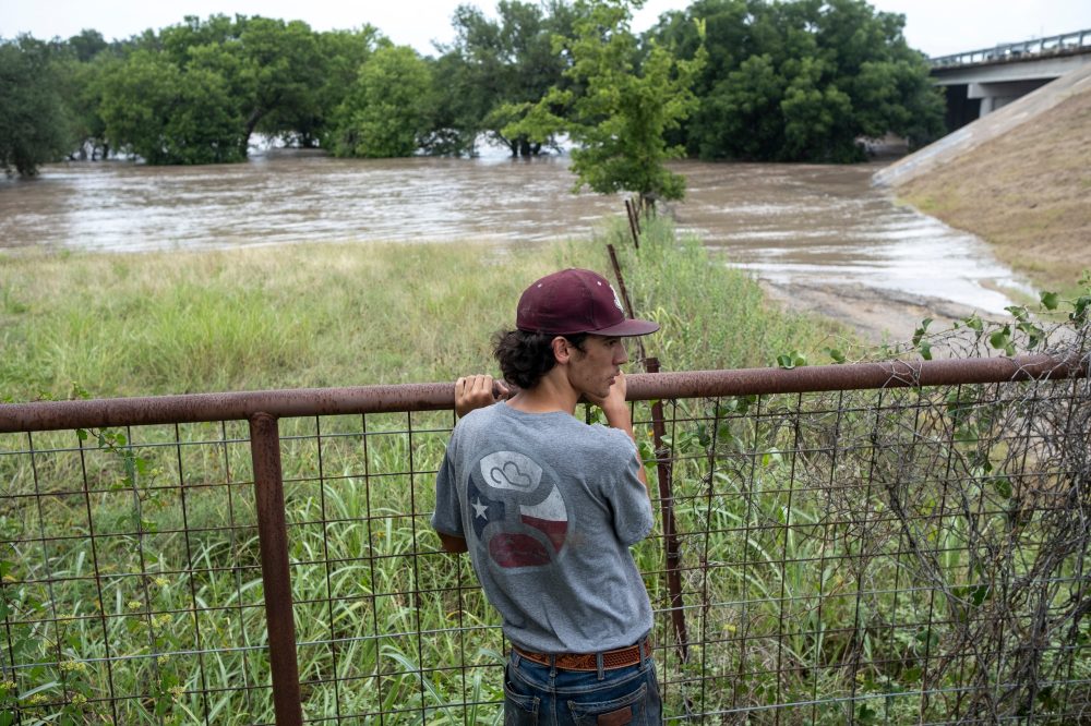

Before the sun came up Thursday morning in Texas, the Guadalupe River surged to heights matching a two-story building — and it did so in just five hours — sending a wall of water crashing through a region that is still recovering from last summer’s deadly flash floods.
For the second year in a row, severe flooding has triggered dozens of high-water rescues, washed out roads, and claimed at least one life, according to authorities. Days of nonstop heavy rain have served as yet another terrifying reminder of just how dangerous the flood-prone Texas Hill Country can be. Experts say this latest event was fueled by a combination of atmospheric conditions and an abundance of available moisture in the air.
“Last year, it was one big wave that came through. And it wiped everything out, and then it receded, and then we could deal with the damage. This time, we’re on day three of heavy rain and everything keeps continuing to rise, and it’s expected to rain today and tonight,” said Suzanne Sutphin Gschwind of Kerrville, one of the communities hit hardest by the flooding.
A mass of hot air sitting over the center of the continental United States caused storm systems to stall and move very slowly, allowing round after round of rain to fall — sometimes at a rate of several inches per hour over roughly the past three days. Bob Oravec, a meteorologist with the National Weather Service, described the flooding as being “about as bad as it gets,” calling these kinds of conditions typically rare.
“Obviously, something like this doesn’t occur every year, but it has occurred over two years in a row and it has occurred over a region that is prone to flash flooding by its topography,” Oravec said.
Over those three days, nearly 1 trillion gallons of rain fell across the three counties hit hardest in Texas. According to Ryan Maue, former chief scientist at the National Oceanic and Atmospheric Association, Uvalde County alone received more rainfall during that stretch than the entire state of California has seen over the past month.
The flooding that struck over the Fourth of July weekend last year killed more than 100 people, including approximately two dozen children and camp counselors at Camp Mystic, a now-closed Christian summer camp for girls. This week’s storms dropped rain across an even broader area, overlapping with many of the same locations where floodwaters overturned vehicles, tore down trees, and forced rescuers into emergency action last July.
A local official in Travis County, which encompasses Austin, reported that residents were stranded on barn rooftops and in trees. Texas Gov. Greg Abbott confirmed that drones and helicopters had been deployed to carry out rescues.
“We are looking at every square inch of the entire area for anybody who may be stranded anywhere. And there will be help coming very rapidly to whoever may be displaced, wherever they are,” Abbott said.
The storms hit the Texas Hill Country, a region of central and south Texas defined by steep, rugged terrain. Thin layers of soil sit on top of limestone hills that have been saturated for days. Rather than soaking into the ground, rainwater rushes directly into rivers with steep banks, causing water levels to spike dangerously fast — a scenario that can catch people completely off guard.
Tyler Roys, a senior meteorologist with the forecasting company AccuWeather, said that when rivers rise that quickly, “it’s almost like a river tsunami.” He noted that these situations are so deadly because water is both extremely heavy and fast-moving. A single cubic foot of water — roughly the size of a box slightly larger than a basketball — weighs about 62 pounds, or 28 kilograms.
Texas State Climatologist John Nielsen-Gammon noted that while this week’s flooding is serious, the rain has fallen somewhat less intensely than last year’s event in many locations, and rivers have generally not risen quite as rapidly.
“This one is producing greater overall precipitation totals, but it is mostly doing it with lower rain rates. They are still fairly high, but they aren’t as high as they were last year,” he said.
Although the Guadalupe River is running very high, its levels have mostly stayed below the record marks set during last year’s deadly floods — with one notable exception. At the small community of Comfort, the river climbed to 37 feet, or 11.3 meters, early Thursday morning. That is 1.5 feet, or about half a meter, higher than it reached at the same location last year. At its peak last year, water equivalent in weight to the Empire State Building was flowing downstream roughly every minute. The all-time record at that location stands at 42.3 feet, or 12.9 meters, set back in 1869.
Scientists say it is difficult to directly link any single storm to climate change, especially while events are still unfolding. Oravec noted that the atmospheric conditions responsible for this storm — hot air that slows and steers storm systems — have existed for a long time, but that climate change could make those conditions more frequent. A warmer atmosphere is also capable of holding more moisture, which can lead to heavier rainfall.
Last year’s deadly floods did increase public awareness of the dangers that flash floods pose, particularly when they strike at night, Oravec said.
“I think overall it has been a good forecast. The effects are catastrophic, but the signal was there for potential heavy rainfall,” he said.