An unsettled weather pattern will continue across the Delmarva region through the upcoming weekend, bringing occasional chances for rain along with a gradual warming trend by the end of the weekend.

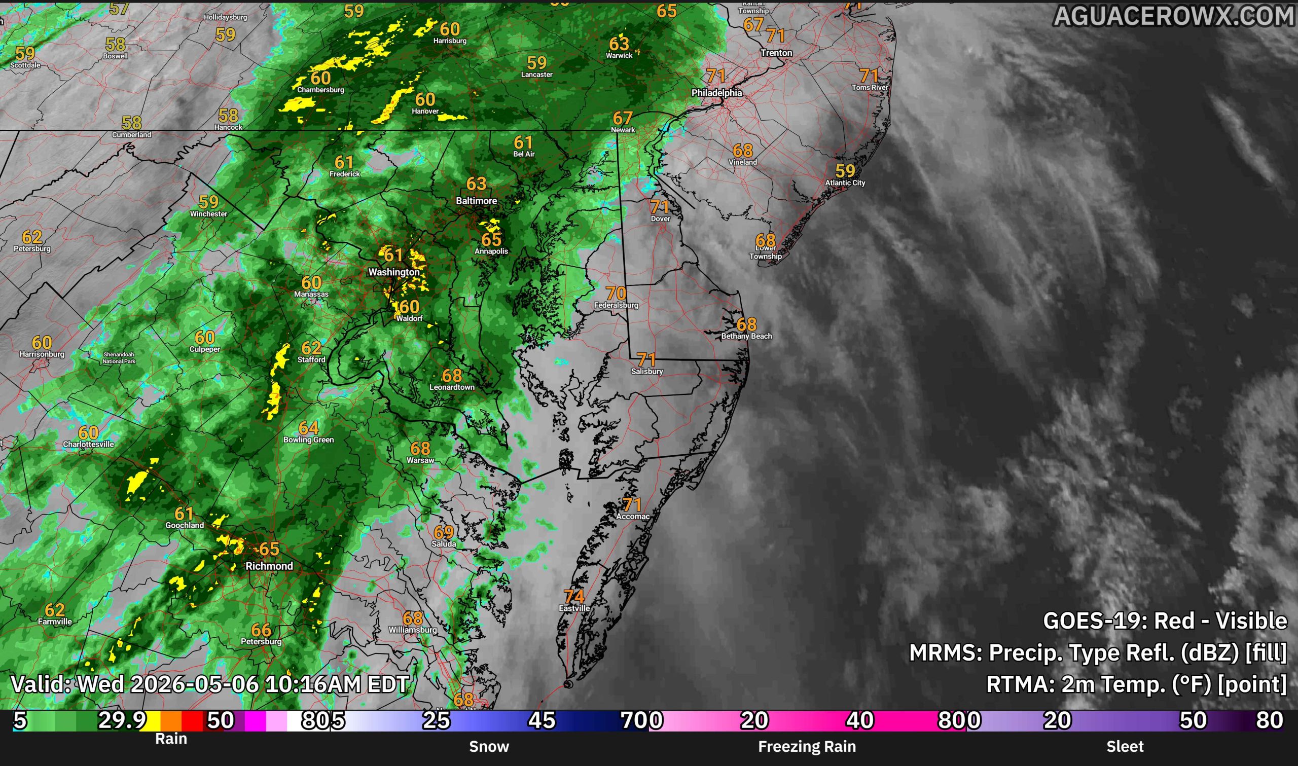
Following a cold front moving through Wednesday night into early Thursday, another weak area of low pressure is expected to develop along the stalled boundary just south of the region. This system may bring additional light rain to parts of Delmarva and southern New Jersey Thursday morning, although recent forecast trends have shifted the system slightly farther south, reducing overall rainfall coverage.
Outside of any lingering showers, Thursday will feel noticeably cooler for early May standards. Afternoon temperatures are expected to remain mainly in the 60s under mostly cloudy skies and a cooler northerly flow.

Conditions improve briefly on Friday as high pressure builds into the Mid Atlantic. This should allow for drier weather and at least partial sunshine across much of the region before the next systems arrive over the weekend.

We are monitoring additional weak disturbances that could bring scattered showers back into the forecast for Saturday and again later Sunday. At this time, these systems appear relatively weak and are not expected to produce significant impacts. Instead, they may simply act as occasional interruptions to outdoor plans during the weekend.

Temperatures will begin moderating Saturday with highs reaching the 60s to lower 70s across much of Delmarva. A more noticeable warmup is expected by Sunday as highs climb into the 70s, with some inland locations potentially nearing 80 degrees if enough sunshine develops.
Despite the periodic shower chances, no severe weather or flooding concerns are anticipated at this time. Overall, the pattern favors generally light precipitation and seasonable to slightly below average temperatures before warmer air returns by the end of the weekend.