
Residents across the Delmarva Peninsula should remain alert Wednesday afternoon and evening as a developing weather system may bring the potential for strong to severe thunderstorms before a powerful cold front sweeps through the region overnight.
A strengthening area of low pressure moving across the eastern Great Lakes this afternoon will track into southern Quebec tonight. As this system intensifies, it will drag a strong cold front eastward across the Mid-Atlantic, arriving in the Delmarva region late tonight into early Thursday morning.

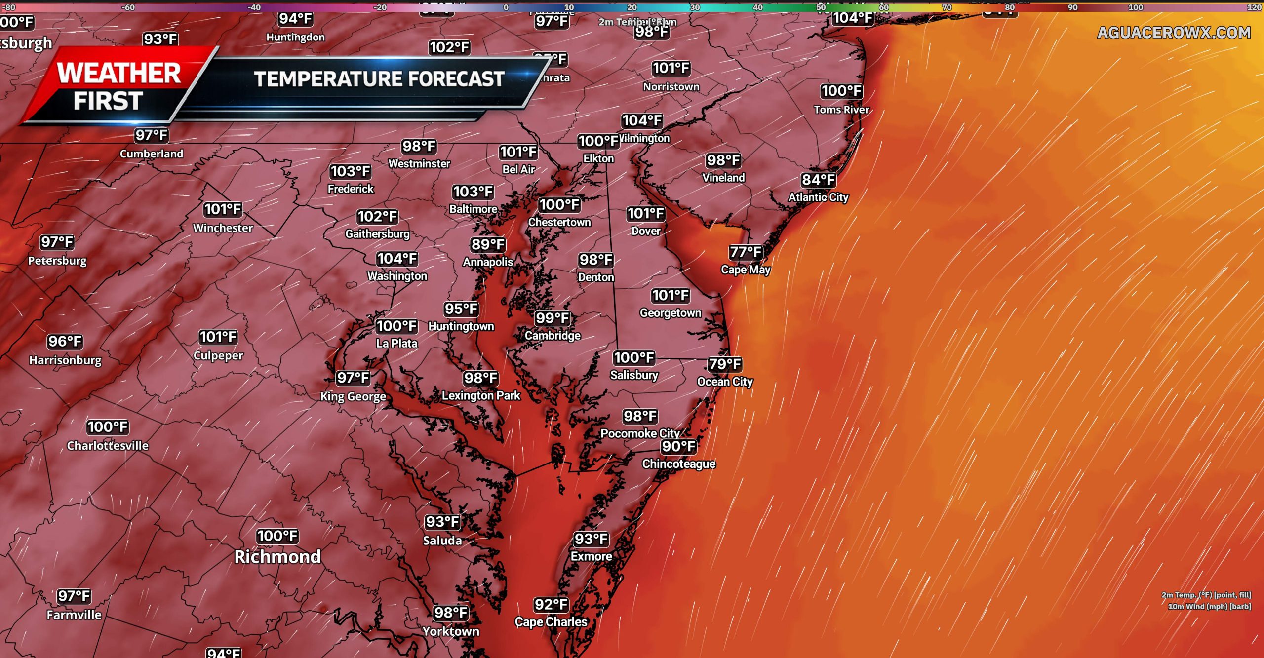
Ahead of the front, a warm and increasingly humid air mass will settle across the region during the day Wednesday. Temperatures will climb well above normal, while dew points rise into the upper 50s and lower 60s. This combination of warmth and moisture will help create a favorable environment for thunderstorms to develop.
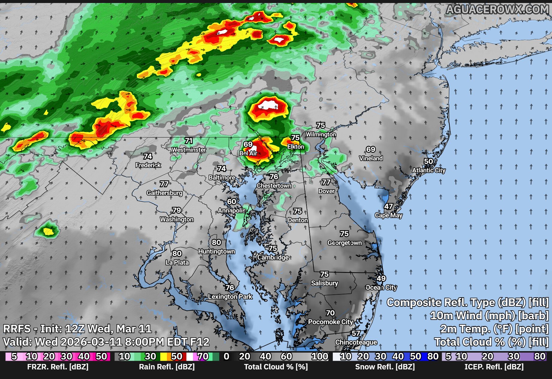
We are closely watching a pre-frontal trough expected to form over central Pennsylvania during the afternoon. Thunderstorms that develop along this feature could organize and move eastward into the Delmarva region by mid to late afternoon and into the early evening hours.


Strong winds in the atmosphere will help support organized storm development. Forecast models indicate wind shear values of around 40 to 50 knots, which can help storms organize into line segments capable of producing damaging wind gusts. Some storms may also produce small hail, generally around quarter size, and there is a low but non-zero chance that an isolated tornado could occur.

The overall severe weather threat will depend heavily on how much sunshine develops during the day. If clouds remain widespread or if morning showers limit daytime heating, the atmosphere may not become unstable enough to support stronger storms. However, if breaks of sunshine develop, particularly across southern and western parts of the region, storm intensity could increase.

Current guidance suggests that areas south and west of Philadelphia have the greatest potential for stronger storms. The Storm Prediction Center has placed these areas in a Slight Risk, or Level 2 out of 5, for severe weather. Closer to the coast, including parts of coastal Delaware and New Jersey, the threat is lower due to cooler marine air moving in from the Atlantic Ocean, which tends to stabilize the atmosphere.
After the initial round of thunderstorms moves through Wednesday evening, activity may decrease overnight with only scattered showers expected for a time. The main cold front is forecast to cross the region early Thursday morning. Most of the rain associated with the front appears likely to occur after the boundary passes, which should limit any additional severe weather threat.

Temperatures will remain unusually warm overnight until the cold front moves through. Once the front passes early Thursday morning, temperatures will begin to drop quickly, signaling the arrival of cooler air across the region to start the day.