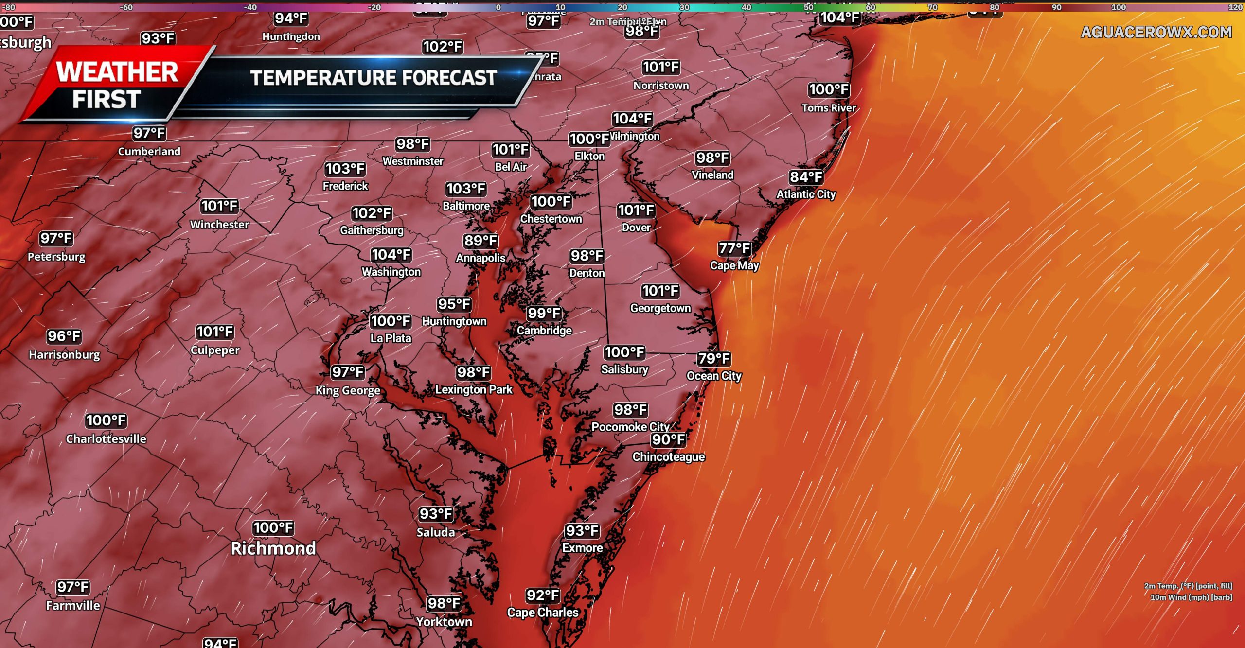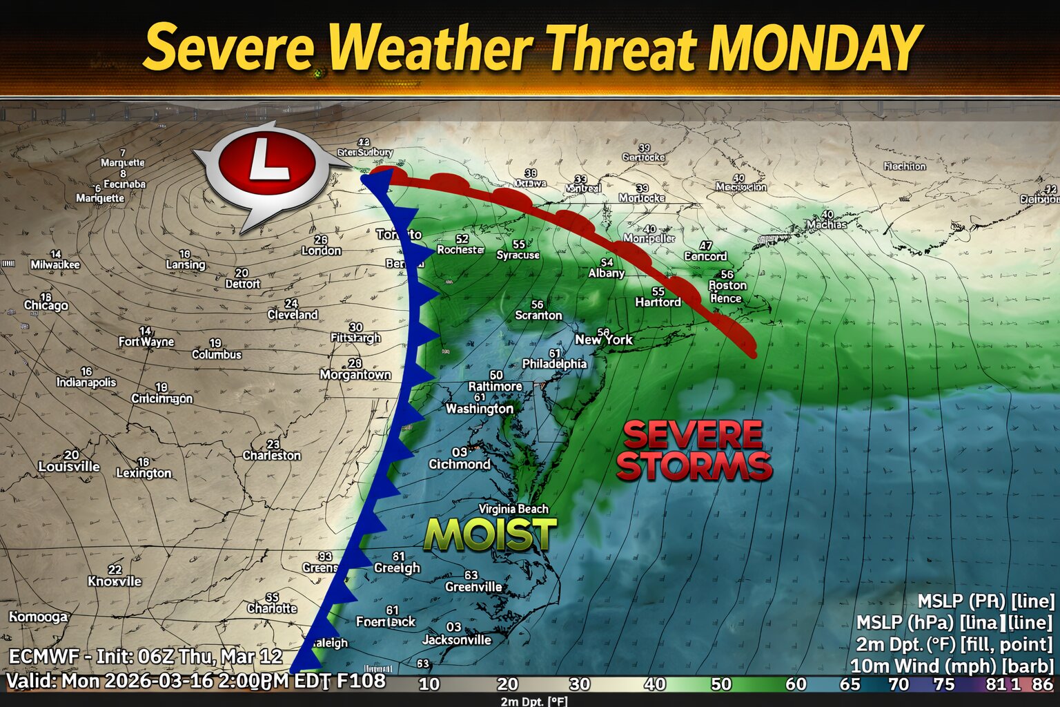

A strong storm system moving from the Mississippi Valley toward the East Coast could bring the potential for severe thunderstorms across parts of the Mid Atlantic on Monday.

Ahead of an approaching cold front, warm and humid air will surge northward with dew points climbing into the 60s. At the same time, strong southwesterly winds throughout the atmosphere will overspread the region, creating favorable conditions for organized thunderstorms.

The primary threat appears to be a line of thunderstorms developing along the advancing cold front, which could produce damaging wind gusts as it moves east through the region. Even though atmospheric instability may remain somewhat limited, the strength of the storm system and strong forcing along the front could still support severe weather.

There is also a more uncertain risk for isolated supercell thunderstorms ahead of the main line, particularly across parts of eastern Virginia and North Carolina where low level wind shear may be enhanced.
The Storm Prediction Center have highlighted portions of the Mid Atlantic with a 15 percent severe weather risk Monday, mainly due to the potential for damaging winds with the line of storms. Cloud cover and early day showers may limit instability, which could affect the overall severity of the storms.