
A developing severe weather setup will bring the potential for damaging storms across portions of the Mid-Atlantic later today, as an organized cluster of thunderstorms pushes east from the Midwest.

This morning, a complex of storms moving out of Missouri is expected to gradually track eastward, entering a more favorable environment for strengthening as it approaches the Ohio Valley and eventually the Mid-Atlantic. Ahead of this system, warmer and more unstable air will continue to build across the region through the afternoon, helping to fuel additional storm development.
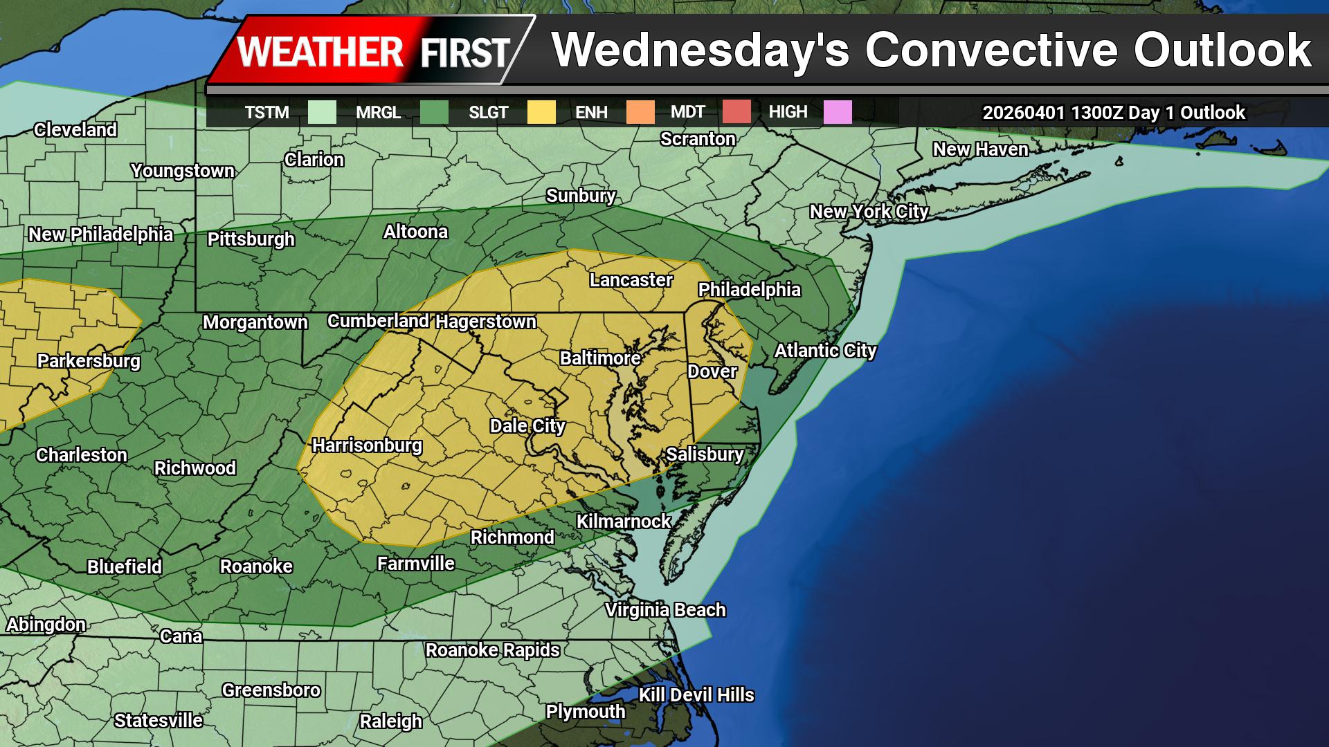
This setup is being driven by increasing instability south of a frontal boundary combined with moderate westerly flow aloft. While wind shear is not particularly strong, it is sufficient to support organized storm structures, especially in the form of bowing line segments. These types of storm features are efficient at producing strong to damaging wind gusts, which will be the primary severe weather hazard.

The highest concentration of storms, along with the greatest risk for severe weather, is expected to extend from the middle Ohio Valley eastward into the Mid-Atlantic by the late afternoon and evening hours. For areas across Delmarva and surrounding regions, storms may arrive during the late day or early evening timeframe.
While widespread severe weather is not expected, any stronger storms that develop could produce localized damaging winds, brief heavy downpours, and possibly small hail. The progressive nature of the system should limit the duration of impacts at any one location, but conditions could change quickly as storms move through.
Residents are encouraged to stay weather-aware throughout the day, especially during the afternoon and evening when storm intensity is expected to peak. Having multiple ways to receive warnings will be important as this system evolves.