
After several rounds of unsettled weather across the Mid-Atlantic in recent weeks, a much calmer and more comfortable stretch of weather is now expected across Delmarva heading into the start of meteorological summer.
A cold front moving through the region early Thursday morning is bringing a few lingering showers to portions of southern Delaware and South Jersey. Those showers are expected to quickly move offshore around daybreak as drier air pushes into the region from the northwest.
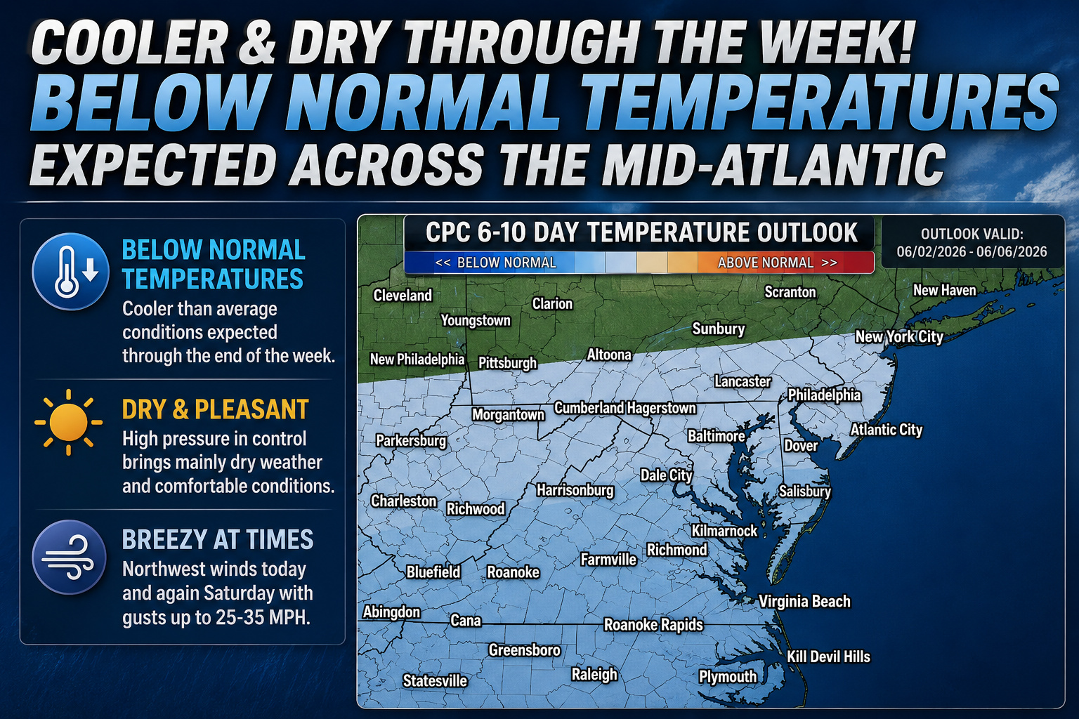
Behind the front, high pressure will build into the Mid-Atlantic and dominate the weather pattern through much of the upcoming week. The result will be several days of tranquil conditions featuring comfortable humidity levels, cooler overnight temperatures, and seasonable daytime highs mainly in the middle to upper 70s.
While the overall pattern remains quiet, breezy northwest winds are expected at times. Wind gusts Thursday afternoon could reach 20 to 30 mph, especially closer to the coastline and open areas. Another dry cold front is forecast to move through Friday night, which may bring another round of gusty winds for Saturday with gusts potentially reaching 25 to 35 mph. Despite the breezy conditions, no widespread rainfall or severe weather is expected with the frontal passage.
We are also monitoring the development of a large scale “Omega Block” weather pattern across the central United States. This pattern tends to slow down weather systems and promote more stable conditions. Delmarva will remain on the eastern side of this blocking pattern, helping keep temperatures slightly below normal through the weekend while also limiting any major storm development.
Looking ahead into next week, forecast confidence becomes lower as a disturbance may attempt to cut off near the East Coast. This could eventually introduce a more unsettled pattern with increased cloud cover or scattered showers at times. However, current indications suggest the risk for any hazardous or impactful weather remains very low.