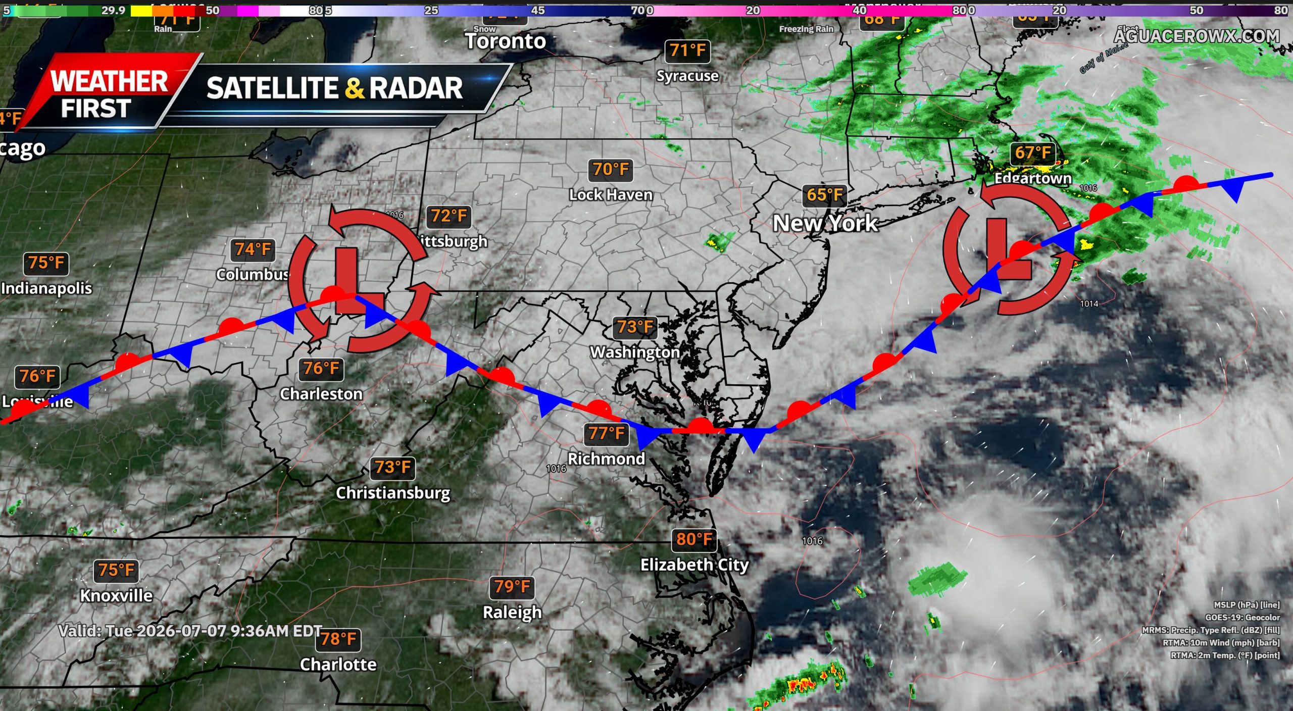
Cool and cloudy conditions will remain locked in across much of Delmarva today as a stubborn marine layer continues to sit over the region. While shower and thunderstorm chances remain in the forecast, most areas are expected to stay mainly dry through the day.

A stationary front remains positioned just south of the region, and that boundary will continue to act as a focus for showers and storms. However, persistent low clouds and an onshore flow have helped reinforce a cooler, more stable marine air mass across the area. That setup will likely limit widespread thunderstorm development for much of Delmarva.
Some drizzle or light rain will be possible at times, especially where the low clouds are deepest. The best chance for more persistent showers will be across southern Delaware, along with Talbot and Caroline counties in Maryland, where the stationary front will remain close enough to support better shower development through the day.

The front is expected to finally begin making more meaningful progress southward tonight into Wednesday, allowing conditions to slowly improve. Temperatures Wednesday and Thursday should climb back into the 80s, but the region will not see a quick return to the extreme heat that impacted the area late last week.

The next more organized chance for showers and thunderstorms will arrive Thursday through Saturday as a cold front approaches and eventually crosses the region. Dewpoints may climb back into the 70s by Thursday, allowing humidity to increase, but the overall setup looks less favorable for widespread severe weather or flooding compared to the active stretch Delmarva just experienced.
Unlike the previous several days, this upcoming pattern appears more progressive. That means weather systems should keep moving rather than stalling over the region. A small disturbance may move through Thursday, followed by a stronger upper-level trough and cold front Friday into Saturday.
While a few stronger storms or pockets of heavy rain cannot be ruled out late this week, the overall risk for severe weather and flash flooding appears lower than what the region dealt with over the past four days.