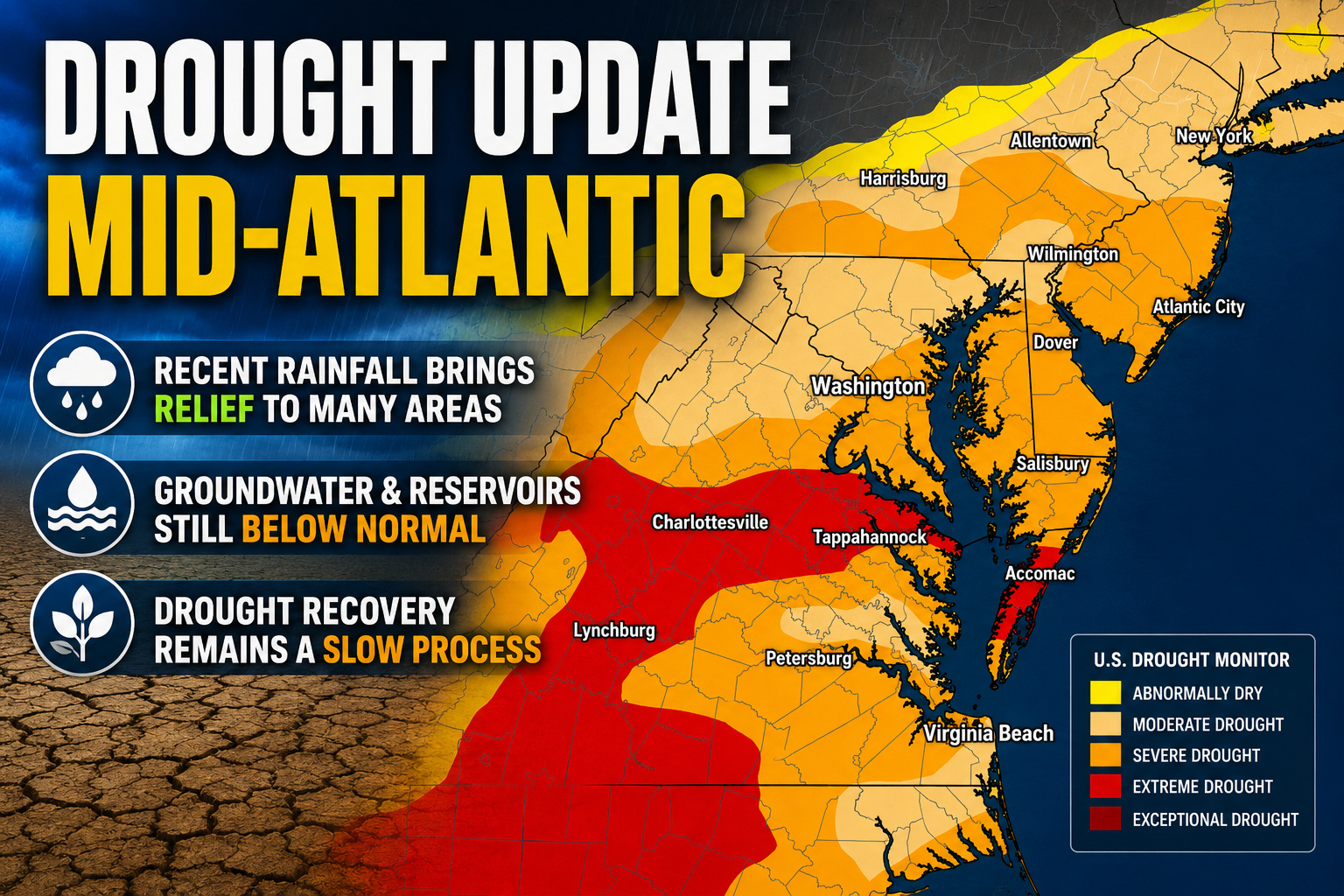

After months of growing drought concerns across portions of the Mid-Atlantic and Northeast, this week’s U.S. Drought Monitor update shows meaningful improvement in several areas following widespread soaking rainfall and cooler temperatures.
A highly active weather pattern during the past week delivered multiple rounds of heavy rain from the southern Plains through the Mid-Atlantic states. Across parts of Maryland, West Virginia, and southern Pennsylvania, many communities received between 2 to 4 inches of rainfall, with isolated areas picking up even higher totals.
The beneficial rainfall came as a strong cold front pushed through the eastern United States, ending an early season heat wave and replacing it with a much cooler and unsettled weather pattern. The combination of steady stratiform rain and convective downpours helped improve soil moisture conditions and increase streamflows across much of the region.

As a result, the latest drought monitor introduced widespread drought reductions across portions of the Mid-Atlantic. Areas of Maryland, West Virginia, and southern Pennsylvania saw notable improvements, especially in locations where rainfall totals exceeded 3 inches during the week.
Despite the recent improvement, experts caution that long term drought impacts have not fully disappeared. Groundwater supplies and reservoir levels remain below normal in some locations after months of persistent dryness. While short term drought indicators such as soil moisture and recent precipitation trends have improved significantly, longer term indicators continue to show lingering deficits.
Because of this, drought classifications across parts of Pennsylvania and Maryland were adjusted from both short and long term drought to primarily long term drought concerns. This reflects improving near surface conditions while acknowledging that deeper hydrological impacts remain in place.
Further north across New England, modest improvements were observed in portions of Maine and Vermont due to improving groundwater conditions. However, drier weather in southeastern New England led to some worsening conditions across parts of Rhode Island and eastern Massachusetts.
Across the broader eastern United States, the same storm system also brought widespread drought relief to portions of the Southeast. Heavy rainfall totals ranging from 2 to 6 inches fell across parts of Mississippi, Alabama, Georgia, and the Florida Panhandle, leading to additional drought reductions in those regions as well.
Looking ahead, forecasters expect a quieter weather pattern to settle over the Mid-Atlantic heading into early June. While additional scattered rainfall opportunities may develop next week, no major widespread flooding or drought busting rainfall events are currently anticipated.
Even with recent improvements, drought recovery is often a slow process. Hydrologists and agricultural experts will continue monitoring groundwater recharge, reservoir recovery, and longer term precipitation trends throughout the summer season.


