
Heavy rainfall triggered dangerous flash flooding across parts of West Virginia Tuesday night, overwhelming homes and businesses, destroying bridges, and prompting numerous water rescues, according to officials.
Gov. Patrick Morrisey deployed 100 National Guard members to the most severely affected areas in the northern part of the state and declared a state of emergency covering all 55 counties Tuesday evening. An additional 200 Guard members were expected to be on the ground by late Wednesday morning.
“State and local agencies will remain on the ground for as long as it takes to help affected communities,” Morrisey said in a written statement.
Meteorologists reported that some locations received as much as 7 inches — about 18 centimeters — of rainfall. No fatalities were immediately confirmed.
The National Weather Service office in Charleston issued urgent warnings of life-threatening flood conditions in certain communities Tuesday night, instructing residents to “SEEK HIGHER GROUND NOW!”
One man riding out the flooding at a hotel in Weston said the power stayed on even as the building’s first floor filled with water, and that most guests planned to wait until Wednesday morning before leaving. Bob Pfister shared his experience on Facebook, writing: “Right now this option is much better than a shelter and a life boat. If the power goes out that may change a whole lot!”
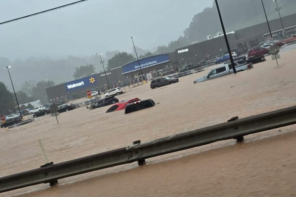
Videos and images circulating on social media showed cars completely submerged in parking lots. Among the scenes captured was a Walmart in Weston, where muddy floodwater surged deep into the store.
Emergency crews carried out dozens of rescues for people trapped in their flooded vehicles. In some cases, however, high water cut off access roads, preventing rescuers from reaching certain locations.
Flash flood warnings across the state had expired by Wednesday morning, though similar warnings were issued for portions of neighboring Virginia.
The intense rainfall was part of a broader storm system that also spawned tornado reports stretching from the Cincinnati area through New Jersey and into the suburbs of New York City. Reports of possible tornado damage also came in from the St. Marys and Belmont areas of West Virginia.
Emergency communications in Lewis and Upshur counties — which together have roughly 40,000 residents — were flooded with activity late Tuesday night.
Water rescues continued for hours through the night and into Wednesday morning, according to Lewis County Commissioner Agnes Quinn Queen. “The devastation across our county is extensive,” she wrote in a social media post.
In the southern part of the state, a storm-caused sinkhole swallowed a vehicle outside a bar in Fayetteville on Tuesday night.
Gov. Morrisey urged residents to stay home, warning that travel conditions remained dangerous. Sections of Interstate 79, U.S. Route 48, and many secondary roads were shut down due to flooding. The situation was made worse by already-saturated ground following storms that dropped more than 2 inches — about 5 centimeters — of rain statewide just the previous Saturday.
The timing of Tuesday’s storms was notable: they struck almost exactly a decade after a deadly flood event that killed 23 people in the same region.
A water gauge operated by the U.S. Geological Survey recorded a creek tributary called Sand Run reaching a record high level near Buckhannon, surpassing the previous record set during a November 1985 flood that left 47 people dead across the state.