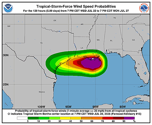

Tropical Storm Bertha is bearing down on the Gulf Coast, with its center positioned near the southern Louisiana shoreline as of 10:00 PM CDT on Wednesday, July 22nd.
According to the National Hurricane Center, the storm was located near coordinates 29.4 degrees north, 91.1 degrees west, tracking westward at approximately 12 miles per hour. The system had maximum sustained winds of around 45 mph and a minimum central pressure of 1002 millibars.
Authorities have expanded the Tropical Storm Warning zone, stretching it westward to include the upper Texas coast, signaling growing concern about the storm’s reach as it continues its westward track along the Gulf.
Residents along the Louisiana and Texas Gulf Coast should remain alert and follow guidance from local emergency management officials as Bertha continues to move through the region.