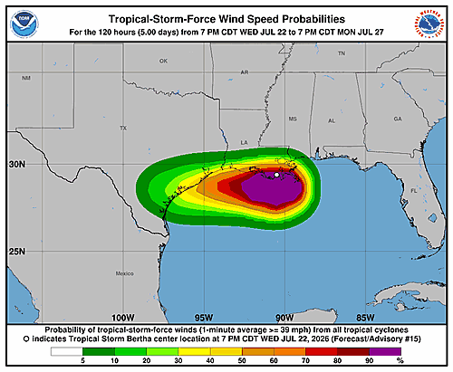

The National Hurricane Center in Miami released Forecast Advisory Number 15 for Tropical Storm Bertha at 3:00 a.m. UTC on Thursday, July 23, 2026.
According to the advisory, the storm’s center was positioned near 29.4 degrees north latitude and 91.1 degrees west longitude at the time of the report. That position is considered accurate within 30 nautical miles.
Bertha is moving toward the west at approximately 10 knots, or about 260 degrees. The storm’s estimated minimum central pressure stands at 1002 millibars, with maximum sustained winds of 40 knots and gusts reaching up to 50 knots.
Looking ahead, forecasters expect the storm to maintain similar wind strength through midday Thursday, with maximum winds of 40 knots. By early Friday morning, the storm is forecast to move inland, weakening slightly to 35-knot winds with gusts up to 45 knots.
By midday Friday, the system is expected to downgrade to a post-tropical remnant low, with winds dropping to 25 knots and gusts around 35 knots. Forecasters project the storm will fully dissipate by Saturday, July 25.
The National Hurricane Center has requested ship reports every three hours from vessels within 300 nautical miles of the storm’s current center. The next advisory was scheduled for 9:00 a.m. UTC Thursday. The advisory was issued by Forecaster Pasch.