The combination of a strong cold front and an unusually moisture-rich atmosphere will create a threat for torrential rainfall and localized flash flooding across portions of the Mid-Atlantic on Tuesday and Wednesday.
The flood threat will initially cover a broad area Tuesday, July 21, before shifting south toward Virginia and North Carolina on Wednesday, July 22. While not every community will experience flooding, thunderstorms will be capable of producing extremely heavy rainfall over a short period.
Widespread Thunderstorms Expected Tuesday

A strong cold front moving south and east from the Midwest will encounter tropical moisture being transported northward from Tropical Depression Two over the Gulf. The tropical system itself will remain far from the Mid-Atlantic, but its moisture will become incorporated into the larger weather pattern affecting the eastern United States.

Atmospheric moisture values, known as precipitable water or PWATs, are expected to exceed 2 inches across much of the region. Some locations could briefly experience values above 2.25 inches. Those levels indicate an unusually deep supply of moisture available for thunderstorms to convert into heavy rainfall.

Numerous thunderstorm segments are expected to develop along and ahead of the front Tuesday. Heavy rainfall could affect areas from the central and northern Appalachian Mountains eastward toward the Interstate 95 corridor, including locations from Richmond through Washington, Baltimore, Philadelphia, New York City and Boston.
Most storms should move relatively quickly, which may prevent widespread flooding in many communities. The faster storm movement also means damaging winds could become the more immediate concern with some of the thunderstorms.
However, the flash-flood threat will increase wherever storms repeatedly track over the same locations.
Training Storms Could Produce Localized Flooding

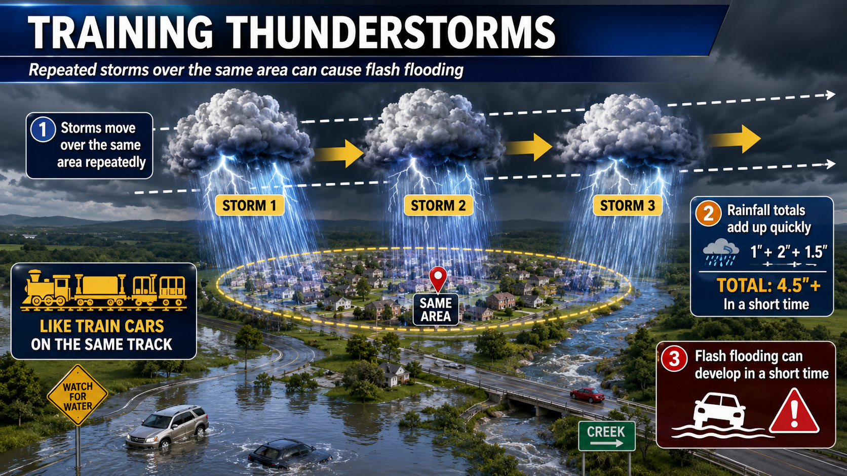
Thunderstorms sometimes develop or move repeatedly along the same boundary, creating a pattern known as training. Similar to train cars traveling along the same track, multiple storms can pass over one community while nearby locations receive considerably less rain.
Backbuilding is another concern. This occurs when new thunderstorms continuously develop along the rear edge of an existing line, allowing heavy rainfall to persist over one area even while individual storm cells are moving.
Training or backbuilding storms could produce several inches of rain in a short period Tuesday. The greatest concerns will include urban areas, poor-drainage locations, low-lying roads and communities near smaller streams and creeks.
A Level 2 out of 4 Slight Risk for excessive rainfall remains in place across much of the Mid-Atlantic for Tuesday. This category indicates that scattered or widely separated episodes of flash flooding will be possible.
For Delmarva, the flood risk will depend heavily on the exact placement and movement of thunderstorm clusters. Storms that remain progressive may primarily produce strong winds and brief heavy rain. However, any slowdown or repeated movement over the same communities could quickly result in flooded roads and drainage problems.
Flood Threat Shifts South Wednesday

The cold front responsible for Tuesday’s storms is expected to slow and stall across central Virginia on Wednesday.
Abundant Gulf moisture will continue flowing northeastward ahead of the boundary. PWAT values could once again rise above 2.25 inches across portions of the Carolinas and southeastern Virginia.

Unlike Tuesday, when many storms should remain relatively fast-moving, the stalled front could act as a track for repeated rounds of thunderstorms Wednesday. The interaction between the boundary and the deepest tropical moisture may promote numerous training and backbuilding storms.
The greatest Wednesday concern currently extends from central North Carolina northeastward through northeastern North Carolina and the Tidewater region of Virginia. A higher-end Slight Risk remains in place across this area.
Forecast trends will be monitored closely because an upgrade to a Level 3 out of 4 Moderate Risk remains possible. Such an upgrade would indicate a more concentrated potential for numerous or significant flash-flooding incidents.
Areas farther north across the Mid-Atlantic may experience a lower flood threat Wednesday as the front and deepest moisture settle southward. However, the exact location of the stalled boundary remains important and could shift as newer forecast information becomes available.
Tropical System Supplying Additional Moisture

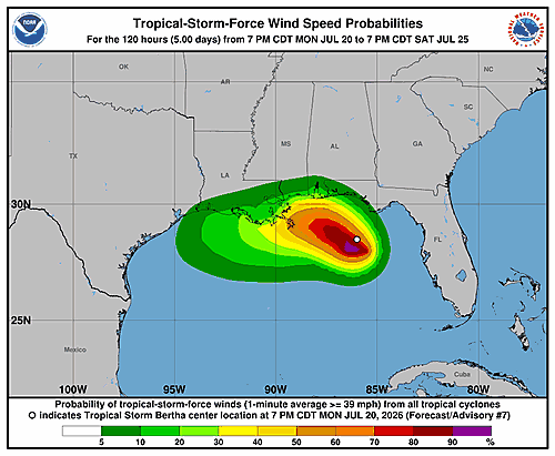
As of Monday morning, Tropical Depression Two was moving slowly northwestward over the northeastern Gulf with maximum sustained winds near 35 mph. The system was forecast to strengthen into a tropical storm while moving near or along portions of the northern Gulf Coast.
The tropical system is not expected to move into the Mid-Atlantic. Instead, moisture circulating around it will be drawn northward and interact with the approaching cold front.
That moisture connection will help thunderstorms produce very efficient rainfall rates, particularly where storms train or repeatedly develop along the boundary.
Remain Alert for Rapidly Changing Conditions
Flash flooding can develop quickly during tropical downpours, especially at night or in locations where drainage systems become overwhelmed.
Residents should have several ways to receive weather warnings and avoid driving through flooded roads. Water depth can be difficult to judge, and roads may be damaged or completely washed away beneath the water.
Never attempt to walk or drive through a flooded roadway. Turn around and find another route.
Tuesday will bring the broader heavy-rain and severe-thunderstorm threat across the Mid-Atlantic. By Wednesday, the most concentrated flash-flood concern is expected to shift south into Virginia and North Carolina, where a stalled front could support repeated rounds of torrential thunderstorms.