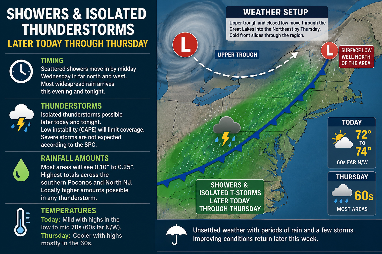

A stretch of unsettled weather is expected across the Delmarva region beginning later today and continuing through Thursday as an area of low pressure and an approaching cold front move through the eastern United States.
According to the latest details, an upper-level trough connected to a closed low over central Canada will swing through the Great Lakes and Ohio Valley tonight before settling into the Northeast by Thursday. While the main surface low will remain well north of Delmarva, its associated cold front will cross the region and bring periods of showers along with the chance for a few isolated thunderstorms.
The timing of rainfall has slowed somewhat compared to earlier expectations. Only scattered showers are expected to begin developing across northern and western portions of the region around midday Wednesday, while the steadier and more widespread rainfall is now expected to hold off until later this evening and overnight.

Although thunderstorms remain possible later today and tonight, the overall severe weather threat remains very low. Limited atmospheric instability, also known as CAPE, is expected to keep thunderstorm coverage isolated at best. The Storm Prediction Center is not expecting severe thunderstorms across the region during this event.

Rainfall totals also continue trending lower with most locations expected to receive between one tenth and one quarter of an inch of rain. Locally higher amounts could occur underneath any thunderstorm, but widespread heavy rainfall is not anticipated. The highest rainfall totals are expected farther north across portions of the southern Poconos and northern New Jersey.

Temperatures ahead of the system will remain seasonably mild today with highs reaching the lower to middle 70s across much of Delmarva, though some far northwestern areas may stay in the 60s. Cooler air arrives behind the cold front on Thursday with daytime highs generally falling back into the 60s region-wide.
While this system is not expected to produce severe weather, residents should still prepare for periods of wet weather, occasional downpours, and a few rumbles of thunder through Thursday before improving conditions gradually return later in the week.