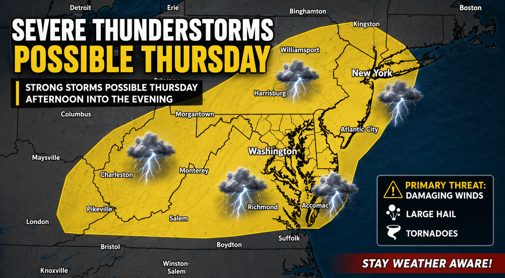

After a stretch of comfortable weather to start the week, attention is turning to a potentially active weather pattern that could bring strong to severe thunderstorms to portions of the Mid-Atlantic on Thursday afternoon and evening.
We are monitoring a strengthening upper-level trough that will sweep across the Great Lakes and northeastern United States. As this system approaches, a deepening area of low pressure tracking through the eastern Great Lakes will drag a strong cold front toward the region, setting the stage for potentially hazardous weather.

Southerly winds ahead of the approaching front will transport warmer, more humid air northward throughout the day Thursday, allowing instability to build across much of the region. At the same time, increasing winds aloft will create a more favorable environment for organized thunderstorms capable of producing severe weather.
The primary concern at this time appears to be damaging straight-line winds, particularly if storms organize into a fast-moving squall line along the advancing cold front. However, we caution that if instability becomes greater than currently expected or storms develop as isolated cells before forming a line, additional hazards such as large hail and isolated tornadoes could also become possible.

One of the biggest uncertainties remains how much instability can develop before storms arrive. Morning cloud cover and any early-day showers or thunderstorms could limit daytime heating and reduce the overall severe weather threat in some locations. Likewise, the strongest upper-level winds may remain displaced somewhat north of the richest moisture, creating additional uncertainty in the magnitude of the event.
Despite these questions, the overall synoptic pattern is supportive of severe weather, with strengthening wind shear, increasing moisture, and a strong approaching cold front all coming together during the late afternoon and evening hours.

Ahead of the storms, temperatures are expected to climb well into the upper 80s and lower 90s, especially along the Interstate 95 corridor and across the coastal plain away from the immediate shoreline. Combined with increasing humidity, heat index values could approach 100 degrees before thunderstorms develop.
Residents across the Mid-Atlantic, including the Delmarva region, should closely monitor the forecast over the next couple of days as confidence in the exact timing and severity of the threat continues to improve. Forecast adjustments are likely as mesoscale details become better resolved.
Stay weather-aware Thursday afternoon and evening, and be prepared for the potential of rapidly changing conditions if severe thunderstorms develop.