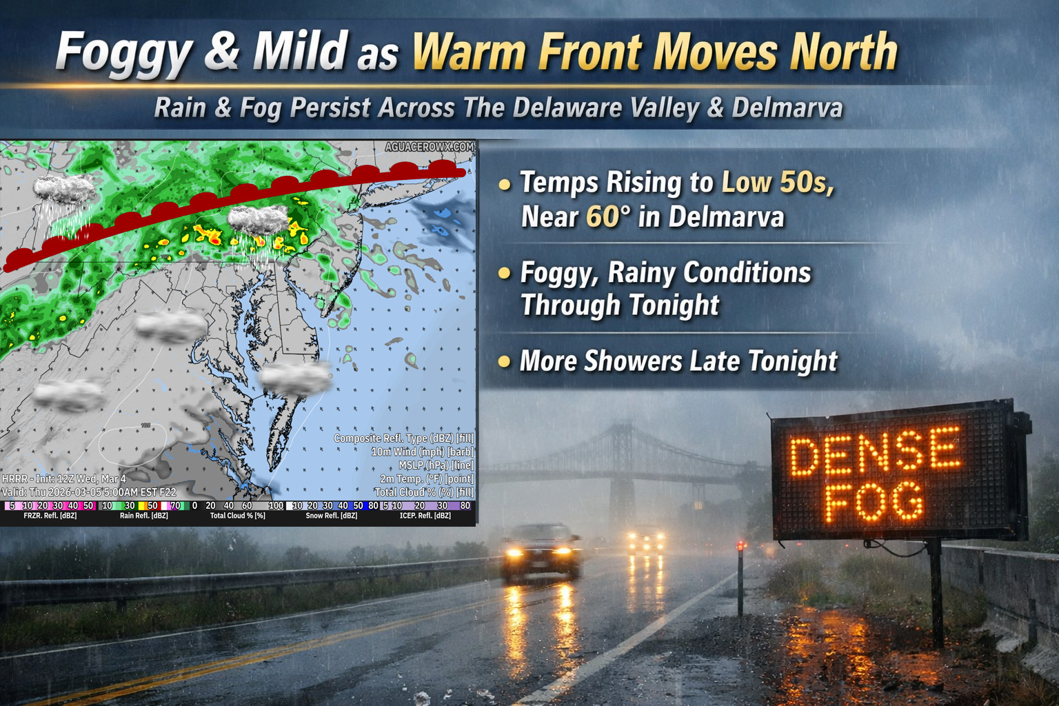
Cloudy, foggy conditions will continue across the Delmarva Peninsula today as a slow moving weather system lifts north through the region. A stationary front currently stretching from low pressure over the Ohio Valley across Delmarva and southern New Jersey will gradually begin to shift northward as a warm front through the day.
As this front lifts north, temperatures across the region will slowly rise. Afternoon highs are expected to reach the low 50s for many areas, with some locations across Delmarva potentially climbing into the upper 50s. Temperatures will remain relatively mild overnight as well, only dropping into the 40s.

Fog has been widespread across the region early today, although visibility has shown some improvement in some areas. Despite this, fog is expected to remain a concern through much of the day, particularly closer to the coast, Delaware Bay, and along the shoreline where it may remain thicker and more persistent. Motorists traveling in these areas should continue to exercise caution due to reduced visibility.
Later this afternoon and into the evening hours, a disturbance in the upper atmosphere combined with weak low pressure moving through the region may trigger scattered showers. The best chance for rain will be across the Delaware Valley, southern New Jersey, and the Delmarva Peninsula. While rainfall amounts are expected to remain relatively light, wet roads could add to the already challenging travel conditions caused by fog.

As the main low pressure system moves closer tonight, fog is expected to redevelop and cloud ceilings will likely lower once again. Another round of light rain may also develop late tonight as the system approaches. Overnight temperatures will remain mild, generally settling into the 40s across the region.

The unsettled and damp conditions are expected to linger into Thursday as the slow moving weather pattern continues to influence the Mid-Atlantic.