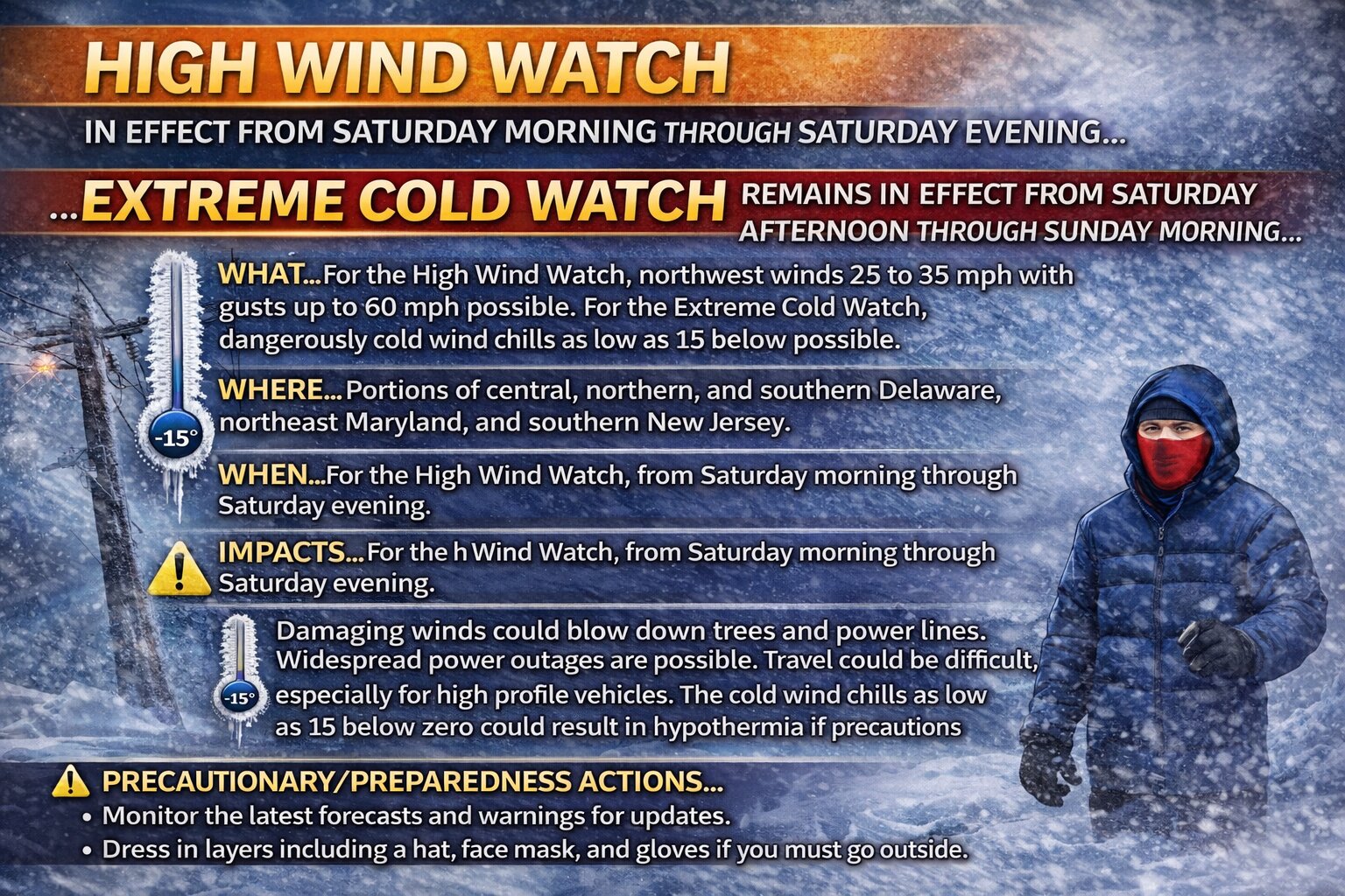


…HIGH WIND WATCH IN EFFECT FROM SATURDAY MORNING THROUGH SATURDAY EVENING… …EXTREME COLD WATCH REMAINS IN EFFECT FROM SATURDAY AFTERNOON THROUGH SUNDAY MORNING…
* WHAT…For the High Wind Watch, northwest winds 25 to 35 mph with gusts up to 60 mph possible. For the Extreme Cold Watch, dangerously cold wind chills as low as 15 below possible.
* WHERE…Portions of central, northern, and southern Delaware, northeast Maryland, and southern New Jersey.
* WHEN…For the High Wind Watch, from Saturday morning through Saturday evening. For the Extreme Cold Watch, from Saturday afternoon through Sunday morning.
* IMPACTS…Damaging winds could blow down trees and power lines. Widespread power outages are possible. Travel could be difficult, especially for high profile vehicles. The cold wind chills as low as 15 below zero could result in hypothermia if precautions are not taken.
PRECAUTIONARY/PREPAREDNESS ACTIONS… Monitor the latest forecasts and warnings for updates. Dress in layers including a hat, face mask, and gloves if you must go outside.