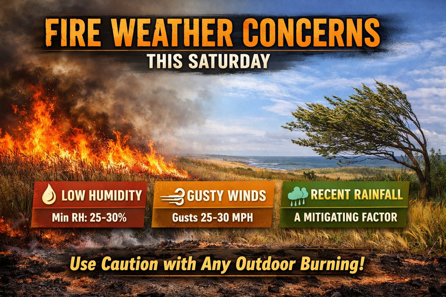
A shift in the weather pattern behind today’s cold front could bring an increased risk for fire spread across the Delmarva Peninsula heading into Saturday.

Canadian high pressure building into the region will usher in a much drier and cooler airmass. While skies will turn partly to mostly sunny, the combination of low humidity and gusty winds is raising some concern. Relative humidity values are expected to drop into the 25 to 30 percent range, while northwest winds increase to around 10 to 15 mph with gusts between 25 and 30 mph.

This setup can enhance the potential for fires to spread more quickly, especially in areas with dry vegetation. Early spring is a particularly vulnerable time across Delmarva, as dormant grasses and brush can ignite easily under these conditions.
One key factor that may help limit the overall threat is rainfall from today’s system. Recent moisture will help keep fuels from becoming critically dry, reducing the likelihood of widespread fire issues. However, localized concerns could still develop, particularly in areas that see lighter rainfall totals.
Residents are encouraged to use caution with any outdoor burning on Saturday, as conditions may allow fires to spread more rapidly than expected.