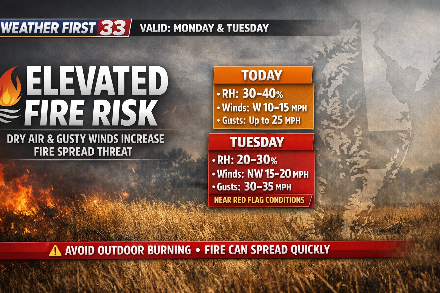

An elevated risk for fire spread is expected across the Delmarva Peninsula today, with conditions becoming more concerning on Tuesday as a much drier air mass moves into the region.
This afternoon, relative humidity values are forecast to fall into the 30 to 40 percent range. At the same time, westerly winds will increase to around 10 to 15 mph, with gusts reaching 20 to 25 mph. While these conditions support an elevated fire risk, they are not expected to reach critical thresholds today.
However, the situation changes heading into Tuesday.

A secondary cold front will move through the region early Tuesday, ushering in a significantly drier air mass. Dew points are expected to drop into the teens, which will allow relative humidity levels to fall even further, into the 20 to 30 percent range by the afternoon.

In addition, northwest winds will strengthen to around 15 to 20 mph, with gusts as high as 30 to 35 mph. This combination of low humidity and gusty winds will create conditions that are close to meeting Red Flag Warning criteria, which signals a high potential for rapid fire spread.

While the meteorological setup strongly supports critical fire weather conditions on Tuesday, recent rainfall may help limit the overall threat. Many areas across Delmarva picked up between a quarter and a half inch of rain on Sunday, with locally higher amounts near one inch across southern Delaware and parts of New Jersey.
That recent moisture could keep fine fuels, such as grasses and small vegetation, from drying out as quickly. Still, ongoing drought conditions across much of the region mean that fire risk remains elevated overall.
Officials are continuing to coordinate with fire weather partners to determine whether additional alerts, such as a Special Weather Statement or a Red Flag Warning, will be issued for Tuesday.
Residents are urged to avoid outdoor burning and use caution with any potential ignition sources, as fires could spread quickly under these conditions.