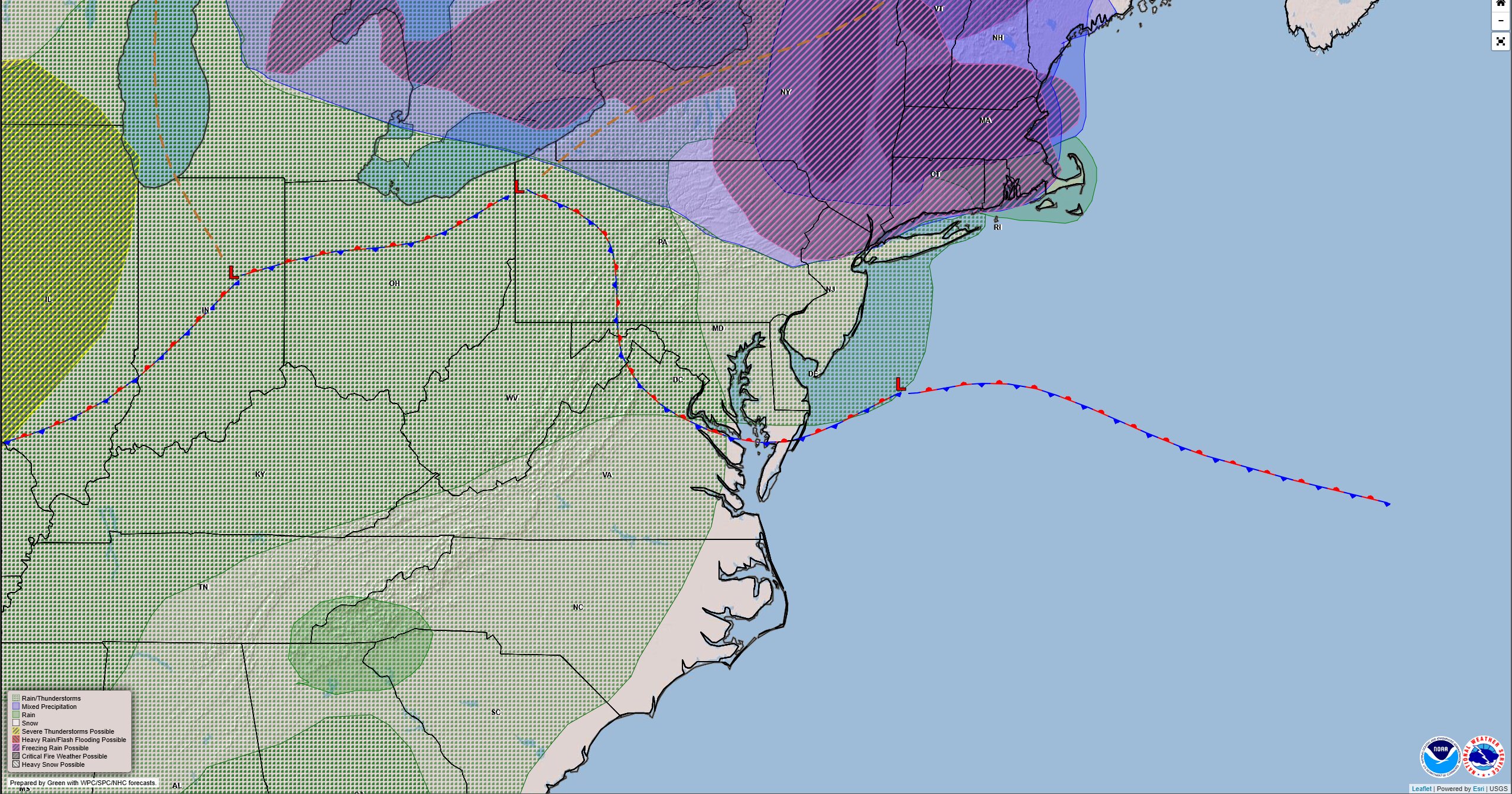

A stretch of gloomy weather is expected to continue across the Delmarva Peninsula through Friday as a stalled frontal boundary keeps the region locked into cool, damp conditions.
The front will remain positioned mostly south of the region, allowing several weak areas of low pressure to move along it. These disturbances will periodically bring light rain or scattered showers while maintaining a very moist air mass over the area.

The first round of rain arrived early Thursday morning, with another wave expected to move through later tonight. Between these periods of rainfall, mist and drizzle are likely to develop, along with areas of fog as light winds and abundant moisture linger across the region.

Patchy dense fog will remain a concern at times through Friday. However, forecasters note that winds may stay just strong enough to prevent widespread dense fog development. Melting snow and warming ground temperatures may also help reduce the risk somewhat, though localized visibility reductions are still possible, particularly during the overnight and early morning hours.
As a result, conditions may remain murky across much of the Delmarva Peninsula with low clouds and periods of reduced visibility.

The unsettled pattern continues into Friday as a backdoor cold front pushes into the region from the north and east before stalling across Delmarva. This setup will trap low-level moisture beneath a temperature inversion, leading to persistent cloud cover along with occasional drizzle, light showers, and areas of fog.
Temperatures will stay on the cool side for early March, with afternoon highs across most of the region expected to remain in the 40s.