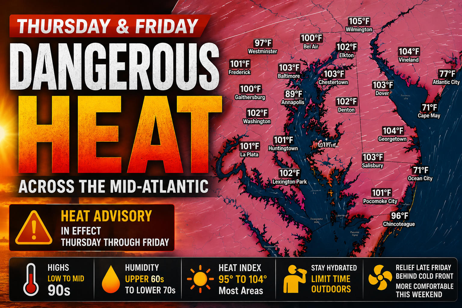

The Mid-Atlantic is set for another round of dangerous summer heat as temperatures surge into the 90s on both Thursday and Friday, with heat index values climbing above 100 degrees in many communities. The combination of hot temperatures and high humidity has prompted Heat Advisories across much of the region, including portions of Delmarva.
A strengthening area of high pressure centered over the Southeast will continue to pump warm, humid air into the region through the end of the workweek. While an upper-level disturbance over Canada may slightly limit just how hot temperatures become, it will do little to reduce the risk of dangerous heat.

High temperatures on Thursday are expected to reach the low to mid 90s across much of the Mid-Atlantic, with many locations climbing even higher on Friday. When combined with dew points in the upper 60s to lower 70s, it will feel more like 95 to 104 degrees during the hottest part of the afternoon.
The highest heat index values are expected across southeastern Pennsylvania, central and southern New Jersey, and much of Delmarva, where prolonged outdoor exposure could quickly lead to heat-related illnesses.

Residents are encouraged to stay hydrated, limit strenuous outdoor activities during the afternoon hours, wear lightweight clothing, and check on vulnerable family members and neighbors. Never leave children or pets unattended in vehicles, where temperatures can become life-threatening in just minutes.
The heat won’t be the only concern. Scattered thunderstorms are expected to develop Thursday and Friday afternoon, with some storms capable of becoming severe and producing damaging winds. While these storms may offer temporary relief from the heat, they could also create hazardous conditions across the region.
Relief is expected to arrive behind a cold front late Friday. While temperatures will remain warm through the weekend with highs generally in the upper 80s to lower 90s, humidity levels are forecast to drop noticeably, making conditions significantly more comfortable and reducing the threat for additional heat advisories.