
A changing weather pattern is expected across the Mid-Atlantic over the next couple of weeks, starting with a cooler stretch before transitioning to a milder setup heading into early April.
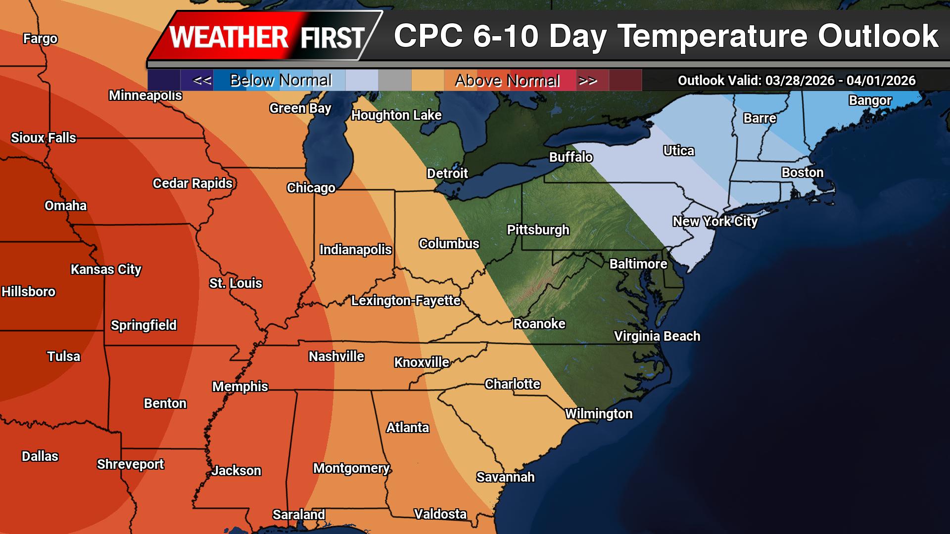
According to the Climate Prediction Center, an upper-level trough developing over the eastern United States will bring below-normal temperatures to the region during the 6 to 10 day period. This pattern supports a push of cooler air into the Mid-Atlantic, with temperatures running several degrees below average as we close out March.

This cooler period will be driven by persistent troughing along the East Coast and a reinforcing northwest flow aloft, allowing cooler air masses to settle into the region.
However, that pattern does not last.

As we move into the 8 to 14 day timeframe, the overall upper-level pattern begins to shift. The eastern trough weakens and lifts out, allowing heights to rise across the eastern United States. This transition opens the door for temperatures to rebound across the Mid-Atlantic, with a growing signal for above-normal temperatures developing.
In other words, after a cool end to March, a warming trend is expected to take hold as we head into early April.

Precipitation, meanwhile, remains somewhat limited through the period. The primary storm track is expected to stay displaced to the north, which favors below-normal precipitation overall across the Mid-Atlantic. While a few systems may pass through, widespread or prolonged rainfall does not appear likely at this time.
The overall takeaway: a cooler-than-normal stretch in the short term will give way to a milder and potentially warmer pattern heading into early April, with generally limited precipitation along the way.