Delaware’s peanut farmers saw a small but positive bump in their earnings last week, according to new agricultural data.
Growers received an average of 24.1 cents per pound for all farmer stock peanuts during the seven-day period that ended on February 7th. This represents an increase of half a cent compared to the previous week’s pricing.
The price improvement comes as local agricultural producers continue to navigate market conditions for their peanut harvests. These weekly price reports help farmers and agricultural businesses track market trends for one of the region’s important crops.
WASHINGTON—As millions of Americans prepare to watch the New England Patriots take on the Seattle Seahawks in the 2026 Super Bowl, farmers across the region are working to satisfy an enormous appetite for game day favorites.
According to the National Chicken Council’s annual Chicken Wing Report, football fans nationwide are projected to consume a staggering 1.48 billion chicken wings during the championship game. This figure represents an increase of approximately 10 million wings compared to the previous year’s Super Bowl consumption.
To put this massive number in perspective, if all 1.48 billion wings were placed end to end, they would wrap around Earth nearly three complete times.
Virginia’s thriving poultry sector plays a crucial role in supplying this tremendous demand. Data from the most recent U.S. Census of Agriculture shows that 1,168 Virginia farms raised more than 55 million broilers and other meat chickens in 2022.
The poultry industry represents one of America’s most valuable agricultural sectors, generating approximately $45.4 billion in national farm-level receipts during 2024. Virginia alone saw cash receipts for broilers surpass $1.2 billion, based on USDA Economic Research Service statistics.
Economic analysts from the American Farm Bureau Federation recently examined popular Super Bowl snacks and the financial challenges facing the farmers who produce them in their latest Market Intel report.
The Super Bowl ranks as the second-largest food consumption day in America, trailing only behind Thanksgiving.
“As fans gather around their TVs this Super Bowl Sunday, it’s worth remembering that every bite reflects far more than what’s on the plate,” the Market Intel states. “It reflects a highly coordinated agricultural system and the farmers and ranchers working every day to keep it running, even as economic pressures continue to mount well beyond game day.”
Despite strong wing demand, poultry producers face significant challenges within a highly consolidated, contract-driven industry. Farmers receive fixed payments that prevent them from capitalizing when wholesale or retail prices increase. Additionally, producers must finance their own facilities, often investing over $1 million in specialized poultry houses and equipment.
Tortilla chips dominate Super Bowl snacking preferences. These corn-based treats begin with field corn, America’s most extensively planted crop. Virginia’s corn production generated $227 million in value during 2024.
However, corn farmers currently face historically low prices, with projections showing average losses of $173 per acre for the 2026 crop year.
Potato chips rank as the second most popular Super Bowl snack. American farmers annually produce nearly $5 billion worth of potatoes, while Virginia’s 481 potato farms harvested 3,240 acres in 2022.
Although potato demand remains robust, escalating expenses for labor, energy, storage, and other operational costs have exceeded market payments to farmers.
Popular game day items including pizza, queso dip, and charcuterie boards depend on the nation’s approximately 24,800 dairy operations. Dairy products secured fourth place among Virginia’s top farm commodities in 2024, producing over $363 million in revenue.
While U.S. milk production has reached record highs, helping maintain affordable and plentiful cheese supplies for consumers, economic pressures have caused dairy farm numbers to drop by more than 60% between 2005 and 2024.
“Farmers are proud to grow the food America’s families enjoy during their parties, and every other day of the year,” said AFBF President Zippy Duvall. “We’re fortunate to be blessed with such an abundant food supply, but the reality is, farmers are facing an economic crisis like we haven’t seen in generations.
“We’re grateful for aid the administration has delivered to farmers this year and do not take that for granted, but more steps are needed to ensure farmers can stay in business until markets improve,” he continued. “There will be only one winner in the game this Sunday, but everyone wins when we protect America’s food supply chain.”
ASHLAND—While Delaware residents grow weary of shoveling snow and navigating icy conditions, local gardens are actually benefiting from winter’s frozen grip. The white blanket covering lawns and flower beds serves as natural protection for plants while delivering valuable nutrients to the soil below.
Snow collects beneficial elements such as nitrogen and phosphorus as it falls through the atmosphere, according to Scot Ferguson, who works as a Virginia Cooperative Extension agent in Hanover County.
Delaware homeowners can maximize these benefits by being strategic about where they pile snow during cleanup efforts. Rather than viewing snow removal as just another winter chore, Ferguson suggests thinking of it as preparation for spring growth.
“You’d want to relocate snow along the drip line of the shrub or tree, kind of like you would with mulch,” Ferguson explained. Placing snow around garden beds and landscaped areas provides “a little bump of nitrogen” to plants.
The melting process delivers these fertilizing compounds gradually into the ground. When warmer weather arrives, the slow melt provides consistent moisture without overwhelming plant roots.
“Plants are probably not getting super waterlogged, and you’re not dealing with runoff,” Ferguson noted. “They will be quite hydrated and trying to transpire!”
Rural property owners who manage large areas of grassland typically invest between $4 and $10 per acre for professional nutrient management services. These landowners appreciate the free fertilization that winter storms provide.
“And for bigger landowners with cover crop programs, that’s where they find the bang for their buck,” Ferguson said.
While Delaware’s native plants handle local weather patterns well, imported ornamental species like boxwood and delicate perennials can suffer damage when cold snaps arrive suddenly.
North Carolina Cooperative Extension research shows that even thin snow coverage shields soil from dramatic temperature swings. This protective barrier keeps soil temperatures more stable, preventing damage to plant root systems.
“And if it’s warm enough under there, the snow forms an insulating blanket, and grass will certainly grow,” Ferguson observed. “Snow still allows sunlight to penetrate its surface. If the plant can move water, if the ground isn’t frozen, then plants and grass can probably photosynthesize!”
Despite predictions of six additional weeks of winter conditions, Delaware temperatures will continue to vary throughout the season.
“Your flowering plants may come into bloom when we have warm weather,” warned Mark Viette, former host of “In the Garden,” a video series from Virginia Farm Bureau Federation. These mild periods may be followed by “a real cold spell.”
Viette recommends covering blooming plants with sheets or soft materials, adding warmth with outdoor-rated incandescent lighting when needed.
Delaware State University women’s basketball standout Amya Scott has captured her fourth Mid-Eastern Athletic Conference Rookie of the Week recognition, the university announced.
The honor marks another milestone in Scott’s impressive debut season with the Hornets, demonstrating her consistent impact on the court throughout the campaign.
Scott’s repeated recognition by the MEAC underscores her significant contributions to Delaware State’s women’s basketball program and establishes her as one of the conference’s top first-year players.
The freshman’s performance has been a bright spot for the Hornets this season, with her fourth weekly honor reflecting her sustained excellence in conference play.
Delaware State University’s softball team experienced mixed results during the opening day of the Elon Phoenix Invitational, managing to secure one victory while dropping another contest.
The Hornets faced Manhattan in one of their matchups, where despite a strong individual performance from Lopez de Haro, who collected three hits during the game, Delaware State was unable to secure the win.
The split record leaves the Hornets with a 1-1 mark as they completed their first day of competition at the tournament hosted by Elon University.
Delaware State will look to build on their opening day performance as the invitational continues, with the team hoping to capitalize on the offensive production demonstrated by players like Lopez de Haro.
The Delaware State University Hornets men’s basketball squad encountered a tough night on the court, falling to Norfolk State by a final score of 75-58 in conference action.
The Hornets struggled to keep pace with their opponents throughout the contest, unable to mount a significant comeback against Norfolk State’s offensive attack. The 17-point margin of defeat reflects the challenges DSU faced in both offensive execution and defensive stops during the game.
This setback continues what has been a difficult stretch for the Delaware State basketball program as they work to find their rhythm in conference competition. The team will look to regroup and refocus as they prepare for upcoming matchups in their schedule.
The Hornets will need to address both ends of the court moving forward, as they seek to bounce back from this loss and build momentum for the remainder of their season.
The Delaware State University women’s basketball team experienced a challenging night on the court, falling to Norfolk State by a margin of 77-45 in their recent matchup.
While the Hornets struggled as a team, they did see a bright spot in the performance of player Huggins, who managed to reach double figures in scoring. However, her individual effort was not sufficient to prevent the substantial defeat.
The loss represents a difficult outcome for the DSU women’s basketball program as they continue their season. The 32-point deficit highlights the challenges the team faced throughout the game against their Norfolk State opponents.
The Hornets will look to regroup and bounce back from this setback as they prepare for their upcoming games in the season.
Delaware State University’s baseball team got off to a challenging start this season, dropping both games of their opening doubleheader and being held scoreless in the process.
The Hornets were defeated 10-0 by VMI in what marked a difficult beginning to their 2026 campaign. The shutout loss left the team searching for answers as they look to bounce back from the disappointing season debut.
With the twin defeats, Delaware State now sits at 0-2 as they prepare to regroup and work on the issues that plagued them in their first outing of the year.
The Hornets will need to address their offensive struggles and tighten up their defense as they move forward in the early portion of their schedule.
The Delaware State University Hornets softball squad got off to a rough start this season, suffering a crushing 20-0 shutout loss to the University of Virginia in their opening game.
The Dover-based Hornets were unable to generate any offensive momentum against the Cavaliers, failing to cross home plate throughout the entire contest. Meanwhile, Virginia’s offense exploded for 20 runs in what became a one-sided affair.
The lopsided defeat marks a challenging beginning to the new campaign for Delaware State’s softball program. The team will look to regroup and bounce back from this difficult season opener as they continue their schedule.
This represents the first game of what the Hornets hope will be an improved season despite the setback against the ACC opponent from Charlottesville.
The Delaware State University women’s basketball team experienced a challenging night on the court, falling to Howard University by a score of 68-51 in their recent matchup.
While the Hornets struggled as a team, they did see a notable individual performance from Scott, who managed to reach double-digit scoring in the contest. However, her efforts were not sufficient to lift Delaware State to victory against their opponents.
The loss adds to the season’s challenges for the Hornets as they continue their campaign. The team will need to regroup and focus on their upcoming games as they work to improve their performance on both ends of the court.
Delaware State will look to bounce back from this setback as they prepare for their next scheduled contest.
NORFOLK, Va., Feb. 11, 2026—Two Delaware State University track and field competitors have been recognized with Mid-Eastern Athletic Conference weekly awards.
Sophomore Ian Cain received the distinction of MEAC Men’s Track Athlete of the Week, while his DSU teammate Christopher Johnson was honored as the conference’s Men’s Field Athlete of the Week.
The weekly honors highlight the strong performance of Delaware State’s men’s indoor track and field program as the season continues.
Delaware State University’s equestrian team delivered an impressive performance at home, defeating UT Martin by a score of 12-6 in Dover.
The Hornets showcased their skills with outstanding performances in both the Jumping Seat and Western categories, leading them to a commanding win over their opponents.
The victory highlights the strength of Delaware State’s equestrian program as they continue their competitive season with solid results across multiple riding disciplines.
The Delaware State University equestrian squad delivered an impressive performance in Western riding disciplines, claiming victory 6-3 in that category, though they ultimately suffered an 11-8 defeat against tenth-ranked UC Davis during NCEA competition action in Dover.
The Hornets demonstrated their strength in Western events, showcasing the talent that has made them competitive in collegiate equestrian sports. Despite the overall loss to the highly-ranked UC Davis team, Delaware State’s Western riders proved they could compete with top-tier programs.
The close final score reflects the competitive nature of the match, with Delaware State’s Western dominance keeping the contest tight throughout the competition held on their home turf.
Three student-athletes from Goldey-Beacom College earned recognition from the Central Atlantic Collegiate Conference this week for their exceptional performances on the field and court.
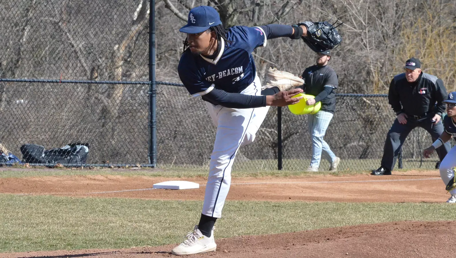
Senior pitcher Kory Williams, who hails from Pennsauken, New Jersey, received the conference’s Baseball Pitcher of the Week award. The Lightning also had sophomore Jaime Neris Jr. from Philadelphia, Pennsylvania, earn a spot on the baseball Weekly Honor Roll.
The college’s men’s basketball program was also represented in the weekly honors, with junior Emarquis Jones of Brooklyn, New York, being selected for the Men’s Basketball Weekly Honor Roll.
The multiple recognitions highlight the strong athletic performances across different sports programs at the Wilmington-based college during the current competitive season.
The Goldey-Beacom College Lightning baseball team showcased exceptional pitching in a doubleheader sweep today in Cary, North Carolina.
The Delaware-based Lightning started their day with a narrow 1-0 shutout victory against Franklin Pierce University before following up with a commanding 7-0 blanking of Mercy College.
Both games demonstrated the team’s strong defensive play and pitching prowess, with Lightning hurlers preventing their opponents from crossing home plate in either contest.
The doubleheader sweep marks a successful road trip for the Goldey-Beacom program as they continue their season away from their Wilmington campus.
Athletes from Goldey-Beacom College turned in impressive performances during weekend competition at the Widener Indoor Classic, with both men’s and women’s track and field squads delivering notable results.
The Lightning’s track and field programs showcased their talents during the indoor meet, demonstrating the strength of both their male and female competitors across various events.
The weekend competition provided an opportunity for Goldey-Beacom’s student-athletes to test their skills against other collegiate programs in an indoor setting, with the teams representing the college well in their respective events.
Goldey-Beacom College’s baseball team launched their 2026 season with contrasting outcomes during their opening weekend in Cary, North Carolina.
The Lightning, who enter the season with regional rankings, secured a 7-5 win against Franklin Pierce University in their season opener, marking a successful start against another regionally-ranked opponent.
However, the team couldn’t maintain that momentum in their second contest, falling to Mercy College by a score of 11-6.
The split results give Goldey-Beacom a 1-1 record as they begin what they hope will be a successful campaign in 2026.
The Goldey-Beacom Lightning men’s basketball team returned to winning ways Tuesday night, defeating Georgian Court 89-79 in Central Atlantic Collegiate Conference play at their home court in Wilmington.
The Lightning dominated the second half, converting 60 percent of their field goal attempts to pull away from a determined Georgian Court team that kept the game competitive throughout.
This victory marks the Lightning’s ninth win in their past ten contests, continuing their strong recent performance as they build momentum in conference play.
The home win showcased Goldey-Beacom’s ability to execute when it mattered most, using their second-half shooting surge to overcome Georgian Court’s persistent efforts and secure the double-digit victory.
The Goldey-Beacom Lightning women’s basketball team dropped a conference matchup against Georgian Court on Thursday evening, falling 73-52 at their home court in Wilmington.
The Lightning hosted the visiting team at the Joseph West Jones Center, where they battled their Central Atlantic Collegiate Conference rivals but ultimately came up short by 21 points.
The defeat marks another challenging game for Goldey-Beacom as they continue their season against CACC competition.
Three student-athletes from Goldey-Beacom College earned recognition on the Central Atlantic Collegiate Conference Weekly Honor Roll for basketball this week.
On the men’s side, junior players Julian Williams from Fayetteville, North Carolina, and Emarquis Jones from Brooklyn, New York, were both selected for the Men’s Basketball Weekly Honor Roll.
The women’s basketball program also had representation, with junior Genesis Garcia from Aguada, Puerto Rico, earning a spot on the Women’s Basketball Weekly Honor Roll.
The weekly honors recognize outstanding individual performances by student-athletes across the CACC conference during recent games.
The Goldey-Beacom Lightning’s remarkable run came to a disappointing conclusion Thursday night, as the team suffered a narrow 80-78 defeat on the road against Felician University in Rutherford, New Jersey.
The highly anticipated matchup between the Central Atlantic Collegiate Conference’s two leading teams delivered the thrilling contest that fans expected, though the outcome wasn’t what Lightning supporters had hoped for.
The loss brings an end to Goldey-Beacom’s impressive eight-game winning streak, marking their first defeat since their hot streak began. The two-point margin highlights just how competitive the game remained throughout, with both teams battling for conference supremacy.
The Lightning will now look to regroup and start a new winning streak as they continue their conference schedule.
The Goldey-Beacom Lightning women’s basketball team encountered a challenging road game this week, traveling to Rutherford, New Jersey to take on Felician University.
The Lightning faced an uphill battle against the Golden Falcons, who currently hold the runner-up position in the Central Atlantic Collegiate Conference standings. Goldey-Beacom was unable to keep pace with their opponents throughout the contest, ultimately suffering a decisive 90-49 defeat.
The loss highlights the competitive nature of conference play as the Lightning continue their season against strong opposition within the Central Atlantic Collegiate Conference.
The Goldey-Beacom College track and field programs began their 2025-26 athletic season by competing at the Fastrack National Invite held in Staten Island, New York.
Both the men’s and women’s teams from the Wilmington-based college are entering this season with considerable momentum from their previous campaign. The men’s squad achieved a historic milestone last year by capturing their first-ever Central Atlantic Collegiate Conference championship in program history.
Meanwhile, the women’s team also had a strong showing in conference competition, securing a third-place finish in the Central Atlantic Collegiate Conference standings.
These impressive results from the previous season have created elevated expectations and optimism for both programs as they embark on their current campaign. The Lightning teams will look to build upon their recent success throughout the 2025-26 season.
HAMPTON, Va. – The Salisbury University women’s swimming program delivered a dominant performance this weekend, capturing their second straight New Jersey Athletic Conference championship title at the Hampton Aquaplex.
Unlike last season’s nail-biting finish that earned the Sea Gulls their inaugural conference crown, this year’s victory was decisive from start to finish. The nationally-ranked 24th team controlled the four-day competition, accumulating an impressive 1,635 total points.
The Sea Gulls’ commanding lead left little doubt about the outcome, as they finished more than 600 points ahead of runner-up Mary Washington, which earned 987.5 points. Rowan University claimed third place with 971.5 points in the 10-team field at the 2026 NJAC Swimming & Diving Championships that concluded Sunday.
The back-to-back conference titles mark a significant achievement for the Salisbury program, demonstrating the team’s growth from last year’s dramatic championship victory to this season’s wire-to-wire dominance.
The Salisbury University men’s swimming program added another impressive achievement to its resume this weekend, capturing second place at the New Jersey Athletic Conference Swimming and Diving Championships held in Hampton, Virginia.
The Sea Gulls, currently ranked 18th nationally, concluded their championship run on Sunday at the Hampton Aquaplex, demonstrating the program’s continued improvement within conference standings. The team’s silver medal performance represents their ongoing progress as they work their way up through the league hierarchy.
Sunday marked the conclusion of the four-day championship event, where Salisbury’s swimmers competed against other NJAC institutions for conference supremacy. The strong finish caps off what has been a successful season for the Sea Gulls’ swimming program.
SALISBURY, Md. – Salisbury University’s men’s tennis program, currently ranked 39th nationally, secured a commanding 7-0 victory against the Goucher College Gophers this past Sunday at the university’s Indoor Tennis Center.
The decisive win held special significance as it marked the inaugural official match triumph for newly appointed head coach Tyler Linscott, who recently took over leadership of the Sea Gulls tennis program.
The Sea Gulls dominated across all match-ups during the afternoon competition, shutting out their opponents completely in what proved to be a strong opening performance under their new coaching leadership.
SCRANTON, Pa. – The Salisbury University men’s lacrosse squad showcased their championship caliber with a dominant 20-3 triumph over Scranton University’s Royals during Saturday’s matchup at Weiss Field.
The second-ranked Sea Gulls established complete control from the opening faceoff, executing a perfect first half that featured 13 consecutive goals without allowing a single score from their opponents. This overwhelming offensive display set the tone for what would become a lopsided victory.
The afternoon contest demonstrated Salisbury’s offensive prowess and defensive discipline as they maintained their momentum throughout the game. The Sea Gulls’ ability to dominate both ends of the field proved too much for the Royals to overcome.
This decisive victory continues Salisbury’s strong season performance and reinforces their position as one of the top-ranked programs in collegiate men’s lacrosse.
WASHINGTON, DC – Salisbury University’s women’s lacrosse squad delivered a dominant performance on Saturday, defeating the Catholic University of America Cardinals by a score of 17-9 at Carlini Field.
The Sea Gulls, currently holding the third position in national rankings, secured their second victory away from home within a span of four days. The team’s strong showing in the nation’s capital demonstrated their continued excellence on the road this season.
Saturday’s matchup saw Salisbury control the game against the Cardinals, building a substantial lead through consistent offensive pressure and solid defensive play throughout the contest.
SALISBURY, Md. – Salisbury University’s baseball program kicked off the 2026 season in dominant fashion Saturday, as the nationally fifth-ranked Sea Gulls delivered a stunning doubleheader sweep against the visiting Moravian Greyhounds at Donnie Williams Sea Gull Baseball Stadium.
The Sea Gulls showcased an explosive offensive performance throughout both contests, shutting out their opponents by scores of 30-0 and 13-0. Each game was completed in seven innings on Saturday afternoon.
The overwhelming victories marked an impressive start to the new campaign for the highly-ranked Salisbury squad, demonstrating the team’s offensive firepower right from the season’s opening day.
HAMPTON, Va. – Salisbury University’s women’s swimming program, currently ranked 24th nationally, moved closer to capturing their second straight New Jersey Athletic Conference championship following an outstanding performance on Saturday.
The Sea Gulls demonstrated their dominance during the third day of competition at the 2026 NJAC Swimming & Diving Championships, held at Hampton Aquaplex in Virginia.
With their strong showing throughout the weekend, Salisbury appears well-positioned to defend their conference title and claim consecutive NJAC crowns.
HAMPTON, Va. – A senior leader from Salisbury University’s 18th-ranked men’s swimming squad captured his first championship title, capping off an impressive third day of competition at the 2026 New Jersey Athletic Conference Swimming & Diving Championships on Saturday at the Hampton Aquaplex.
Dominic Kazzi earned the top spot in the 100-yard breaststroke, marking a breakthrough victory for the veteran swimmer who had been seeking his first conference gold medal. The triumph highlighted another solid performance for the Sea Gulls, who continue to hold their position as strong contenders in the team standings.
The championship meet showcased the depth and talent of Salisbury’s swimming program, with the team maintaining their competitive edge throughout the multi-day event. Kazzi’s victory represents the culmination of years of training and dedication as he approaches the end of his collegiate swimming career.
Competition at the NJAC Championships continues as teams battle for conference supremacy in the pool, with Salisbury’s swimmers looking to build on their momentum from Saturday’s successful session.
FREDERICKSBURG, Va. – Salisbury University’s women’s basketball squad secured an important conference victory during their weekend road trip, defeating the University of Mary Washington on Saturday afternoon.
The Sea Gulls claimed a crucial win in SCORE conference play, adding another victory to their season record while competing away from their home court.
The triumph in Fredericksburg, Virginia represents a significant achievement for the Salisbury program as they continue their campaign in conference competition.
SALISBURY, Md. – Salisbury University’s women’s tennis squad kicked off their 2026 campaign with a narrow defeat on Saturday, falling to Stevens University by a score of 4-3 at the SU Outdoor Tennis Center.
The Sea Gulls battled hard in their home opener but came up just short against the visiting Ducks in what proved to be a closely contested match. The one-point margin highlighted the competitive nature of the season-opening encounter.
The match took place on Saturday afternoon at Salisbury University’s outdoor tennis facility, marking the beginning of what the Sea Gulls hope will be a successful 2026 season despite the disappointing start.
The University of Delaware Blue Hens baseball squad is gearing up for their inaugural home game of the season as they prepare to face off against La Salle.
The team will be taking the field at their home diamond for the first time this season, marking an important milestone in their campaign. This matchup represents the official start of home games for the Blue Hens as they look to establish momentum on familiar territory.
The contest against La Salle will give local fans their first opportunity to see the team in action at home this year, as the Blue Hens work to build on their early season performance.
DALLAS – University of Delaware senior basketball standout Justyn Fernandez has captured his second Conference USA Player of the Week award this season, recognition that comes after he powered the Fightin’ Blue Hens to two wins in league action over the past week.
The weekly honor highlights Fernandez’s outstanding performance as he continues to lead Delaware’s men’s basketball team through conference play. His efforts helped the Blue Hens maintain their perfect 2-0 record during the week in Conference USA matchups.
This marks the second time this season that the senior has received the prestigious weekly recognition from Conference USA officials, underscoring his consistent impact on the court for the Delaware program.
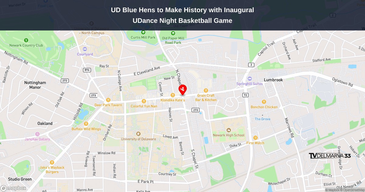
NEWARK, Del. – The University of Delaware men’s basketball squad is preparing to make program history this Wednesday evening at the Bob Carpenter Center as they welcome Western Kentucky for what will be the Blue Hens’ inaugural UDance Night celebration.
This milestone event represents a first for the Delaware basketball program, combining athletic competition with the university’s signature dance marathon tradition. The Blue Hens will take the court against the visiting Western Kentucky team in what promises to be a memorable evening for fans and players alike.
The matchup is scheduled to tip off Wednesday night at the Bob Carpenter Center in Newark, where Delaware supporters will have the opportunity to witness this historic moment in Blue Hens basketball.
The University of Delaware Blue Hens softball team delivered an exciting finish to their home-opening weekend, completing a doubleheader sweep against Saint Joseph’s on Sunday, February 15th.
The Blue Hens dominated the opening contest, securing an 11-3 victory that concluded after six innings due to the run rule. Delaware’s offensive power was on full display as they built a commanding lead throughout the game.
Game two provided much more drama for the home crowd. Trailing entering the bottom of the seventh inning, the Blue Hens mounted a spectacular comeback, scoring three runs in their final at-bat to secure a walk-off victory over the Hawks.
The doubleheader victories capped off a successful 3-2 record for Delaware’s opening weekend at home. The Blue Hens demonstrated both their offensive capabilities in the first game and their resilience in the nightcap, showing they can win games in multiple ways.
The dramatic finish in game two highlighted the team’s ability to perform under pressure, with the seventh-inning rally providing an exciting conclusion for fans in attendance at the home opener.
NEWARK, Del. – The University of Delaware ice hockey squad has learned their fate for the upcoming Atlantic Hockey America Championship tournament following the conclusion of regular season play.
The Blue Hens, who earned the seventh seed in the tournament, are set to clash with sixth-seeded Robert Morris in their opening playoff matchup on Thursday, February 19. The game will take place in St. Charles, Missouri, with the opening faceoff scheduled for 2 p.m. Eastern Time.
Fans who want to follow the action can watch the game via streaming on FloHockey.
The matchup represents a crucial postseason opportunity for Delaware’s hockey program as they look to advance through the AHA Championship bracket.
ELON, N.C. – The Delaware Blue Hens baseball program wrapped up their season-opening weekend with a twin bill against Elon University this past Saturday.
The Blue Hens made the trip to North Carolina on February 14th to face the Phoenix in the doubleheader matchup, marking the conclusion of Delaware’s first weekend of competition for the new season.
BOSTON – A University of Delaware distance runner made history Saturday, smashing the school’s 5,000-meter record at the Valentine Invitational track meet.
Marie-Theres Gruber, competing for the Blue Hens track and field program, demolished the previous program standard in the 5K during the Boston competition. Her record-breaking performance highlighted a strong day for Delaware athletics.
The Blue Hens didn’t stop there, as three additional athletes secured spots among the program’s all-time top-10 performances in their respective events during Saturday’s meet.
The Valentine Invitational provided an excellent stage for Delaware’s track and field team to showcase their talents against quality competition, with Gruber’s historic run leading the way for the Blue Hens’ impressive showing.
The University of Delaware Blue Hens softball squad delivered high drama on Saturday, February 14th, splitting a twin bill against the Georgetown Hoyas in spectacular fashion.
In the opening contest, Delaware found themselves trailing 7-3 entering the bottom half of the seventh and final inning. What happened next was pure magic for the home crowd, as the Blue Hens mounted an incredible four-run rally to snatch victory from the jaws of defeat.
The heroics culminated when Bridget Chapman stepped to the plate and delivered a clutch walk-off single, sending teammates and fans into celebration as Delaware captured an 8-7 victory.
However, the second game told a different story entirely. Georgetown bounced back with strong pitching and timely hitting to shut out the Blue Hens 3-0, ensuring the day would end with each team claiming one victory.
The doubleheader showcased both the resilience and competitive spirit that defines college softball, with Delaware’s remarkable comeback in game one serving as a testament to never giving up until the final out.
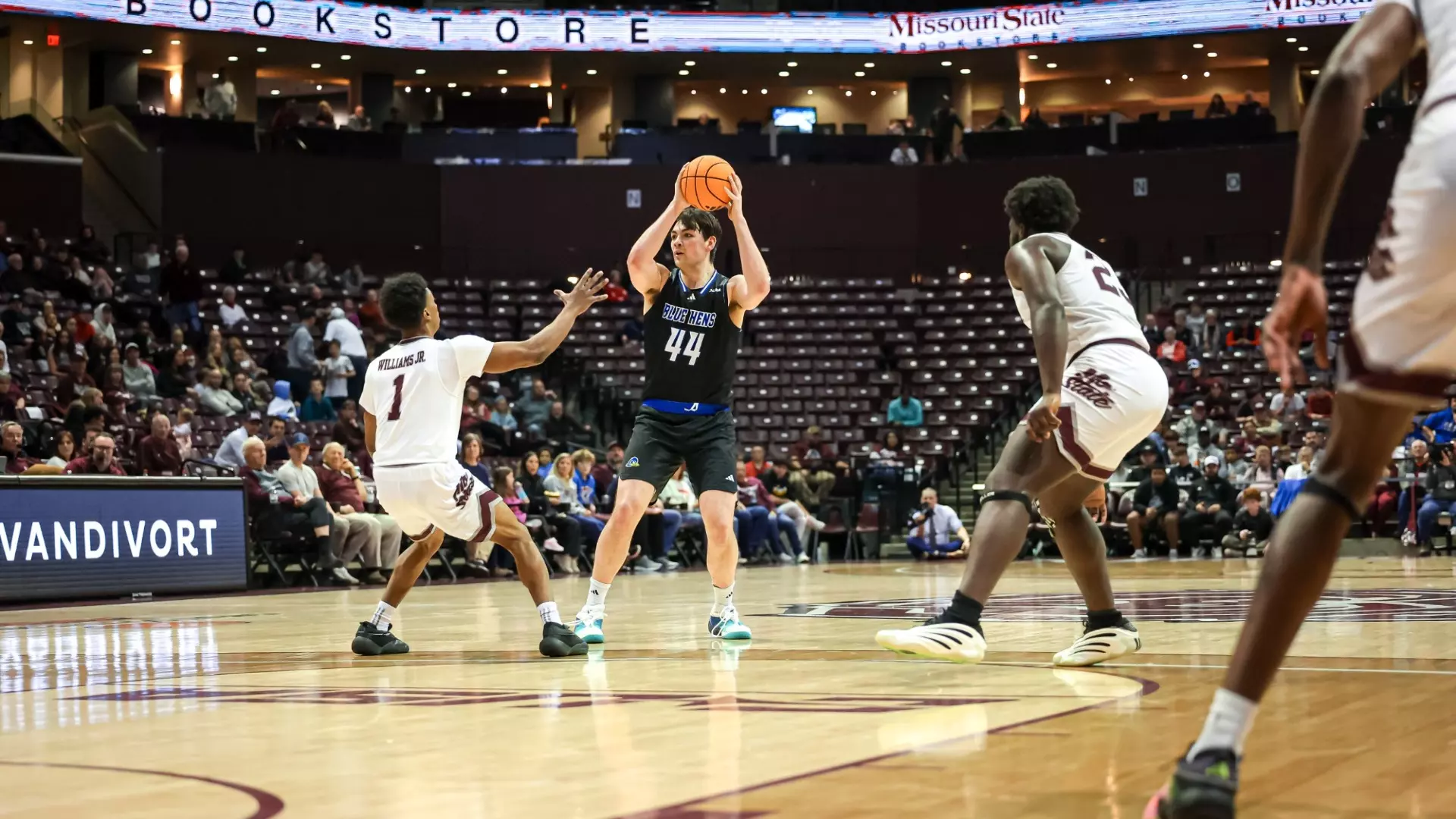
The University of Delaware Fightin’ Blue Hens basketball squad continued their recent hot streak Saturday, defeating Missouri State 76-67 on the road in Springfield, Missouri.
The victory marks the third straight win for Delaware, bringing their overall season record to 9-16 while improving to 5-9 in Conference USA competition. Missouri State suffered the loss, dropping their record to 13-12 overall with a 7-7 mark in CUSA play.
The Blue Hens have shown significant improvement during this three-game winning streak, finding their rhythm as the conference season progresses. The road victory demonstrates the team’s growing confidence and ability to perform away from their home court.
QUEENS, N.Y. – The University of Delaware men’s lacrosse squad earned their first victory of the season Saturday, edging St. John’s 12-11 in a hard-fought contest in New York. John McCurry powered the Blue Hens’ offense with three goals, marking his first hat trick of the campaign.
The narrow victory moves Delaware’s record to 1-2 on the young season, while St. John’s remains winless at 0-2. The Fightin’ Blue Hens managed to hold off the Red Storm in what proved to be a closely contested battle throughout.
McCurry’s offensive explosion provided the spark Delaware needed to secure the one-goal triumph on the road. The performance gives the Blue Hens momentum as they continue their 2026 campaign.
Torrential downpours struck New Zealand’s South Island on Tuesday, creating dangerous flooding conditions and prompting authorities to shut down numerous roads and bridges as a destructive storm system continued its path southward after wreaking havoc in Wellington over the weekend.
Weather officials warned that a low-pressure system positioned off the eastern coastline could deliver additional rounds of intense rainfall throughout Tuesday. The meteorological service cautioned that waterways could surge quickly and that the saturated ground conditions raised concerns about potential landslides.
MetService New Zealand’s most recent forecast also predicted hazardous ocean conditions with massive swells expected along the coastline.
Emergency officials issued a local state of emergency for the Banks Peninsula area adjacent to Christchurch, the nation’s second-most populous city, following severe flooding, toppled trees, and mudslides that isolated neighborhoods while knocking out utilities and communications infrastructure in multiple locations.
“We anticipated the weather easing off, but unfortunately that hasn’t happened, and isn’t forecast to begin easing until 6:00 p.m. (0500 GMT),” Christchurch Mayor Phil Mauger said.
Mayor Mauger called on citizens to limit water usage as the extreme weather persisted, and officials instructed some residents to boil their drinking water after floodwaters compromised a water processing plant.
The popular tourist destination of Akaroa, located approximately 90 kilometers (56 miles) northwest of Christchurch, became completely inaccessible due to the conditions.
Cameron Gordon, who owns a local cafe, described how floodwaters had risen to his establishment’s exterior walls. “Worst I’ve seen in my 20 years by quite some margin,” he told NZME media group.
Digital photographs circulating online revealed crumbled roadway sections, submerged streets, and rapidly swelling creeks throughout the affected areas.
The weather system had previously created significant chaos across extensive portions of the North Island, where aviation operations were suspended, primary transportation routes were blocked, and electrical service was disrupted for tens of thousands of people. Multiple Wellington residents on the North Island continued experiencing power outages on Tuesday, according to New Zealand news outlets.
A war of words has erupted between President Donald Trump and Maryland Governor Wes Moore regarding the handling of a catastrophic sewage leak that has contaminated the Potomac River since January.
From his Florida residence during the holiday weekend, Trump criticized what he characterized as inadequate local leadership in addressing the environmental crisis. The president announced on social media that he was directing federal agencies to take charge of coordinating the cleanup effort.
“There is a massive Ecological Disaster unfolding in the Potomac River as a result of the Gross Mismanagement of Local Democrat Leaders, particularly, Governor Wes Moore, of Maryland,” Trump wrote in his post. He further stated he “cannot allow incompetent Local ‘Leadership’” to transform the Potomac “into a Disaster Zone.”
However, the damaged infrastructure falls under the authority of DC Water, a Washington-based utility that operates under federal oversight from the U.S. Environmental Protection Agency. The failed pipeline, known as the Potomac Interceptor, dates back to the 1960s.
Governor Moore’s spokesperson, Ammar Moussa, fired back at the president’s accusations, stating the administration has been avoiding its responsibilities regarding the cleanup of what University of Maryland scientists describe as among the most significant sewage disasters in American history.
“The President has his facts wrong — again,” Moussa declared. “Apparently the Trump administration hadn’t gotten the memo that they’re actually supposed to be in charge here.”
Moussa also noted that EPA representatives failed to attend a recent legislative session focused on the cleanup efforts, suggesting federal agencies were not fully engaged in the response.
DC Water’s top executive, David L. Gadis, confirmed Monday that his organization has maintained communication with the EPA since the pipeline failure occurred.
A White House representative, speaking without authorization to be named publicly, defended Trump’s criticism by claiming Maryland had been slow to work with federal authorities and had neglected necessary infrastructure improvements to the state’s water systems.
The president indicated that the Federal Emergency Management Agency would lead coordination efforts, while acknowledging that a funding freeze affecting the Department of Homeland Security could impact operations.
Congressional Democrats and the Trump administration failed to reach agreement on DHS funding legislation, resulting in a partial government shutdown that began Saturday. The funding gap affects multiple agencies including FEMA, the Coast Guard, TSA, Secret Service, ICE, and Customs and Border Protection.
White House spokesperson Karoline Leavitt used the sewage crisis to pressure Democrats, posting on social media: “Add this to the long list of reasons Democrats need to get serious and fund the Department of Homeland Security.”
The environmental disaster began January 19 when a massive 72-inch diameter sewage pipe collapsed, releasing millions of gallons of untreated wastewater into the river system northwest of the nation’s capital.
DC Water officials report that repair work has proven more challenging than initially anticipated. Recent pipeline inspections revealed a substantial blockage approximately 30 feet from the rupture site, described as “far more significant” than originally estimated. Engineers discovered a large rock formation blocking the line that must be cleared before permanent repairs can begin.
The utility estimates emergency repairs will require an additional four to six weeks to complete. The restoration work will address the immediate pipe damage as well as broader environmental remediation needs.
District of Columbia environmental officials have assured residents that drinking water supplies remain uncontaminated but have advised against direct contact with Potomac River water. Authorities recommend avoiding fishing in affected areas and keeping pets away from the waterway.
This latest dispute adds to ongoing tensions between Trump and Moore, a Democrat considered a potential presidential candidate in 2028. The two have clashed repeatedly since Trump returned to office.
Trump has announced he will exclude Moore and Colorado Governor Jared Polis from a White House governors’ dinner scheduled for Saturday during the National Governors Association gathering in Washington.
The administration has also criticized Moore regarding crime rates in Baltimore, with Trump threatening to deploy National Guard forces to the city. Moore and other Maryland Democratic leaders have countered that Baltimore homicides have dropped to historic lows, with sustained decreases beginning in 2023, and rejected the need for Guard deployment.
Additionally, the Trump administration has questioned Moore about diversity contracting policies and rising expenses related to rebuilding Baltimore’s Francis Scott Key Bridge, which collapsed in March 2024 after a container vessel collision.
Speaking to reporters during his return flight from Florida Monday evening, Trump cited both the bridge reconstruction and sewage spill response as reasons for excluding Moore from the governors’ dinner.
“He can’t fix anything,” Trump told the press corps.
Moore’s spokesman emphasized the state’s willingness to collaborate with federal officials on addressing the crisis.
“The Potomac isn’t a talking point, and the people of the region deserve serious leadership that meets the moment,” Moussa concluded.
Delmarva poultry producers monitor feed costs as federal agency credibility comes under fire following major corn acreage corrections
Market Overview
The United States Department of Agriculture is facing intense scrutiny after major corn production data errors sent grain prices tumbling and raised questions about the reliability of agricultural statistics that farmers depend on for critical business decisions.
The USDA released final 2025 corn acreage numbers in January that dramatically exceeded earlier projections from June, causing already struggling grain prices to plummet by more than 5 percent. The federal agency, historically considered the most trusted source for agricultural statistics globally, has not fully explained the discrepancy between the June estimates and the January final numbers.
Week-ending market numbers reflected the turmoil. December corn futures settled Friday at $3.92 per bushel, down 18 cents for the week, while March corn closed at $4.01, off 16 cents. November soybean futures finished the week at $10.48 per bushel, down just 4 cents, while January beans closed at $10.61. The soybean-to-corn price ratio widened to 2.67, the highest level in three weeks, potentially signaling a shift in spring planting intentions.
Wheat markets bucked the downtrend, with December futures gaining 9 cents to settle at $5.37 per bushel on deteriorating crop conditions in Kansas and Oklahoma. Livestock markets showed mixed results, with live cattle futures for April delivery settling at $184.25 per hundredweight, up $2 for the week.
Local Impact
For Delmarva grain farmers, the USDA corrections add another layer of uncertainty to an already challenging market environment. Lower corn prices affect rotation decisions and more immediately impact poultry producers across the peninsula who purchase millions of bushels of corn annually for feed.
Several grain elevators across the Eastern Shore reported slower farmer selling this week as producers wait to see if markets stabilize. Some are holding old-crop corn and soybeans in on-farm storage, hoping for a price recovery before moving grain to market. The Laurel grain elevator reported cash corn bids at $3.70 per bushel, while soybeans brought $10.15.
Feed mills continue steady purchases to meet poultry industry demand, providing underlying support for local basis levels even as futures markets struggle. The integration model that dominates Delmarva’s poultry industry means most growers aren’t directly exposed to feed price swings, but the overall health of the industry depends on profitable operations up and down the supply chain.
Agricultural Weather Outlook
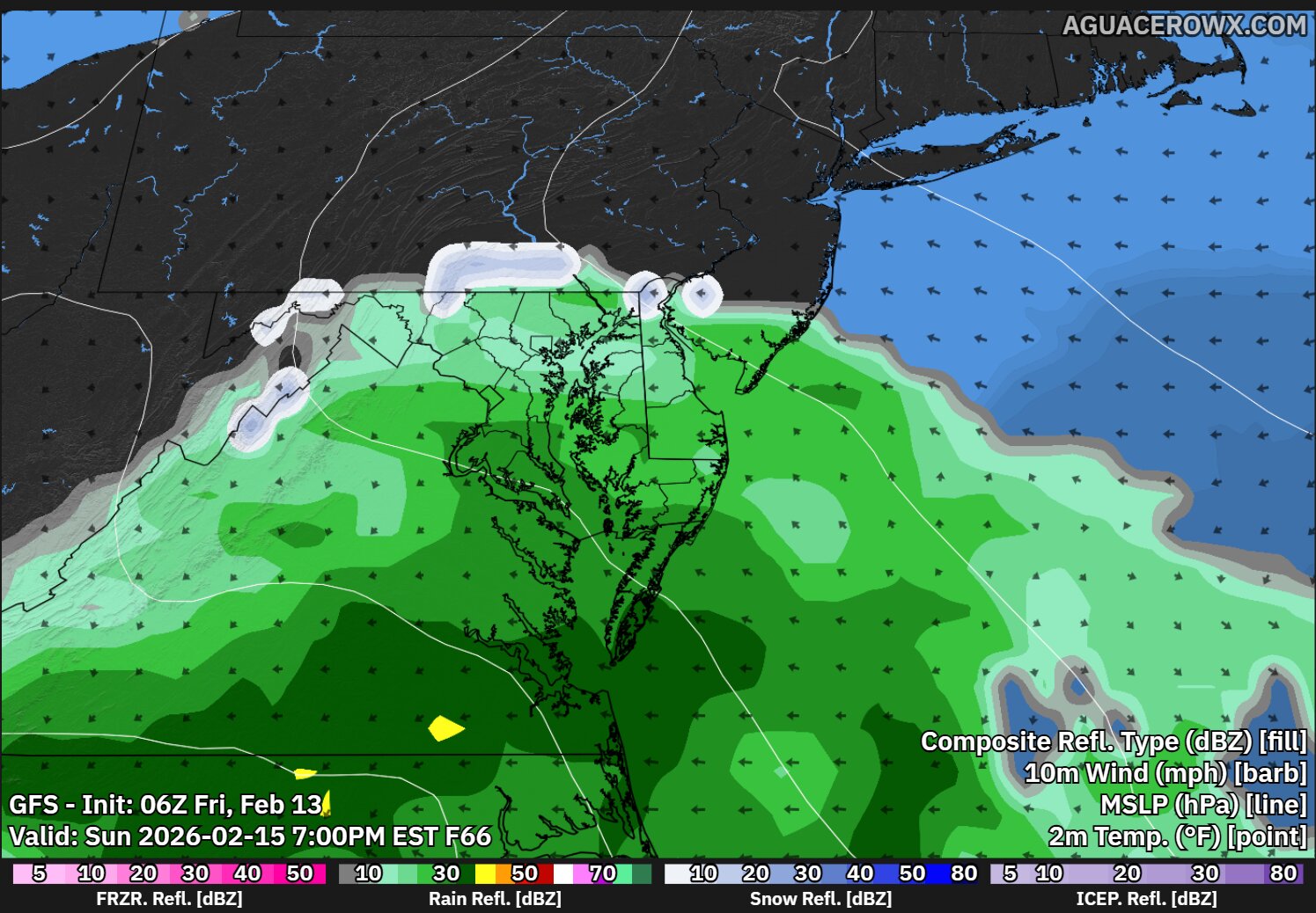
A relatively quiet Valentine’s Day weekend will give way to a beneficial rain system Sunday night into Monday, bringing needed moisture for winter wheat across the Eastern Shore. Current models suggest a quarter to half inch of precipitation—beneficial moisture for wheat fields that have been relatively dry over the past two weeks.
Field conditions heading into next week should remain good, with soils potentially too wet for tillage work Tuesday and Wednesday but accessible again by late next week for early spring preparation. The extended outlook shows periodic light rain events typical for mid-February, with no heavy rain or severe weather threats.
Looking Ahead
The next month is critical for Delmarva farmers finalizing crop rotations and securing input supplies. Fertilizer prices have moderated from extreme recent highs, with nitrogen products running 20 to 25 percent below last year’s levels. Traders next week will be watching for additional USDA commentary on the data revisions and monitoring South American harvest progress.
University of Delaware Cooperative Extension and University of Maryland Extension are offering winter programs covering topics from new soybean varieties to soil health practices. Several regional equipment dealers are also hosting open house events in the coming weeks.
Community Calendar
Monday, February 16: Harrington Livestock Auction regular sale, 1 p.m.; Dover Farmers Market planning meeting, Kent County Extension Office, 7 p.m.
Tuesday, February 17: Delaware Soybean Board meeting, Georgetown, 10 a.m.
Saturday, February 21: Sussex County Young Farmers equipment safety workshop, Bridgeville, 9 a.m.
A 39-year-old Newark resident will spend the rest of his life behind bars for the deadly shooting of Dmajah Tickles three years ago.
Tramont Mitchell received his sentence of life imprisonment plus an additional 50 years on February 13th, according to the Delaware Department of Justice.
The lengthy prison term comes after a Superior Court jury found Mitchell guilty in 2024 on multiple charges, including First Degree Murder and Possession of a Firearm During the Commission of a Felony in connection with Tickles’ death.
The fatal shooting occurred in 2021, leading to the criminal case that concluded with Mitchell’s conviction last year.
(Editor’s note: John Hall works as a professional commodities analyst.)
Over the last five weeks, I’ve been providing information designed to help farmers with their 2026 crop planning choices. Today, I’m focusing on corn market dynamics – both supply and consumption patterns. The information presented comes from WASDE reports, with production figures shown in million metric tonnes.
My first analysis examines global corn production locations. I’ve also added U.S. acreage planted and production measured in million bushels.
Key observations include:
• China ranked as the world’s second-largest corn producer. The country relies on corn primarily to support its massive pig farming operations.
• While Argentina’s output remains steady, Brazil shows signs of growth. Brazilian reports indicate their expanding ethanol sector might absorb most of their increased production.
• Russia and Ukraine present a notable situation. The conflict that started in 2014 and intensified in February 2022 has disrupted their export capabilities, particularly after bombing campaigns targeted ports and affected grain market stability.
Moving to domestic consumption patterns, USDA maintains reliable statistics for Feed and Seed, Ethanol, and Exports, though feed and residual data proves more challenging to track. The 2017-18 and 2025-26 feed usage numbers appear questionable, so they shouldn’t be overanalyzed. These represent the most accurate estimates currently available.
Food, seed, and ethanol sectors remain relatively stable, while exports show modest growth for 2025-26. Media reports suggest expanded E15 usage could boost ethanol consumption.
The U.S. Treasury Department has issued updates indicating that usage revisions may result from the One Big Beautiful Bill expected later this year.
Examining America’s corn export rivals reveals that overall global exports have stayed fairly constant. With world population growth slowing, increased sales must come at competitors’ expense. The United States shows notable growth in 2024-25.
I credit this improvement to recent trade agreements. While some major trading partners had shifted to competitors, these trade deals have brought them back. The data clearly shows how the Russian-Ukraine war impacted their export volumes. Our main challenge in serving their former customers involves distance and shipping costs to those markets.
Looking at worldwide corn buyers, most of these purchasing nations maintain friendly relationships with the United States. I believe we previously lost some business due to higher prices, but we’ve recovered most of those sales through strategic trade agreements.
Our analysis concludes with ending stock levels. The data shows U.S. ending stocks in both metric tonnes and millions of bushels. I’ve included USDA’s average price information as reference to demonstrate the typical pattern: when ending stocks drop, prices generally rise, and when stocks increase, prices typically fall.
China controls nearly two-thirds of global ending stocks. The country takes food security very seriously since it requires depending on other nations. Their food security approach has transformed from strict, government-controlled self-reliance (1949–1970s) to a market-based strategy emphasizing “absolute security of staple foods.”
Under President Xi Jinping’s leadership, the strategy emphasizes 95-percent grain self-sufficiency, rigorous farmland conservation, and agricultural innovation, shifting from quantity-focused to quality and diversification priorities. In 2004, a new strategy emerged prioritizing “guaranteed supply” through international commerce while maintaining tight control over domestic wheat and rice production. Consequently, the government maintains a year’s worth of grain reserves and distributes it to farmers gradually. This approach also enables them to regulate farmer pricing.
I realize this represents substantial information. I intend to reference this material in upcoming discussions to assist with your planting choices.
(Note: I compile research from Allendale, DTN, USDA, University Land Grants and other reliable sources for this article. This represents not just my personal view, but a consensus among trade experts. Seeking a marketing advisor or strategy discussions? Reach me at [email protected], or call 410-708-8781.)
Delaware cattle ranchers are grappling with increased financial uncertainty despite experiencing historically high livestock prices, prompting agricultural experts to emphasize the importance of comprehensive risk management strategies.
As market fluctuations continue to challenge the industry, Landon Nelson from Farm Credit Services of America’s Commercial Insurance Services division is advising producers on methods to safeguard their investments and maintain profitability during turbulent times.
Nelson outlined several approaches that cattle operations can implement to shield their financial interests, control profit margins, and stay viable amid ongoing market instability. These protective measures are becoming increasingly vital as producers work to balance the benefits of elevated prices with the inherent risks of volatile market conditions.
The guidance comes at a time when Delaware’s agricultural community is seeking ways to capitalize on favorable pricing while establishing long-term financial security for their operations.
Drivers in Milton should prepare for traffic changes beginning Monday, February 23rd, as the Delaware Department of Transportation starts a major reconstruction project at the Route 1 and Hudson Road intersection.
DelDOT officials announced they will temporarily shut down the crossover at Route 1 and Hudson Road/Steamboat Landing Road, along with implementing lane restrictions on both northbound and southbound Route 1. The construction project involves rebuilding the crossover and adding a new median island between the north and south lanes of Route 1, plus installing an acceleration lane for southbound traffic.
Construction crews will be active Monday through Friday from 9:00 AM to 6:00 PM throughout the approximately three-week timeline, assuming favorable weather conditions allow work to proceed as planned.
Transportation officials are urging drivers to reduce their speed when traveling through the construction zone and to allow extra time for their commutes due to anticipated minor delays in the area.
Delaware State Police are actively pursuing leads in a violent attack that left an Ocean View man hospitalized early Saturday morning.
Officers were dispatched to a home in the 37000 block of Mahogany Street around 12:30 a.m. on February 14, 2026, following reports of an assault. Upon arrival, they discovered a 64-year-old resident who had suffered injuries from a crowbar attack. The victim was transported to a local hospital where he is being treated for injuries that are not considered life-threatening.
According to the initial police investigation, two unidentified white males approached the victim’s residence, creating a disturbance by shouting and pounding on his door. When the homeowner answered, he did not recognize either individual and attempted to shut the door. At that point, one of the men physically grabbed the victim, knocked him down, and struck him with a crowbar before both attackers escaped in a red vehicle of unknown make and model.
The case remains under active investigation by the Delaware State Police Troop 4 Criminal Investigations Unit. Authorities are urging anyone with relevant information to reach out to Detective W. Saylor at 302-752-3832. Tips can also be submitted through private messages to the Delaware State Police Facebook page or by calling Delaware Crime Stoppers at 1-800-847-3333.
Crime victims and witnesses seeking support can access services around the clock through the Delaware State Police Victim Services Unit and Delaware Victim Center. Their toll-free helpline is available at 1-800-VICTIM-1 (1-800-842-8461), and they can also be contacted via email at [email protected].
Delaware State Police have taken a Wilmington senior care facility worker into custody on felony charges following accusations that he burglarized an elderly resident’s apartment and stole jewelry this past Sunday morning.
Kem Mays, 62, of Wilmington, now faces serious criminal charges after the incident at Forwood Estates on Marsh Road. According to police reports, the crime occurred on February 15, 2026, when law enforcement received a theft complaint at the facility located at 1912 Marsh Road around 10:30 in the morning.
Investigators determined that approximately two hours earlier, at 8:30 a.m., an elderly resident had stepped out of their living quarters. Police say Mays, who worked at the facility, took advantage of the resident’s absence by illegally entering their apartment and taking valuable jewelry items.
During their investigation, law enforcement officials made contact with Mays and successfully retrieved the stolen jewelry pieces, which have since been given back to the victim.
Authorities apprehended Mays without any complications and brought him to Troop 1 for processing. Following his arrest, he appeared before Justice of the Peace Court 11 for arraignment and was subsequently freed after posting a $12,000 unsecured bond.
The suspect now faces two felony charges: Burglary Second Degree and Theft Under $1,500 Where Victim is 62 Years of Age or Older.
Delaware State Police have taken a 19-year-old Henderson, Maryland resident into custody on multiple felony charges following two separate incidents at a Marydel business.
**Ryan Harding** now faces several charges including attempted burglary after investigators connected him to break-in attempts at Smoke Needs on Halltown Road.
The investigation started on February 8, 2026, when police began looking into a failed break-in at the shop located at 825 Halltown Road. Investigators determined that someone dressed in dark clothes, gloves, and a face covering had tried to break into the establishment using a hammer during nighttime hours.
A week later, on February 15, 2026, at around 2:15 a.m., investigators spotted a Toyota Camry parked on Halltown Road close to the same business. When they approached the vehicle, they found Harding behind the wheel, dressed in dark clothing and wearing latex gloves. Officers detained him without any resistance.
Police investigation revealed that Harding was preparing to break into the business again and confirmed he was responsible for the earlier break-in attempt. When officers searched the Camry with Harding’s permission, they discovered tools commonly used for burglary.
Following his arrest, Harding was transported to Troop 3 where he faced formal charges. Justice of the Peace Court 3 processed his arraignment, and he was released after posting a $3,100 unsecured bond.
The charges against Harding include:
Two counts of Attempted Burglary in the 3rd Degree (Felony)
Two counts of Possession of Burglar Tools (Felony)
Wearing a Disguise During the Commission of a Felony (Felony)
Drivers in New Castle County should prepare for significant construction activity as the Delaware Department of Transportation prepares to launch a major infrastructure project in Stanton.
DelDOT officials have announced that extensive construction will commence Monday, February 23rd on the Limestone Road bridge that spans railroad tracks, located between Kirkwood Highway and Route 4.
The comprehensive two-year undertaking will involve restoring the existing bridge structure, removing and repaving roadway surfaces, and updating curbing and accessibility features to meet ADA compliance standards.
Throughout the duration of the construction period, drivers can expect a contraflow traffic pattern to be implemented along Limestone Road, which will affect normal traffic flow in the area.
Motorists are advised to plan for potential delays and consider alternate routes when traveling through this section of Stanton during the construction timeline.
Nearly ten years after a deadly shooting in New Castle, investigators continue searching for answers in the death of a local man.
Jamar Kilgoe, age 31, was killed on February 16, 2015, in what remains an unsolved homicide case. The fatal shooting occurred at 19 Lambson Lane in New Castle, at the Rose Hill Community Center.
Police responded to reports of gunfire at the community facility around 3:00 p.m. that Monday afternoon. When officers arrived at the scene, they discovered Kilgoe had been shot.
The case has been classified as a cold case homicide, with the New Castle County Police Department continuing to investigate the circumstances surrounding Kilgoe’s death.
Anyone with information about this unsolved shooting is encouraged to contact local authorities as investigators work to bring closure to this case that has remained open for nearly a decade.
Five Delaware residents were honored last week with the state’s most prestigious civilian recognition during a ceremony in Dover.
Governor Matt Meyer bestowed the Order of the First State award upon Brooks Banta, Ellen Bartholomaus, Anand Panwalker, Mike Vincent, and Robert “Bob” for their exceptional contributions that have benefited communities throughout Delaware.
The recipients were acknowledged for their outstanding achievements and leadership across multiple fields including public service, healthcare, the arts, and sports.
Delaware’s Order of the First State represents the highest honor the state can give to civilians who have demonstrated extraordinary service and created a lasting positive impact on their communities.
The ceremony recognized these five individuals for their dedication to strengthening Delaware through their various professional and volunteer efforts over the years.
Hollywood has lost one of its most respected performers with the death of Robert Duvall at age 95, his wife announced on social media.
The Academy Award-winning actor, who had deep ties to our region having been raised in Annapolis, Maryland, passed away after a career spanning nearly 100 films and countless memorable characters.
“For each of his many roles, Bob gave everything to his characters and to the truth of the human spirit they represented,” his wife Luciana Duvall wrote in her Facebook announcement.
Born to a Navy admiral father and amateur actress mother, Duvall’s journey to stardom began in Annapolis before taking him to Principia College in Illinois and military service. He eventually landed in New York City, where he shared living quarters with future star Dustin Hoffman and formed friendships with Gene Hackman during their days as aspiring performers.
Duvall’s breakthrough came with his haunting portrayal of the enigmatic Boo Radley in “To Kill a Mockingbird,” a role that showcased his ability to make powerful impressions even without extensive screen time. This collaboration with screenwriter Horton Foote would prove pivotal, as Foote later crafted “Tender Mercies” specifically for Duvall, earning him the 1983 Academy Award for Best Actor as a down-and-out country music performer.
Among his most iconic performances was Lieutenant Colonel Bill Kilgore in Francis Ford Coppola’s Vietnam War masterpiece “Apocalypse Now.” Despite appearing for only minutes, Duvall dominated the screen as the surf-obsessed military officer who famously declared, “I love the smell of napalm in the morning,” adding that it smelled “like victory.”
His collaboration with Coppola extended to “The Godfather” series, where he portrayed Tom Hagen, the trusted advisor to the Corleone crime family. While he returned for the sequel, Duvall declined to participate in the third installment due to disagreements over compensation.
Throughout his career, Duvall demonstrated remarkable range, excelling in both commanding roles like Lieutenant Colonel Bull Meechum in “The Great Santini” and the Soviet dictator in “Stalin,” as well as more vulnerable characters in films like “The Apostle.”
Western roles became a particular specialty for the versatile performer. He captured an Emmy Award for the television production “Broken Trail,” shared the screen with John Wayne in “True Grit,” and earned widespread acclaim for his portrayal of the affable former lawman Gus McRae in the miniseries “Lonesome Dove,” which he often cited as his most satisfying performance.
“I think I nailed a very specific individual guy who represents something important in our history of the Western movement,” Duvall shared with the New York Times. “After that, I felt I could retire, that I’d done something.”
When Hollywood’s demands became tiresome, Duvall took creative control of his projects. He served as writer, director, and star of “The Apostle,” exploring the story of a troubled minister, which earned him another Oscar nomination. He repeated this triple role in “Assassination Tango,” a project that allowed him to showcase his love for Argentine tango dancing.
His passion for tango led him to Argentina, where he met his fourth wife, Luciana Pedraza. In a remarkable coincidence, both shared the same birthday of January 5, though separated by 41 years.
Duvall divided his later years between Los Angeles, Argentina, and a sprawling 360-acre Virginia farm, where he transformed a barn into a dedicated tango studio.
Over his distinguished career, Duvall received seven Academy Award nominations, including recognition for “The Great Santini,” “The Apostle,” “A Civil Action,” and “The Judge” in 2014, cementing his legacy as one of cinema’s most dependable and compelling performers.
With America’s 250th birthday celebration approaching in 2026, Delaware has wrapped up its commemorative grant program by distributing one last round of funding worth $20,000 for Semiquincentennial activities throughout the First State.
The Delaware 250 initiative has now concluded its grant distribution process, having provided financial support totaling $334,000 to organizations across New Castle, Kent, and Sussex counties. A total of 47 groups received assistance through this statewide funding program.
This final allocation marks the end of the grant cycle designed to help Delaware communities prepare meaningful projects and events to honor the nation’s upcoming quarter-millennium milestone. The funding has been spread across all three counties to ensure statewide participation in the historic anniversary observance.
The Semiquincentennial represents a significant milestone for the United States, and Delaware’s comprehensive grant program aimed to enable local organizations to contribute to this once-in-a-lifetime celebration through various community-based initiatives and projects.
Authorities have released the identity of the motorist who lost his life in a deadly single-vehicle accident that followed a police chase in Milford this past Sunday evening. Linwood Owens, Jr., age 37 and a resident of Georgetown, Delaware, was the individual who perished in the crash.
Investigators with the Delaware State Police Troop 7 Collision Reconstruction Unit remain actively working on this case. Officials are requesting that any individuals who may have observed the accident or possess information that could assist in the investigation reach out to Master Corporal K. Argo by calling (302) 703-3264. Citizens can also share details by sending a direct message through Facebook to the Delaware State Police page or by calling Delaware Crime Stoppers at 1-800-847-3333.
Those who have been affected by crime as victims or witnesses, or families who have experienced the unexpected loss of a family member and require support, can access help through the Delaware State Police Victim Services Unit and the Delaware Victim Center. These services are accessible around the clock via a toll-free helpline at 1-800-VICTIM-1 (1-800-842-8461). Additionally, the Victim Services Unit can be contacted through email at [email protected].
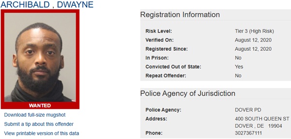
Delaware State Police are turning to the public for assistance in locating several sex offenders who have either failed to comply with registration requirements or are currently without permanent housing.
The Sex Offender Apprehension and Registration Unit, known as SOAR, has published notifications regarding these individuals as part of their ongoing efforts to monitor registered offenders in our state.
Offenders Who Failed to Register
Law enforcement officials are actively searching for ten sex offenders who have not fulfilled their obligation to register or update their address information as required by law. These individuals include Dwayne Archibald, Luis Burgos, Charles Fulton, Deangelo Hoskins, Clarence Jeter Jr., John Martz, Mollie Anne Schonwit, Demond Shockley, Joshua Smith, and Michael Viscount.
Anyone with knowledge of where these individuals might be located is urged to contact the SOAR unit at (302) 672-5306. Tips can also be submitted anonymously through Delaware Crime Stoppers by calling (800) 847-3333.
Police emphasize that the individuals featured in this notification represent just a fraction of the sex offenders currently being sought. A comprehensive list of all wanted sex offenders can be found on the Delaware Sex Offender Registry website.
Homeless Offender Notifications
Additionally, authorities have issued notifications about sex offenders who are currently homeless. Unlike the wanted individuals, these offenders – Sean Hafer, Clarence Inge, and Lewis Nicholson – are not being sought for registration violations but are being monitored due to their lack of stable housing.
If residents have information indicating that any of these homeless offenders have taken up residence somewhere, they should contact the same phone numbers provided for the wanted offenders.
State police note that these three individuals represent only those recently reported as homeless, and a complete listing of all homeless sex offenders is available through the official registry website.
The public can access detailed profiles and additional information about all these individuals by visiting the Delaware Sex Offender Registry online, where clicking on individual photos will provide complete background information.
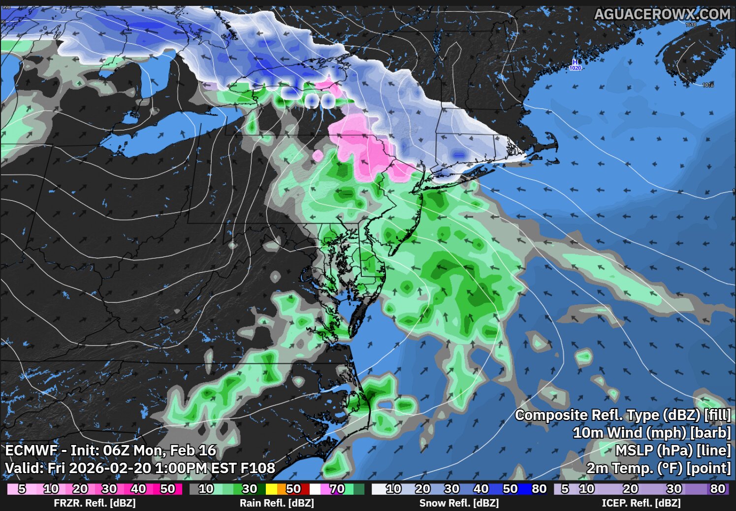
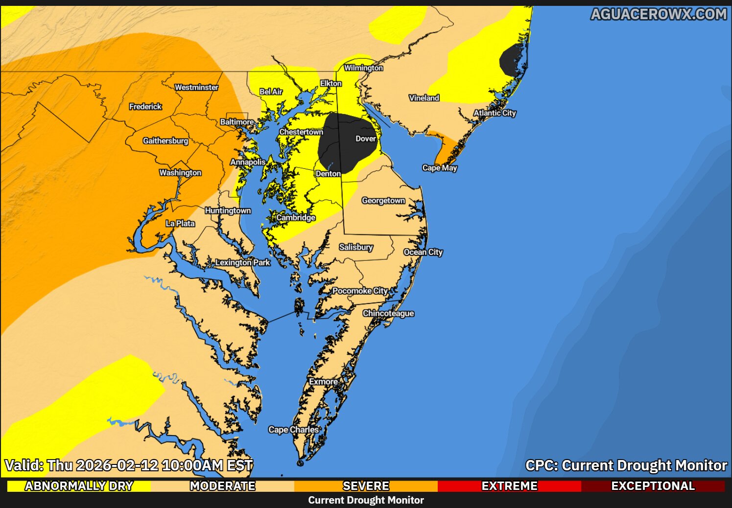
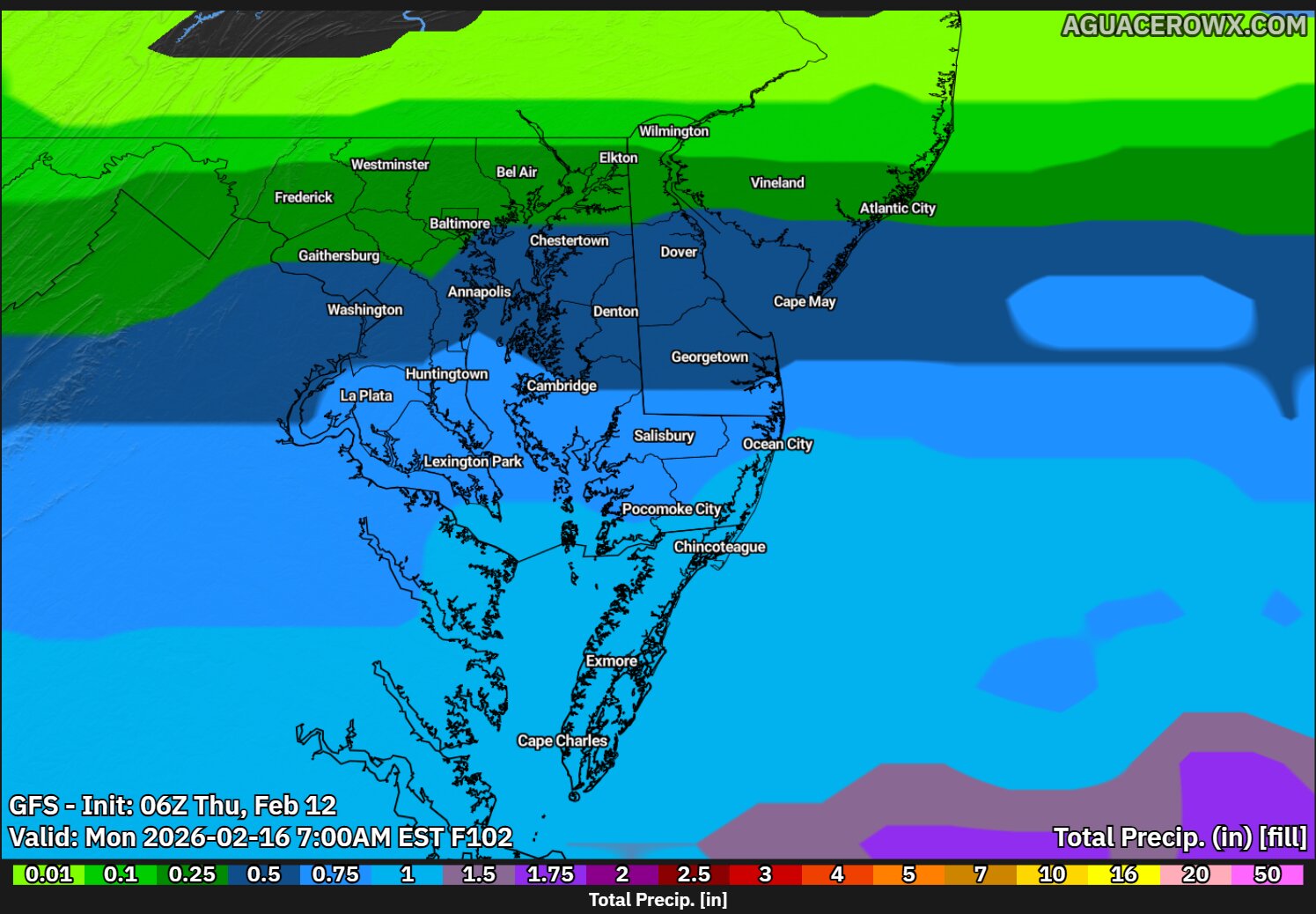
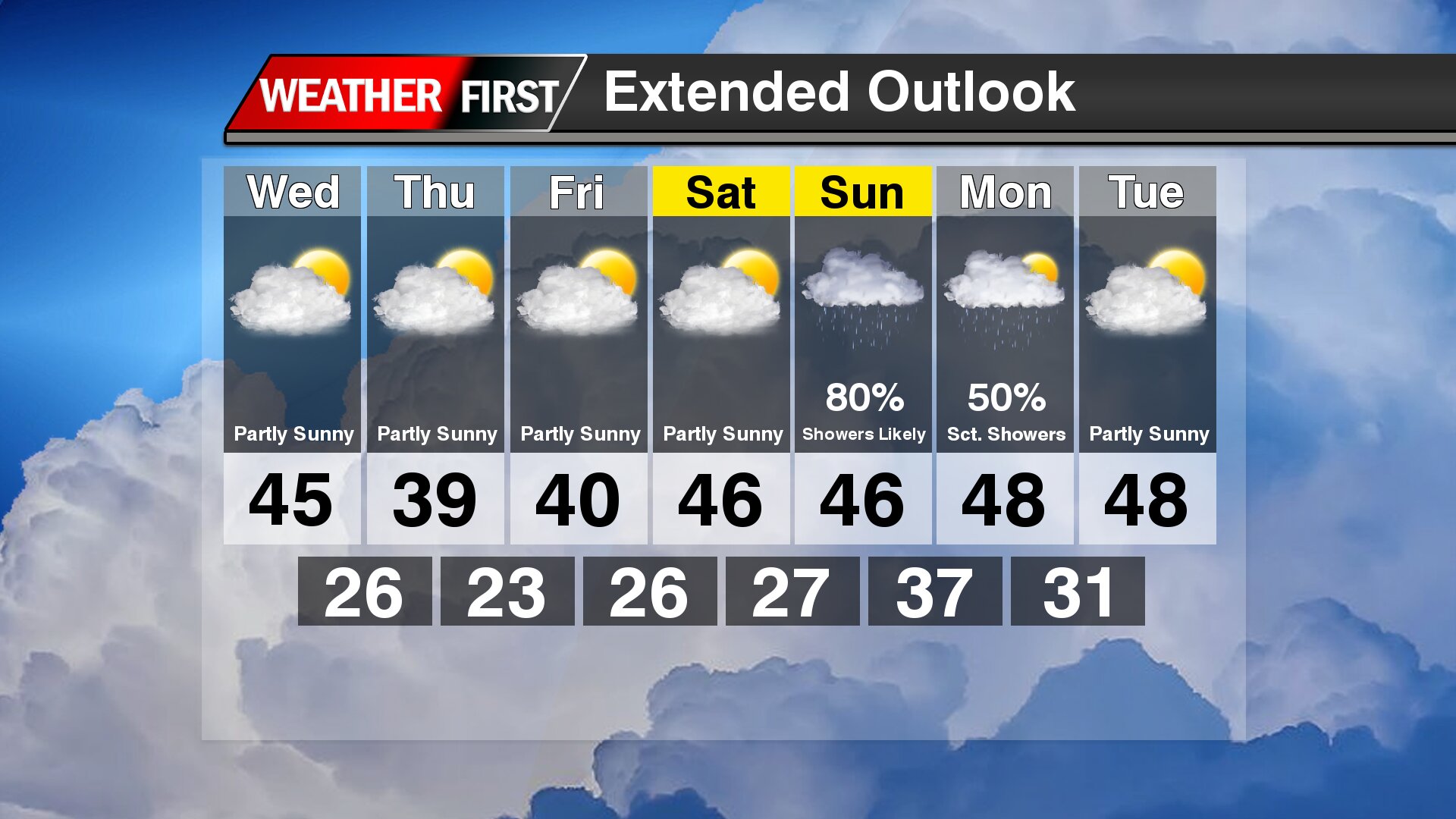
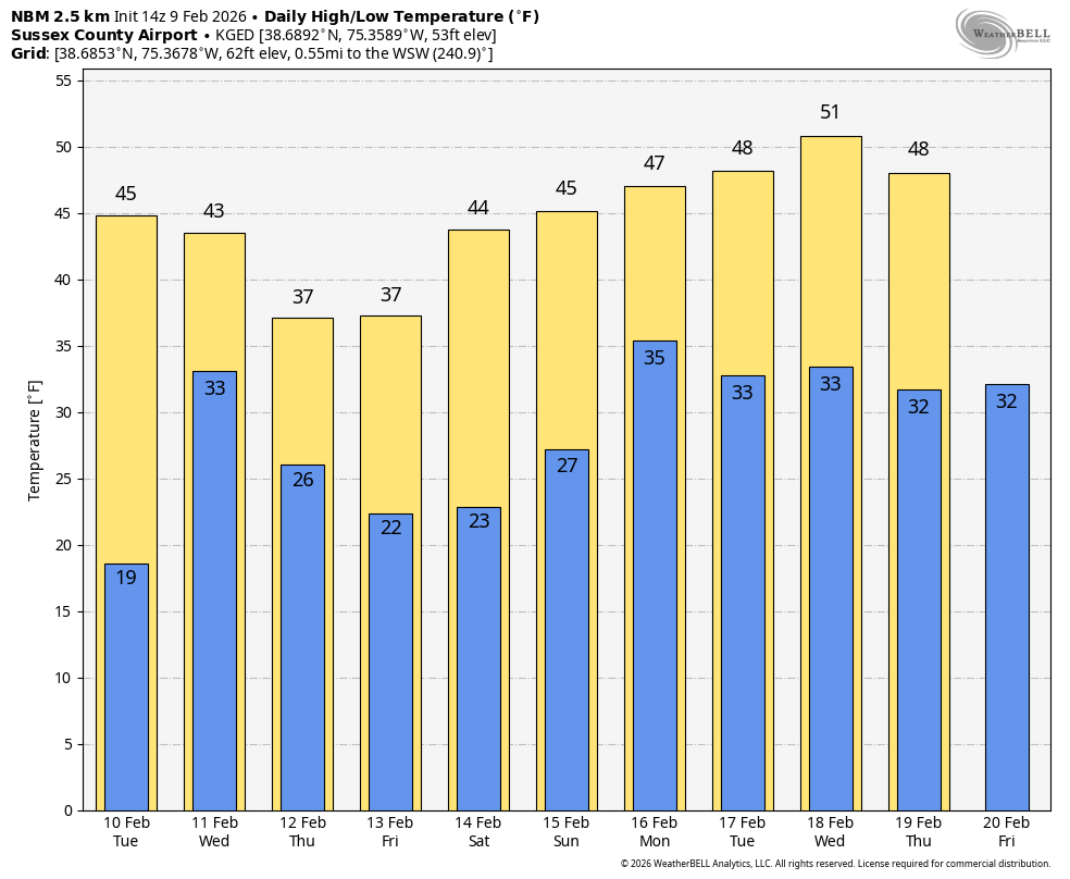
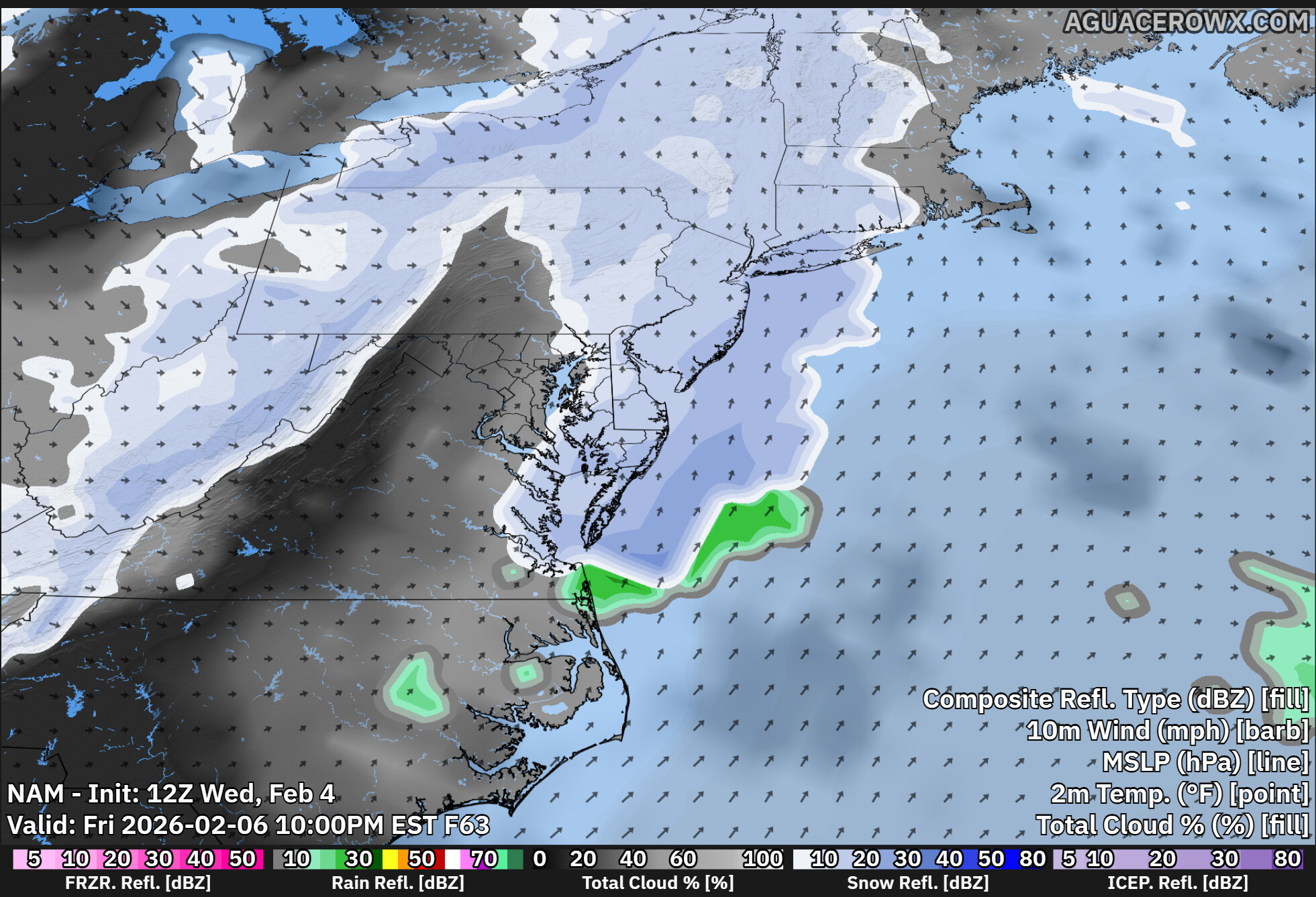
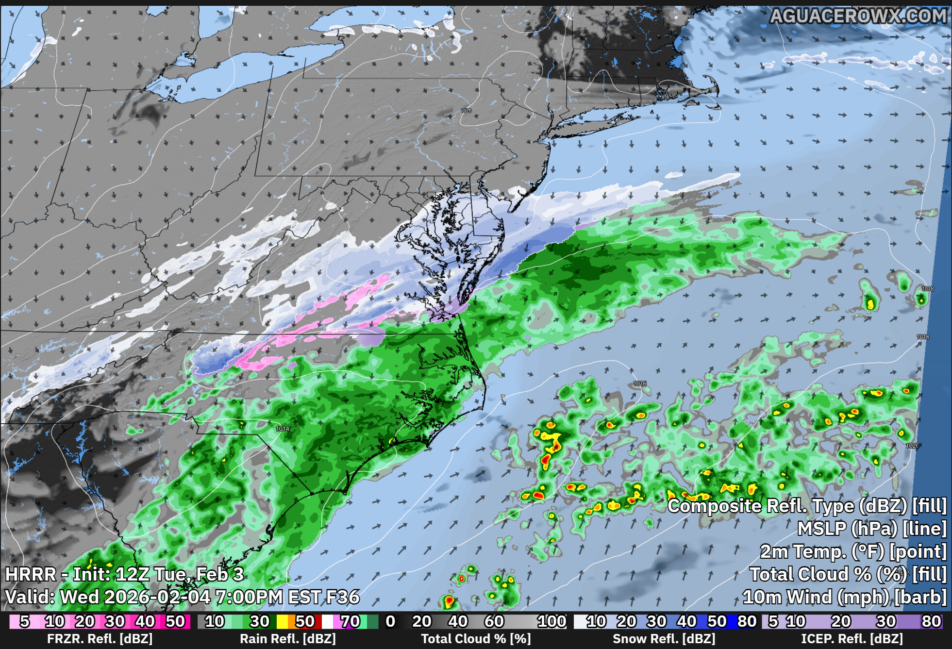
After a prolonged stretch of cold and limited rainfall, a much more unsettled weather pattern is taking shape across the Delmarva Peninsula this week. Several low pressure systems are expected to move through the Mid-Atlantic, bringing multiple opportunities for measurable rain through the weekend.
First Round: Wednesday into Wednesday Night
The first system arrives Wednesday afternoon into Wednesday night as a warm front lifts northward ahead of low pressure tracking through the Midwest.
For Delmarva, this system is expected to bring mainly light rain, with recent model trends pointing toward an all-rain event. Rainfall amounts look modest overall, with:
Low probability of totals exceeding 1 inch
Most locations likely seeing light to moderate rainfall
Rain chances highest Wednesday afternoon and evening
While rainfall amounts do not appear heavy, this system could deliver the first measurable rainfall in several weeks for parts of the region, as recent precipitation events have largely fallen as snow due to persistent cold temperatures.
Thursday: Spotty Showers Possible
Delmarva remains in the warmer sector of the system Thursday into Thursday night. That means temperatures stay milder, and while widespread rain is not expected, isolated showers may pass through at times.
Second System: Friday into Saturday
Another low pressure system moves toward the region late Friday into Saturday. Much like the midweek system, this one also appears to favor primarily rain across Delmarva.
Current projections suggest:
Rain likely late Friday into early Saturday
Lower probabilities of heavy rainfall
No significant winter weather concerns for the Peninsula
At this time, forecast guidance does not indicate any moderate or major impacts from this system.
Watching the Weekend
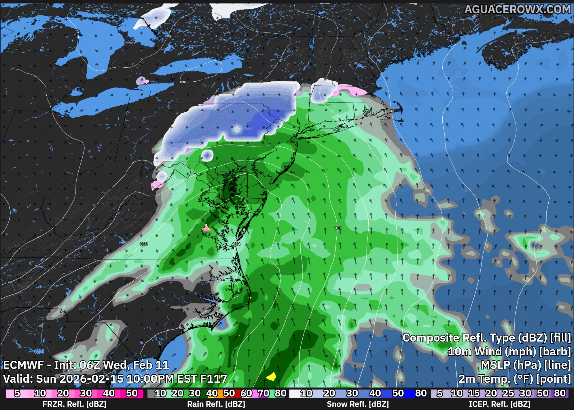
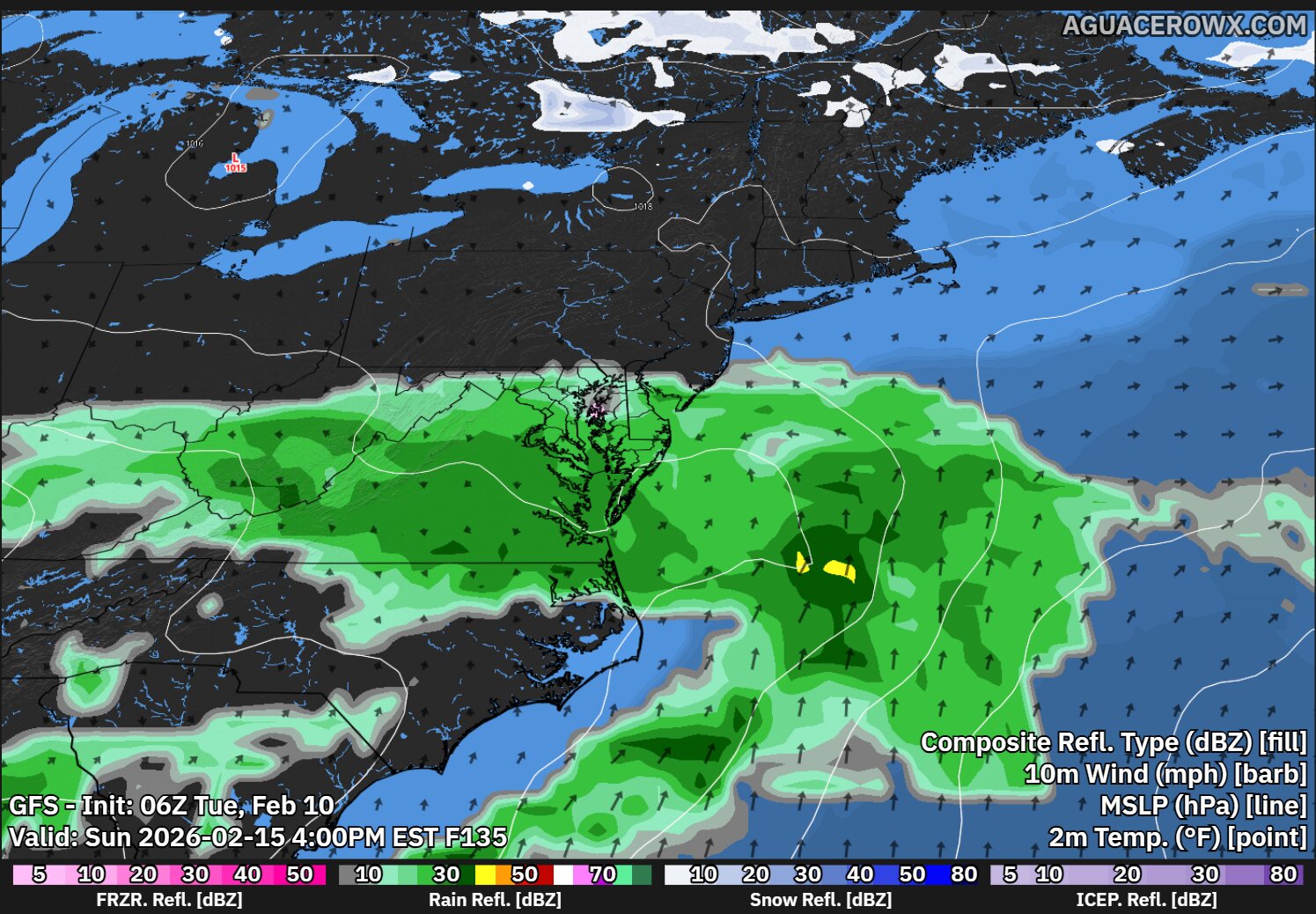
Looking ahead to late weekend, there are signals of yet another potential system. However, forecast models vary significantly on its strength and track. It is too early to determine specific impacts or precipitation types, but it is something forecasters will continue monitoring.
Overall Impact for Delmarva
For the Delmarva Peninsula, this upcoming pattern looks to bring beneficial rainfall rather than disruptive weather. After weeks of colder conditions and limited liquid precipitation, this stretch of rain could help recharge soils and provide needed moisture without significant flooding concerns.
Good morning, Delmarva! We’re dealing with a steady soaking rain across the peninsula today, so definitely keep those umbrellas handy if you’re heading out.
Today’s story is all about the rain. We’re looking at cloudy skies with temperatures reaching around 50 degrees, which isn’t too bad for mid-January. However, this northeast wind at 5 to 10 mph is bringing in a persistent rain system with 100% chance of precipitation. We could see between 1 and 2 inches of new rainfall, so watch for some ponding on roadways and give yourself extra time if you’re traveling.
Tonight, the rain continues with temperatures dropping to around 40 degrees. Sunday brings a slight improvement with just a chance of light rain and cooler highs near 45. The good news? Sunday night looks much better as we clear out with temps dipping to 29 degrees.
Stay dry out there, Delmarva, and remember – this rain will help our lawns come springtime! I’m tracking your forecast and will have updates throughout the weekend.
A Bridgeville property owner found himself in hot water with Sussex County officials after constructing a large storage building without proper permits, based on incorrect advice from his contractor.
Recordo Nock appeared before the Sussex County Board of Adjustment earlier this month requesting two zoning variances for a 30-by-60-foot pole barn already built on his Chaplains Chapel Road property. The structure violates the required 20-foot rear yard setback regulations.
During the January 5th hearing, Nock explained his predicament to board members.
“If I knew this in the beginning, I would have gotten the permit, and we wouldn’t even be here. But I was told I don’t need a permit,” Nock stated. “I never built a pole barn before.”
According to Nock, a representative from Weller’s Utility Trailers, Sheds and Carports in Bridgeville informed him that no permit was necessary since the building would rest on a concrete foundation rather than having poles driven into the earth.
The property owner uses the structure to house tools and construction equipment for personal purposes. When asked about neighbor complaints, Nock indicated he had received none directly.
However, the county received written opposition from residents living south of Nock’s property. Two neighbors attended the hearing to voice their concerns.
Elmer Perry, who authored the opposition letter, expressed worries about water drainage issues caused by the building’s proximity to property lines.
“We do know we do have water standing, from time to time, on the front side of this property when it does rain,” Perry told the board. “I believe the whole water table in that area is up high.”
Perry indicated he would withdraw his opposition if the building were relocated or repositioned to comply with county regulations.
Jason Perry, another neighboring resident, questioned what would prevent future homeowners from constructing similar large structures in rear yard corners once the surrounding farmland undergoes development.
Assistant County Attorney James Sharp noted that the county has occasionally granted variances in cases involving “severe contractor error,” citing an example where a home’s foundation accidentally extended onto an adjacent property.
Nock acknowledged the difficulty of his situation, telling board members, “If I could move the building 8 feet, I would. I can’t move it.”
The Board of Adjustment postponed their decision and will revisit Nock’s variance application during their January 26th meeting, allowing additional time to review the case details.
Dover law enforcement officials are actively investigating a violent incident that unfolded in the early hours of Monday morning, leaving one person wounded by gunfire.
The incident began at approximately 3:55 a.m. on Monday, January 12th, 2026, when Dover Police received reports of gunshots in the unit block of South Governors Avenue. When officers arrived at the scene, they discovered clear evidence that a shooting had taken place.
During the investigation, a 24-year-old Dover resident arrived at Bayhealth Kent Campus seeking treatment for a gunshot wound to his lower body. Medical personnel are treating his injuries.
Police also made contact with two additional victims at the scene who reported being targeted by gunfire from two unidentified suspects. Fortunately, these individuals were not struck by bullets and avoided physical harm.
Authorities have not yet developed any suspect leads to share with the public as the investigation continues.
Dover Police are urging anyone with information about this incident to come forward. The department can be reached at (302) 736-7130, and callers have the option to remain anonymous. Community members can also provide tips through Delaware Crime Stoppers by calling 800-TIP-3333 or visiting www.delaware.crimestoppersweb.com online. Crime Stoppers offers potential cash rewards for information that leads to arrests.
The investigation remains active as detectives work to identify the suspects and determine the circumstances surrounding the shooting.
Delaware State Police are actively searching for an armed suspect who held up a Wilmington 7-Eleven during the early morning hours of Wednesday, January 13, 2026.
Law enforcement officers were called to the convenience store on Foulk Road at 2100 around 2:40 a.m. following reports of an armed holdup. According to initial police findings, a male perpetrator walked into the establishment and confronted a worker while brandishing a firearm, ordering the employee to hand over cash. When the worker refused to cooperate, the gunman helped himself to money from the cash drawer along with tobacco products before fleeing on foot. Fortunately, no injuries were reported in connection with the crime. Officers conducted a search of the surrounding area but came up empty-handed in their pursuit of the robber.
Authorities have released a description of the perpetrator as a male individual dressed in dark clothing including a black hoodie and black trousers, along with gloves and a light-colored backpack. He was also wearing a face covering during the incident. Officials note that security footage and photographs from the scene are not currently ready for public release.
The case remains under active investigation by the Delaware State Police Criminal Investigations Unit. Investigators are urging anyone who may have witnessed the robbery or possesses relevant details to reach out to Detective B. Timmons at (302) 365-8434. Tips can also be submitted through private messages to the Delaware State Police Facebook page or by calling Delaware Crime Stoppers at 1-800-847-3333.
For individuals who have been affected by crime or experienced sudden loss and require support services, the Delaware State Police Victim Services Unit and Delaware Victim Center provide round-the-clock assistance through their toll-free helpline at 1-800-VICTIM-1 (1-800-842-8461). Support can also be accessed by emailing [email protected].
New Castle County police are actively searching for a missing teenager after issuing a Gold Alert Monday evening.
Sixteen-year-old Jacob “Jay” Nieves vanished from his home at the Paladin Club Apartments on Park Court in Wilmington around 9:15 p.m. on January 12, 2026. The apartment complex is located in the 8000 block of Park Court in the 19702 area.
According to the New Castle County Division of Police, the teen departed from his residence and failed to return home. Law enforcement officials say they have conducted thorough search operations but have been unable to locate Nieves.
Anyone with information about Jacob Nieves’ whereabouts is urged to contact local authorities immediately. The Gold Alert system is designed to help locate missing individuals who may be in danger.
Newark law enforcement officials have taken two individuals into custody following a robbery investigation that began earlier this month.
The incident unfolded on January 4, 2026, when a victim contacted Newark Police at around 10:03 p.m. to report being robbed that same evening. According to police reports, the robbery took place in the 200 block of East Delaware Avenue at approximately 7:11 p.m.
Police investigators worked to identify and locate the suspects involved in the street crime. The department has not released additional details about the circumstances surrounding the robbery or the identities of those arrested.
This case represents another example of Newark Police’s ongoing efforts to address street crimes and respond to victims in the community. The investigation led to the successful apprehension of both suspects.
The Newark Police Department continues to encourage residents to report crimes promptly to assist with investigations and community safety efforts.
A Georgetown woman is behind bars facing serious charges after authorities discovered an active explosive device and illegal drugs during a probation compliance check at her residence.
Amanda Seward, 34, was taken into custody following the Tuesday afternoon incident on the 17000 block of McColley’s Chapel Road. The arrest occurred around 2:20 p.m. on January 7, 2025, when probation officers conducting a routine administrative search of Seward’s home uncovered suspicious materials that prompted them to call for backup.
The Sussex County Governor’s Task Force responded to assist probation and parole officials after the discovery of narcotics, drug-related equipment, and what appeared to be an explosive device. Authorities detained Seward along with two other men at the scene without any resistance.
Given the potentially dangerous nature of the device, Delaware State Police called in their specialized Explosive Ordnance Disposal Unit. The bomb squad confirmed the device was indeed active and successfully neutralized the threat.
Investigators recovered multiple illegal items from the property, including:
• An active explosive device • Roughly .07 grams of methamphetamine • Approximately .06 grams of heroin • 12 mg of buprenorphine sublingual film • 3 mg of naloxone sublingual film • A digital scale
Following her arrest, Seward was transported to Troop 4 headquarters where she faced multiple charges. Justice of the Peace Court 3 arraigned her on several serious offenses, including possession of a destructive weapon (bomb), which carries felony penalties. She also faces three counts of possessing controlled substances without a prescription and two counts of drug paraphernalia possession.
While the court set Seward’s bond at $1,500 unsecured, she remains incarcerated at Sussex Correctional Institution due to violations of her existing probation terms. The two men found at the residence received misdemeanor charges and were subsequently released.
Law enforcement officials are actively investigating a shooting incident that occurred at the Paladin Club Apartments located in the 8000 block of Park Court in Wilmington.
New Castle County Division of Police officers have secured the scene and are conducting their investigation into the shooting. The apartment complex is located in the 19802 zip code area.
Authorities are warning area residents to anticipate significant disruptions in the vicinity, including blocked roadways and a heavy law enforcement presence. Additional emergency response vehicles may also be dispatched to the location as the investigation progresses.
Police are strongly urging community members to steer clear of the Park Court area while investigators work to gather evidence and piece together the circumstances surrounding the shooting incident.
A Newark resident is facing multiple charges, including his third driving under the influence offense, after police responded to a trespassing call in the early morning hours last week.
Newark Police Department officers were dispatched to the first block of Waterworks Lane around 12:31 a.m. on January 8, 2026, following reports of suspicious activity. A concerned resident contacted authorities about an unknown male individual who was wandering around the property and attempting to look through the windows of their home.
The incident escalated when officers arrived on scene and attempted to make contact with the suspect. According to police reports, the individual failed to comply with officers’ commands and subsequently resisted arrest.
During the course of the investigation, officers determined that the suspect had been operating a vehicle while under the influence of alcohol or drugs. This marks the third time the Newark man has been charged with DUI, which carries enhanced penalties under Delaware law.
The suspect now faces charges of driving under the influence (third offense), failure to comply with lawful police orders, resisting arrest, and trespassing. Third-offense DUI charges in Delaware are classified as felonies and can result in significant jail time and substantial fines.
The Newark Police Department continues to investigate the incident. The suspect’s name has not been released pending formal arraignment proceedings.
Delaware State Police are conducting an investigation into a deadly vehicle accident that took place Sunday evening in Milford after a driver attempted to escape from law enforcement during a traffic stop.
The incident began around 9:00 p.m. on January 11, 2026, when a state trooper noticed a Nissan Altima violating traffic laws on Johnson Road close to North Old State Road in Lincoln. A vehicle registration check revealed additional violations with the car’s documentation. When the officer attempted to stop the Altima on North Old State Road, the driver suddenly accelerated and fled the scene without explanation before the trooper could approach the vehicle. The Altima traveled dangerously through multiple local streets at excessive speeds during the chase, prompting authorities to call off the pursuit to protect public safety. Moments after officers ended the chase, the vehicle crashed on Lakeview Avenue inside Milford city boundaries.
According to initial findings from crash investigators, the Altima was moving at dangerous speeds when it veered off the southern edge of Lakeview Avenue onto the sidewalk area. The car then traveled across West Clarke Avenue, hitting a smaller tree and landscaping in a residential property before rotating and finally striking a larger tree.
Emergency responders transported the Altima’s operator, a 37-year-old Georgetown resident, to a local medical facility where he was pronounced dead. Authorities are withholding his identity pending notification of relatives.
Traffic on Lakeview Avenue was temporarily blocked for roughly two hours as investigators examined and cleared the accident site.
The case continues under active investigation. Police are requesting that anyone who saw the accident or possesses relevant details contact Master Corporal K. Argo at (302) 703-3264. Tips can also be submitted through private messages to the Delaware State Police Facebook page or by calling Delaware Crime Stoppers at 1-800-847-3333.
Crime victims, witnesses, or families affected by sudden loss can access support through the Delaware State Police Victim Services Unit and Delaware Victim Center, available around the clock via their toll-free helpline at 1-800-VICTIM-1 (1-800-842-8461). Email assistance is also available at [email protected].
TV Delmarva’s technical team is currently conducting routine verification procedures to confirm that social media images are displaying accurately across our digital platforms.
The testing process involves checking various aspects of our automated image generation system to ensure Delaware residents continue receiving properly formatted visual content alongside our news stories on social media channels.
This technical maintenance represents part of our ongoing commitment to delivering reliable news content to the Delmarva community through all available digital channels.
Good morning, Delmarva! We’re looking at a mild but cloudy Wednesday across the peninsula, with temperatures climbing to a pleasant 54 degrees under mostly cloudy skies. Light southwest winds around 5 mph will keep things comfortable for any outdoor activities you have planned.
However, get ready for a dramatic temperature swing! Tonight brings our first notable weather change as we’ll see the chance for some light rain moving through, with temperatures dropping significantly to around 29 degrees. This sets up an interesting Thursday as that moisture could transition to a slight chance of light snow early in the day before skies begin to clear and we see partly sunny conditions. Thursday’s high will only reach about 34 degrees.
Thursday night turns quite chilly with partly cloudy skies and temperatures plummeting to around 20 degrees – so you’ll definitely want to bundle up and protect any sensitive plants or pipes.
Stay warm out there, Delmarva, and keep those winter coats handy! I’m your meteorologist reminding you to stay weather-aware as we navigate this temperature roller coaster.
The Delaware Department of Natural Resources and Environmental Control is now accepting applications from local organizations seeking financial assistance for water-related planning initiatives.
Local county governments, municipalities, conservation districts, and estuary programs throughout Delaware are eligible to apply for these matching grant funds, which are specifically designated for surface water project planning efforts.
Organizations interested in applying for these planning grants must submit their complete proposals no later than 4:30 p.m. on Wednesday, February 18, 2026.
The grant program represents an opportunity for Delaware communities to advance their water management and conservation planning with state support through the matching funds structure.
A significant winter storm is barreling toward southern Delmarva, prompting the National Weather Service to issue a Winter Storm Warning effective from 7 PM tonight through 7 AM Monday morning.
The warning covers inland Sussex County, Delaware beaches, and portions of southern New Jersey including Cape May and Atlantic counties. Forecasters predict 4 to 8 inches of snow and sleet accumulation, with up to one-tenth of an inch of ice coating surfaces. Wind gusts could reach 35 mph, creating dangerous whiteout conditions.
Travel is expected to become very difficult, with the hazardous conditions likely impacting Monday morning’s commute. Officials strongly advise against unnecessary travel during the storm.
If you must venture out, the National Weather Service recommends keeping emergency supplies in your vehicle including extra flashlights, food, and water. For the latest road conditions, dial 5-1-1 before traveling.
The Winter Storm Warning remains in effect until Monday at 7 AM. TV Delmarva will continue monitoring this developing storm and provide updates throughout the weekend. Stay with us for the latest forecast information and travel advisories as conditions change.
A Winter Storm Warning remains in effect until 1:00 PM Monday for much of northern Delmarva, with dangerous icy conditions expected to create hazardous travel during the Monday morning commute.
The National Weather Service warns that portions of New Castle and Kent counties in Delaware, along with Queen Anne’s, Talbot, and Caroline counties on Maryland’s Eastern Shore, will see additional snow and sleet accumulations up to one inch. Perhaps most concerning is the potential for ice accumulations up to one-tenth of an inch, which could make roads extremely slippery.
The mixed precipitation is expected to continue through Monday afternoon, making morning travel particularly treacherous for commuters heading to work or school.
Officials strongly advise avoiding unnecessary travel. If you must drive, the National Weather Service recommends keeping emergency supplies in your vehicle, including an extra flashlight, food, and water. For the latest road conditions, drivers can dial 5-1-1 before heading out.
The Winter Storm Warning, issued Saturday afternoon by the National Weather Service in Mount Holly, New Jersey, will remain in effect until 1:00 PM Monday. Residents should monitor conditions closely and plan for potential delays or cancellations Monday morning.
Delaware residents will see widespread closures this Monday as the state observes Presidents Day, with government buildings, educational institutions, and financial markets shutting down while major retail chains continue normal operations.
For those planning errands or activities, it’s recommended to verify hours by calling businesses directly or checking their websites for location-specific schedules.
Here’s your complete guide to Monday’s closures and openings for Presidents Day 2026:
All federal and state government facilities will be shuttered Monday. Additionally, court systems and the majority of educational institutions will remain closed.
The federal holiday officially honors Washington’s Birthday, named for America’s first president George Washington, though it’s commonly referred to as Presidents Day. Many also use this time to remember President Abraham Lincoln, whose February 12th birthday falls close to the observance.
Financial institutions and U.S. stock exchanges will suspend operations Monday, resuming normal business hours Tuesday.
Major retail chains and most commercial businesses will maintain regular operating hours.
Delaware residents can enjoy free admission to national parks on Presidents Day. The National Park Service recently modified its free admission schedule, removing Martin Luther King Day and Juneteenth from the list while adding Flag Day and President Donald Trump’s birthday on June 14. The complimentary access continues for Presidents Day, Memorial Day, and Independence Day weekend.
A developing low pressure system is expected to bring another round of wet weather to the Delmarva region late Sunday into Monday, with rain favored across much of the area.
The latest forecast guidance shows the storm system tracking south of Delmarva as it moves along the East Coast. In recent model runs, there has been a continued shift toward a more southern and faster-moving track. This trend reduces the overall impact locally and keeps the bulk of the system’s energy offshore.
With this setup, precipitation will primarily affect the coastal plain, including areas along the Atlantic coastline and the lower Eastern Shore. Rain is expected to be the dominant precipitation type across Delmarva.
While a brief mix could occur at the very onset in isolated spots, the overall air mass in place ahead of this system is milder compared to recent storms. Temperatures leading into the event will support mainly rain, and snow is not expected to be an issue for the region.
Confidence has increased that measurable precipitation will occur, particularly closer to the coast, as forecast models continue to come into better agreement. Rainfall amounts and exact timing will continue to be refined, but the most likely window for wet conditions appears to be late Sunday through early Monday.
There remains a small amount of uncertainty. A few model solutions still suggest a slightly stronger and farther north track, which could expand precipitation coverage inland. However, the prevailing forecast favors a weaker system staying mainly to our south.
Drought conditions continue across parts of the Mid-Atlantic, according to the latest update from the U.S. Drought Monitor.
Much of Maryland and Virginia remains in Moderate to Severe Drought, while portions of Delaware and the Delmarva Peninsula are classified as either Abnormally Dry or in Moderate Drought. The weekly drought assessment reflects ongoing rainfall deficits, low soil moisture, and below-normal streamflow levels.
Although the region has seen occasional precipitation events this winter, it has not been enough to significantly improve long-term moisture deficits. Water managers continue to monitor conditions closely as the region heads toward spring, when agricultural demands typically increase.
Officials say meaningful, sustained rainfall will be needed to ease drought conditions across the Mid-Atlantic in the weeks ahead.
Residents across Delmarva should keep an eye on the forecast heading into late Sunday and early Monday as a developing low pressure system tracks along the East Coast.
Current model guidance shows the center of low pressure sliding by to the south of the peninsula. While there is still some uncertainty regarding the exact track and strength of the system, the latest trends suggest Delmarva will remain on the milder side of this storm.
Temperatures on Saturday are expected to climb into the 40s across much of the region. That relatively mild air mass will be in place ahead of the system’s arrival, meaning any precipitation that reaches Delmarva would fall as rain.
Forecast confidence continues to increase that the stronger storm scenario seen in some earlier model runs is becoming less likely. While a more amplified system would bring heavier precipitation farther north, current ensemble and deterministic guidance favor a weaker solution overall.
Because there is still some uncertainty in how far north the precipitation shield extends, rain chances have been maintained in the forecast from Sunday afternoon through early Monday. Probabilities currently range from around 30 percent to as high as 70 percent across the peninsula, with the higher chances generally closer to southern portions of Delmarva.
At this time, the main impact locally appears to be periods of rain late Sunday into early Monday. No winter weather impacts are expected for Delmarva with this system.
We will continue to monitor trends as newer data comes in over the next couple of days.
A noticeable warming trend is expected to take hold across the Eastern United States, including the Delmarva region, as we head deeper into February.
According to the latest Climate Prediction Center outlook, the 6 to 10 day temperature forecast, valid February 16 through February 20, shows a strong signal for above normal temperatures across much of the eastern half of the country. Delmarva is firmly within that above-average zone, with higher confidence indicated by the deeper orange shading across the Mid-Atlantic.
The trend continues in the 8 to 14 day outlook, valid February 18 through February 24. While the intensity of the warmth slightly moderates compared to the earlier period, the overall pattern still favors temperatures running above seasonal averages across Delaware and Maryland’s Eastern Shore.
What This Means for Delmarva
For mid to late February, average high temperatures across Delmarva typically range from the low to mid 40s. With this projected pattern, highs could frequently climb into the upper 40s and 50s, with occasional days potentially pushing even warmer if sunshine is present.
Overnight lows are also expected to trend milder than average, reducing the frequency of hard freezes and potentially limiting prolonged cold stretches.
Why the Warm Pattern?
The large-scale pattern depicted on the outlook maps shows persistent ridging across much of the central and eastern United States. This setup promotes milder air flowing northward and limits sustained Arctic air intrusions into the Mid-Atlantic region.
Meanwhile, colder-than-normal conditions are favored across parts of the western United States, reinforcing the overall east-west temperature contrast.
A developing storm system along the Eastern Seaboard could bring unsettled weather to the Delmarva region late Sunday into early Monday, though significant impacts appear less likely based on the latest forecast trends.
We continue to monitor an area of low pressure expected to track along the East Coast beginning Sunday and continuing into Monday. While uncertainty remains in the exact timing and track, most recent model guidance has shifted the system farther south and east. This trend would limit impacts across Delaware and Maryland’s Eastern Shore.
Temperatures leading into the weekend will be relatively mild for February standards. Highs Saturday are expected to reach the upper 30s to upper 40s across Delmarva. With that milder air mass in place, precipitation that does reach the region would most likely fall as rain, especially across southern Delaware and along the coast.
There remains a lower probability scenario in which the storm strengthens and tracks slightly farther north. In that case, some colder air could wrap into the system, allowing for a brief period of snow or a rain-snow mix, mainly across northern portions of the peninsula. However, this solution currently carries a lower likelihood compared to the prevailing forecast guidance.
At this time, precipitation chances late Sunday into early Monday range from about 30 to 60 percent across Delmarva, with the highest probabilities across southern Delaware. Farther north on the peninsula, precipitation chances are lower.
Residents should continue monitoring updates through the weekend as the track and strength of the system become clearer.
A generally quiet stretch of weather is expected across the Delmarva Peninsula through the end of the workweek, with increasing cloud cover and a return to rain chances late in the weekend and early next week.
Midweek Through Friday: Dry and Seasonable Wednesday through Friday will feature a mix of clouds and sunshine with dry conditions across the region. Afternoon highs will range from the upper 30s to mid 40s, while overnight lows dip into the 20s. These temperatures are close to seasonal averages for early February, and no precipitation is expected during this period.
Saturday: Mild and Mostly Dry Saturday continues the dry trend, with partly sunny skies and highs climbing into the mid 40s. This will be one of the milder days of the upcoming week, making it a decent day for outdoor plans before wetter weather arrives.
Sunday into Monday: Rain Likely A developing storm system is expected to bring increasing rain chances late Sunday into early Monday. Sunday appears cloudy with rain becoming likely, especially later in the day and overnight. High temperatures will remain in the mid 40s, with milder overnight lows staying well above freezing.
Rain chances linger into Monday, though coverage may become more scattered as the system begins to move away. Temperatures on Monday are expected to reach the upper 40s.
Early Next Week: Improving Conditions By Tuesday, conditions are expected to improve with a return to partly sunny skies. Highs will remain mild, hovering in the upper 40s, with no additional precipitation currently expected.
We continue to monitor a developing storm system expected to impact the Delmarva Peninsula late this weekend into early next week. While some uncertainty remains regarding the system’s exact track and strength, confidence is increasing that the region will see a period of rain.
Current forecast guidance shows an area of low pressure moving along the eastern seaboard sometime between late Sunday and early Monday. Because the system is still several days away, details such as rainfall amounts and exact timing are still being refined. However, the overall pattern supports at least some rain affecting Delmarva during this timeframe.
Temperatures ahead of the system are expected to remain relatively mild for early February standards. Highs on Friday and Saturday are forecast to reach the mid 30s to low 40s across the peninsula, supporting an all-rain event for the region.
The most likely window for rainfall appears to be late Sunday night into early Monday morning, though this timing could shift as the forecast becomes clearer. At this point, there are no indications of significant winter weather impacts for Delmarva with this system.
Residents are encouraged to stay updated with the latest forecasts over the coming days as confidence improves and more details on rainfall amounts and impacts become available.
After a stretch of bitter cold, temperatures across the Delmarva Peninsula are set to moderate back toward seasonal levels as we move into the middle of the week.
A shift in the upper-level pattern will allow warmer air to move into the region on Tuesday as high pressure slides offshore and a warm front crosses the area. This will bring daytime temperatures closer to average for mid-February, leading to some daytime thawing across Delmarva.
Despite the milder afternoons, overnight lows will continue to drop below freezing. This sets up repeated thaw-and-refreeze cycles, especially on untreated roads, sidewalks, and driveways. Tuesday night is expected to be the mildest night of the week, helped by southwest winds ahead of an approaching cold front.
The warm front may also bring a chance for light wintry precipitation Tuesday afternoon into Tuesday night. Any precipitation looks to be spotty and light, with overall chances remaining low, generally no higher than 20 percent. Impacts, if any, would be minor and localized.
A cold front will move through late Tuesday night into early Wednesday, shifting winds from the southwest to the west-northwest. Some brief, light precipitation cannot be ruled out with the frontal passage. Colder air becomes more noticeable later Wednesday as a secondary front moves through, bringing increasing west-northwest winds and a return to colder conditions for the second half of the week.
While temperatures will trend cooler again, this cold spell is not expected to be nearly as severe as the recent arctic outbreak.
Looking ahead to the weekend, another system may approach the region on Sunday. This could bring milder air along with rain or a mix of rain and wintry precipitation. Confidence remains low at this time due to significant uncertainty in the storm’s track and overall setup.
A fast-moving clipper system will bring a brief period of light snow to the Delmarva Peninsula tonight, before a powerful Arctic air mass surges into the region early Saturday. While snowfall amounts will remain minor, the combination of sharply falling temperatures, strong winds, and dangerous wind chills will create hazardous conditions through the weekend.
Light Snow This Evening Into Early Saturday
Snow will overspread Delmarva this evening as a clipper system passes north of the region. Snow is expected to begin during the evening hours and continue into the overnight period before tapering off early Saturday morning.
Most areas of Delaware, eastern Maryland, and the Virginia Eastern Shore can expect a coating to around one inch of snow. While widespread impacts are not anticipated, an isolated snow squall cannot be ruled out near daybreak Saturday, particularly along the Arctic front. Any squall that develops could briefly reduce visibility and create slick travel conditions, especially on untreated roads.
Snowfall totals are expected to remain below advisory criteria across the region.
Arctic Front Ushers in Brutal Cold
A strong Arctic cold front will move through Delmarva during the pre-dawn hours Saturday. Temperatures may briefly peak near midnight before falling rapidly into the teens and single digits by Saturday morning.
Behind the front, intense cold air advection will dominate the region. Daytime temperatures Saturday are expected to struggle, remaining in the teens and lower 20s with little improvement through the afternoon.
Strong Winds Increase Cold Stress
As Arctic high pressure builds into the Great Lakes and Ohio Valley and low pressure deepens offshore, a tight pressure gradient will develop across the Mid-Atlantic. This will lead to strong northwest winds across Delmarva, sustained between 20 and 30 mph with gusts up to 50 or even 60 mph, particularly in coastal areas.
As a result, High Wind Warnings have been issued region wide in combination with extremely dangerous wind chills. Valid from 8am to 9pm EST Saturday.
Extreme Cold Warnings in Effect
Saturday night will bring the coldest conditions of the event. Overnight lows will fall into the single digits, with wind chills dropping to -10 to -25 degrees across much of Delmarva.
Because of the severity of the cold, Extreme Cold Warnings have been issued. This is part of a newer warning system introduced in October 2024, replacing the former Wind Chill Warning which is the first time ever issued throughout the Delmarva region. Even Wind Chill Warnings has never been issued for our region dating back prior to 2014. Under updated criteria, warning-level cold is now issued at lower thresholds to better reflect the health risks posed by extreme cold exposure.
Cold weather headlines are expected to continue into Sunday morning. Despite some sunshine Sunday afternoon, temperatures will remain bitterly cold, with highs only reaching the single digits to teens.
Safety Precautions Urged
Residents across Delmarva are urged to take precautions:
Limit outdoor exposure and dress in multiple layers if going outside.
Cover exposed skin to prevent frostbite.
Secure loose outdoor items due to strong winds.
Check on elderly neighbors and ensure pets have adequate shelter.
Use heating sources safely and never run generators or grills indoors.
While snowfall will be limited, this Arctic outbreak will bring dangerous cold and wind to the Delmarva Peninsula, making preparation and caution essential through the weekend.
A massive and rapidly growing sunspot region on the Sun, designated Active Region 4366, has become one of the most energetic solar flare producers in recent years, unleashing a torrent of powerful bursts that have grabbed the attention of space weather scientists around the world.
Over the past several days, the Sun has emitted dozens of solar flares from AR 4366, including numerous M-class flares and several X-class eruptions, the strongest category of solar flare. Among these was an X8-class flare detected on February 1–2, one of the most powerful recorded so far in 2026 and the most intense event this year to date.
Solar flares occur when magnetic energy built up in the Sun’s atmosphere is suddenly released. X-class flares produce intense radiation and can interfere with Earth’s ionosphere, leading to temporary radio blackouts, degraded high-frequency communications, and navigation signal disruptions. The X8 event and subsequent strong blasts have already caused R3-level radio blackouts in parts of the South Atlantic region.
In addition to the X8-class flare, researchers have recorded other powerful eruptions, including a recent X4.2 flare from the same active region. In the past 24 hours alone, NOAA scientists observed dozens of flares from AR 4366, including at least 26 events ranging from moderate M-class to X-class strengths.
The sheer number and intensity of flares from this sunspot has led forecasters to describe AR 4366 as a “solar flare factory.” As it rotates further into a position more directly facing Earth, space weather agencies warn that any future coronal mass ejections (CMEs)which are huge clouds of charged particles launched from the Sun, would be more likely to intersect Earth’s magnetic field. Even glancing blows from CMEs can spark enhanced auroras, possibly visible at lower latitudes than usual later this week.
Scientists continue to monitor AR 4366 closely. Its increasing size and magnetic complexity make it capable of further strong eruptions, and forecasters expect more activity as the Sun remains near the peak of its current 11-year cycle. Solar flares and related space weather effects, from radio transmission disruptions to vivid auroral displays, may persist as long as the region remains active.
The latest U.S. Drought Monitor update shows that the ongoing drought across the Mid-Atlantic remains a significant concern this winter, with dryness and drought conditions expanding and lingering across much of the region.
According to the most recent data from the U.S. Drought Monitor, released weekly by the National Drought Mitigation Center, USDA, and NOAA, areas of moderate drought (D1) and severe drought (D2) have grown in parts of the Mid-Atlantic, particularly across central Maryland and large portions of central Virginia. Moderate drought has also extended into southern Delaware and along portions of the Maryland and Virginia coasts. Meanwhile, abnormally dry conditions (D0) stretch across extensive portions of the region, indicating ongoing moisture deficits even where formal drought classifications are lighter.
Meteorologists and drought specialists note that this persistence of dryness is linked to persistent precipitation deficits in recent months, including well-below-normal rainfall and limited snow accumulation. These conditions have contributed to low soil moisture, suppressed streamflow levels, and challenges for water resources in watersheds throughout the Mid-Atlantic.
Although some pockets of the Northeast have seen isolated improvements due to recent precipitation, overall dryness remains widespread in the Mid-Atlantic. Without sustained rainfall or significant snowpack melt, these drought conditions could continue into the spring, potentially affecting agriculture, water supply, wildfire risk, and ecosystem health.
…HIGH WIND WATCH IN EFFECT FROM SATURDAY MORNING THROUGH SATURDAY EVENING… …EXTREME COLD WATCH REMAINS IN EFFECT FROM SATURDAY AFTERNOON THROUGH SUNDAY MORNING…
* WHAT…For the High Wind Watch, northwest winds 25 to 35 mph with gusts up to 60 mph possible. For the Extreme Cold Watch, dangerously cold wind chills as low as 15 below possible.
* WHERE…Portions of central, northern, and southern Delaware, northeast Maryland, and southern New Jersey.
* WHEN…For the High Wind Watch, from Saturday morning through Saturday evening. For the Extreme Cold Watch, from Saturday afternoon through Sunday morning.
* IMPACTS…Damaging winds could blow down trees and power lines. Widespread power outages are possible. Travel could be difficult, especially for high profile vehicles. The cold wind chills as low as 15 below zero could result in hypothermia if precautions are not taken.
PRECAUTIONARY/PREPAREDNESS ACTIONS… Monitor the latest forecasts and warnings for updates. Dress in layers including a hat, face mask, and gloves if you must go outside.
A surge of Arctic air will bring some of the coldest and windiest conditions of the winter so far to the region this weekend, creating dangerous wind chills and potentially hazardous travel and outdoor conditions.
An Arctic front is set to move through late Friday into Saturday, followed by strong high pressure building east across the Great Lakes and Ohio Valley. As this high pressure system strengthens, it will clash with low pressure offshore, tightening the pressure gradient and driving strong northwest winds across the area.
Saturday will begin with temperatures near their daily highs early in the morning, but conditions will deteriorate quickly. By late morning, temperatures are expected to plunge into the teens as cold air rapidly pours in behind the front. Northwest winds will increase to 20 to 30 mph, with gusts reaching 40 to 50 mph. Wind Advisories are likely as these gusts could cause isolated power issues and make travel difficult, especially for high-profile vehicles.
Wind chills on Saturday will be especially dangerous. Much of the region will experience wind chills in the single digits, with values dropping as low as 10 below zero north and west of the Fall Line. The southern Poconos could see wind chills near 20 below zero during the day.
Conditions will remain harsh Saturday night as temperatures fall into the single digits, with some locations dropping below zero. Lows could reach around 5 below zero in the southern Poconos and far northwest New Jersey. While winds will decrease slightly overnight, sustained speeds of 15 to 20 mph with gusts up to 35 mph will continue to drive dangerously low wind chills. By early Sunday morning, wind chills of 10 to 20 below zero are expected across much of southern New Jersey, the Delaware Valley, and Delmarva. Farther north, wind chills may fall to 20 to 25 below zero in the Lehigh Valley and northern New Jersey, with values approaching 30 below zero in the southern Poconos.
Arctic air will remain locked in place on Sunday, with daytime highs only reaching the teens to lower 20s. Winds will gradually ease through the day, but wind chills will still hover in the single digits, keeping conditions bitterly cold.
Temperatures are expected to slowly moderate as the new work week begins, but residents are urged to prepare now for the weekend cold. Limiting time outdoors, dressing in layers, protecting pets, and checking on vulnerable individuals will be critical as the region faces this prolonged blast of Arctic air.
Residents across the Delmarva Peninsula should prepare for a quick change in weather late Friday night into Saturday morning as an Arctic front sweeps through the region, bringing snow showers, gusty winds, and the potential for brief but intense snow squalls.
A fast-moving clipper system will approach the area Friday, though recent forecast trends suggest the system will arrive a bit later than previously expected. Any snow associated with the clipper is not expected to reach western portions of Delmarva until Friday evening. This initial round of snow will be light, with little to no accumulation expected.
The more impactful weather arrives late Friday night as a strong Arctic front moves through the region after midnight and clears the area by Saturday morning. This front is tied to a deep upper-level trough and strong atmospheric energy, creating favorable conditions for widespread snow showers across Delmarva.
Some of these snow showers could briefly intensify into snow squalls, capable of producing heavy snowfall in a short period of time. Visibility could quickly drop to under one mile, while wind gusts may reach up to 40 mph. In areas impacted by stronger squalls, quick accumulations of up to or slightly over one inch of snow are possible.
These conditions may lead to slick and hazardous travel, especially on untreated roads and during the early morning hours Saturday. Drivers are urged to slow down, allow extra stopping distance, and be alert for sudden changes in visibility.
Behind the front, sharply colder air will settle into the region, reinforcing winter conditions heading into the weekend. Residents should stay weather-aware and be prepared for rapidly changing conditions late Friday night into Saturday morning.
A sharp arctic cold front is expected to move across the Delmarva Peninsula late Friday into early Saturday, bringing a brief period of snow followed by very strong winds and sharply colder air. Not to mention dangerous winds chills.
The system is tied to a fast-moving clipper tracking across southern Canada. Ahead of it, a warm front will lift through the region during the day Friday. This will be followed by a much stronger cold front Friday night into Saturday morning, accompanied by strong energy in the upper atmosphere.
We are monitoring the potential for two separate rounds of snow.
The first round is expected during the day Friday as light precipitation develops ahead of the warm front. Snow amounts with this initial round should be minor, with most locations across Delaware, eastern Maryland, and the Lower Eastern Shore seeing a quick coating up to around a half inch.
The second round will arrive with the arctic cold front late Friday night into early Saturday morning. This is when conditions could become more hazardous. Brief but intense snow showers or snow squalls are possible as the front moves through. While confidence in exact placement and intensity is still limited, the atmospheric setup supports the potential for quick bursts of snow, rapidly reduced visibility, and sudden wind gusts. Confidence in snow squall development will increase over the next one to two days as higher-resolution models come into range.
Once the cold front clears the region around daybreak Saturday, conditions will turn sharply colder and much windier. Northwest winds are expected to strengthen quickly, with gusts of 40 to 50 mph possible across much of Delmarva. Strongest winds are likely Saturday afternoon and evening, particularly in open areas and near the coast, before gradually easing overnight.
We are getting concerned of again widespread below zero wind chills during the day on Saturday and into the overnight hours. Model guidance continues to drive in wind chills down in the rand of -5F to even -15F across the northern tier. Creating frost bite conditions throughout the region
A powerful arctic blast is expected to move into the Northeast and Mid-Atlantic this weekend, bringing dangerously cold temperatures and life-threatening wind chills, according to the latest outlook issued Tuesday afternoon. The coldest conditions are forecast from Friday through Monday, with impacts extending into Delmarva.
Forecasters indicate a significant arctic outbreak will surge southward late this week, ushering in some of the coldest air of the winter season. Bitterly cold temperatures combined with strong winds will result in hazardous wind chills across much of the region. While the most extreme cold will be focused across the Interior Northeast and New England, Delmarva will still experience sharply colder conditions and dangerous cold stress, especially during the overnight and early morning hours.
Wind chills across parts of the Northeast are expected to plunge well below zero, with some locations potentially seeing values in the minus 30s. Daytime temperatures in the hardest-hit areas may struggle to climb out of the teens and single digits. While Delmarva is not expected to see wind chills quite that extreme, cold air spilling southward will still bring unusually low temperatures for early February.
In addition to the cold, gusty winds are expected to accompany the arctic air mass. These winds will intensify the cold and could lead to isolated tree damage and scattered power outages, particularly in elevated and more exposed areas. Brief periods of intense snowfall are also possible with the arrival of the cold air, including the potential for snow squalls on Friday and Saturday. These fast-moving bursts of snow could quickly reduce visibility and create hazardous travel conditions, even if overall snow accumulation remains limited.
Officials are urging residents to take cold weather safety precautions seriously. Prolonged exposure to extreme cold and wind chills can lead to frostbite and hypothermia in a short period of time. Limiting time outdoors, wearing layered clothing, and covering exposed skin will be critical. Travelers are encouraged to carry cold weather survival kits, while pet owners should ensure animals have adequate protection from the cold.
Residents should also take steps to protect homes and infrastructure. Frozen pipes are a significant concern during extended cold spells, and precautions should be taken to prevent damage. Caution is advised around frozen bodies of water, as ice thickness may be unreliable.
A gradual warming trend is expected to begin by early to mid next week, but forecasters stress that the period from Friday through Monday will pose the greatest risk from extreme cold. Continued updates are expected as the arctic air mass moves closer to the region.
Delmarva has a couple chances for light snow this week, with the first arriving tonight and the second coming late in the week. While neither system looks particularly strong, there are a few details worth watching, especially for parts of central Delmarva.
The first round of snow moves in late Tuesday night and continues into early Wednesday morning. High pressure along the Southeast coast will slide offshore tonight, allowing a weak weather system to move into the Mid-Atlantic. This system does not have a lot of moisture to work with, which will keep snowfall totals limited for most areas.
For much of Delmarva, snow amounts are expected to range from just a coating to around an inch by Wednesday morning. Snow should end around or shortly after daybreak, leading to minimal impacts for the Wednesday commute.
That said, there is a small wildcard with this system. Some high-resolution model guidance suggests that if the two pieces of energy involved with this storm come together a bit more efficiently, a narrow band of heavier snow could develop. If that happens, parts of central Delmarva could see higher totals, with localized amounts approaching three inches. Confidence in this scenario remains low, but it is something we will be keeping a close eye on overnight.
Looking ahead to Friday, another chance for snow arrives as a fast-moving clipper system passes to our north. An Arctic front will sweep through the region, bringing the potential for a brief burst of snow or even a few snow squalls. It is still too early to lock in exact timing or amounts, but any snow on Friday would likely be light and short-lived.
Overall, impacts this week appear limited, but changing conditions overnight tonight and again on Friday could briefly affect travel. Stay tuned for updates as we refine the forecast and track any potential changes.
Groundhog Day delivered a familiar message this morning as Punxsutawney Phil saw his shadow, pointing toward six more weeks of winter according to tradition. While the annual forecast is rooted in folklore, the outlook for Delmarva suggests that winter conditions are far from finished.
The region is already locked into a colder-than-normal pattern, and indications are that chilly conditions will persist through much of February. Arctic air masses continue to funnel into the eastern United States, keeping temperatures suppressed across the Mid-Atlantic and reinforcing a winter-like feel across Delmarva.
For the remainder of the month, daytime highs are expected to frequently remain in the 20s and low 30s, with overnight lows dipping well below freezing. Periodic intrusions of even colder air could bring stretches of single-digit temperatures and dangerous wind chills, particularly during overnight and early morning hours. While not every day will be harsh, the overall pattern favors sustained cold rather than a quick transition toward spring.
In addition to the cold, the persistent winter pattern will keep the door open for occasional light snow events. While widespread or significant snowfall is not currently expected, weak systems moving through the cold air could produce brief periods of snow or flurries at times, especially during nighttime hours. Any accumulation is expected to be minor, but even light snow could create slick travel conditions given the cold ground temperatures.
The prolonged cold will also place continued strain on heating systems and increase the risk of frozen pipes, particularly during the coldest stretches. Residents are encouraged to remain winter-prepared, limit prolonged exposure to the cold, and take precautions to protect pets, plants, and vulnerable neighbors.
Although Groundhog Day marks the symbolic midpoint of winter, February across Delmarva is shaping up to remain firmly in winter mode. A more noticeable moderation in temperatures may not arrive until later in the season, keeping winter weather concerns in focus for the weeks ahead.
Residents across Delmarva should be aware of a couple of opportunities for light snow as we move through the week, with the first chance arriving Tuesday night into early Wednesday, followed by another potential round on Friday.
High pressure will remain in control along the Southeast coast through Tuesday before sliding offshore by Tuesday night. As this occurs, a broad upper-level trough will dig into the southern Plains and Gulf Coast states, while a closed mid-level low tracks across Ontario and Quebec. At the same time, a weak surface low moving out of the Midwest will approach the Mid-Atlantic late Tuesday.
Although this system will be moisture starved and relatively weak, strong upper-level energy combined with sufficiently cold air will allow an area of light snow to develop across the region Tuesday night into early Wednesday morning. Most areas south of Interstate 78, including much of Delmarva, could see a coating to around one inch of snow. Localized totals slightly above an inch are possible, particularly across northern Delaware and portions of southern New Jersey. Areas north of Interstate 78 may see a few flurries, but little to no accumulation is expected.
Any snow from this system should taper off by Wednesday morning, with minimal impacts anticipated overall.
Looking ahead to Friday, another chance for snow may develop as a fast-moving clipper system approaches ahead of an Arctic front. While it is too early to determine exact impacts, this system could bring a brief period of light snow and possibly snow squalls to parts of the region late Friday or Friday night.
Forecast confidence and details will continue to be refined as these systems draw closer.
Another surge of arctic air is expected to move into Delmarva and the Mid-Atlantic during the second week of February, bringing a renewed threat of dangerously cold temperatures and harsh wind chills across the region. The latest outlook for February 7 through February 13 indicates a high likelihood of much below normal temperatures, particularly early in the period.
The coldest conditions are currently expected around February 7 and 8, when Delmarva and much of the Mid-Atlantic fall within a high-risk zone for much below normal temperatures. Overnight lows could plunge well into the single digits, with some inland and rural locations potentially dropping below zero. Strong winds accompanying the arctic air mass may lead to subzero wind chills, creating hazardous conditions for anyone outdoors.
While the most intense cold is expected early in the period, moderate risks for much below normal temperatures are forecast to persist across the Mid-Atlantic through at least February 10. This suggests a prolonged stretch of below-freezing temperatures, with daytime highs struggling to reach the 20s and low 30s across much of the region. A broader signal for colder-than-normal conditions remains in place through February 13, indicating limited relief as the week progresses.
The extended duration of cold increases the potential for cold-related impacts across Delmarva. Frozen and burst pipes, increased energy demand, and continued risks to vulnerable populations are all concerns as temperatures remain well below seasonal averages. Agricultural interests and pet owners should also prepare for the prolonged exposure to extreme cold.
Cold weather safety measures remain critical, including limiting time outdoors during the coldest periods, wearing layered clothing, and ensuring pets and livestock have proper shelter. Additional updates and refinements to the forecast are expected as the event draws closer.
We are closely monitoring an unusual atmospheric event developing high above the Arctic that could significantly influence weather across the United States in February and beyond. A sudden stratospheric warming (SSW) a rapid rise in temperature and pressure in the upper atmosphere is now forecast to take place in early to mid-February and trigger a collapse of the polar vortex, a large circulation of cold air normally centered over the North Pole.
What is a Stratospheric Warming Event?
Sudden stratospheric warming occurs when atmospheric waves push energy from lower levels up into the stratosphere, abruptly raising temperatures tens of kilometers above the surface and distorting the polar vortex. Under normal winter conditions the vortex helps keep the cold Arctic air bottled up in the far north. But when it is disrupted, weakened, or splits into multiple pieces, it can no longer contain that cold air, allowing it to spill southward into lower latitudes. These events are relatively rare but known to have large impacts on seasonal weather patterns.
What the Forecast Shows
Latest model guidance indicates a prolonged weakening and eventual collapse of the stratospheric polar vortex in early February, driven by a strong warming signal at the 10 mb level of the stratosphere. This collapse could split the vortex into separate lobes and shift the circulation, creating a high-pressure ridge near Greenland and low pressure extending from the eastern United States into the Atlantic. Such a pattern encourages cold, northerly flow into the central and eastern U.S. in the weeks after the stratospheric event.
We emphasize that there is a delay between the peak of the stratospheric warming and the surface weather impacts, typically ranging from 10 to 30 days. But once that coupling occurs, the result often includes a pattern favorable for colder than normal temperatures across large portions of North America.
Potential Impacts for the United States
Colder and more volatile late-winter weather is a possible outcome of this event. If the vortex collapses and the circulation becomes displaced, Arctic air may intrude far southward, increasing the likelihood of cold snaps, deeper snowstorms, and more frequent high-impact winter events. A disrupted vortex also tends to produce “blocking” patterns in the atmosphere, which can allow cold air masses to remain over regions longer than usual.
In previous winters, similar sudden stratospheric warming events have been associated with episodes of severe cold and heavy snowfall across the United States when the displaced polar air interacts with moisture and storm systems at lower levels of the atmosphere. We caution that while not every SSW leads to extreme weather at the surface, the conditions forming this February are unusual for this time of season and deserve attention.
What Comes Next
We will continue to refine the expected timing and magnitude of this event as February approaches. Because the atmospheric coupling process is complex, surface weather impacts such as specific temperature anomalies and storm tracks remain uncertain at this range. However, the emerging pattern underscores the possibility of a colder and more active late winter period across much of the United States should the stratospheric warming and vortex collapse fully materialize.
A rapidly intensifying coastal storm is expected to develop off the East Coast this weekend, bringing a combination of snow, strong winds, and coastal flooding concerns to parts of the Delmarva Peninsula. While the storm is forecast to track far enough offshore to limit widespread impacts inland, coastal and southern portions of Delmarva remain at risk for more significant winter weather impacts.
Snowfall Forecast
Snowfall amounts across Delmarva will feature a very sharp gradient, with accumulations increasing quickly from north to south and from inland areas toward the coast.
Northern and central Delaware, along with much of interior Maryland’s Eastern Shore, are expected to see little accumulation, generally less than 1 inch. This includes areas such as Dover, Easton, and much of inland Kent and Queen Anne’s counties.
Across central Delmarva, including Cambridge and Georgetown, snowfall totals are forecast to range from a coating up to around 1 inch, with 1 to 3 inches possible near Salisbury.
The highest snowfall totals are expected along the coast and across southern Delmarva. Ocean City could see 2 to 5 inches of snow, while farther south, Pocomoke City is forecast to receive 3 to 6 inches. The most significant accumulations are expected across Chincoteague, Exmore, and Cape Charles, where 4 to 8 inches of snow remain possible.
We stress that even small shifts in the storm’s track could result in noticeable changes to snowfall totals, especially along the northern edge of the heavier snow band.
Timing and Impacts
Snow is expected to develop Saturday night, with the highest confidence for accumulation occurring overnight into Sunday morning. Snow should gradually taper off from west to east by late Sunday morning.
Strong winds will become an increasing concern early Sunday morning through Sunday evening, coinciding with the period of rapid storm intensification offshore. Gusts along the Delmarva coastline could approach or exceed 55mph, especially in exposed coastal locations.
The combination of snow and strong winds could lead to blowing and drifting snow, particularly in southern Delaware and along the coast. These conditions may reduce visibility and create hazardous travel, even where snowfall totals are not extreme.
Coastal Flooding Concerns
At least minor tidal flooding is possible during the high tide cycle on Sunday, with some impacts potentially lingering into Monday. While wind direction is expected to limit more severe flooding, higher astronomical tides associated with the full moon, combined with increasing offshore swells, may exacerbate water level rises.
Additional complications include existing ice on bays and waterways, which could influence how water levels respond during high tide.
Forecast Confidence
Confidence is increasing that Delmarva will experience impacts from this winter storm, though confidence in exact snowfall placement remains below average. The storm is expected to remain offshore, but a shift of as little as 50 miles could significantly change snowfall totals across the peninsula.
Residents across Delmarva, especially in coastal and southern communities, are urged to monitor the forecast closely as additional updates and potential advisories may be issued over the next 24 hours.