
After a milder stretch this weekend, another potential system could bring a renewed chance of wintry weather to the Delmarva region early next week.
Milder Weekend Ahead

In the wake of Thursday night’s system, temperatures will moderate across Delaware and Maryland’s Eastern Shore. Highs are expected to climb into the 40s Friday through Sunday, with some locations possibly reaching the lower 50s on Saturday.
This brief warmup should help melt portions of the existing snowpack across the region, especially in areas that received measurable snowfall earlier this week.
Cold Air Returns Late Sunday

A cold front is expected to sweep through later Sunday, ushering colder air back into Delmarva just as we head into the start of the new week.
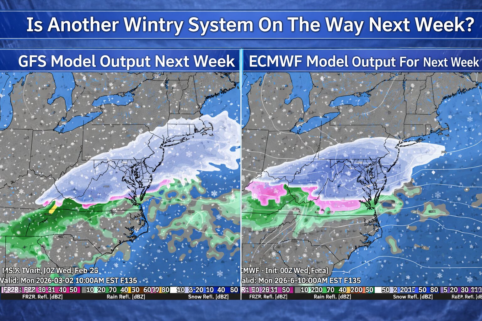
Forecast guidance suggests a wave of low pressure may ride eastward along this boundary on Monday. With fresh cold air in place, this setup could support another round of wintry precipitation.
Uncertainty Remains


However, confidence remains low at this time. Not all forecast models show a well-developed system. Some solutions depict a weaker and drier disturbance with limited impacts, while others suggest a more organized system capable of producing more widespread precipitation.
If the system does materialize, it currently appears more likely to be a typical winter event rather than a major storm. At this stage, there are no indications of a significant or high-impact system for Delmarva.
We will continue to monitor model trends over the coming days as details regarding track, timing, and precipitation type become clearer.
Stay tuned for updates as we move closer to early next week.