A messy and unsettled weather pattern will continue across the Mid-Atlantic and Delmarva region today as multiple fronts and areas of low pressure move through the area, bringing periods of showers, thunderstorms, patchy fog, and the potential for locally heavy rainfall.

Early this morning, a warm front began lifting northward across the region ahead of a strengthening area of low pressure tracking through the eastern Great Lakes and Ohio Valley. This setup has already produced areas of patchy fog, drizzle, low clouds, and light rain across portions of eastern Pennsylvania, New Jersey, Delaware, and Maryland.
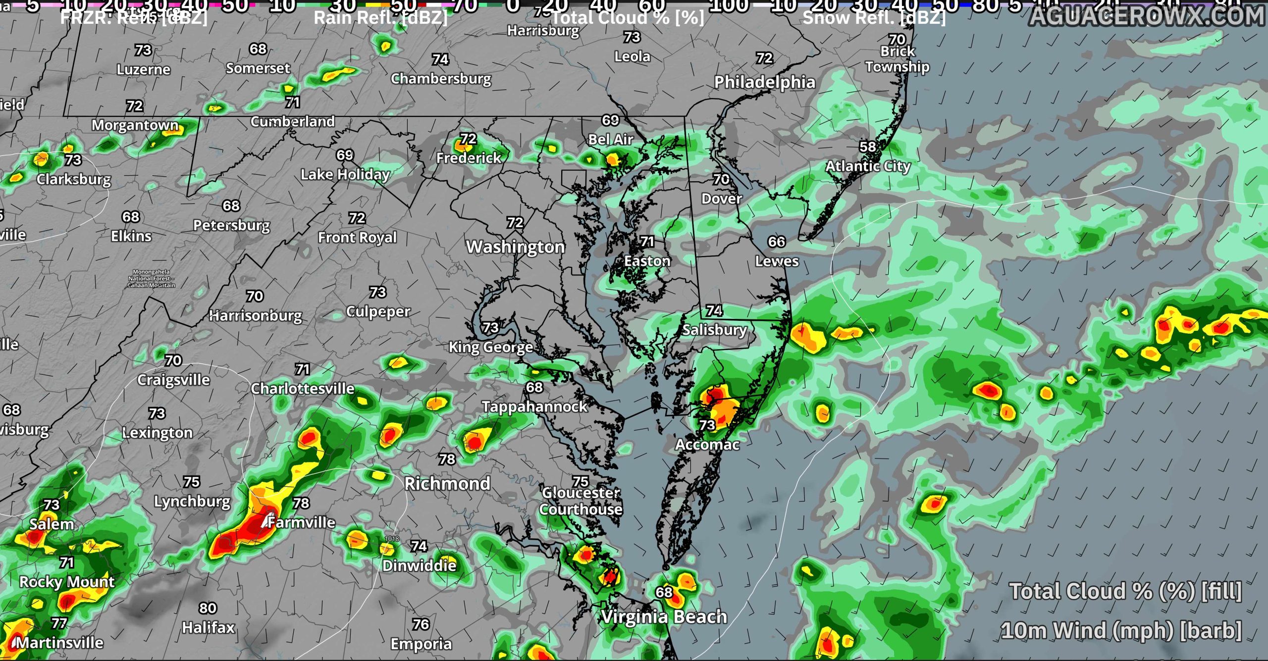
As the warm front continues northward through the morning hours, a band of showers moving east out of western Pennsylvania and New York will begin interacting with the increasingly humid and unstable air mass across the region. This interaction could lead to the development of thunderstorms capable of producing torrential downpours and localized flooding concerns.
The first round of heavier showers and thunderstorms is expected to develop from the southern Poconos and Lehigh Valley eastward toward the Interstate 95 corridor during the late morning into early afternoon. Additional storms are then expected to redevelop later this afternoon and evening as a cold front sweeps through the region.

The greatest concern for Delmarva appears to arrive later today into tonight, when thunderstorms are forecast to intensify across southern New Jersey and the Delmarva Peninsula. Some of the stronger storms may produce gusty winds, frequent lightning, and pockets of heavy rainfall that could lead to poor drainage flooding in low-lying and urban areas.

Despite the clouds and rainfall, temperatures will still climb into the low to mid 70s this afternoon as warmer air spreads northward ahead of the cold front.
Patchy fog and low clouds may redevelop tonight behind the front as lingering moisture remains trapped near the surface.
Residents across the region are encouraged to remain weather aware through the day, especially during periods of heavy rain and thunderstorms that could quickly reduce visibility on area roadways.


