
A developing coastal storm system could bring a period of rain to the Delmarva region on Saturday, though uncertainty remains regarding how widespread the impacts will be.
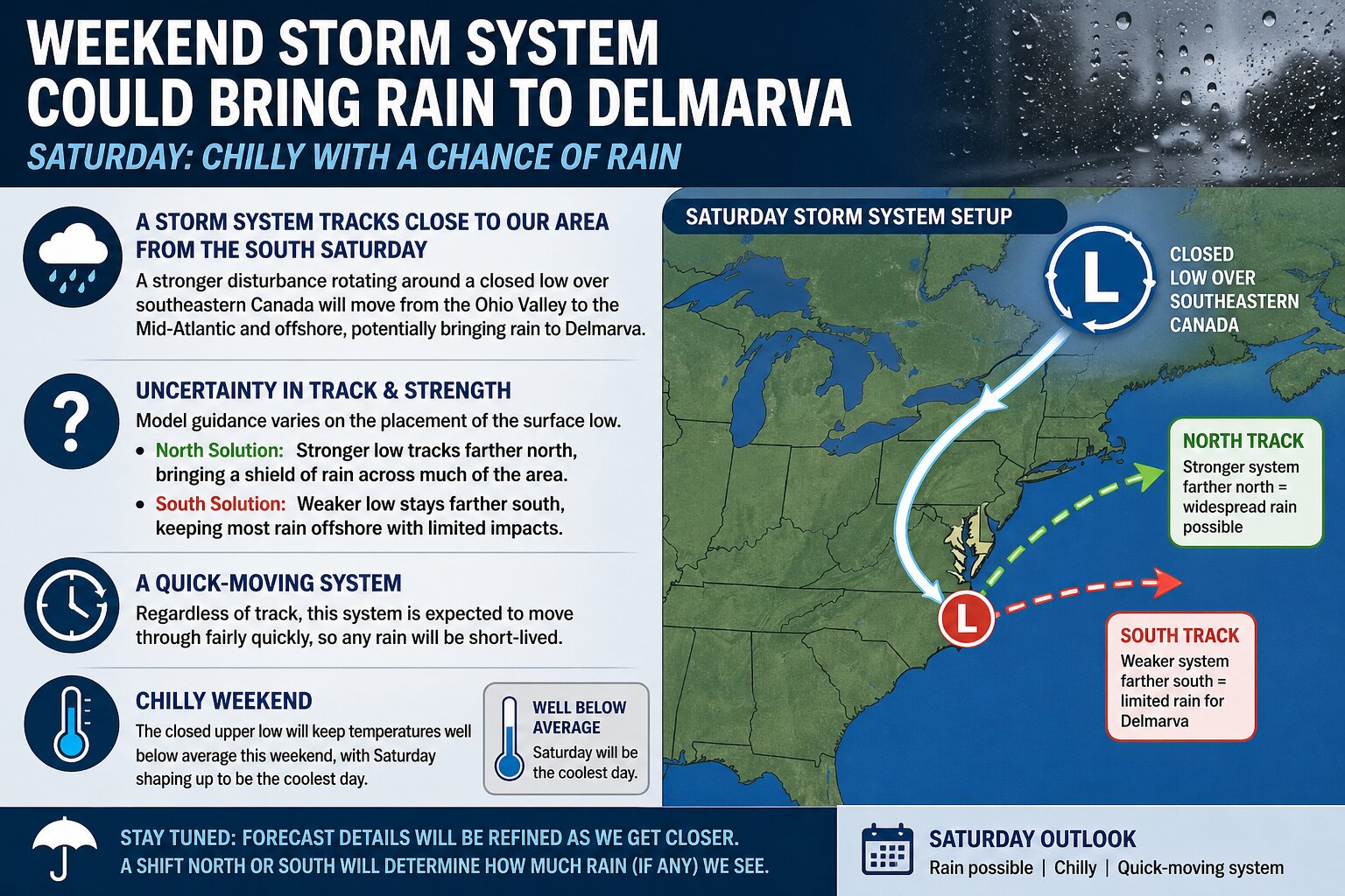
The setup involves a large, closed upper-level low lingering across southeastern Canada, with a stronger disturbance rotating around its base from the Ohio Valley into the Mid-Atlantic. This feature is expected to help generate an area of low pressure near or just south of the region. However, forecast models continue to differ on exactly where this surface low will track and how strong it becomes.


Some guidance like the ECMWF suggests a stronger system tracking farther north, which would spread a steady shield of rain across much of Delaware, Maryland’s Eastern Shore, and adjacent coastal areas. Other solutions, including the GFS model, depict a weaker and more southern track, which would keep the bulk of the rainfall offshore and result in more limited precipitation locally.
Despite the uncertainty, one consistent signal is that this system will be relatively fast-moving. Any rainfall that does develop would likely move through quickly rather than linger for an extended period.

In addition to the rain chances, temperatures across Delmarva are expected to run well below average for late April. The influence of the upper-level low will keep conditions noticeably chilly, with Saturday shaping up to be the coolest day of the weekend.
We will continue to refine the track and strength of this system over the coming days. A slight shift north or south will ultimately determine whether Delmarva sees a widespread soaking rain or only spotty, light precipitation.


