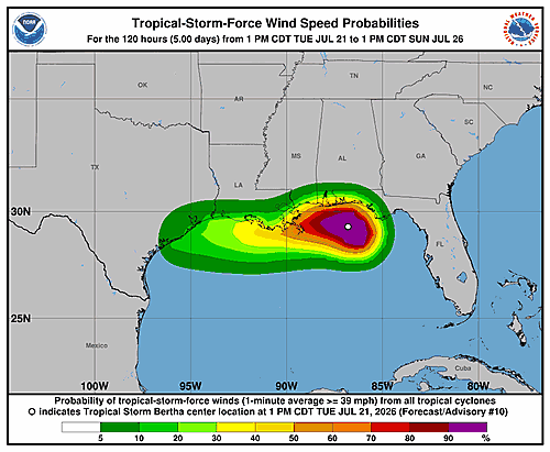
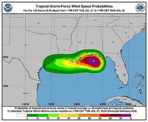
The National Hurricane Center has issued an updated Potential Storm Surge Flooding Map for Tropical Storm Bertha, with the most recent update recorded on Tuesday, July 21, 2026, at 15:53 UTC.
Storm surge flooding maps are critical tools used to show areas that could be inundated with water if a tropical storm makes landfall. Residents in potentially affected coastal zones are encouraged to stay informed and follow guidance from local emergency management officials.
For the most current storm surge information, the National Hurricane Center continues to provide updates as Tropical Storm Bertha develops.