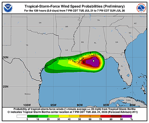
The National Hurricane Center has issued an updated Potential Storm Surge Flooding Map for Tropical Storm Bertha, with the most recent update recorded at 9:52 p.m. GMT on Tuesday, July 21, 2026.
The map provides a visual representation of areas that could experience storm surge flooding as Tropical Storm Bertha continues to develop. Residents in low-lying and coastal communities are encouraged to review the latest storm surge information and follow guidance from local emergency management officials.
Storm surge can be one of the most dangerous and deadly hazards associated with tropical storms, capable of pushing large volumes of water inland and causing significant flooding in a short period of time.
The National Hurricane Center continues to monitor Tropical Storm Bertha and will provide updated maps and forecasts as conditions evolve. Anyone in potentially affected areas should stay informed and be prepared to act quickly if local authorities issue evacuation orders or other emergency directives.