
The National Hurricane Center issued its second forecast discussion for Tropical Depression Two on Sunday afternoon, noting that the storm has shown little change over the past several hours but continues to pose a growing threat to the Gulf Coast.
As of 4:00 PM CDT Sunday, July 19, 2026, the depression’s circulation remains well organized, with deep thunderstorm activity gradually building near the storm’s center and in outer bands. Satellite data from an ASCAT pass around 15Z and measurements from Air Force Reserve reconnaissance aircraft both confirmed peak winds of approximately 25 knots, so the initial intensity has been kept at 25 knots for this advisory. The storm is described as large and somewhat spread out, with associated shower activity blanketing much of the eastern Gulf of Mexico.
The depression has barely moved throughout the day and has actually drifted slightly to the southeast over the past few hours. Forecasters say this near-standstill motion is caused by very weak steering currents — the system is essentially trapped between a ridge of high pressure over the western Atlantic, another ridge over the south-central and southwestern United States, and a trough over the northeastern U.S.
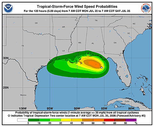
Most computer forecast models show the storm drifting northwestward over the next couple of days. Its outer bands could begin bringing tropical storm conditions to parts of the Florida Panhandle as early as late Monday. By Tuesday, a turn toward the west or west-northwest is expected as a ridge over the U.S. builds eastward and takes over as the main steering feature. That movement would carry the system along or just off the northern Gulf Coast through the middle and latter part of the week. The NHC has shifted its track forecast slightly to the south, in line with its top-performing forecast models.
Strengthening is expected to be gradual, particularly in the short term, due to the storm’s sprawling size, nearby dry air, and northeasterly wind shear. Despite those obstacles, the system is forecast to reach tropical storm strength on Monday while positioned offshore of the Florida Panhandle. If wind shear relaxes mid-week and the storm remains over open water, additional strengthening is possible. Model forecasts vary widely — ranging from the system staying a tropical depression all the way to potentially becoming a hurricane. The NHC’s official intensity forecast falls between those extremes but leans toward the stronger end of the guidance. Forecasters caution, however, that confidence in the intensity forecast is low given uncertainty about how much the storm will interact with land.
The National Hurricane Center highlighted three key messages for the public:
First, the depression is expected to gradually strengthen and could bring tropical storm conditions to parts of the Florida Panhandle beginning late Monday, where a Tropical Storm Watch is already in effect.
Second, residents and interests in Alabama, Mississippi, Louisiana, and Texas should closely monitor this storm’s progress, as tropical storm watches may be issued for portions of those areas within the next day or two.
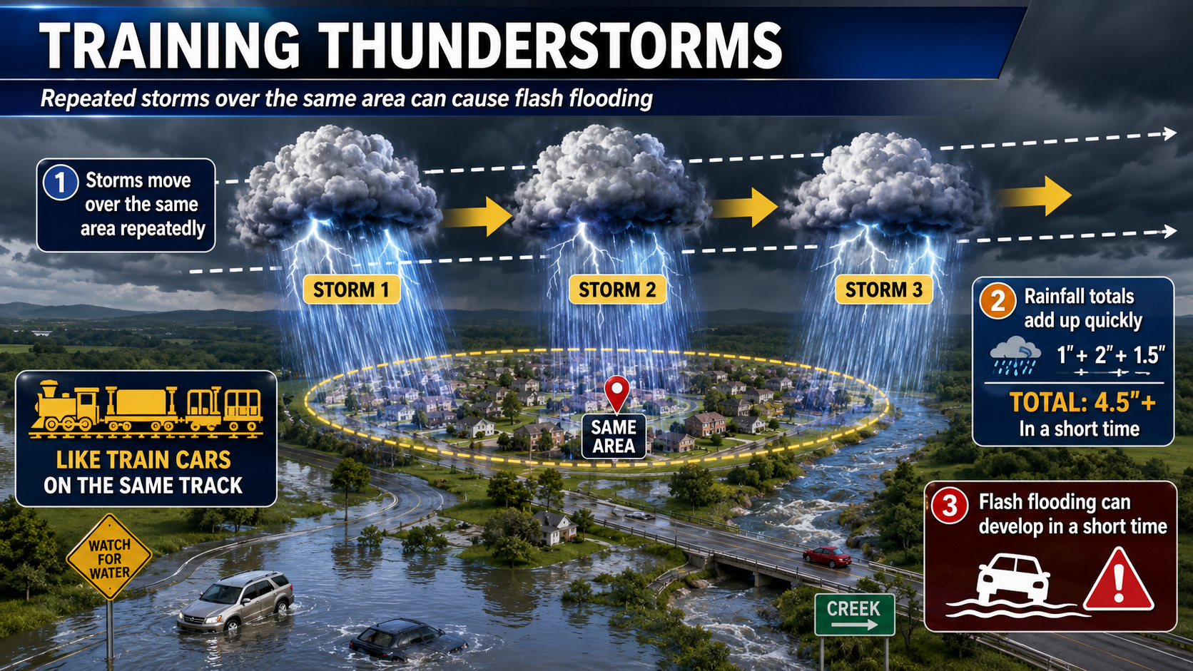
Third, flash flooding will be possible through Thursday along the eastern and central Gulf Coast, stretching from western Florida through southern portions of Alabama, Mississippi, and Louisiana.
This forecast was prepared by Forecaster Cangialosi at the National Hurricane Center.