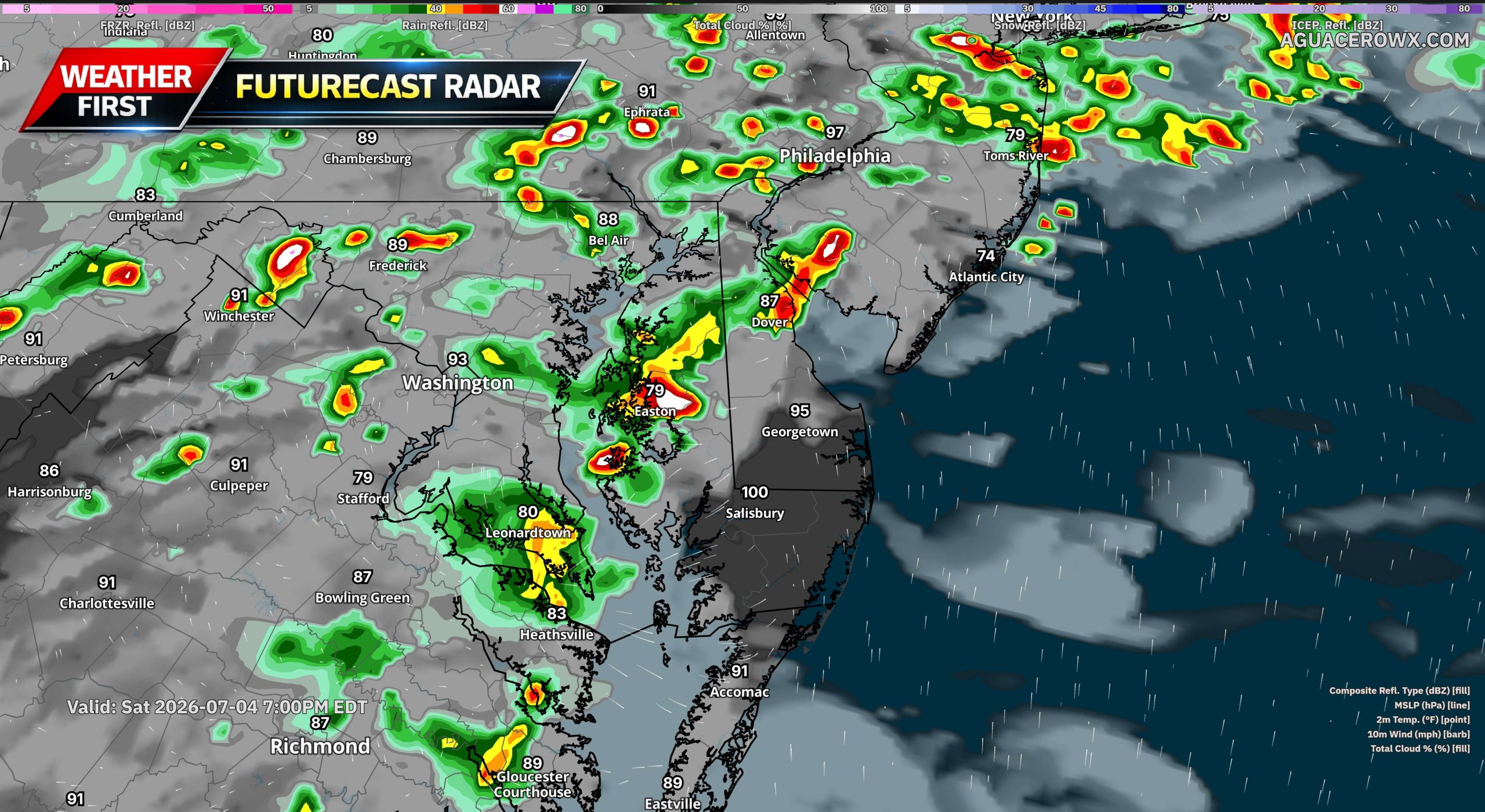
A more active weather pattern is expected to develop across Delmarva and the surrounding Mid-Atlantic through the holiday weekend, bringing increasing chances for afternoon and evening showers and thunderstorms. This comes as dangerous heat and humidity continue to impact the region, adding another concern for outdoor plans and holiday festivities.

The large ridge of high pressure responsible for the extreme heat is beginning to break down and shift back to the south and west. As this happens, a mid-level trough will dig southeastward into New England, allowing several disturbances to ride over the top of the ridge and move into the region. These disturbances will help trigger more showers and thunderstorms, especially during the afternoon and evening hours.

Storm chances will begin to increase late today, though coverage should remain more isolated to scattered. Rain chances are around 20 to 30 percent for this afternoon and evening. By Saturday, storm coverage should become a bit more widespread, with rain chances generally ranging from 30 to 60 percent. The most active period looks to arrive Sunday into Monday, when showers and storms could become more widespread across much of the area.


The Storm Prediction Center has placed portions of the region under a Slight Risk, level 2 out of 5, for severe thunderstorms today, Saturday, and Sunday. While storm coverage may be limited today, any storm that develops could become strong. By Saturday, storms may become more organized, with damaging wind gusts being the primary severe weather threat.
Sunday could bring a more focused severe weather risk across Delmarva as the atmosphere becomes unstable ahead of an approaching cold front. While the entire region may see showers and thunderstorms, Delmarva may have the better chance for stronger storms depending on how much heating and instability can develop during the day.
The timing and coverage of thunderstorms remains somewhat uncertain, but the main message is that holiday weekend plans could be impacted at times by storms, especially during the afternoon and evening. Anyone with outdoor events, beach plans, fireworks, or travel should stay weather aware and have a way to receive warnings.
After the cold front moves through Sunday, it may stall near or just south of the region. That stalled boundary, combined with another upper-level disturbance moving through, could lead to scattered to widespread showers and a few thunderstorms Sunday night through Monday night. Even after that, isolated daily storm chances may continue into the middle of next week, mainly during the afternoon and evening.
Along with the storm threat, dangerous heat remains a concern through Saturday. Heat index values could still climb into the 100 to 108 degree range Saturday, especially across inland areas. The combination of extreme heat, high humidity, and scattered storms will make it important to take precautions, stay hydrated, limit strenuous outdoor activity, and move indoors quickly when thunder is heard.