
A significant warmup is on the way for the Delmarva region as a developing ridge of high pressure is forecast to bring summerlike temperatures and increasing humidity through early next week.
Following the departure of a closed low pressure system to the East Coast on Friday, upper-level ridging is expected to strengthen across the eastern United States through the weekend and into early next week. At the surface, high pressure building over the western Atlantic will help establish a persistent southerly flow, transporting a much warmer air mass into the Mid-Atlantic region.
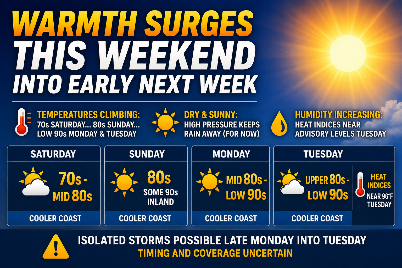
Temperatures will begin climbing noticeably on Saturday with highs ranging from the 70s near the coast to the middle 80s inland. By Sunday, widespread 80s are expected across much of Delmarva, with some inland communities potentially approaching the 90-degree mark. Areas along the beaches and immediate coastline will remain somewhat cooler thanks to onshore winds coming off the Atlantic Ocean.
The heat is forecast to intensify even further Monday and Tuesday. Forecast highs Monday are expected to reach well into the 80s region-wide, while several inland areas could top out in the lower 90s. The warming trend continues Tuesday with highs projected in the upper 80s to lower 90s across much of the region.
Humidity levels are also expected to increase as southerly flow strengthens. Surface dew points are forecast to rise into the low to middle 60s Monday and Tuesday, making conditions feel even warmer. Heat index values may climb several degrees above the actual air temperatures, especially in more urbanized areas along the Interstate 95 corridor. Some locations could come close to reaching Heat Advisory criteria by Tuesday afternoon, where heat index values of 96 degrees or higher can trigger advisories during the month of May.
In addition to the warming temperatures, dry weather is expected to dominate through much of the weekend and into early next week due to the presence of strong high pressure aloft. Forecast guidance currently shows little to no precipitation through Monday for most of the region.
However, we are monitoring the potential for isolated thunderstorms later Monday into Tuesday as the northwestern edge of the ridge begins to weaken. An approaching upper-level trough and eventual cold front from the west may allow showers and thunderstorms to develop by the middle of next week. The timing and overall coverage of any storms remain uncertain and will depend on how quickly the ridge weakens and how fast the next weather system approaches.
After a relatively cool and unsettled stretch of weather recently, the upcoming pattern change will deliver the first widespread taste of summer conditions across Delmarva heading into next week.