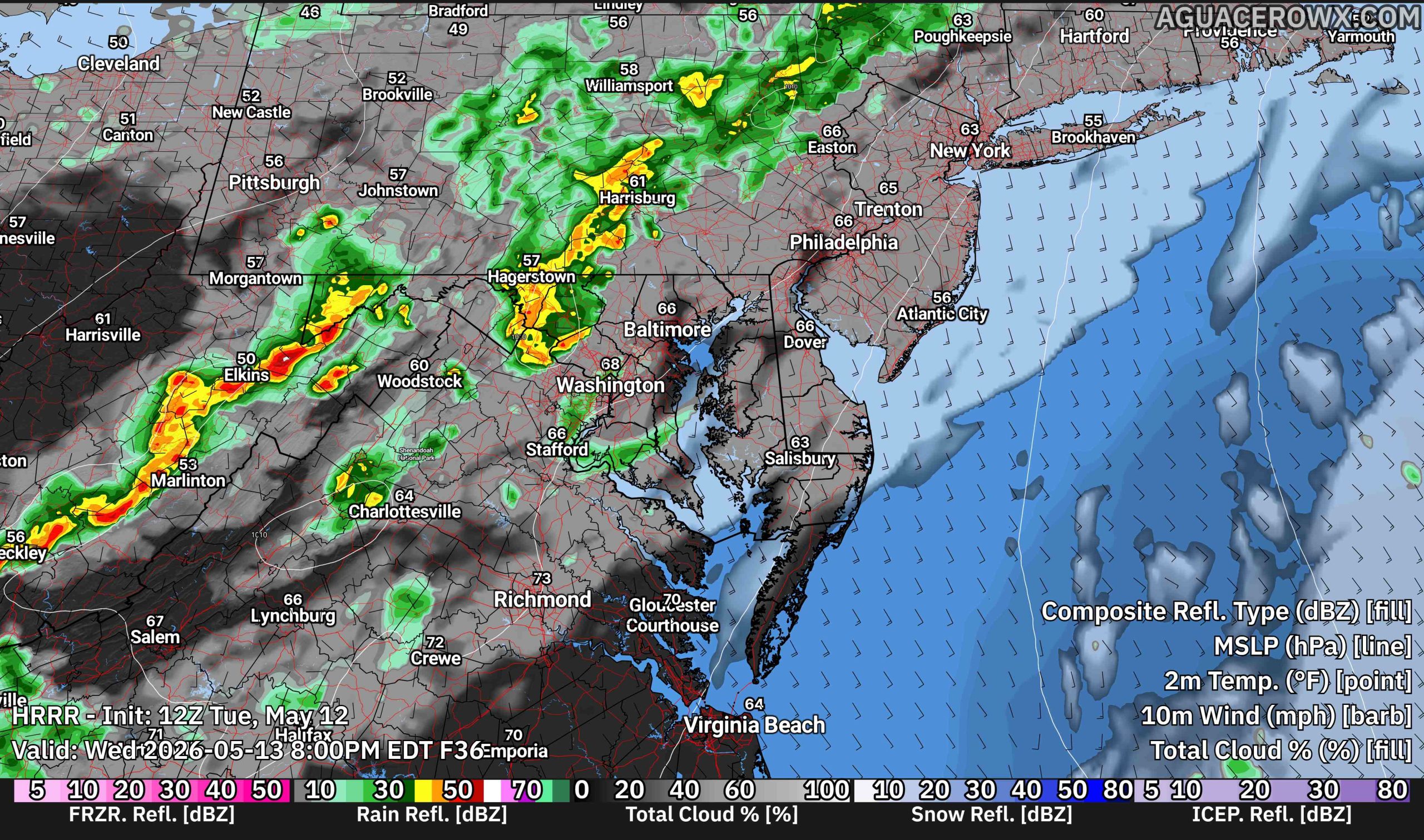
A more unsettled weather pattern is expected to return to the Delmarva region during the middle of the week as an upper-level storm system approaches from the west. Showers are expected to increase Wednesday afternoon and continue through Wednesday night, with a few thunderstorms also possible before conditions gradually improve Thursday.

We are tracking an upper-level trough that is expected to evolve into a closed low over the Mid-Atlantic and Northeast by Thursday. As this system approaches, a warm front lifting northward across the region Wednesday will help increase moisture and atmospheric lift. This setup is expected to lead to showers developing from west to east during the afternoon hours, with the steadiest and most widespread rainfall occurring Wednesday night as a cold front pushes through the area.

While severe weather is not expected to be a major concern across Delmarva, enough instability may develop to support a few thunderstorms Wednesday afternoon into Wednesday night. The better chance for stronger thunderstorms is expected to remain farther west where instability and wind shear will be greater. However, locally heavy downpours and occasional lightning will still be possible with any thunderstorms that develop locally.

Rainfall totals are currently forecast to range between around 0.20 and 0.50 inches across much of the region, though isolated higher amounts could occur where more organized showers or thunderstorms develop. The rainfall will provide some beneficial moisture to the region following recent dry conditions, though this does not appear to be a widespread heavy rain event.

By Thursday, the main cold front and deeper moisture will begin shifting offshore. However, with the closed low potentially moving overhead and colder air aloft lingering across the region, additional scattered showers may redevelop during the day Thursday before the system finally departs later in the day or Thursday night.
Temperatures will also trend cooler Thursday behind the cold front, with more seasonable conditions expected heading into the end of the week.


