
A developing El Niño signal across the Pacific Ocean is gaining attention from forecasters, with new data from the Climate Prediction Center and the European Centre for Medium-Range Weather Forecasts suggesting the potential for a strong event later this year.
Current observations show warming sea surface temperatures across the central and eastern equatorial Pacific, a key indicator that El Niño conditions are beginning to take shape. Forecast guidance from the Climate Prediction Center indicates a high likelihood of El Niño developing by summer, with increasing confidence that it could persist and strengthen into the fall and winter months.

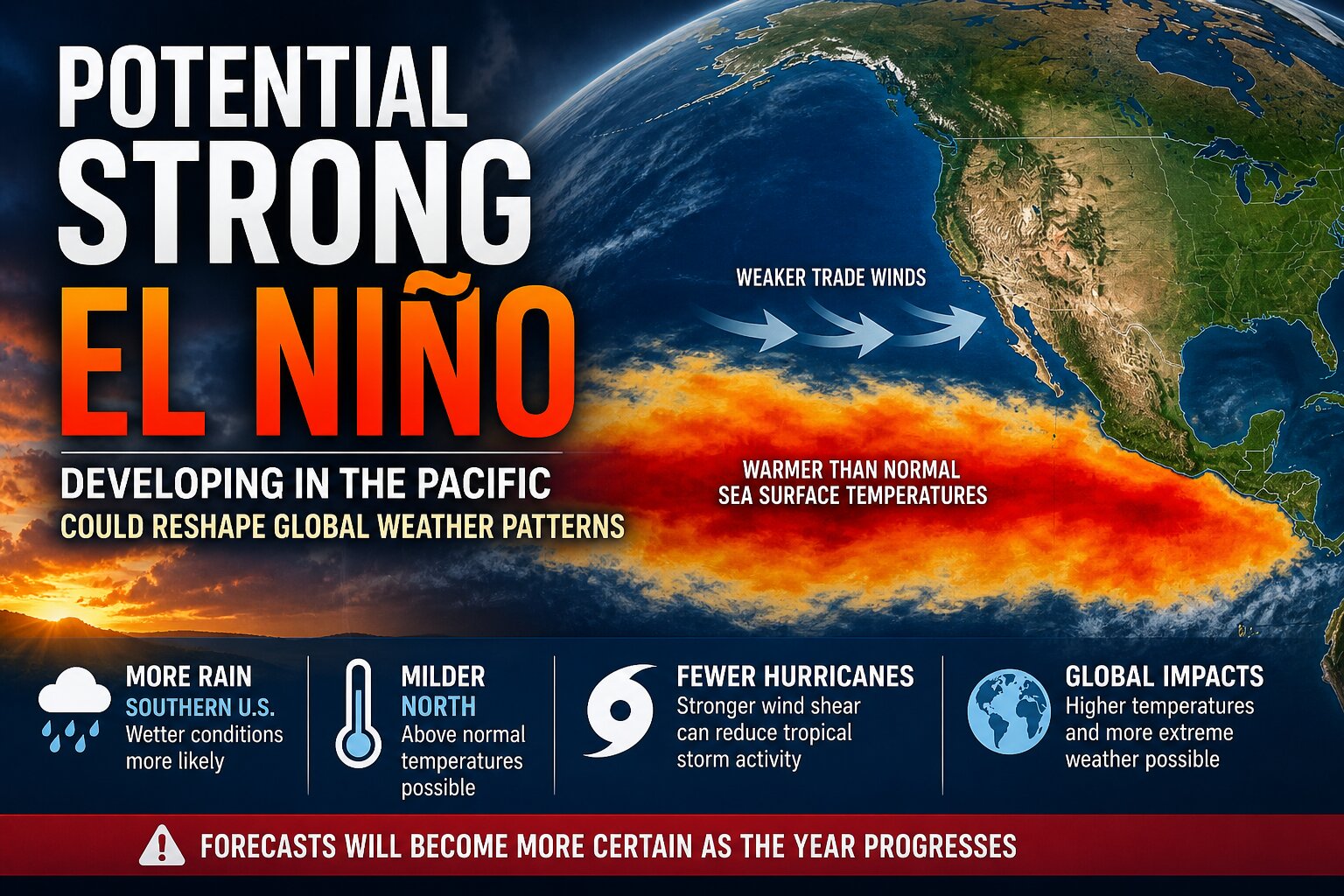
The European Centre for Medium-Range Weather Forecasts supports this trend, with seasonal model output pointing toward continued ocean warming through the second half of the year. Some ensemble members suggest sea surface temperature anomalies in the Niño 3.4 region could exceed 2 degrees Celsius, which would place this event in the strong category if realized.

El Niño occurs when warmer than average ocean water develops across the tropical Pacific, disrupting normal atmospheric circulation patterns. This shift alters the jet stream and can influence weather across much of the globe, including North America.
For the United States, a strong El Niño typically shifts the jet stream farther south. This pattern often results in wetter conditions across the southern tier of the country and can bring more active storm tracks across parts of the East. In contrast, northern areas may trend milder overall.

Another important impact is on the Atlantic hurricane season. El Niño tends to increase wind shear across the Atlantic Basin, which can suppress tropical development and reduce the number of storms.
Globally, strong El Niño events are often associated with above average temperatures and an increased risk of extreme weather events, including flooding in some regions and drought in others.
For the Delmarva region, the most noticeable impacts typically arrive during the late fall and winter months when El Niño reaches peak intensity. This can influence storm tracks and precipitation patterns, though exact local impacts vary depending on how the pattern evolves.
Forecasters caution that uncertainty remains, especially during the spring when long range predictions are more challenging due to what is known as the spring predictability barrier. However, the agreement among multiple climate models and ongoing ocean warming signals suggest that a significant El Niño event is increasingly possible.
We will continue to monitor conditions across the Pacific in the coming months as the strength and impacts of this developing pattern become clearer.


