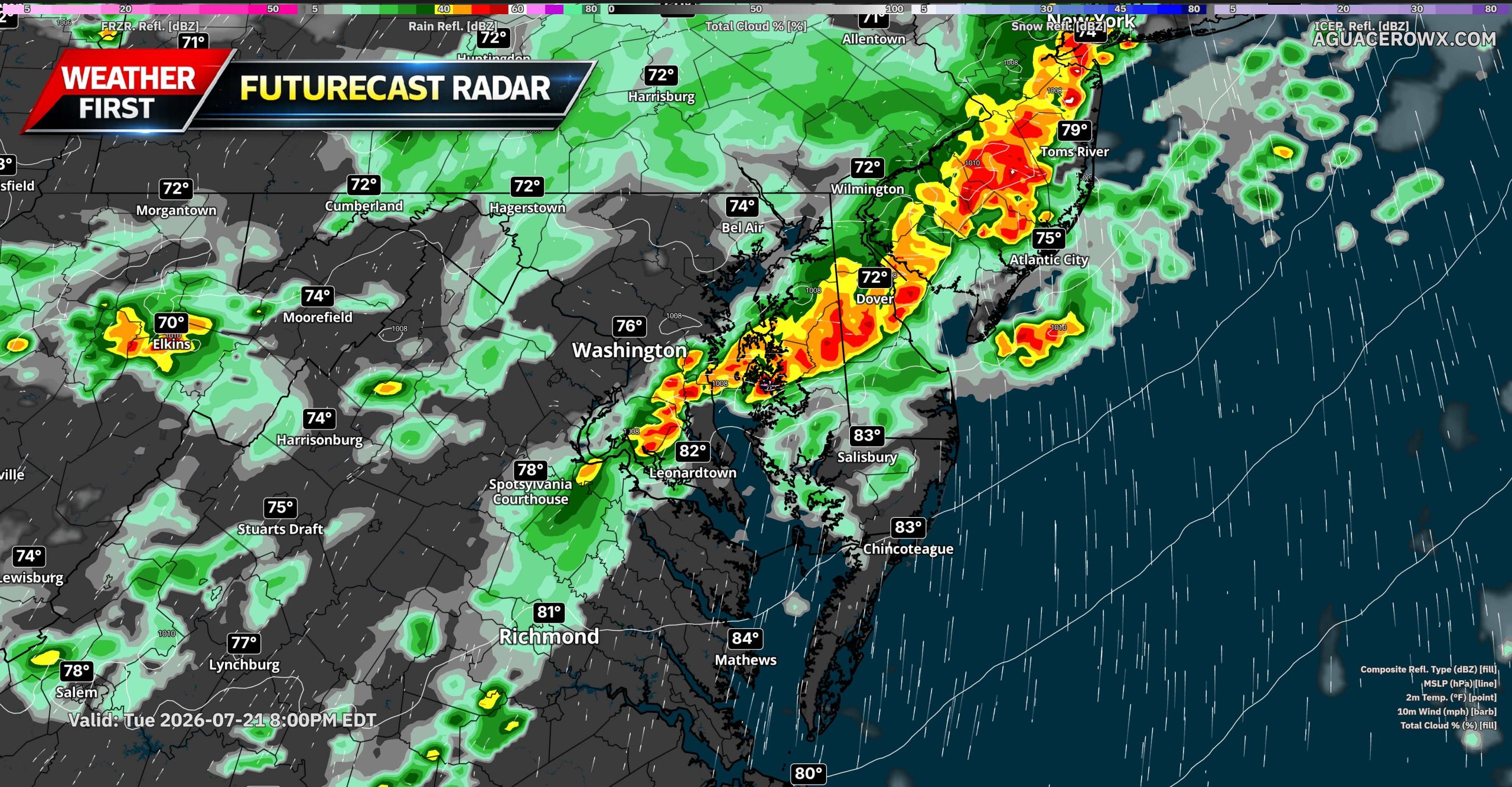
A potentially active stretch of severe weather is taking shape across the Mid-Atlantic, with the greatest concern expected Tuesday afternoon and evening before the threat shifts farther south and east on Wednesday.

The latest SPC outlook places parts of the Ohio Valley and Mid-Atlantic under a Level 3 out of 5 Enhanced Risk for severe thunderstorms Tuesday. This includes portions of West Virginia, northern Virginia, Maryland and Pennsylvania. Severe storms will also be possible across surrounding areas, including other parts of the Mid-Atlantic and Northeast.
Tuesday Brings the More Widespread Threat

Tuesday appears to have the greatest potential for numerous severe thunderstorms across the region. An upper-level trough and several smaller disturbances will move through the eastern United States while an area of low pressure tracks from southern Ontario into Quebec. A cold front will approach from the west, while a separate trough develops ahead of the front across the Mid-Atlantic.

A very warm and humid air mass will be in place ahead of these features, with dew points generally in the middle 60s to lower 70s. This moisture, combined with daytime heating, should allow moderate to strong atmospheric instability to develop. Strong winds throughout the lower and middle levels of the atmosphere will also provide enough wind shear for organized thunderstorms.

Storms could initially develop as supercells before growing into one or more organized lines or bowing segments. The primary hazard will be damaging wind gusts, with the potential for corridors of more widespread wind damage if a well-organized line develops. Large hail and a few tornadoes will also be possible, especially with any storms that remain isolated or semi-discrete.

The exact storm evolution remains uncertain. Warmer temperatures several thousand feet above the ground could limit the potential for extremely large hail, while the risk of particularly intense wind gusts will depend on whether storms can consolidate into a mature bowing line. Even with those uncertainties, the overall environment supports a broad severe weather threat Tuesday afternoon into Tuesday night.
For Delmarva and areas closer to the coast, the severity of the threat may depend on how quickly storms organize farther west and how much instability remains available as they move eastward. Residents should closely monitor later forecasts for more specific information concerning timing and storm coverage.
Threat Shifts South and East Wednesday
The severe weather risk will not completely end Tuesday night. The upper-level trough will remain over the eastern United States on Wednesday as the cold front continues moving toward the Atlantic coast.

A Level 2 out of 5 Slight Risk is currently in place for portions of southeastern Virginia and North Carolina. Isolated strong to severe storms will remain possible elsewhere from the Mid-Atlantic into New England, although the greatest Wednesday threat is expected across Virginia and North Carolina.
Moisture and instability will remain ahead of the front, while winds of approximately 30 to 40 knots through the lower and middle atmosphere should support organized storm cells and clusters. Damaging wind gusts will be the main hazard Wednesday. The threat will likely become more concentrated along and ahead of the advancing front during the afternoon and evening.
Remain Weather Aware

Tuesday currently appears to be the more significant and widespread severe weather day for the Mid-Atlantic, with damaging winds, large hail and a few tornadoes all possible. Wednesday’s threat is expected to be more isolated and focused farther south, particularly across southeastern Virginia and North Carolina.
Residents should have multiple ways to receive warnings, secure loose outdoor objects and avoid relying solely on outdoor warning sirens. Any severe thunderstorm could produce winds capable of bringing down trees and power lines.