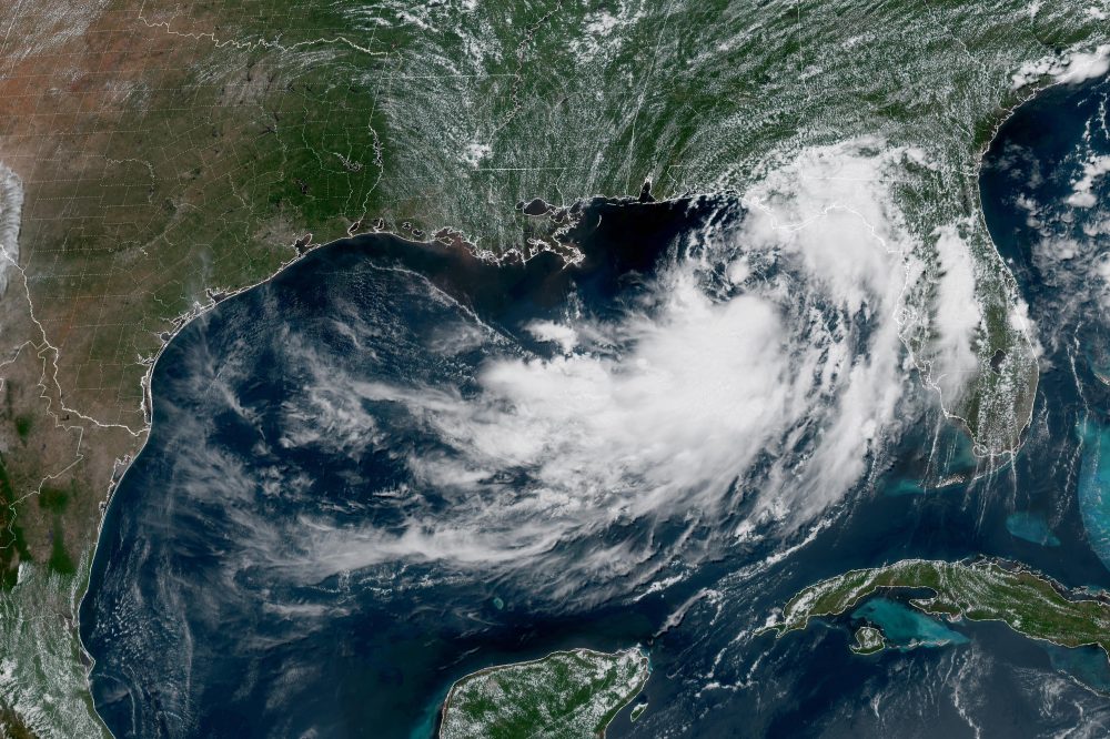

NEW ORLEANS (AP) — A tropical depression moving unpredictably across the northern Gulf of Mexico is forecast to intensify later Monday, bringing heavy rainfall capable of causing flooding and strong winds that could knock down trees and knock out power across multiple states this week.
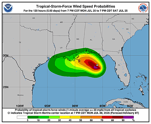
As of the latest update, the storm system was positioned approximately 110 miles south of Panama City, Florida, carrying sustained winds of 35 mph. The U.S. National Hurricane Center, based in Miami, said the depression is on track to gradually gain strength and reach tropical storm classification by the end of the day Monday.
The system has been drifting in a northwesterly direction at roughly 3 mph and is expected to approach and travel along the northern Gulf Coast over the coming days. In response, officials have issued a storm surge watch stretching from the mouth of the Mississippi River eastward to the Alabama-Florida border along the Gulf.
A tropical storm watch has also been put in place from the Ochlockonee River in Florida westward into southeastern Louisiana, reaching to the Jefferson and Plaquemines parish line.
The National Weather Service office in New Orleans cautioned that dangerous storm conditions could develop from the Florida Panhandle westward into Louisiana as early as Tuesday. Forecasters warned of wind gusts reaching 40 mph and flagged a potentially “life threatening” storm surge situation for the coastlines of Alabama, Mississippi, and southeastern Louisiana.
The hurricane center warned that storm surges of up to four feet could impact parts of the Louisiana and Mississippi shorelines. Forecasters also noted the possibility of an isolated tornado or two in the Florida Big Bend area during the week.
Flash flooding is expected to remain a concern through Friday along the coast, from western Florida to middle Texas. Rainfall totals of 3 to 5 inches are anticipated along the Louisiana coastline, with even higher amounts possible in some locations, particularly south of Lake Pontchartrain, according to the weather service.
Elsewhere, in the eastern Pacific Ocean, Tropical Storm Fausto continued to gain strength Monday and was approaching hurricane strength far from the Mexican coastline. Fausto was packing sustained winds of 65 mph and was located about 775 miles southwest of the southern tip of Mexico’s Baja California Peninsula. The storm was tracking west-northwest at 13 mph and posed no threat to any land areas, the hurricane center said.