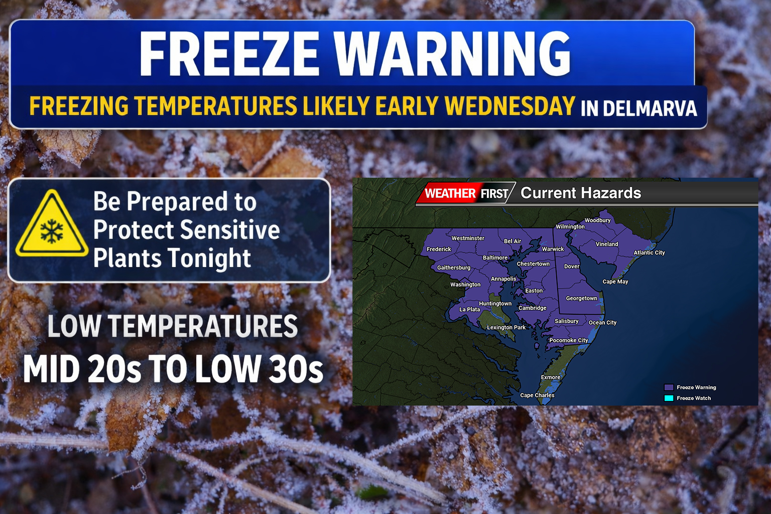

A sharp drop in temperatures will bring widespread freeze conditions to Delmarva early Wednesday morning, with additional frost concerns lingering into Thursday morning.

A strong Canadian high pressure system, centered around 1040 mb, will build into the Northeast behind a cold front that moved through Tuesday. This setup is allowing a reinforcing surge of cold, dry air to settle over the Delmarva Peninsula through midweek.

Temperatures by Wednesday morning are expected to fall into the mid 20s to low 30s across much of Delaware and Maryland’s Eastern Shore. As a result, Freeze Warnings are now in effect, especially as the growing season has recently begun across the region. These temperatures are cold enough to damage or kill sensitive vegetation if proper precautions are not taken.

Despite the cold start Wednesday, the air mass will initially remain very dry, limiting frost development early in the morning. However, conditions will change heading into Wednesday night.
As high pressure shifts offshore, winds will become lighter and turn easterly, allowing moisture to recover slightly. This will set the stage for efficient radiational cooling Wednesday night into early Thursday morning. Temperatures will once again drop into the mid 20s to low 30s inland, with slightly milder readings closer to the immediate coastline.

Unlike the previous night, these conditions will be more favorable for widespread frost formation, particularly across inland areas of Delmarva where winds go calm and skies remain clear. Even near the coast, patchy frost cannot be ruled out if winds diminish enough overnight.
Conditions will begin to moderate by Thursday afternoon and into Friday, with temperatures gradually trending closer to seasonal norms. However, another chilly start is expected Thursday morning, and some patchy frost may still develop in typically cooler inland locations early Friday, though a hard freeze is not anticipated beyond Thursday morning.


