
DELMARVA — A dangerous heat wave is expected to build across the region next week as a strong upper-level ridge, or heat dome, expands across the central and eastern United States.
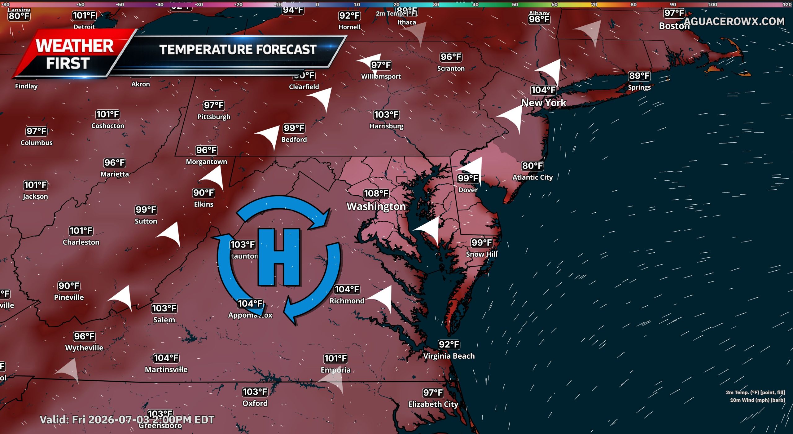
Forecast guidance shows this ridge strengthening over the Ohio Valley, Mid-Atlantic and Southeast, allowing heat and humidity to surge into Delmarva. The hottest stretch looks likely from the middle of next week into the July 4th holiday weekend.

Afternoon temperatures could climb well into the 90s, with some inland areas approaching the upper 90s. When combined with high humidity, heat index values may reach 100 to 110 degrees at times, especially away from the immediate beaches.
This heat wave may last several days, making it more impactful than a short burst of summer heat. Overnight lows may only fall into the 70s, providing limited relief and increasing the risk for heat-related illness.

The Weather Prediction Center highlights a broad area of Major to Extreme HeatRisk across much of the eastern U.S. next week, while longer range outlooks continue to show an elevated risk for extreme heat through the July 4th holiday period.
Residents should begin preparing now by staying hydrated, limiting strenuous outdoor activity during the hottest part of the day, checking on vulnerable family members and neighbors, and making sure cooling options are available.
With outdoor plans, beach trips and July 4th events expected across Delmarva, heat safety will be especially important. Forecast details will continue to be refined, but confidence is increasing that a prolonged and dangerous stretch of heat is on the way.