Another stretch of dangerous summer heat is expected to build across the Mid-Atlantic this week, with temperatures climbing above normal beginning Tuesday and potentially remaining elevated through the weekend.

A strengthening ridge of high pressure will extend into the region from the west while surface high pressure moves offshore. This setup will produce a warm south to southwesterly flow, allowing hotter temperatures and increasing humidity to spread across the region.

Tuesday will mark the beginning of the heat wave, with afternoon temperatures rising into the lower and middle 90s across many locations. Conditions will become even hotter Wednesday, July 15, which is expected to be the hottest day of the stretch.

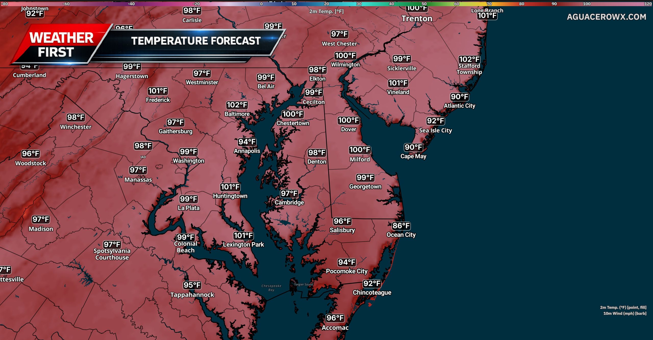
High temperatures Wednesday are forecast to reach the middle and upper 90s, with a few locations potentially approaching 100 degrees. Although humidity levels may not be as extreme as those observed during the early July heat wave, the combination of heat and moisture could still push heat index values between 105 and 108 degrees in the hottest locations.

An Extreme Heat Watch has been issued for the Philadelphia metropolitan area from Wednesday morning through Wednesday evening. The watch includes portions of southeastern Pennsylvania, southern New Jersey and northern Delaware. Additional Heat Advisories or Extreme Heat Warnings may be issued for surrounding areas as the event draws closer.
The most dangerous conditions are expected along the Interstate 95 urban corridor, where the urban heat island effect can keep temperatures especially high during the afternoon and slow overnight cooling. However, dangerous heat will also be possible across surrounding communities, including portions of the Delmarva Peninsula.
Several daily record highs could be approached Wednesday. The current record for July 15 at Georgetown, Delaware, is 96 degrees, while Wilmington’s record is 99 degrees. Philadelphia’s record of 103 degrees is less likely to be reached, but temperatures could once again approach the century mark in and around the city.
A weak and mostly dry cold front is expected to pass through the region late Wednesday. This should lower temperatures slightly, but significant relief is not anticipated. Afternoon highs may remain in the upper 80s and lower 90s Thursday through the end of the week, with above-normal temperatures potentially continuing into the weekend.

Anyone spending time outside should take the developing heat seriously. Drink plenty of water, limit strenuous outdoor activities during the hottest part of the day and take frequent breaks in air-conditioned locations. Children, older adults, outdoor workers and anyone without reliable access to cooling will face the greatest risk for heat-related illness.
Never leave children or pets inside a parked vehicle, even for a brief period. Residents should continue monitoring forecast updates because additional heat alerts will likely be issued before temperatures peak Wednesday.