
DELMARVA – After a relatively seasonable stretch to end this week and through the weekend, confidence is increasing that a significant surge of heat will arrive across the Mid-Atlantic by the middle of next week, bringing the potential for dangerous heat and humidity to the Delmarva Peninsula.
Forecast guidance continues to show a strong upper-level ridge expanding eastward from the Plains and Great Lakes into the Mid-Atlantic by Wednesday. This pattern will allow temperatures to climb steadily while humidity increases, pushing heat index values into the 100‘s during the second half of next week.
While exact temperatures will become clearer over the coming days, the overall signal for a prolonged period of above-normal warmth continues to strengthen.

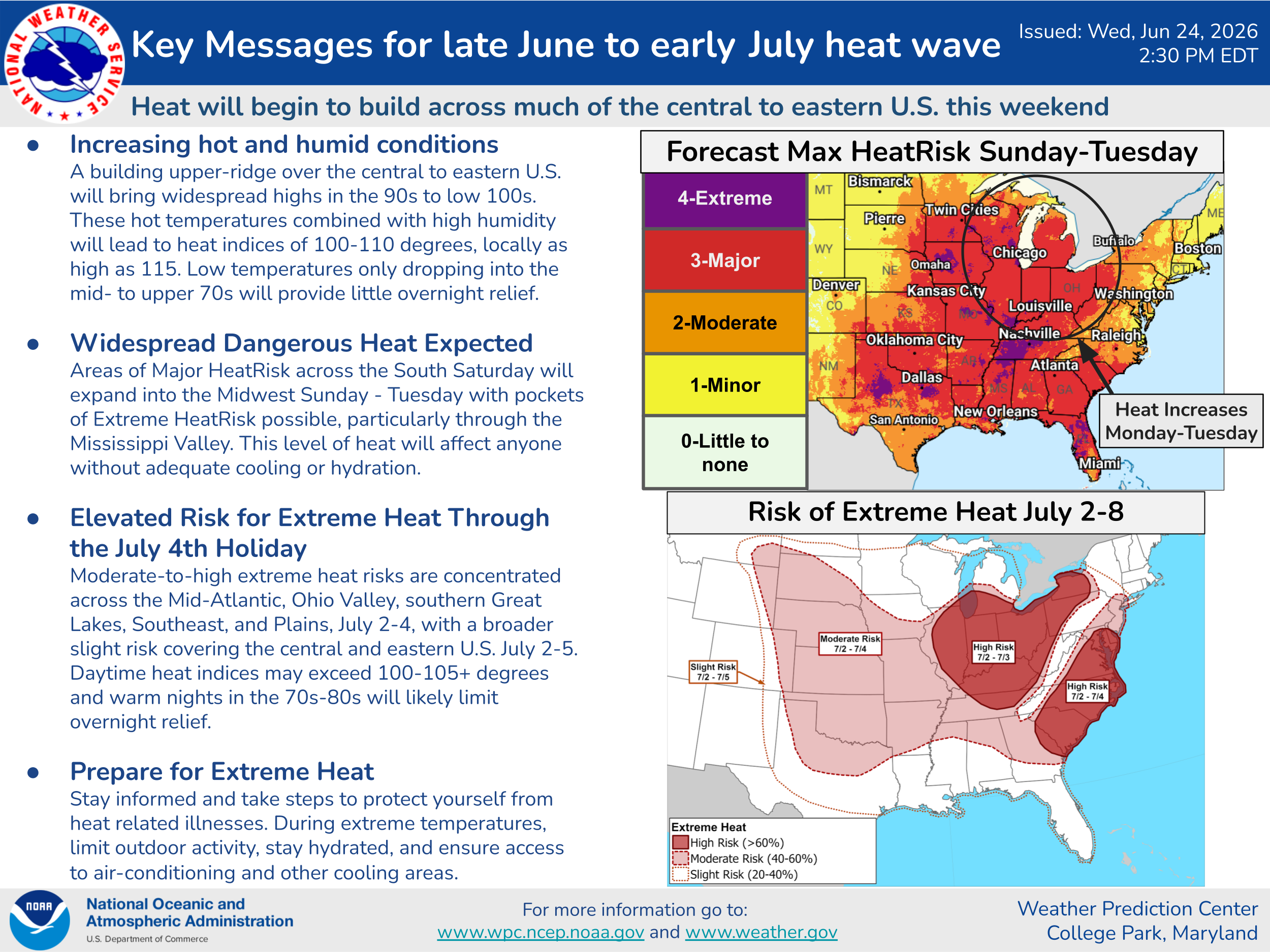
The National Weather Service’s latest long-range outlook highlights a broad area of Major HeatRisk expanding across much of the eastern United States from Sunday through Tuesday, with the threat lingering into early July. Additional outlooks indicate an elevated risk for excessive heat extending through the Independence Day holiday period across much of the eastern U.S.

For Delmarva, the hottest stretch currently appears to begin around Wednesday and continue into next weekend, when afternoon temperatures climbing well into the 90s, combined with increasing humidity, could produce heat index values exceeding 100 degrees.
Unlike short-lived hot spells, this pattern may also feature warm overnight lows in the 70s, limiting overnight cooling and increasing the cumulative stress on the body over several consecutive days.
Although this is still several days away and forecast details will continue to be refined, confidence is increasing that the region will experience its most significant stretch of heat so far this summer.
Residents should begin preparing now by:
- Staying well hydrated.
- Limiting strenuous outdoor activities during the hottest part of the afternoon.
- Checking on elderly family members, neighbors, and those without reliable air conditioning.
- Never leaving children or pets inside parked vehicles.
- Planning outdoor work or recreation for the morning or evening hours whenever possible.
We will continue monitoring the strength and duration of the developing heat dome over the coming days. If current trends continue, heat-related advisories or warnings may become necessary for portions of the Mid-Atlantic next week.