A prolonged stretch of cooler-than-average temperatures is expected to impact much of the eastern United States through at least the first half of May, according to the latest outlooks from the National Oceanic and Atmospheric Administration’s Climate Prediction Center.

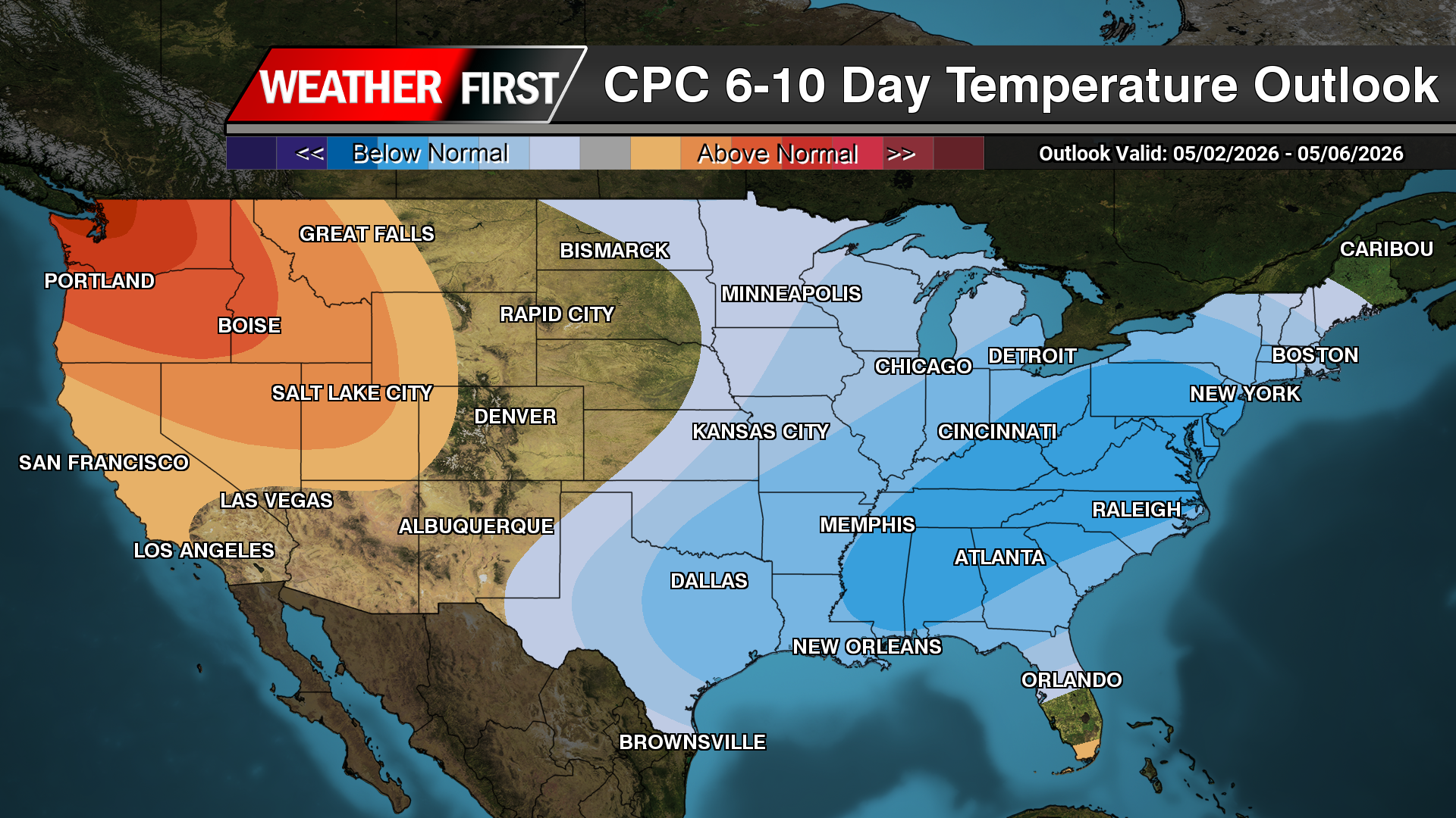
The agency’s 6- to 10-day outlook, valid May 2 through May 6, shows a broad area of below-normal temperatures expanding from the Mississippi Valley into the Mid-Atlantic and Southeast. That trend continues and strengthens in the 8- to 14-day outlook for May 4 through May 10, with much of the eastern half of the country favored to remain cooler than average.

Forecasters say the pattern is being driven by persistent upper-level troughing and a tendency for northwest flow across the eastern U.S., allowing cooler air masses to repeatedly move into the region. While these outlooks reflect probabilities rather than exact temperatures, the consistency between forecast periods increases confidence in a sustained cooler pattern.

Longer-range guidance continues that signal. The Week 3-4 outlook, covering May 9 through May 22, maintains below-normal temperature probabilities across parts of the Midwest, Great Lakes, Ohio Valley and Mid-Atlantic, suggesting the cooler regime may persist well into mid-May.
For the Delmarva Peninsula, this pattern could result in temperatures running several degrees below seasonal averages on multiple days. High temperatures may struggle to reach typical early May levels, especially during periods of cloud cover and rainfall associated with passing disturbances.
Coastal areas may see an even more pronounced cooling effect, as onshore flow and relatively cold ocean temperatures limit daytime warming. Instead of sustained warmth, conditions are expected to remain more typical of early spring, with occasional fluctuations depending on individual weather systems.
While brief warm-ups are still possible, forecasters say the overall trend points toward a delayed arrival of consistent early-season warmth across the region.