
During a March day in Arizona’s Coconino National Forest, an artificial intelligence system flagged what appeared to be smoke through a camera monitoring system. After human experts confirmed the sighting wasn’t dust or clouds, they immediately contacted Arizona’s forestry department and the state’s main power company.
The AI-powered camera, part of a network installed by Arizona Public Service, had identified the beginning stages of what would become the Diamond Fire. Emergency crews quickly responded and successfully limited the fire to just 7 acres before it could expand further.
With extreme temperatures breaking records and minimal snowfall creating dangerous dry conditions, western states vulnerable to wildfires are incorporating artificial intelligence into their fire prevention strategies, hoping the technology will protect both lives and property.
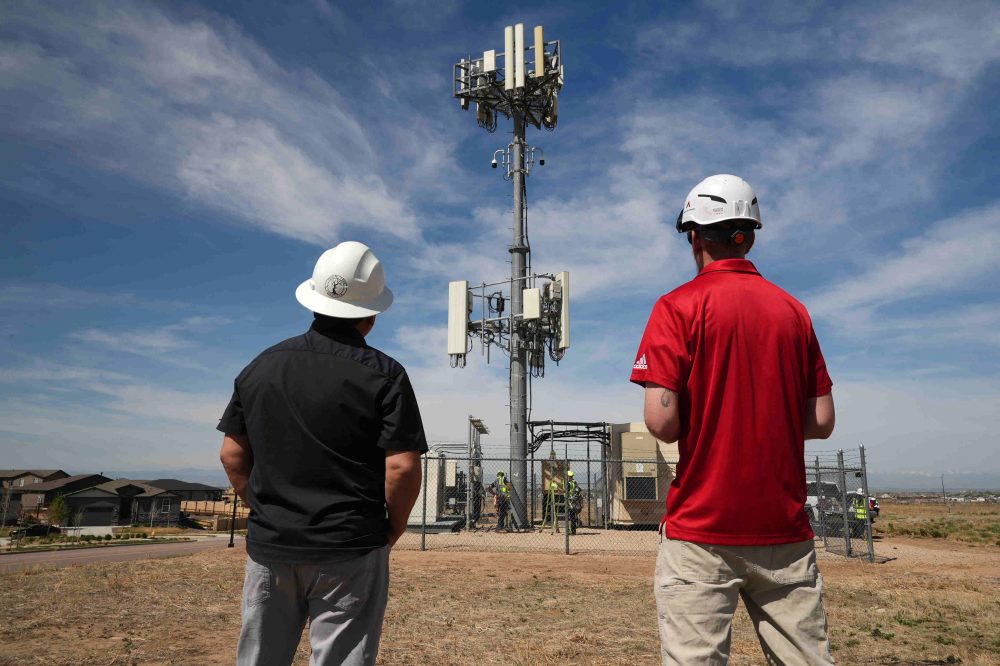
Arizona Public Service currently operates close to 40 AI-powered smoke detection cameras and expects to expand to 71 units before summer concludes, while the state’s fire department has put seven of their own systems into service. Colorado-based Xcel Energy has established 126 cameras and plans to extend coverage across seven of the eight states where it provides service by the end of this year.
“Spotting fires sooner allows us to deploy aircraft and crews immediately, helping us maintain smaller fire sizes,” explained John Truett, who serves as fire management officer for the Arizona Department of Forestry and Fire Management.
California operates ALERTCalifornia, a comprehensive network featuring approximately 1,240 AI-equipped cameras throughout the state that function similarly to Arizona’s approach.
Human oversight reduces incorrect alerts while simultaneously improving the system’s precision, according to Neal Driscoll, a geology and geophysics professor at the University of California, San Diego, who established ALERTCalifornia.
“The artificial intelligence running these cameras is actually outperforming 911 emergency calls,” Driscoll noted.
Throughout Arizona, California and other western regions, this technology primarily monitors high-risk zones that are sparsely inhabited, rural, or isolated, where fires might go unnoticed by people for extended periods.
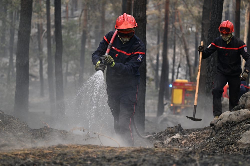
“In locations where 911 calls might be delayed significantly, having AI continuously watching those cameras proves extremely valuable,” said Brent Pascua, battalion chief for the California Department of Forestry and Fire Protection, known as Cal Fire. “We’ve frequently begun emergency responses before anyone called 911, and sometimes we’ve responded, extinguished fires, and never received any emergency calls at all.”
Pano AI, which integrates high-definition camera technology with satellite information and AI surveillance, has experienced increasing demand for its systems since beginning operations in 2020. Their equipment now operates across Australia, Canada, and 17 American states, including Oregon, Washington, and Texas. Clients range from forestry companies and government departments to utility providers like Arizona Public Service.
The company reports their technology identified 725 wildfires across the United States during the previous year.
“Stakeholders frequently tell us that this visual intelligence and the time advantage provides crucial early warning, preventing situations that could have escalated into hundreds or thousands of burned acres,” stated Arvind Satyam, the company’s co-founder and chief commercial officer.
Cindy Kobold, a meteorologist with Arizona Public Service, indicated the technology typically provides notifications approximately 45 minutes ahead of initial 911 reports.
Satyam explained that the technology emerged from the absence of robust solutions to address increasingly severe wildfires. Climate change, resulting from fossil fuel combustion, is raising global temperatures and creating arid conditions that intensify fires, causing them to burn more intensely, rapidly, and frequently. The technology enables firefighters to respond safely and effectively while safeguarding communities and critical infrastructure.
Implementation costs present a major challenge, with Pano AI charging roughly $50,000 per camera annually. This fee includes fire risk assessment and round-the-clock monitoring services.
Incorrect alerts create difficulties, consuming valuable time and resources, noted Patrick Roberts, a senior researcher with the nonprofit RAND organization who recently completed wildfire management innovation research.
Even when AI successfully identifies fires, it doesn’t provide guidance on appropriate responses.
“Should you dispatch help immediately? Should you monitor the situation? Is this cause for concern? Where should resources be sent? Should evacuations be considered? These decisions still require human judgment and support systems,” Roberts explained.
In densely populated regions, residents typically notice and report fires quickly, and the technology proves less beneficial during extreme weather conditions like hurricane-strength winds that rapidly intensify and redirect flames, as occurred in Los Angeles recently.
Pascua emphasizes that the technology enhances Cal Fire’s existing capabilities.
“When fires move and change direction, human expertise determines the most effective firefighting strategies. AI has limitations,” he said. “It simply provides real-time data that improves our decision-making during firefighting operations.”
AI can also help identify optimal locations for vegetation management and controlled burns, and monitor air quality for smoke detection, similar to home carbon monoxide detectors but “1,000 times more sensitive,” Roberts added.
At George Mason University in Virginia, professor Chaowei “Phil” Yang collaborates with researchers from California State University of Los Angeles, Los Angeles city officials, and NASA’s Jet Propulsion Laboratory to develop forecasting systems that predict fire spread patterns and identify communities most affected by smoke pollution.
The goal involves providing agencies with real-time mapping capabilities for rapid, life-saving decisions regarding evacuations, school and road closures, and early air quality alerts. Yang anticipates the technology will become operational within three years.
“AI applications in wildfire management have moved beyond theoretical concepts into practical implementation,” Roberts observed, predicting continued expansion.
“The future involves AI integration everywhere,” he concluded, “and distinctions between AI wildfire detection and traditional wildfire detection will disappear, just as they will in other aspects of our lives.”