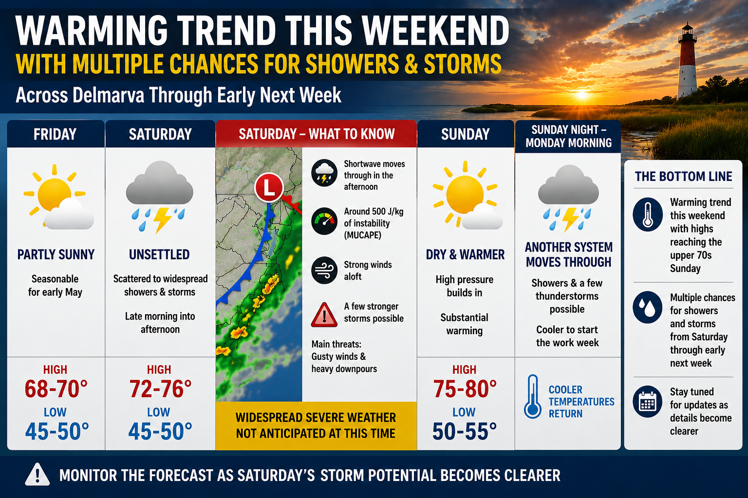

A gradual warming trend is expected to develop across the Delmarva region this weekend, though the warmer temperatures will come alongside several opportunities for showers and thunderstorms through early next week.

Temperatures through Saturday are expected to remain seasonable for early May, with afternoon highs generally in the upper 60s to near 70 degrees and overnight lows ranging from the mid 40s to low 50s.
The weather pattern is forecast to become increasingly unsettled beginning Saturday as an upper level disturbance moves across the Mid Atlantic during the afternoon hours. An associated area of low pressure tracking north of the region will drag a cold front through Delmarva, likely triggering scattered to potentially widespread showers and thunderstorms from late Saturday morning into Saturday afternoon.

Forecast models indicate modest atmospheric instability developing ahead of the front, with around 500 J/kg of elevated instability forecast across portions of the region. In addition, stronger winds aloft may help organize some of the storms. While widespread severe weather is not currently expected, forecasters say a few stronger thunderstorms cannot be ruled out as the system approaches.
At this time, the primary threats with any stronger storms would likely be gusty winds and brief heavy downpours, though confidence in the overall storm intensity remains somewhat limited.
Conditions are expected to improve Saturday night into Sunday as the disturbance exits the region and high pressure briefly builds overhead. This setup should provide mainly dry weather for much of Sunday while also allowing significantly warmer air to surge northward into the region.

High temperatures Sunday are forecast to climb into the upper 70s across much of Delmarva, and a few inland locations could approach the 80 degree mark if enough sunshine develops during the afternoon.
The warmer weather may be short lived, however, as another area of low pressure and its accompanying cold front are expected to move through the region Sunday night into Monday morning. This next system could bring another round of showers and thunderstorms before cooler temperatures return to begin the new work week.
Despite the active weather pattern, no widespread hazardous weather is anticipated at this time. However, residents are encouraged to continue monitoring the forecast through the weekend as details regarding Saturday’s thunderstorm potential become clearer.


