A noticeable warming trend is underway across the Delmarva Peninsula as a warm front begins lifting north through the region, bringing a mix of increasing clouds, spotty showers, and a significant jump in temperatures through mid-week.

High pressure has shifted offshore to the southeast, allowing a milder and more humid air mass to move in. As the warm front pushes northward today into early Tuesday, skies will turn mostly cloudy with the chance for scattered light showers developing later today and lingering into Tuesday. While a brief rumble of thunder cannot be ruled out overnight, the overall setup remains weak, with minimal impacts expected. Rainfall totals will be light, generally a few tenths of an inch or less, and no severe weather is anticipated.

The more notable story will be the warming temperatures. Highs today will climb into the 60s for most inland locations, with a few spots nearing 70 degrees, though cooler conditions will persist along the immediate coast due to onshore flow. Overnight lows will remain mild, settling into the 50s.

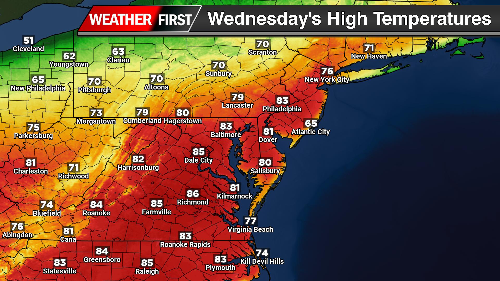
By Tuesday, much warmer air takes hold, with highs surging into the mid to upper 70s across much of Delmarva. The warming trend peaks on Wednesday, when temperatures are expected to reach well into the 80s for many areas. Overnight lows will also turn unseasonably warm, staying in the 60s, creating a noticeably more humid feel.
These temperatures could approach or even challenge record highs for late March, marking a sharp shift from recent cooler conditions. While clouds and a few showers may pass through at times, the dominant theme through mid-week will be spring warmth building across the region.