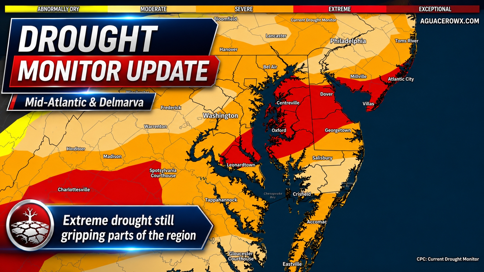

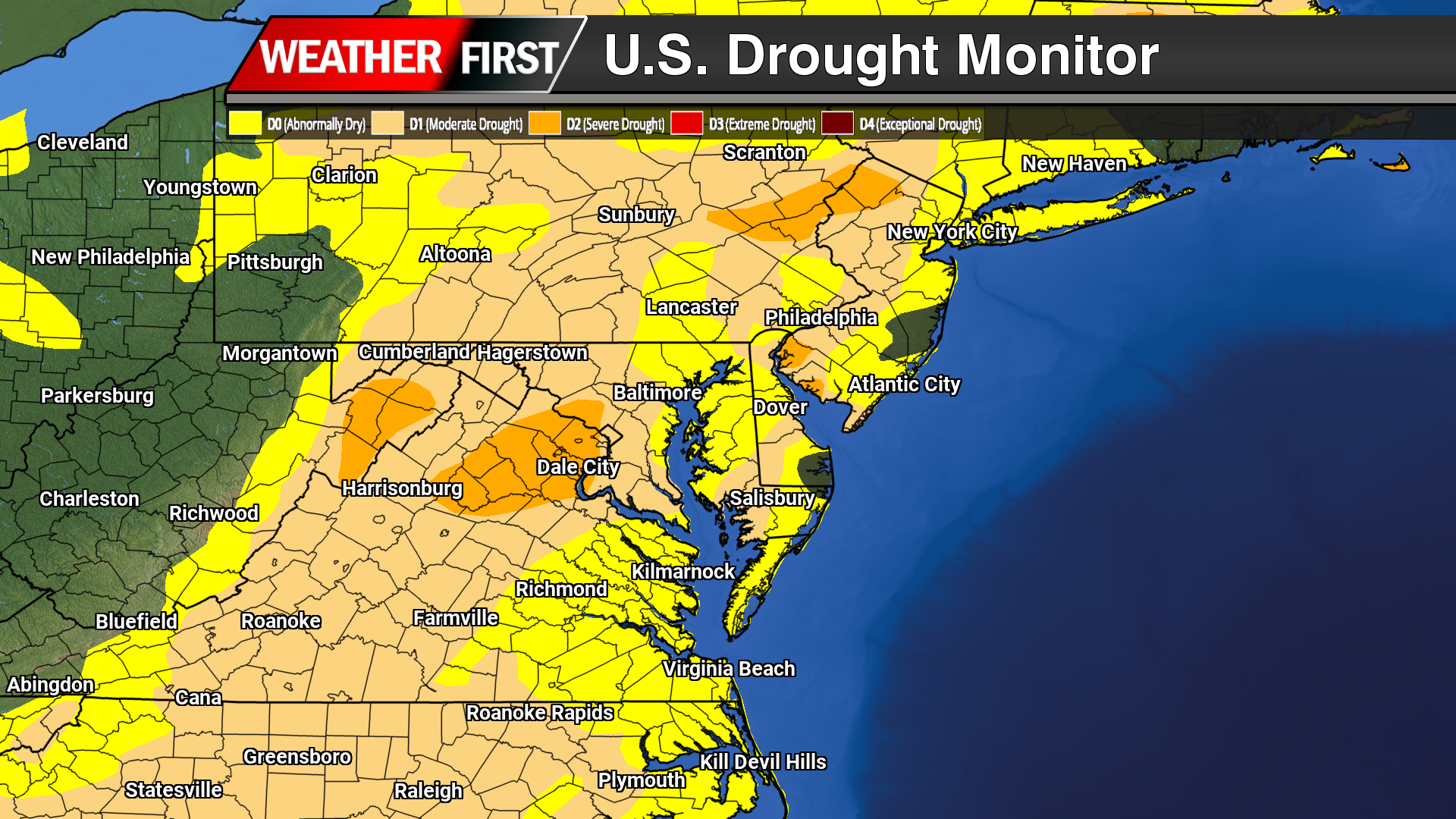
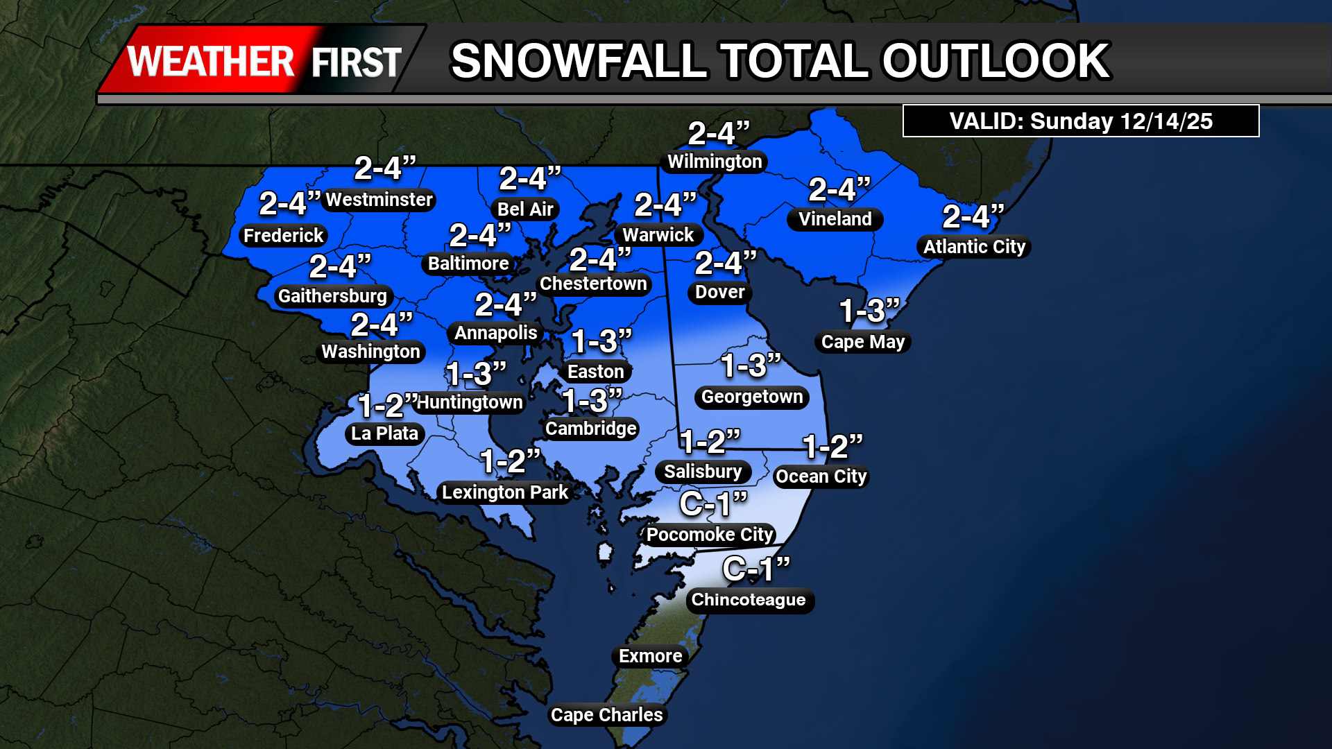
The latest U.S. Drought Monitor shows that drought continues to have a firm grip on much of the Mid-Atlantic, including Delmarva, even after recent rounds of rain and thunderstorms brought some short-term improvement to parts of the region.
The new update is valid as of July 7, 2026, with U.S. Drought Monitor data released each Thursday morning and conditions assessed through Tuesday morning. That means any heavy rain that falls after the cutoff will not be fully reflected until the next weekly update.
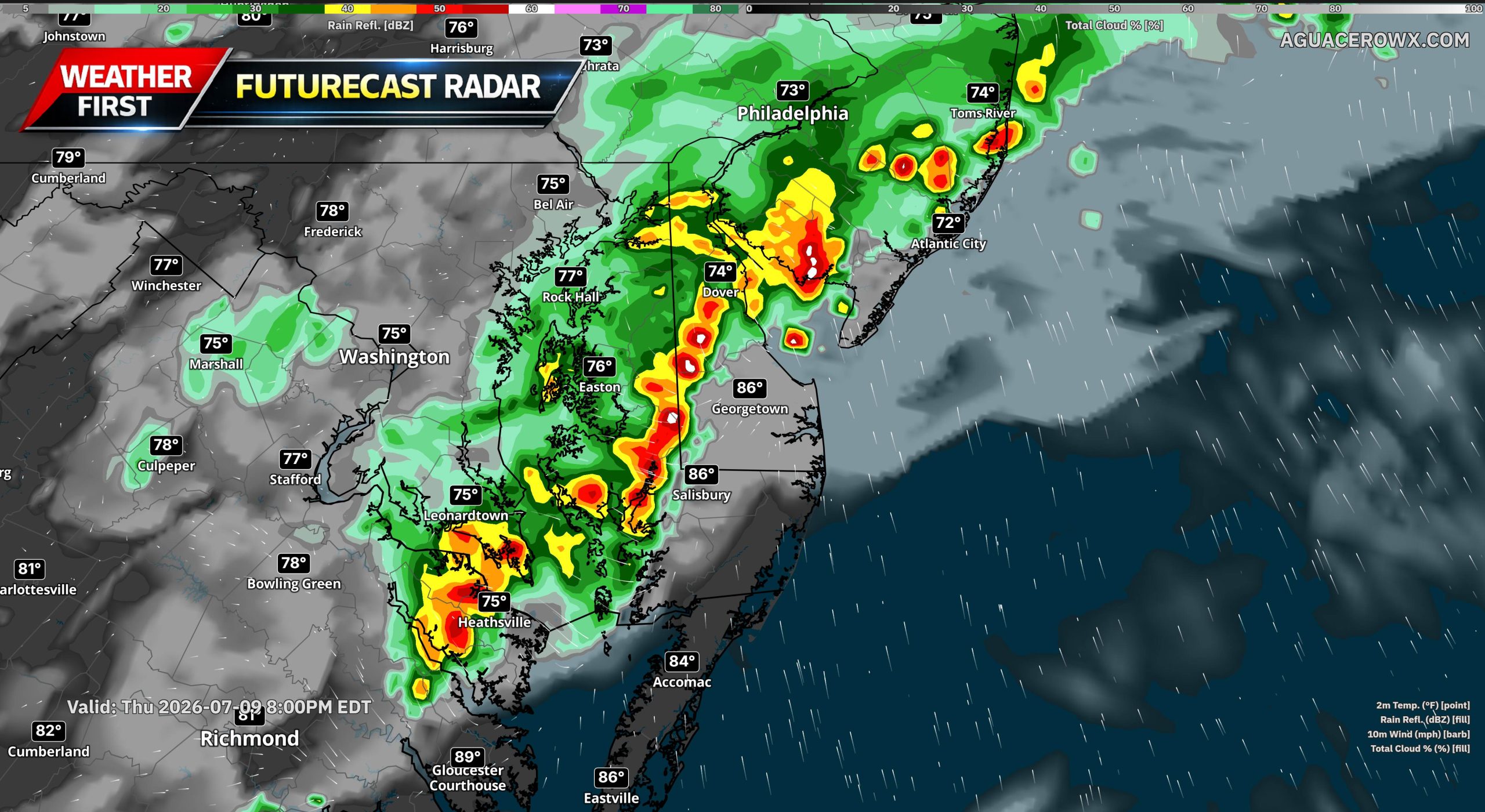
Across the broader Mid-Atlantic and Northeast, the Drought Monitor noted that heavy rain fell in parts of eastern Pennsylvania, New Jersey, southern New York, the New York City area and southern New England. Some locations picked up more than 2 inches of rain, with localized totals between 4 and 6 inches. That rainfall led to some drought improvements, especially where the heaviest rain occurred. However, long-term precipitation deficits and groundwater shortages continue to limit how much improvement can be shown on the map.
For Delmarva, the drought picture remains serious. Delaware remains entirely in drought, with 100% of the state classified in D1 or worse. The latest breakdown shows 14.9% of Delaware in Moderate Drought, 38.2% in Severe Drought and 46.9% in Extreme Drought. No part of the state is currently listed in Exceptional Drought.
Maryland is also still dealing with widespread drought conditions. The latest state data shows 91% of Maryland in drought, including 17.8% in Moderate Drought, 51.9% in Severe Drought and 21.3% in Extreme Drought. About 5.9 million Maryland residents are in areas classified as being in drought.
The Eastern Shore remains one of the areas feeling the impacts. Drought.gov county data shows 100% of people in Kent County, Delaware, Sussex County, Delaware, Talbot County, Maryland, and Worcester County, Maryland are currently affected by drought. Sussex County is also running well below normal for the year to date, ranking as the 7th driest January through May period over the past 132 years.
This comes as Delaware remains under a statewide drought watch. State officials issued that watch in early June because of sharply declining precipitation levels, especially in Kent and Sussex counties. Delawareans have been asked to voluntarily reduce outdoor water use and conserve water while the state continues to monitor rainfall, streamflow, groundwater, soil moisture and reservoir conditions.
Recent thunderstorms have helped in some areas, especially with topsoil moisture and short-term dryness, but they are not enough to erase a drought that has been building for months. The Delaware Climate Office previously noted that May 2026 marked the 10th straight month with below-normal statewide precipitation, and the August 2025 through May 2026 period was the driest August-to-May stretch on record for Delaware dating back to 1895-1896.
The challenge going forward is that summer rainfall is often uneven. One town may pick up several inches from thunderstorms while another location only a few miles away gets very little. At the same time, high humidity, warm temperatures and peak summer evapotranspiration continue to pull moisture out of the ground. That makes drought recovery slower, especially across farm fields, lawns, shallow-rooted vegetation and smaller streams.
There is some rain in the forecast for parts of the region, and additional thunderstorms could bring localized relief. However, heavy downpours can also run off quickly, especially in urban areas or where rain falls too fast. What Delmarva needs most is a more sustained pattern of beneficial rainfall over several weeks, not just isolated bursts of heavy rain.
For now, drought conditions remain a key story across the Mid-Atlantic and Delmarva. While recent rainfall has helped in spots, the latest update shows that long-term dryness, groundwater concerns and agricultural impacts remain ongoing issues heading deeper into July.


 ICON Model Output


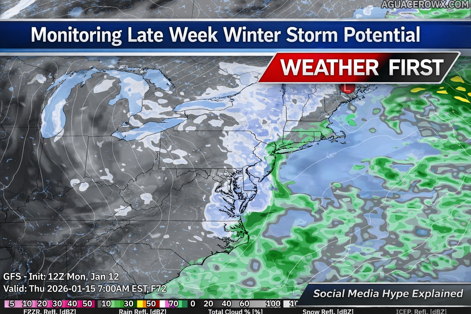
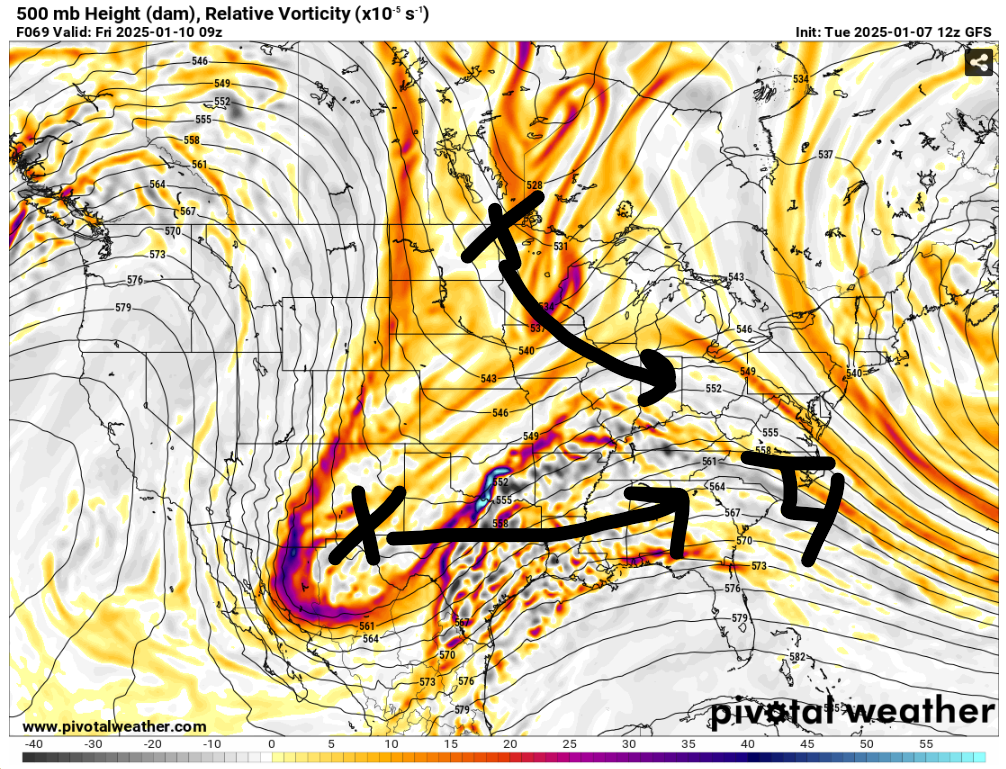
 Severe Cold Weather Alert: An Arctic air mass is forecasted to sweep across a significant portion of the United States this weekend!
  From the Rockies to the Great Plains, this frigid air will reach the Gulf Coast by Saturday night and move towards the Eastern Seaboard by Sunday evening.
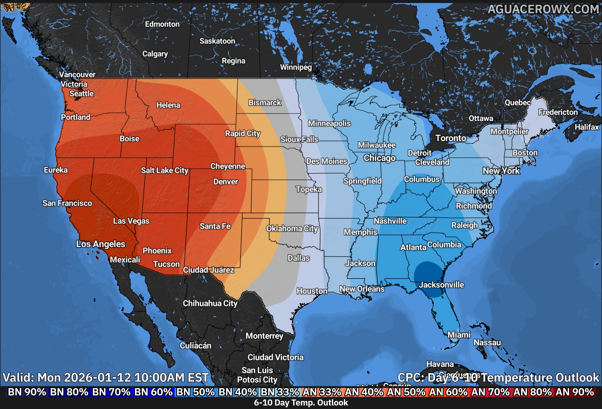
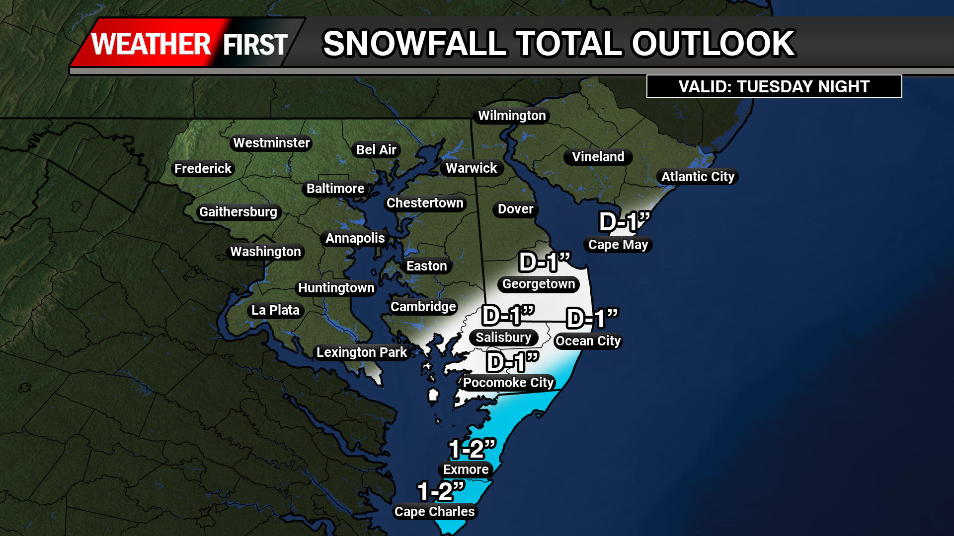
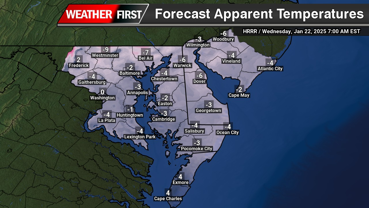
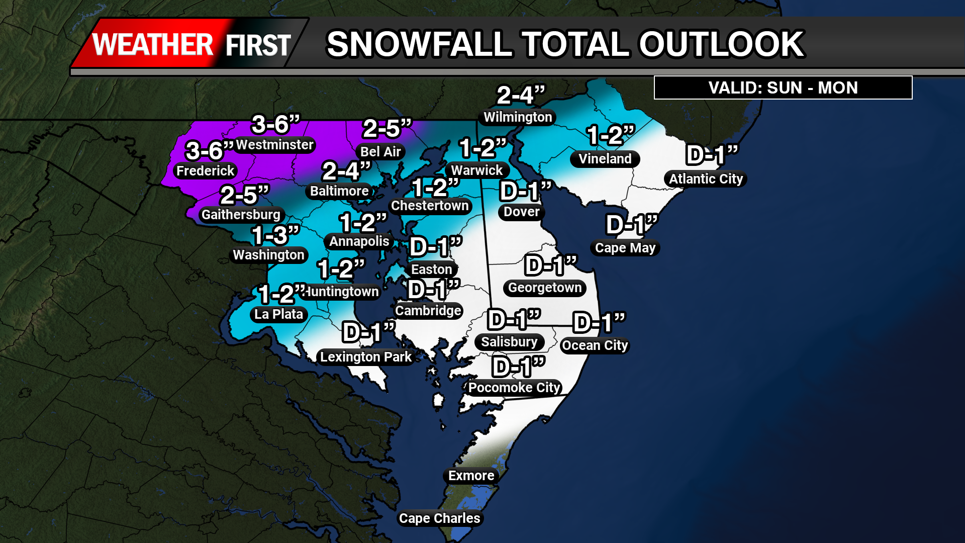
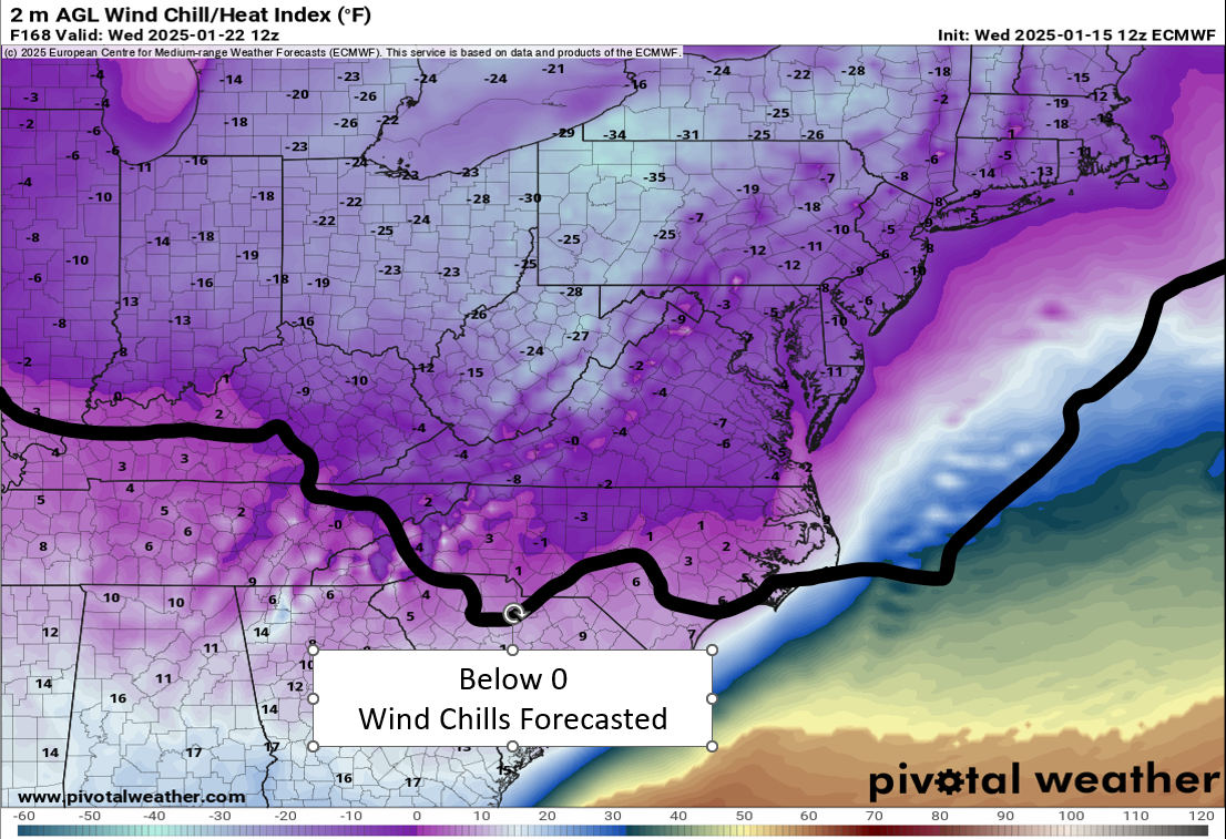
 Extremely Low Wind Chills: The Rockies, northern Plains, and Upper Midwest are expected to experience dangerous wind chills as low as -30°F or even lower from Saturday through Tuesday. This extreme cold poses serious risks of hypothermia and frostbite for individuals exposed to these conditions. If you plan to travel, ensure you have a cold weather survival kit prepared for your safety.
 Furthermore, below-zero wind chills are anticipated to extend into the southern Plains and the Ohio Valley from Sunday night through Tuesday. The hazardous cold is likely to persist along the Gulf Coast and across the Southeast U.S. for much of the following week. Stay warm and take all necessary precautions during this severe cold snap!


